So, you have a GPS and have been cruising around all day collecting waypoints and tracks which are now stored on your device. Suppose you’d like to get those into ArcMap for further work or analysis, how would you do that? An easy way is using ArcGIS Explorer Desktop.
The first step is to export your data to a GPX file using your GPS device (a format just about all of them support). Next, we’ll add the GPX file to Explorer by choosing Add, then GPS Data Files, as shown below:
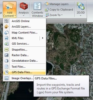
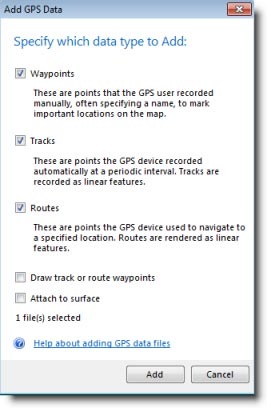
Then choose what you want to add:
After making choices and clicking Add, we now have our GPX file displayed in ArcGIS Explorer Desktop with all the correct symbols.
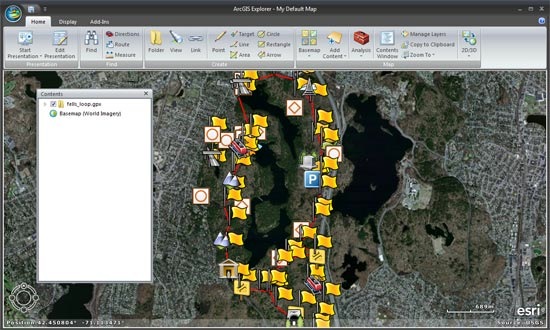
Next, right-click the layer in contents and choose Share.

You can choose to share as either a layer package, KML, or Explorer map content file. We chose layer package since not only does ArcMap support LPKs, but the layer package also captures the symbols for display in ArcMap.

Start ArcMap, then drag and drop the layer package onto your map. Below we’ve also connected to the ArcGIS Online world imagery basemap which serves as our foundation for displaying the now-converted GPX file, just like we used in Explorer. Note that the symbols are exactly the same.
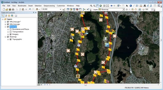
If you are interested in a live feed from a GPS device, you have another option. ArcMap enables you to create a direct connection to a GPS unit for live input. Right-click on the menu and look for the GPS toolbar:
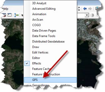
And you can find out more about it in the ArcGIS Help (just search for GPS).
You can also learn more about importing GPS data files in ArcGIS Explorer Desktop by taking a look at the Add GPS Data Files Explorer help topic.

Commenting is not enabled for this article.