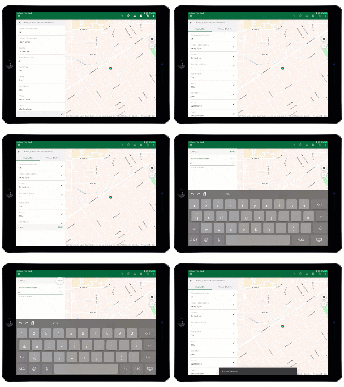
The Map Viewer is one of the most popular configurable templates provided by ArcGIS AppStudio. You can create cross-platform native apps that allow users to view web maps and offline Mobile Map Packages. The Map Viewer includes tools to measure features, identify features and attachments, and perform freeform sketching on the map. With AppStudio 4.4, we are excited to release one of the most requested Map Viewer template features – editing for feature attributes and attachments. Feature attribute editing opens the Map Viewer to a wide variety of new use cases such as asset maintenance and feature inspection.
Some example use cases include:
- Water Utility Inspection (hydrants, valves, etc)
- Street Sign Inspection (condition and reflectivity inspection)
- Update field asset status (bike locks, parking meters)
- Proof of work/repairs (update photo attachments)
New Edit Attributes and Attachments Capability
If the editing capability is enabled for the Map Viewer template, you would see a new edit icon on the Identify panel’s bottom-right. Click/Tap on the edit icon to enter the editing mode. From here, you can edit and save changes for feature attributes and add or remove feature attachments.

Editing capability requirements
The requirements for the editing capability are:
- Enable the edit property in the AppSettings for the Map Viewer template.
- Feature layers in web maps should be editable and allow for updates.
- End-users have to sign in to the Map Viewer template (we do not support editing public feature layers without being signed in at this time).
- Signed in users must have permission to edit feature layers in web maps.
- Signed in users must have Edit features privileges.
- If the app’s Runtime license level is Lite, the signed-in users’ user type must higher than Viewer (cannot be Viewer).
How to enable editing capability
Step 1. Create a new Map Viewer template
- Download AppStudio Desktop 4.4 or above.
- Sign in to AppStudio with your ArcGIS Online or Enterprise account.
- Click on the New App
- Click on the Templates
- Choose the Map Viewer template and click on the Create

Step 2. Enable sign-in
The Map Viewer template requires the user to sign in to edit features. Therefore, you will need to enable the sign-in feature in the Map Viewer template. To do this:
- Upload the Map Viewer app.
- Go to Settings > Properties > Gallery > enable the Support secured maps
- Go to Settings > Licensing and click on Register to register an ArcGIS Client ID that allows users to sign in to your Map Viewer template app.

Step 3. Enable editing capability
- First, enter your web maps in the Settings > Properties > Gallery > Maps query
- Scroll down and enable the Support editing

Learn more about the Map Viewer template
- Check this video to see a step-by-step tutorial on configuring the Map Viewer template.
- Map Viewer template online help documentation
- Map Viewer template success story
- Ask questions and provide feedback in ArcGIS AppStudio GeoNet Community.
Learn more about AppStudio:
- New to AppStudio? Check out this website to learn more about what ArcGIS AppStudio can do for you and your organization.
- Check out our recent workshop recordings to get started with creating native apps using AppStudio.
- Let us know about your creations built using AppStudio to be featured in AppStudio Showcase Gallery.
- Provide your ideas and suggestions to us on the ArcGIS Ideas site.
- Follow us on Twitter @ArcGISAppStudio to keep up-to-date on the latest information.
- The AppStudio team periodically hosts workshops and webinars; please sign up for the AppStudio newsletter if you are interested in information regarding AppStudio events.


Article Discussion: