This is the 3rd blog article in an 6-part series that highlights new capabilities in the Business Analyst extension for ArcGIS Pro 2.6 release from July 2020. Other blogs in this series can be viewed here.
The latest release of the Business Analyst extension for ArcGIS Pro contains several improvements to the Territory Design tools. This 2-minute video provides a good overview of some of the improvements.
As the video illustrates, a number of enhancements have been made to Territory Design to improve reporting and quality of territory solutions.
Reporting
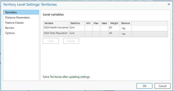
The Territory Design ribbon now contains a new properties dialog that displays the level settings. The dialog allows you to review and manage the territory level settings. Once edits have been made to the level settings, the Territory solution must be re-solved to reflect the changes. The Solve operation can be executed immediately after the modifications or deferred to a later date, when you can manually run the Solve Territory tool. The level settings dialog is an easy way to review or change the settings applied to your territory solution.

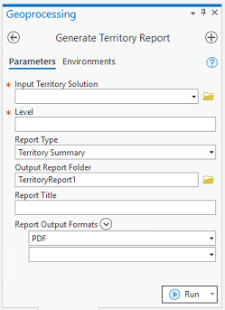
Another way to review and evaluate the territory solution is through reports. A new geoprocessing tool in the in the Territory Solution toolset allows you to create a report for a single solution or a comparison report to compare two solutions. The Generate Territory Report tool is a good way to review statistics of your territory solution and compare how it is similar to or different from another solution.

Enhancements
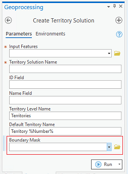
In addition, there are a couple of enhancements to existing Territory Design geoprocessing tools that improve the quality of territories. The first is a new parameter to add a mask layer to the Create Territory Solution geoprocessing tool. The mask layer applies only to a point-based territory solution and allows for more contiguous territories, such as territories that do not cross a body of water.

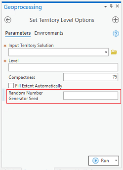
The second enhancement is a new parameter in the Set Territory Level Options geoprocessing tool. By default, Territory Design uses a random number generator (the ACM-collected algorithm 599) to generate random numbers used to create territory centers. As a result, a new territory center is created each time the solution is solved, producing different territories on each run. However, the 2.6 release provides a Random Number Generator Seed, meaning that the same seed value is passed, allowing each run of the Solve Tool to generate the same sequence of random numbers. Now, a solution can create more consistent territories by using the same territory center on each run. The same results can be accomplished by locking territory centers.

Additional information about these enhancements can be found in the ArcGIS Pro documentation for Territory Design. We’re so happy to share these enhancements with you. Please reach out and let us know if you have any questions about Territory Design tools or any other capabilities in ArcGIS Business Analyst.
Email the team: businessanalyst@esri.com
Below you can find some links for Business Analyst that you may find useful.
Article Discussion: