ArcGIS Living Atlas of the World provides foundation elevation layers and tools to support analysis and visualization across the ArcGIS platform. These layers get updated quarterly with high resolution elevation data from open sources and community maps program. In this release, world elevation layers are updated with bathymetry and a few high-resolution elevation datasets as described below.
Terrain and TopoBathy layers are updated with:
- Natural Resources Canada’s HRDEM 1-meter DTM’s covering partial areas of the southern part of the country (Open Government Licence – Canada)
- Värnamo Kommun’s 0.5 meters DTM covering municipality of Varnamo, Sweden
- The Instituto Geográfico Nacional (IGN) 2 meters DTM covering partial areas of Spain (MDT02 2019 CC-BY 4.0 scne.es)
TopoBathy layer is updated with:
- General Bathymetric Chart of the Oceans (GEBCO_2019) 15 arc second (approx. 464 meters) dataset covering entire globe. [GEBCO Compilation Group (2019) GEBCO 2019 Grid (doi:10.5285/836f016a-33be-6ddc-e053-6c86abc0788e)]
Here are a few examples highlighting the improvements with before and after images.
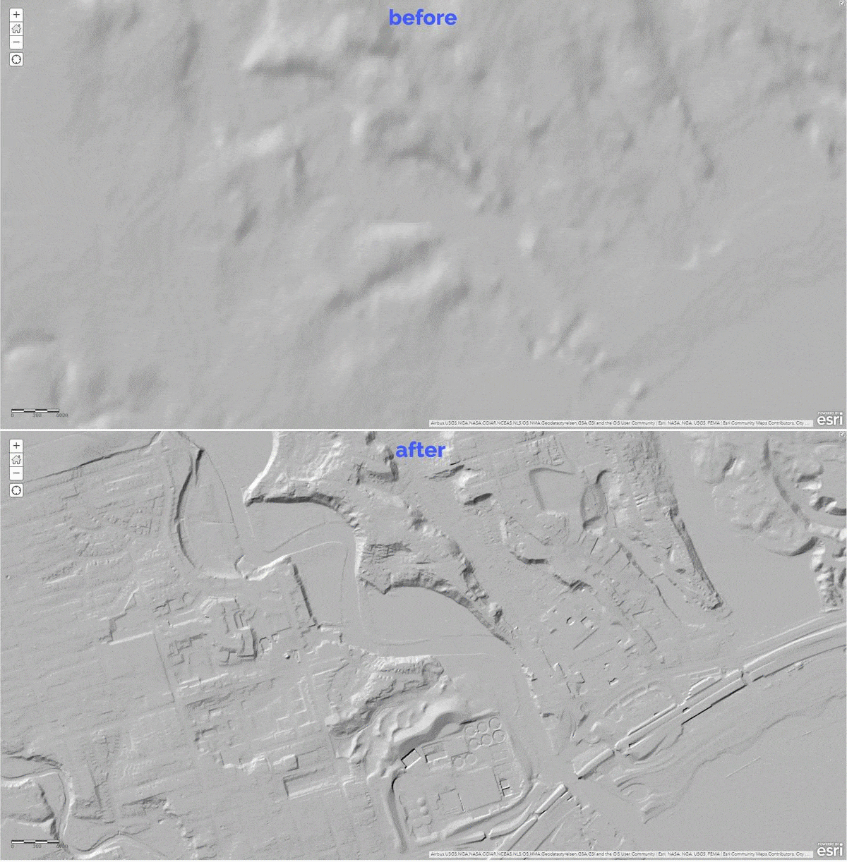
Toronto, Ontario, Canada– fine details depicted with lidar derived NRCan’s HRDEM 1 meter in south-west Toronto in comparison to old NED 10 meters

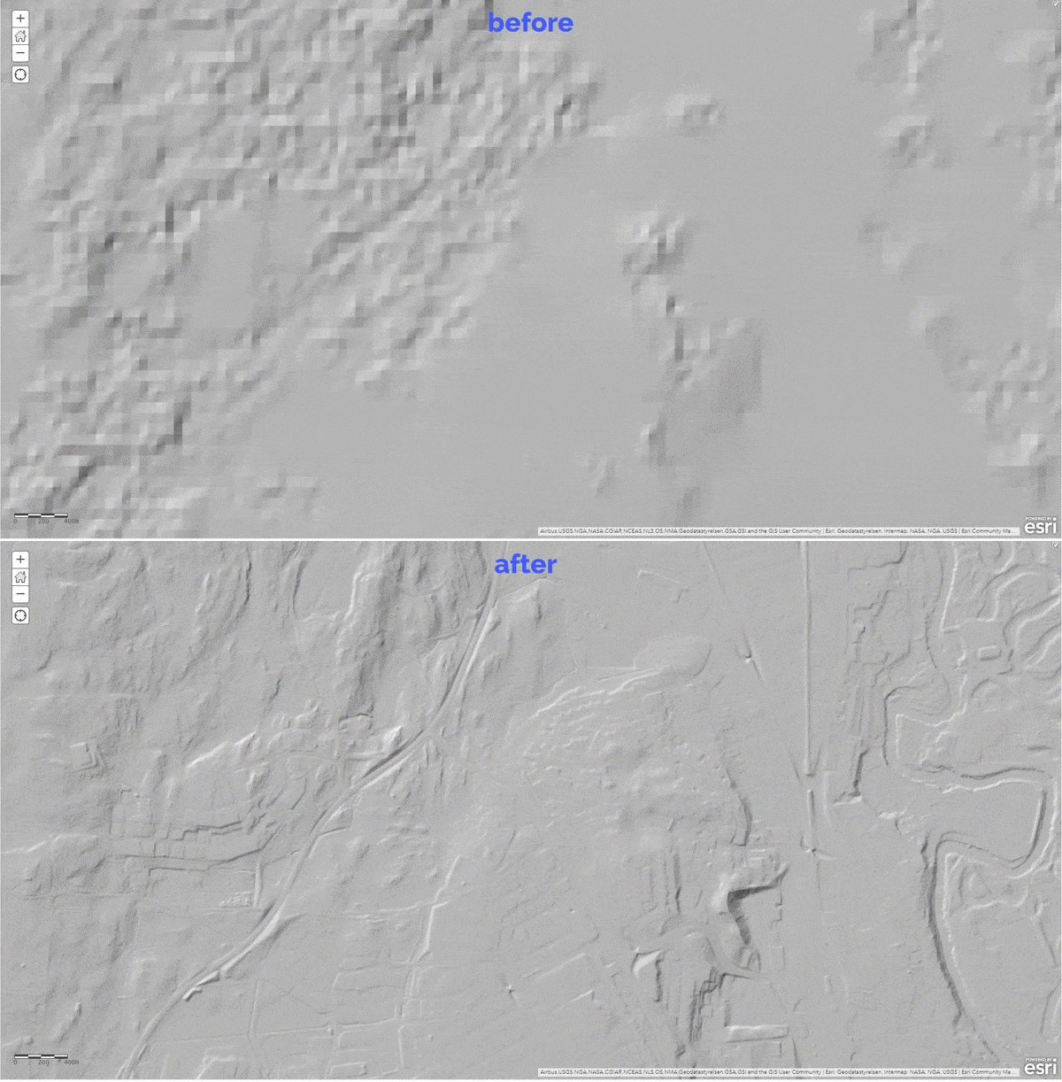
Värnamo, Sweden – depicting the fine details of urban landscape with lidar derived 0.5 meter data in comparison to 24 meters WorldDEM4Ortho

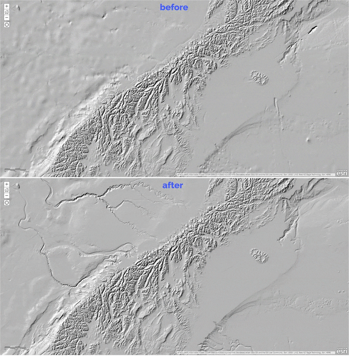
New Zealand – depicting the coastal improvements with 15 arc sec (~ 464 meters) GEBCO 2019 grid in comparison to 30 arc sec (~ 928 meters) GEBCO 2014

These data updates will be rolled out to the world elevation tiled services – Elevation 3D (Terrain3D and TopoBathy3D) and Hillshade (World Hillshade and World Hillshade (Dark) ) by the next quarter.
To see the coverage extents of each source comprising World Elevation services, check out the Elevation coverage map. Elevation coverage map description also contains an enhanced table listing all the data, sources and coverage.
You can help in improving these services by contributing high-resolution elevation data to Living Atlas of the World. To participate and learn more, check out the Esri Community Maps for Elevation program.


Article Discussion: