On January 30th, the Bureau of Land Management Eastern States (BLM-ES) hosted a Story Maps Meetup in their Washington, DC office. The free event introduced federal agencies to ArcGIS StoryMaps and highlighted digital storytelling within public land and water management agencies.
Esri’s StoryMaps team joined the event and offered tips and best practices for the federal storytelling community.
The National Park Service (NPS), Bureau of Ocean Energy Management (BOEM), and BLM-ES General Land Office—all within the US Department of the Interior—presented agency story maps and offered their own lessons learned. Both NPS and BOEM shared story maps created specifically for internal communication; BOEM uses story maps for leadership briefings, while NPS uses them to educate employees and volunteers about scientific topics like urban forestry.
The BLM-ES General Land Office Records team presented their public-facing General Land Office Record of the Week story map series, along with the story behind the stories.


The making of a story map series
The Bureau of Land Management—created when the Grazing Service and General Land Office merged in 1946—manages more than 245 million acres of public land, primarily in the west, and administers 700 million acres of sub-surface mineral estate.
As a part of its multiple-use mission, the agency continues the surveying and conveyance work inherited from the General Land Office. And the BLM-ES General Land Office maintains the over 12 million official land records that serve the public today and tell the stories of the westward expansion of America.
The General Land Office Record of the Week series was established to share those stories with the public.
"The concept of a record of the week began in 2016,” according to the team, “when the staff started to inventory the 'Easter eggs' in the collection, so named because they contain delightful surprises hidden in historical documents: fascinating records depicting towns, cities, battlefields, dinosaur fossils, and more historical notations.”
Daniel Fleming, branch chief of BLM-ES General Land Office Records, initially emailed these surprises to his employees to build motivation for their important mission. Before long, the internal emails grew into a full-blown story maps campaign.
Since February 2018, the team has published a “General Land Office Record of the Week” story map.
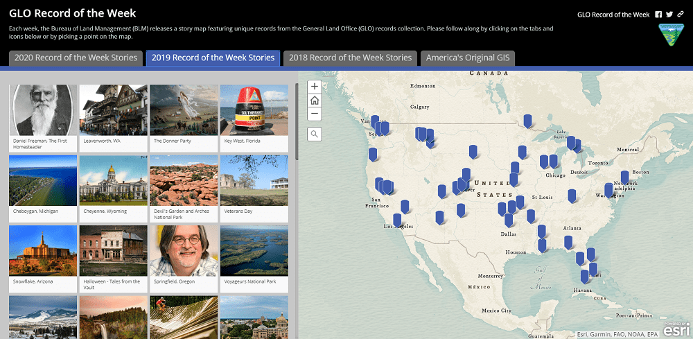
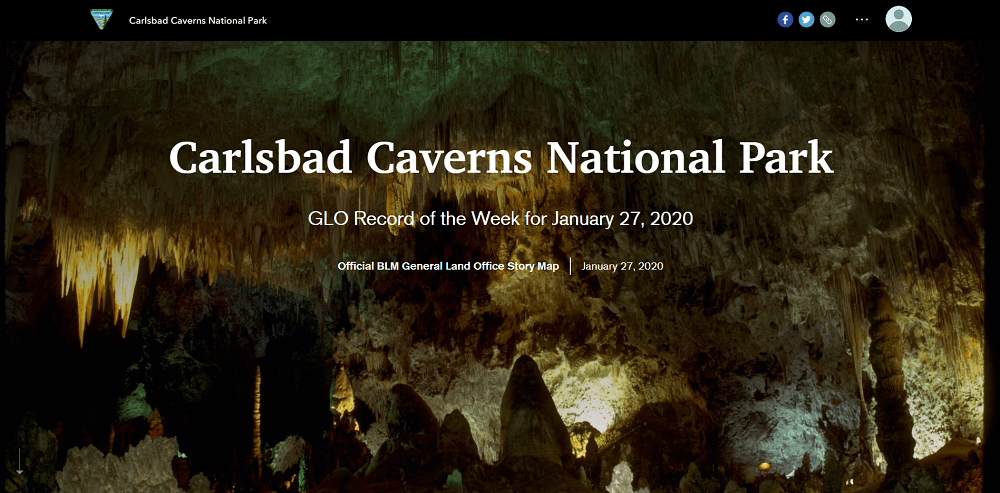
As part of the project, the team curates a General Land Office record relevant to current events, anniversaries, or unique records about noteworthy places or people. Then they create a story map, like the Carlsbad Caverns National Park story below, and share the record with the public through the BLM’s social media platforms.
The team’s Story Maps Meetup presentation focused primarily on the nuts and bolts of developing, publishing, and promoting each story—a proven workflow that was years in the making.
“The success of the BLM Eastern States General Land Office Records Branch - Record of the Week would not be possible without early and ongoing collaboration between BLM’s story map developers and public affairs office.” – Ben Knott, Esri federal account manager

Sharing story map success at FedGIS
On February 11-12th, the BLM-ES General Land Office Records team will share their General Land Office Record of the Week series and the workflow behind it at the 2020 Esri Federal GIS Conference in Washington, DC. Meet the BLM team and learn from their success; hear from other federal agencies and partners; and learn about ArcGIS StoryMaps during the following sessions hosted by Esri’s StoryMaps team.
Champion Your Success with ArcGIS StoryMaps
3:00-4:00 PM, Tuesday, February 11 in Room 145B
4:00-5:00 PM, Wednesday, February 12 in Room 146A
Join Esri’s StoryMaps lead Allen Carroll and team member Michelle Thomas to learn the secrets of great storytelling, how to use the ArcGIS StoryMaps builder, and tips for editing and publishing your stories.
The Bureau of Land Management and the US Department of Agriculture will share their successful General Land Office Record of the Week and #FridaysOnTheFarm story maps campaigns, respectively, and walk you through the development, management, and promotion of story maps within large agencies and teams.
View the agenda and room location on the 2020 Esri Federal GIS Conference website.
Agencies are creating great stories; here’s how you can too.
1:45-2:45 PM, Tuesday, February 11 in Room 145B
2:45-3:45 PM, Wednesday, February 12 in Room 146A
Join Esri’s StoryMaps lead Allen Carroll and team member Michelle Thomas to learn how GIS specialists, communication professionals, and subject matter experts are sharing their work through ArcGIS StoryMaps. Christina Phang of Blue Raster will describe her company’s work on story map projects with numerous agencies and organizations.
View the agenda and room location on the 2020 Esri Federal GIS Conference website.
After the presentations, stop by and meet the StoryMaps team in the ArcGIS showcase. Plus, talk one-on-one with the BLM team at Booth 209 and Blue Raster at Booth B9.

Want to get a jump start on digital storytelling?
Check out our collection of story maps built by Federal agencies, and then get started on your own story.
Commenting is not enabled for this article.