The scene layers team has been hard at work adding functionality for ArcGIS Pro 2.4. Let’s take a look and see what we’ve been working on!
I3S Version 1.7
At the 2.4 release, 3D object and integrated mesh scene layers have been upgraded to version 1.7. The upgraded scene layer enables more efficient access to nodes leading to improved performance and scalability of these services. Testing on medium and large integrated mesh and 3D object scene layers has shown an improvement in draw performance by 2 to 4 times in ArcGIS Pro and the Scene Viewer.
Version 1.7 scene layer packages can be created using the Create 3D Object Scene Layer Package tool. Support for point and building scene layer version 1.7 will be available in ArcGIS Pro 2.5.
I3S Validation and Conversion
For 3rd party data providers and ArcGIS users, there is a new tool that validates existing scene layer packages (slpk). Detailed information is provided on whether or not the slpk conforms to the I3S specification. These slpks can also be upgraded to the latest version 1.7 for 3D object and integrated mesh slpks. Check out the I3S Github repository for more information.

Enhanced Point Scene Layer
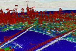
Point scene layers have been enhanced to reduce the amount of thinning that occurred at each level of detail (LOD) in ArcGIS Pro. Previously points were aggressively thinned to maintain performance but enhancements at this release allow more points to display at all LODs.


Default Vertical Coordinate System
When creating a scene layer package, the new default vertical coordinate system is EGM96. This is a global gravity-based vertical coordinate system the doesn’t require the use of the ArcGIS Pro coordinate system data separate install. We do recommend installing this from my.esri.com if you frequently require vertical coordinate system transformations. WGS84/EGM96 is supported in ArcGIS Pro and the Scene Viewer. Vertical coordinate systems are used to define height or depth values and ensure proper Z unit conversions.
ArcGIS Pro SDK
The Scene Layers API in the ArcGIS Pro SDK has been enhanced for 2.4. New functionality includes access to querying, symbolization, and editing workflows along with access to building scene layer filters and filter blocks.
For detailed information check out the ProConcepts Scene Layers topic.
For code snippets check out the ProSnippets Scene Layers topic.
Elevation Surfaces
You can now create multiple custom elevation surfaces from multiple sources at one time. Simply right click on the elevation surfaces in the Contents pane and select Create Surfaces from Sources. From there you can select one or multiple sources using the Cntrl or Shift key and custom surfaces will be created based on the file name of the source.

Eye-dome lighting
A new eye-dome lighting technique was added for point cloud scene layers. Eye-dome lighting is a shading technique that improves depth perception when viewing lidar points in 3D, which is on by default. You can find this option on the appearance tab.

Mobile Scene Package Expiration
With the ArcGIS Publisher extension licensed, mobile scene packages now support setting an expiration. This allows the publisher to set an expiration date on the mobile scene package. Users opening the mobile scene package in an ArcGIS Runtime application can either be allowed to open the package after expiration or be prevented from opening the package. See the Create Mobile Scene Package help for more information.

Arcpy Enhancements
A new isSceneLayer property was added to the arcpy layer class to allow users to access scene layers in a global or local scene. Code samples and additional information can be found on the layer class help page.

Commenting is not enabled for this article.