We’re excited to announce that the latest version of ArcGIS Maps for Office is now available. ArcGIS Maps for Office 5.0 is packed with performance updates and features, and an all-new user interface that makes it easier and quicker to build maps within Excel, analyze data, and share results with your teams. Let’s explore what’s new!
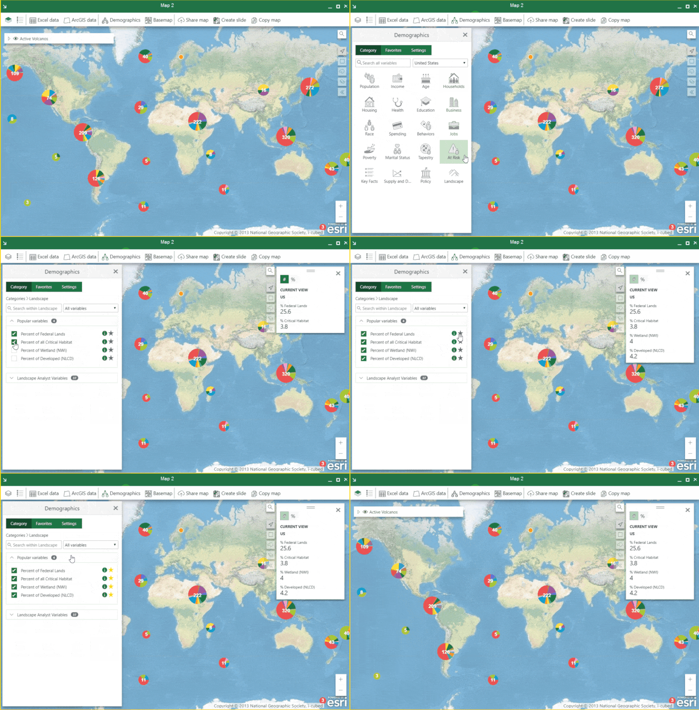
Demographics cards provide access to data for over 130 countries. Simply click on the demographics icon on the top pane, select the country for which you need data and start exploring. From here, you can add data on age, education level, gender, tapestry segmentation and more, and set your favorites so that you don’t have to spend additional time looking for the data you frequently use. As you pan the map from one location to another, you’ll also see the data update to your current selection in real time. Expanding on this capability, you can now enrich each of your Excel data layers with your favorite demographics findings for further processing.

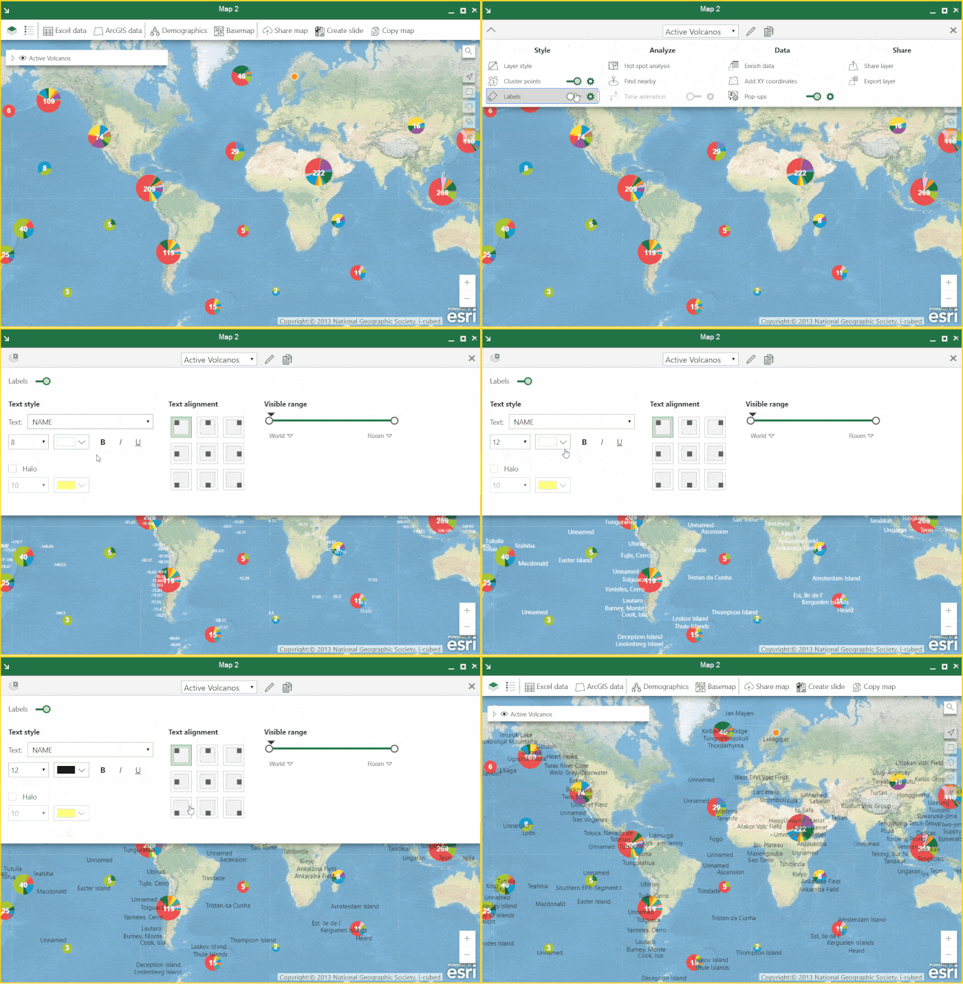
By popular demand, we’ve also added labels – a feature that makes it easier for you to add titles or labels to your map. Simply turn on the labels toggle in the layer properties to show labels with their default settings, then click the gear icon to customize them. To learn more, check out our documentation.

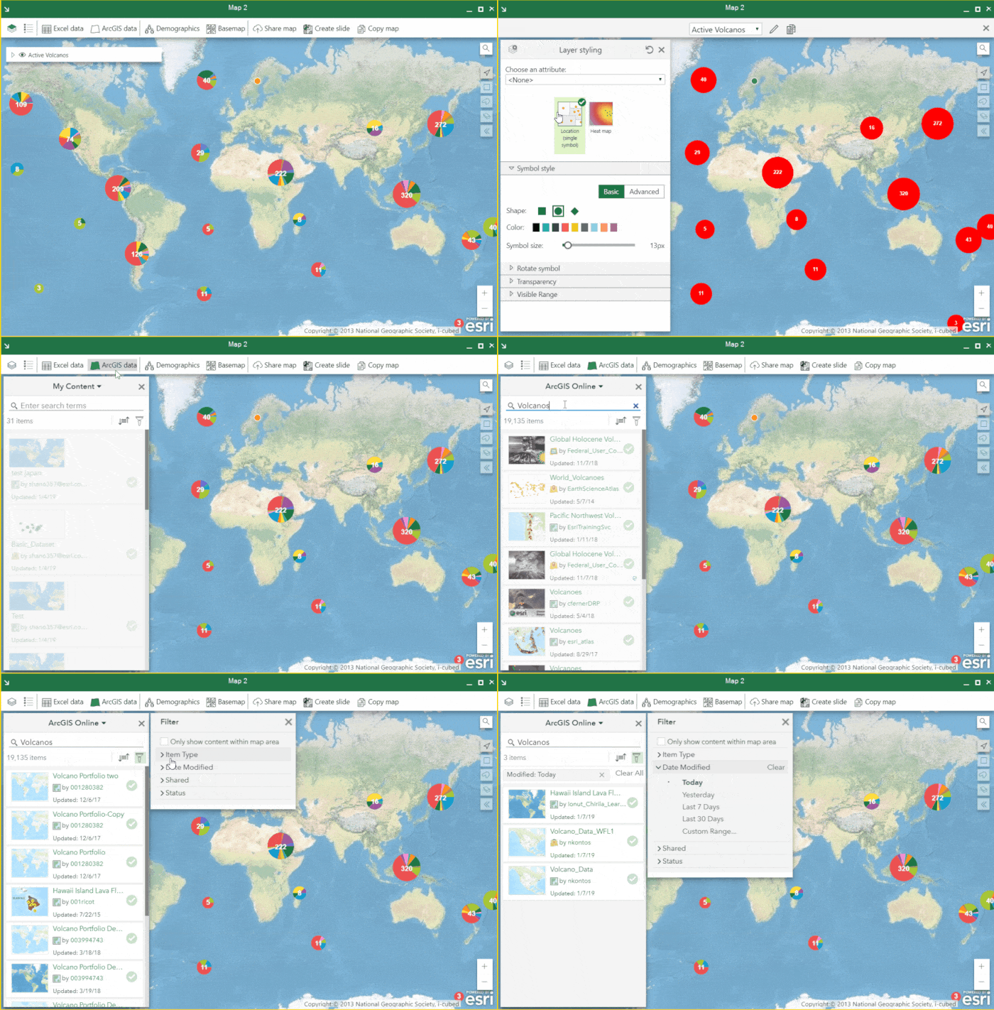
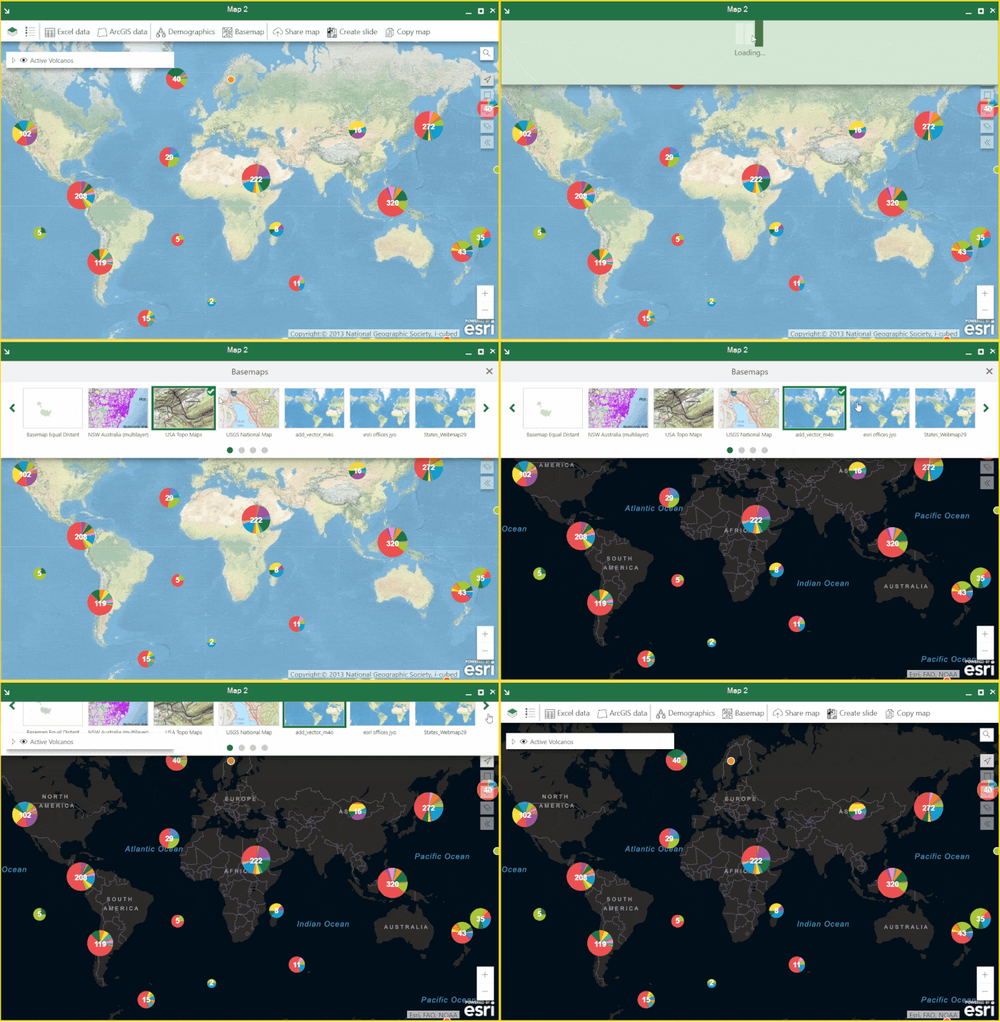
You’ll see significant enhancements to the user interface. It has been completely revamped to make it effortless for you to explore base maps and ArcGIS Online content. While previous versions required you to search by trial and error, you can now simply scroll through and filter data categories to find what you need. We’ve also added a simple but powerful option to reset your layer styling with a single click.

We understand that the correct underlying set of data translates into more powerful and useful analysis. With that in mind, we’ve provided the ability to access vector tiles and image layers. You can now add these layer types to your map from your ArcGIS organization.

Learn more about ArcGIS Maps for Office. If you’re already an ArcGIS Online customer, you can download and use it right away. For additional resources, visit our documentation pages. Join the ArcGIS Maps for Office community to find answers to all your questions, share ideas and for the latest updates.
~The ArcGIS Maps for Office Team
Commenting is not enabled for this article.