So…yes…2018 is drawing to a close, and that means the ArcGIS API for Python team just had to get some new functionality and some problem fixes into the API to set things up for a mind-blowing 2019. You might be tempted to think this is not really that big of a deal because it’s not even getting a new major or minor release number, but alas I’m here to convince you that there’s plenty to notice in 1.5.1. So RUN!… don’t walk to install the Python API. Head here for guidance on getting set up.
You can see the full list of Release Notes, but let’s take a look at some of the highlights.
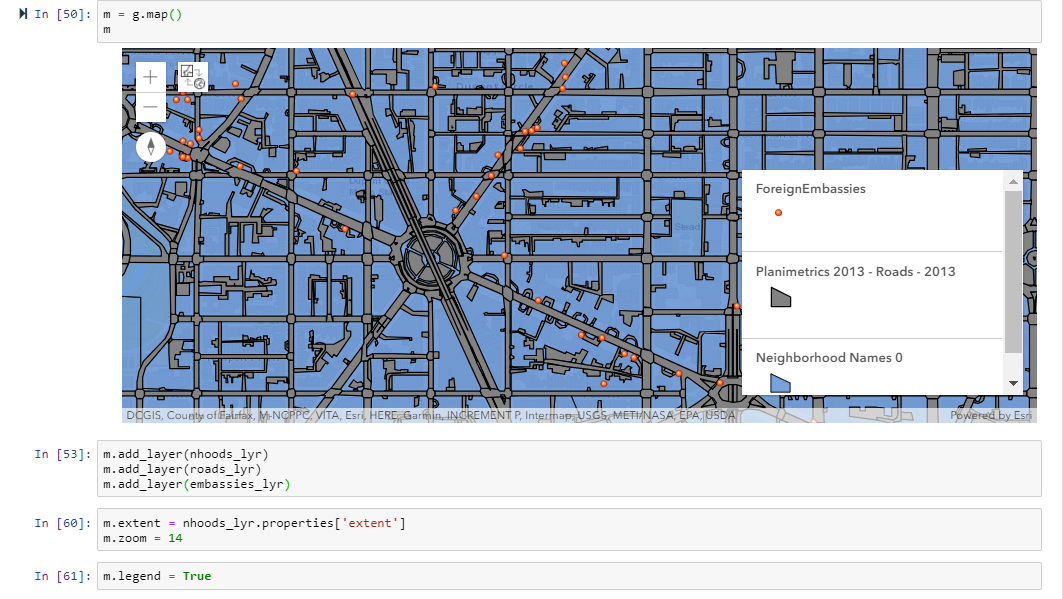
We simply MUST talk about the ability to add a map legend. We heard you say “Yeah. The Jupyter Notebook map widget is pretty cool. And I like that I can add some sweet symbology and use sophisticated ArcGIS map rendering technology. But what’s the point if I can’t let people know what the symbols and colors mean?” Excellent Point! So we went right on ahead and added a legend property to the map widget so that you can do just that – give the people what they want and tell them what it means
Legendary:

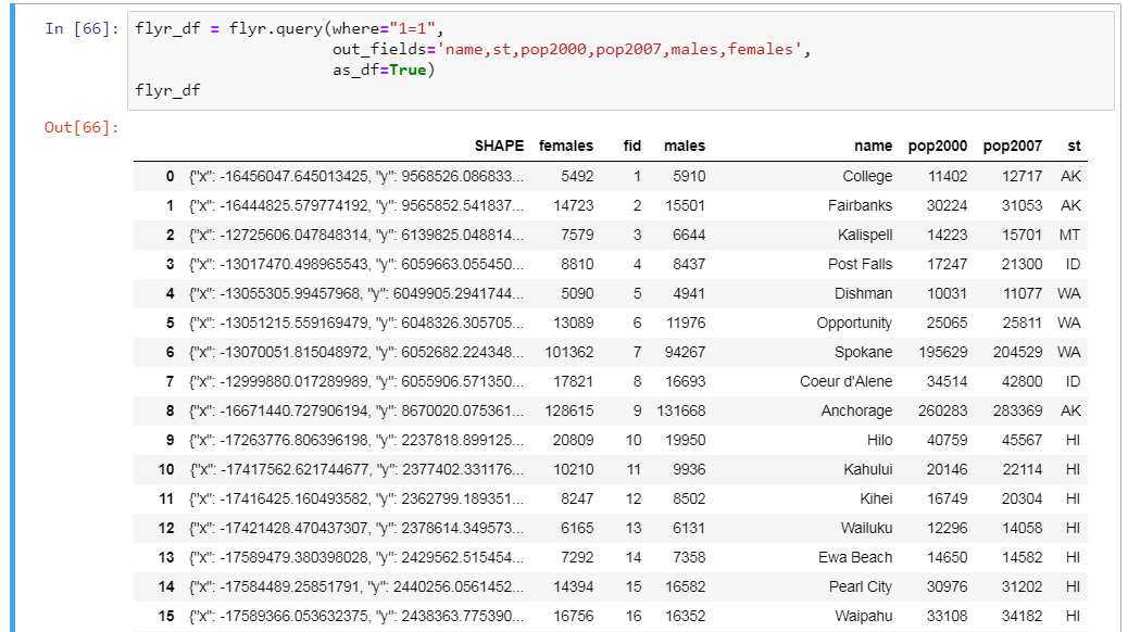
We all spend a good deal of time rummaging through tons and tons of data . Fundamental to making data useful is effective querying. Anything that eases the load so we can produce information and act on it is welcome. Meet the new as_df parameter in the FeatureLayer.query() method. It adds ease and flexibility because the results can be returned directly as a Pandas DataFrame in addition to the already tried and true FeatureSet. Plus, we simplified getting just the fields you want in your query results because the out_fields parameter will now accept a comma-separated string as input rather than just a list of field names. Check it out:

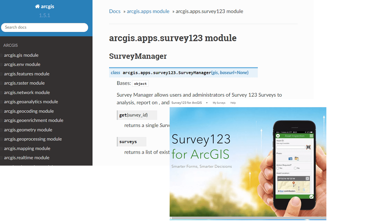
We’re all constantly on the lookout for new apps and ways to use them for making an impact. The Python API Apps module does just that – brings new ways for apps to be more useful. The apps module debuted a short time ago with stunning automation power for both the Story Map Journal and the Workforce for ArcGIS apps. But that was just the beginning. Give it up for the Survey123 module. The module provides a SurveyManager class to search out and retrieve individual surveys. Once you have a survey, you can download the survey data or generate reports from it to dig deep and find out what you’re looking for from the Survey. Stay tuned to future releases to see what other great ArcGIS apps the Python API will bring into its fold.

And that’s not all. Additions to the functionality and documentation of the Spatially Enabled DataFrame continue the progression of the API into wider application. We fixed the map widget so you can use portal basemaps and use custom symbology. Performance improvements on map loading, toolbox importing and GIS modeling, and steady refinements of the clone_items() function round out a whole set of new additions and fixes to the API. Remember… the comprehensive list of Release Notes resides here to see them all.
Coming Soon…
We’ll see you early in 2019 with future updates to the Python API. Don’t forget to join the conversation on GeoNet with any questions or queries, and scope out the API Guide, Sample Notebooks, and Dev Labs for more ways to add the API to your life.
Commenting is not enabled for this article.