The September 2018 update to ArcGIS Online introduces new features and key updates throughout the site. The same applies for configurable apps, as well as introducing a few new apps. Several apps are now out of beta, and various bug fixes and enhancements have been addressed. Check out the highlights for configurable apps below.
Scene with Inset Map out of beta
Scene with inset map is now out of beta. Introduced in our June 2018 update, this app is useful for visualizing a web scene with the inclusion of an inset map to help orient users, which is especially useful when viewing at larger scales. An arrow in the inset map shows the direction and vantage point being displayed in the 3D scene. As the scene is navigated, the inset map arrow updates to stay current. The app user is also able to zoom and pan the inset map independently to control the scale level they would like to use as reference. Furthermore, it offers the ability to present 2D and 3D views side by side or stacked. For a deeper dive into Scene with Inset Map, check out our detailed Scene with Inset Map blog.
Image Visit out of beta
Image Visit is now out of beta. Also introduced in our June 2018 update, this app allows users to quickly review the attributes of a predetermined sequence of locations in imagery. It optimizes workflows by loading the next image while the user is still viewing the current image, reducing the delay caused by waiting for the next image to be returned from the server. Navigation can be based on a “Visit” layer (editable hosted feature layer) or the web map’s bookmarks. Additionally, a “Notes” layer can be used to add or edit features associated with the Visit locations. A use case example for Image Visit would be an insurance company checking properties.
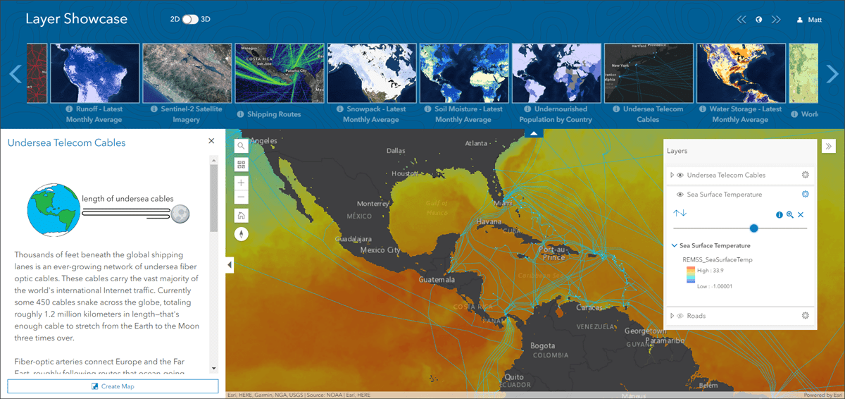
Introducing: Layer Showcase (beta)
Layer Showcase (beta) allows you to display a gallery of layers from a group. Layers can be added to a map or scene within the app and explored using a layer list and map navigation tools. Optionally, a user can choose to create a new web map or web scene from the layers they have added. The side panel in the app displays the description of the group on load and will also display the description of a layer by clicking the info button. Adding a layer also displays the layer description, and the user has the choice of adding a layer as the only one visible in the map. Layer Showcase (beta) is a simple and interactive way to allow users to browse a group of layer based content and transition them to a web map or web scene.
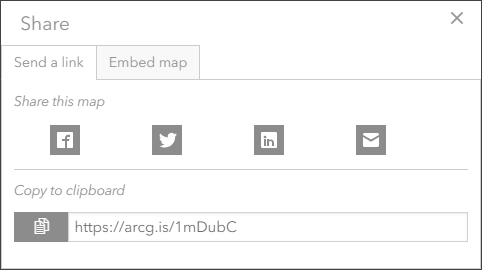
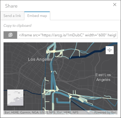
Updated share experience in Media Map
We’ve included improvements when you choose to share your app using Media Map. Sharing the app you’ve created helps expand the audience who will interact with the map and data. Common sources are still present such as Facebook, Twitter, and LinkedIn. The abilities to copy a direct link or embed the app are available as well. We’ve enhanced the parameters in the configuration panel to give more control over what share options are available in the app. On the Options tab you can control where the share button is located, as well as choose to include embed sharing options, social media options, and/or the copy URL option. Within the share dialog in the app, the embed map tab provides a preview of how the app will look when embedded in websites, news pages, articles, etc.

Commenting is not enabled for this article.