ArcGIS StoryMaps is the professional tool for harnessing the power of maps to communicate your work using place-based storytelling. The easy-to-use builder enables you to combine maps, 3D scenes, embedded content, multimedia, and more to create an interactive narrative that can inspire interest — and action — from your readers.
Each month, our team uses community feedback to help inform new capabilities that can enhance your storytelling adventures. Check out what’s new this month!
Quick links
- New cover styles in briefings
- Adjust font size in theme builder
- Media actions support keep pop-up open
- Preserve map extent or scale in swipe block
- Share with a QR code
- Advanced embedding in a website
- And more…
New cover slide styles in briefings
A little creative control can go a long way, so we’re excited to share more options for just that in briefings! First, you can now opt for a Full cover design that enables you to add a compelling cover image or video to catch your audience’s attention. Within the full cover option, select Change panel appearance to adjust your cover’s Style, Horizontal and Vertical position, and Size.
Does the tried-and-true Side-by-side work better for your presentation? Don’t worry, we’ve given you more options there, too! You can now Change panel size to suit your text and cover media needs better.
A great presentation can inspire change and facilitate decision-making. Check out these Great examples: Briefings for tips and tricks to create your own!
Adjust font size in theme builder
You found the perfect font to create a little world for your readers to lose themselves in, but you’re worried it’s too small to be broadly legible. Or your audience is young students, and it’s easier for them to read a larger font size. You might want to adjust the collective font size for your story for many reasons – and now we’ve given you the power to make that decision!
In the theme builder, you will now find an option to Adjust font size under the Typography section; use the slider to select one of five size options and note that font adjustments are reflected when viewing your story on different screen sizes.
Want to learn more about creating a little world for your readers? Watch this video on Creating your own custom theme and then check out these Nine steps to great storytelling.
Media actions support keep pop-up open
In April 2024, we added the capability to keep a pop-up open which enables you to direct your readers’ attention to a particular feature on a web map – and we’ve now extended this to maps with a media action.
After adding a map to your first slide using a Sidecar block, go to the Options tab to toggle on Keep pop-up open when adjusting the map appearance. (It is important to note that your first slide must have a pop-up open to then also have one open with a media action.) Once your map is in place, add a Media action and go to Edit map view to click and open the pop-up you’d like to reveal.
Want to enrich your stories with interactive viewing experiences for your audience? Learn more about Configuring pop-ups for stories and then Supercharge your stories with media actions.
Preserve map extent or scale in swipe block
In November 2024, we added the capability to choose between preserving the extent or the scale of web maps in your stories – and now we’ve extended this to the maps you add using a Swipe block. After adding your maps, select Options, where you will be able to adjust the Map view.
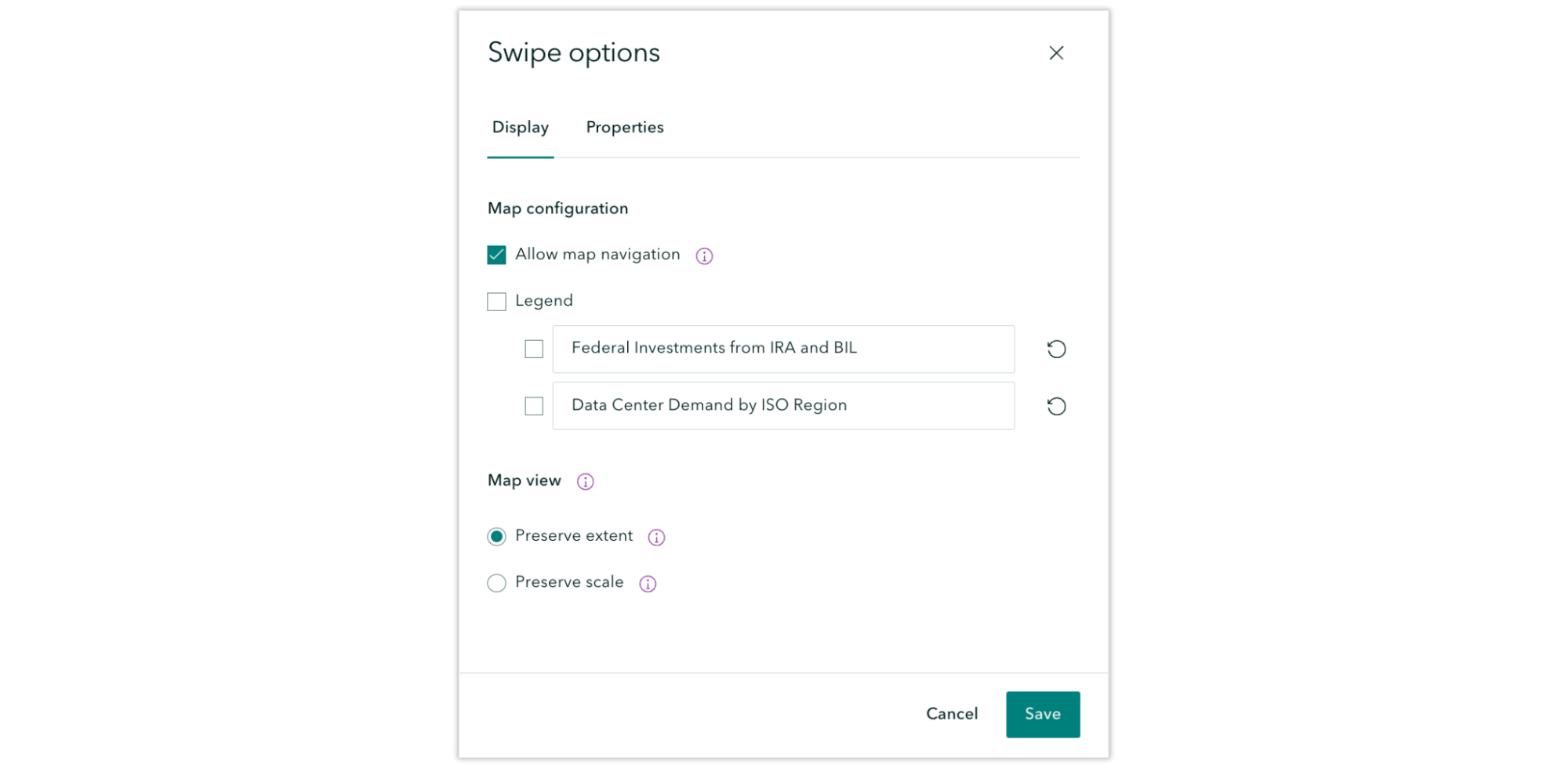
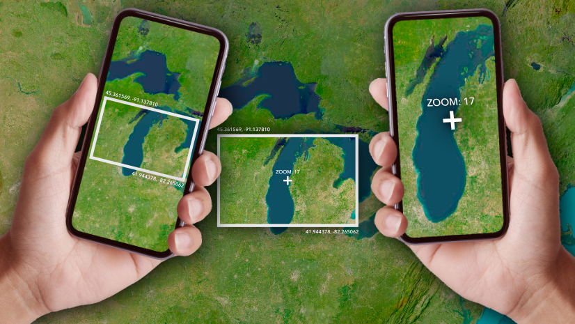
Is the information on the edges of your map just as important as that in the center? Or is the center of your map what readers need to focus on? We know the concepts of map scale or extent can be daunting, let alone how it affects your reader’s experience. Learn more about Mapping with extent or scale in ArcGIS StoryMaps to ease the process.
Share with a QR code
Chances are good that you’ve presented a story or briefing to a live audience and one of their first questions is, “Do you have a QR code for that?” We’re happy to share that you no longer need to bungle your way through producing a QR code on the spot! Now, when you click to Share your public story or briefing, a QR code that can be scanned with a mobile device is included in the range of sharing options.
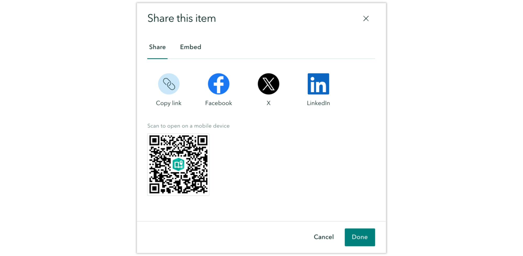
Want to keep tabs on your story after you share it? Learn how you can Use web analytics to measure your traffic in ArcGIS StoryMaps.
Advanced embedding in a website
You’ve always been able to embed stories using simple iframes, but now we’re introducing a more powerful way to bring stories to your audience. We will provide an in-depth look at exciting new updates soon, but in the meantime, we want to share a brief, updated workflow for embedding items in a website.
And more…
- In briefings, the option to Open in a new tab for links to many ArcGIS apps has been added; find the icon at the top right after clicking on an app link.
- In stories, you can now add up to 12 rows in addition to the header row with the Table block.
- Themes for Esri FedGIS25 and DevTech25 have been added to the Featured themes.
Check out the release notes for more detail about other small changes and fixes released this month.
Thank you to Ashley Du and Will Hackney for their contributions to this post.
All Adobe Stock images are © 2025 Adobe Stock. All rights reserved.


Thanks Andria Olson for posting. Very comprehensive and thought provoking. Many of the students and young professionals new to mapping, but passionate about the power of mapping software to help speed up the pace achieving successful Sustainable Development Goals (SDGs) outcomes will benefit from your post (as I did). I’m preparing to take ‘Make an Impact with Modern Geo Apps’ in April, hoping to collaborate with Kenyan and US students to improve data availability for Kenya https://dashboards.sdgindex.org/profiles/kenya. Thanks again