The December 2024 release of ArcGIS QuickCapture is here! By downloading the new release to your mobile device, you will be able to discover these new features and enhancements:
- Improvements to the data upload process
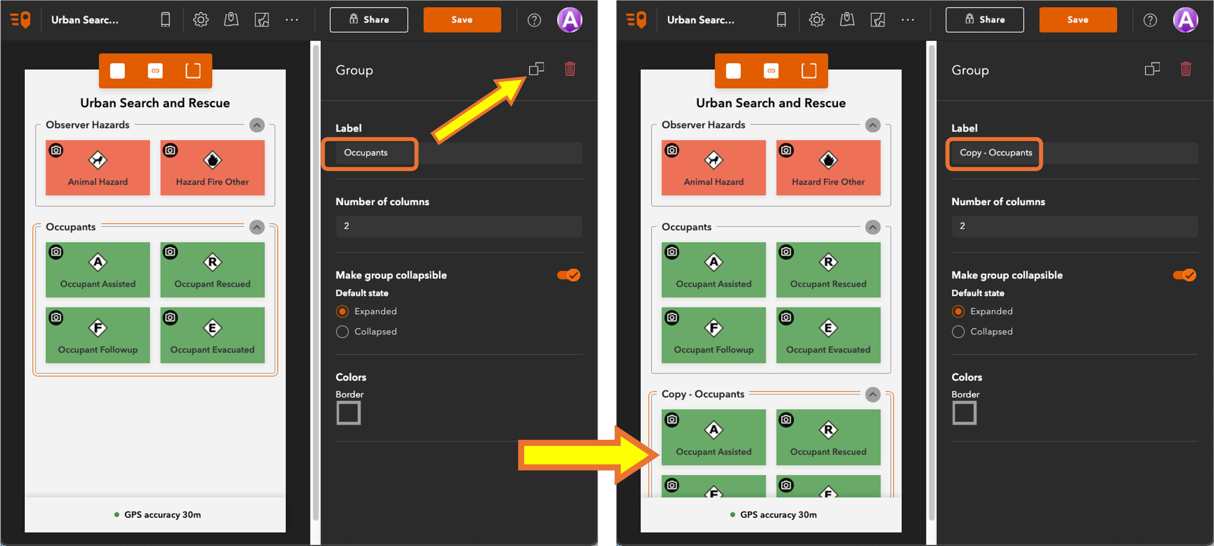
- Support for duplicating groups in the QuickCapture Designer
- Living Atlas content for dynamic choice lists

About ArcGIS QuickCapture
ArcGIS QuickCapture is Esri’s rapid mobile data collection app. Configure it to enable field data collection through a simple big button user experience. Collect lines, polygons, and point observations; all at once and with the single tap of a button!
Not familiar with ArcGIS QuickCapture? Watch this 2-minute video for an overview:

What’s new in ArcGIS QuickCapture…
Improvements to the data upload process
This release enhances the upload process submission process when sending features. The duration for network request timeout has been increased from one minute to two minutes. This means the app will wait longer for a response from the server before considering the request a failure. Increasing the timeout will reduce timeout errors in poor network conditions.
ArcGIS QuickCapture can now be configured to prevent duplicate feature submissions. If the feature service is configured with the supportsApplyEditsWithGlobalIds capability, the app will receive an error from the server if the GlobalID already exists. As a result, the app will not attempt to resubmit the feature.
Support for duplicating groups in the QuickCapture Designer
Similar to buttons, you can now duplicate groups in the designer, including all the buttons they contain. This feature saves time by allowing you to create a duplicate group and then modify the buttons within it as needed.

Living Atlas content for dynamic choice lists
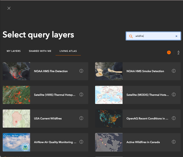
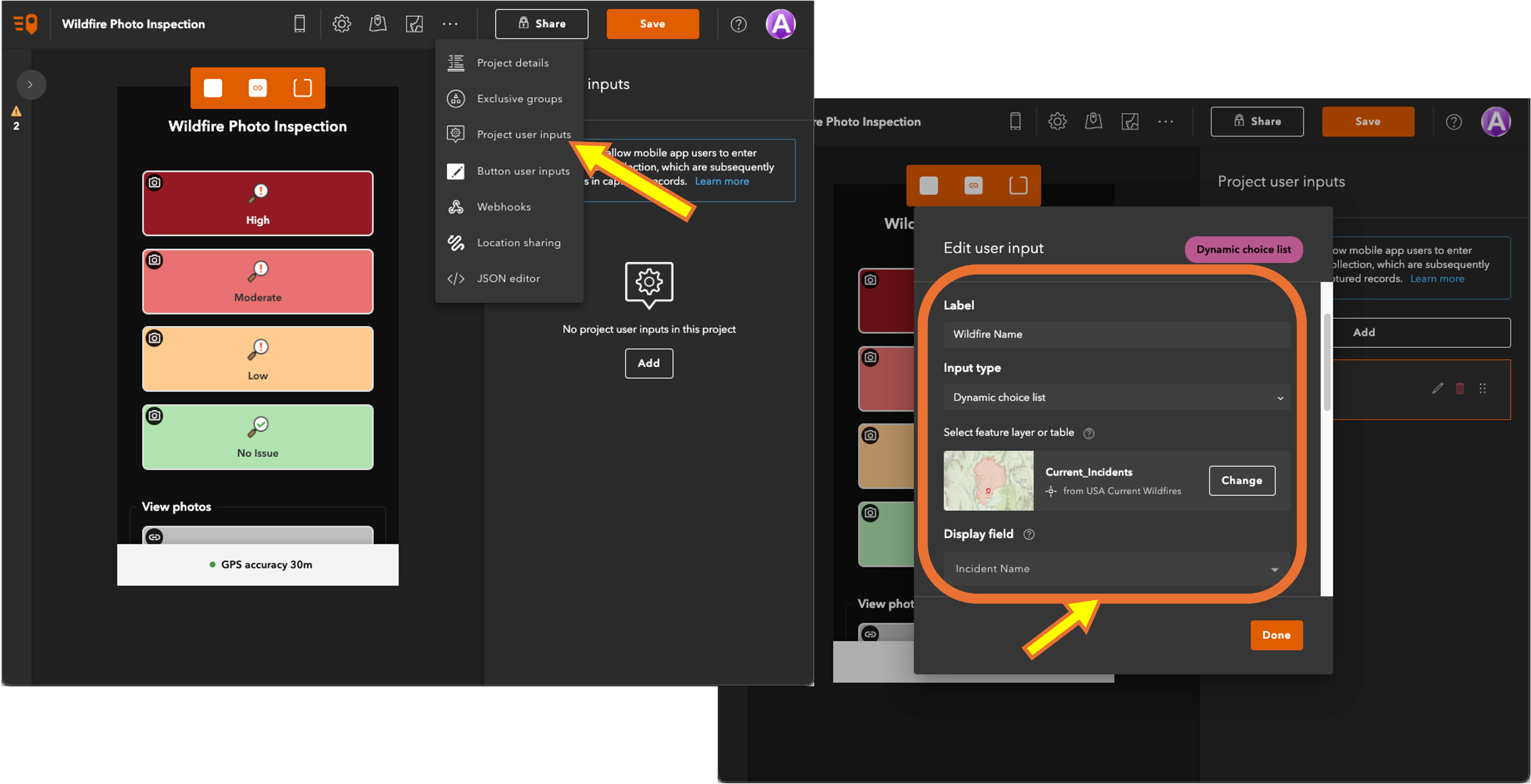
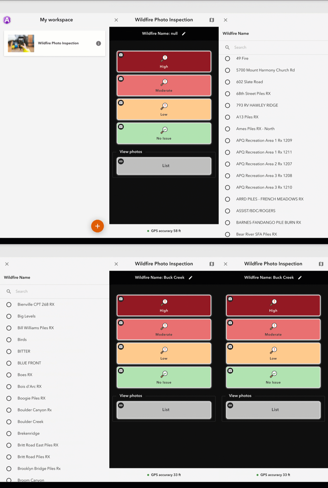
Dynamic choice lists are an input option for project user inputs (the input entered when a project is opened). These lists are based on fields in a feature layer or table, and the QuickCapture Designer now supports basing the list on Living Atlas content. This provides many possibilities, such as creating a list containing ecological unit names or county boundary IDs. This feature is for ArcGIS Online only.


General resources…
The recording and answers to the Q&A from our most recent webinar, Fast-Track Data Collection: Getting started with ArcGIS QuickCapture Q&A and Recording can be found here.
The topics we address are:
- Choosing the field app that works best for you
- Offline data capture and submission
- Improving accuracy with external devices
- Working with QuickCapture templates
- Information on webhooks
If you have ArcGIS QuickCapture-related questions, please post them to our Esri Community page.
If you would like to connect with your fellow users, please join the Esri Field Operations LinkedIn group.

Commenting is not enabled for this article.