ArcGIS Solutions help you make the most of your GIS by providing purpose-driven, industry-specific configurations of ArcGIS.
Special events are nonroutine activities within a community that bring together a large number of people. They drive economic development and are vital to quality of life but also place strain on community resources and often require special permits, planning, preparation, and mitigation of increased safety and security risks.
As a result, police and fire agencies create and map operational plans for special events to minimize threats and ensure attendee safety. Understanding where public safety resources are allocated improves operational planning, increases situational awareness, and reduces response times if an incident were to occur during a special event.
The Special Event Operations solution delivers a set of capabilities that help public safety agencies inventory special events, create operational maps, monitor event operations, and share event maps with the public.
Streamline public safety mapping for special events
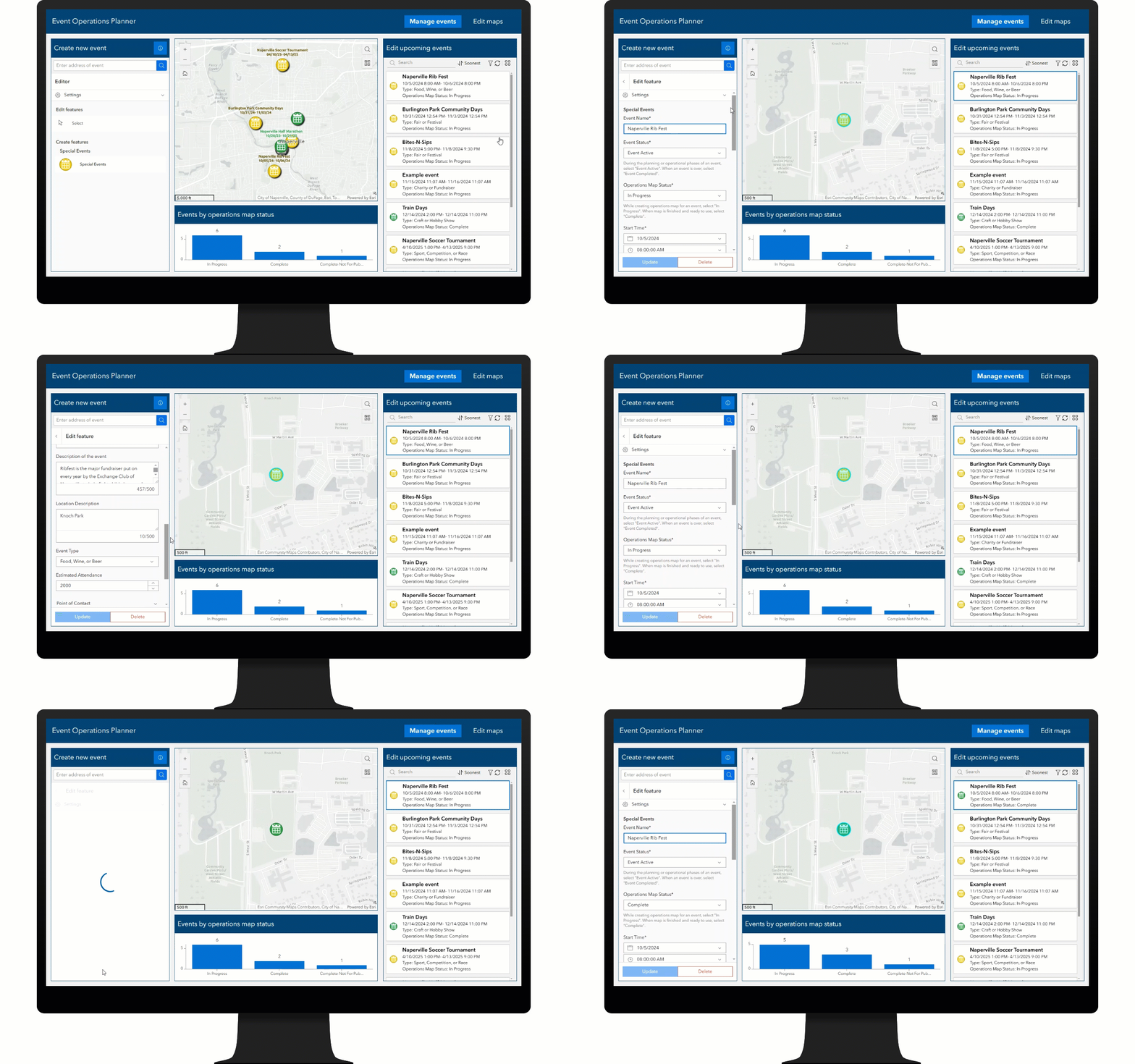
The Event Operations Planner is an ArcGIS Experience Builder app used by public safety event coordinators to manage special events and their operational maps. The app helps coordinators map the locations and key details of upcoming events their agency will support. Coordinators can view all upcoming events, update details, and close out when the event is over.
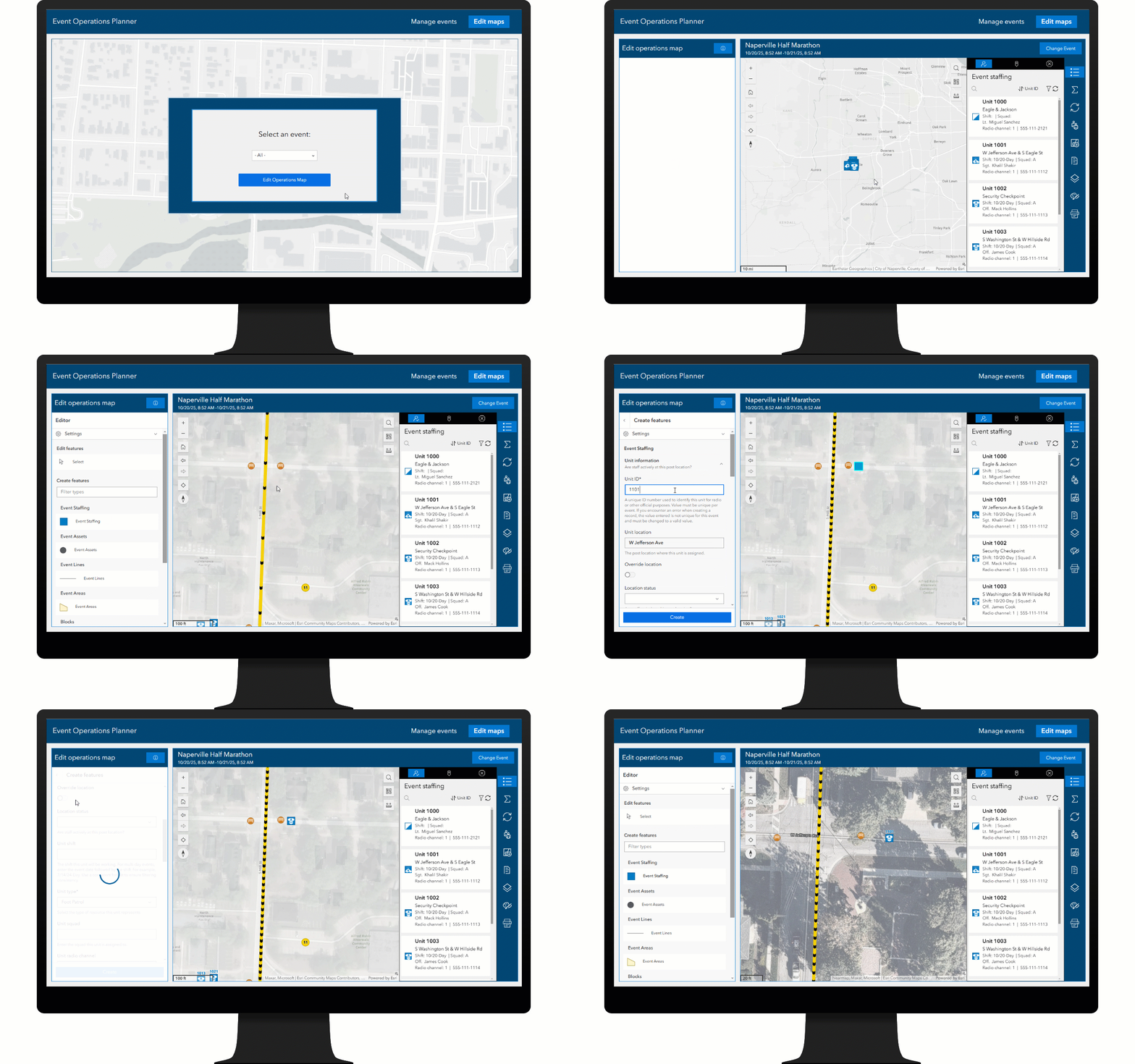
Once a public safety coordinator creates a special event, they can use the Event Operations Planner app to build an operational map for it. The app can create post locations for public safety staff, event assets, lines and areas, as well as road closures, blocks, and detours. If the operational map needs to change over time, coordinators can search and filter lists to view and edit records of interest.
In some cases, public safety event coordinators may need to download data or count staff or assets by type. The app includes the ability to view staffing breakdowns by shift and pay rate, as well as assets, areas, and lines by type, so you can quickly understand distribution of resources, and if necessary, share that information via spreadsheet to other personnel.
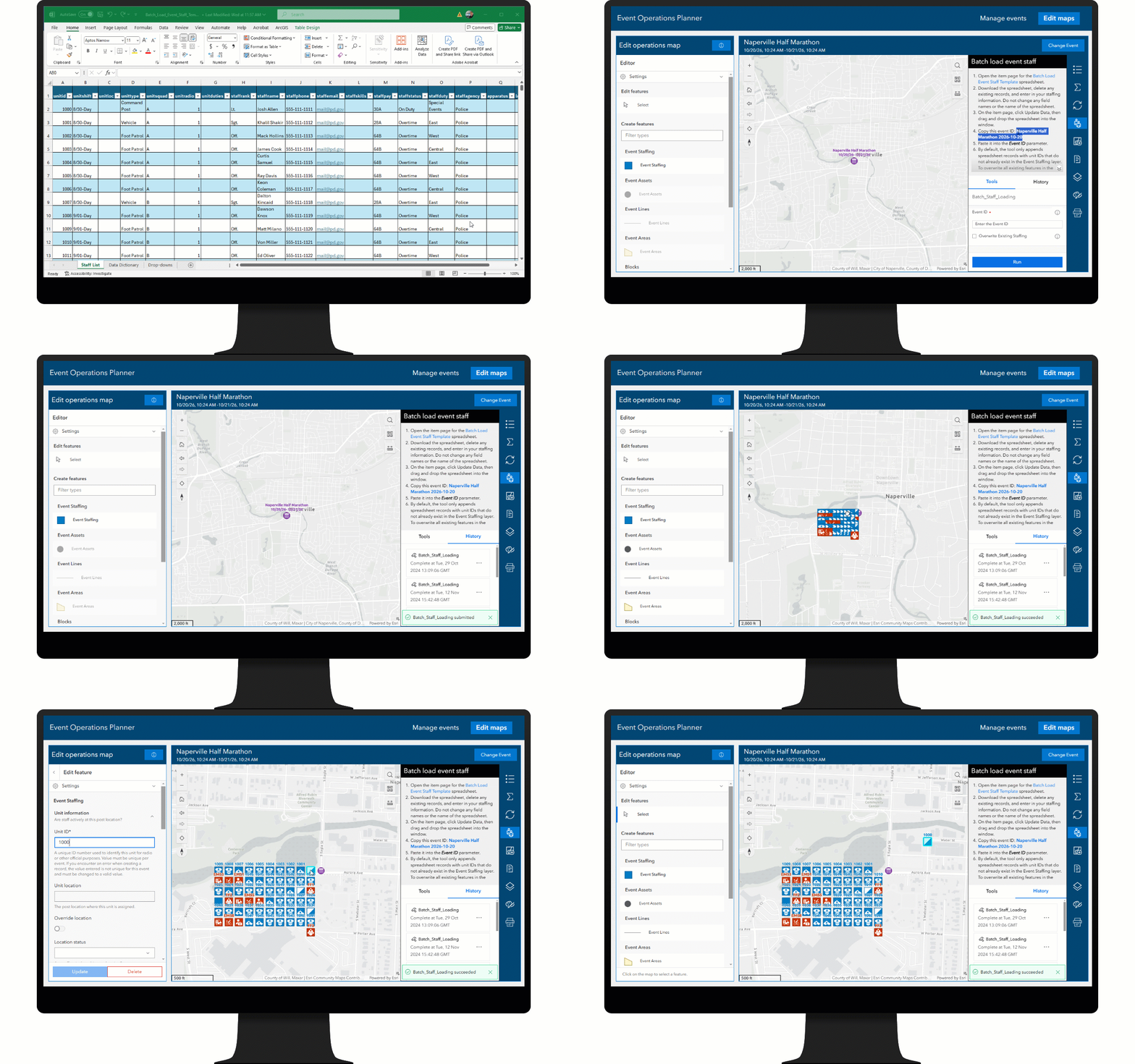
The app also includes a number of productivity features to help public safety coordinators work more efficiently, including the ability to reuse the operational map for an event from a previous year, the ability to load staffing data from a spreadsheet to accelerate mapping of posts, the ability to print maps and staffing reports, download data, and the ability to create maps that can be used in ArcGIS Mission or ArcGIS Field Maps to support location sharing and team collaboration.
Increase operational awareness
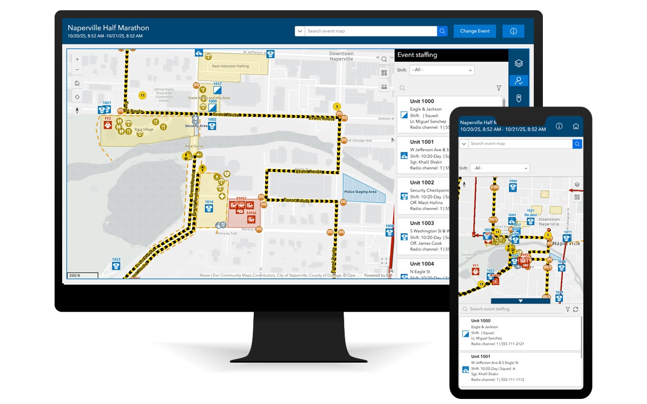
As the planning process culminates, and event day operations start, public safety event coordinators can easily share operational plans to public safety event staff. The Event Operations Maps is an ArcGIS Experience Builder app that can be used by public safety event staff to view dynamic operations maps. For each event, the app includes lists of event staff, assets, lines, areas, road closures, blocks, and detours. Each list includes a variety of filters and a search bar, making it easy to find the post location you have been assigned or to see the post locations of everyone in your squad or shift. All features on the map are dynamic and adjust in real-time, so on the day of the event, if the event coordinator makes a change, that change is instantly reflected for all public safety event staff.
The app also includes a master search bar for easy searching across all map features, as well as the ability to view staffing breakdowns by shift and pay rate, as well as assets, areas, and lines by type, so you can quickly understand distribution of resources, and if necessary, share that information via spreadsheet to other personnel. For added situational context, USA Radar, Weather Watches and Warnings, and Traffic layers can be added to view hazards that may impact event operations.
Share essential information with the public
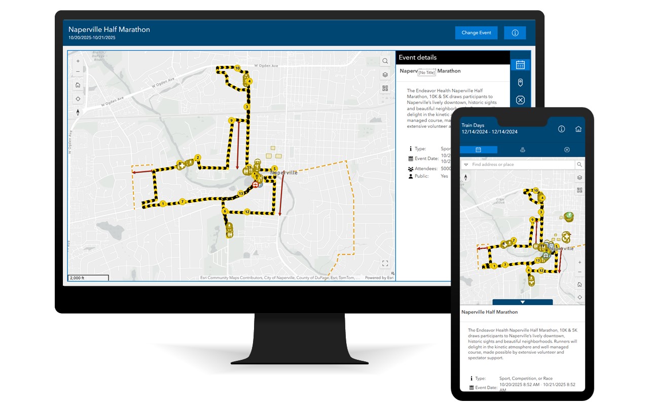
Finally, on event day, authoritative event maps can be shared to the public. Special Event Maps is an ArcGIS Experience Builder app that can be used by the public to view special event maps. Only events that the public safety event coordinator have approved can be displayed. Users can view the event map and key details about the event, but to avoid sharing operational plans, no staffing posts or safety-related features are displayed.
In addition to details about the event, you can view, search and filter lists of points, areas, and lines of interest. To understand driving impacts, lists of road closures and detours specific to the event can also be viewed.
Learn more
For more information about the Special Event Operations solution, check out the following resources:
- Learn how to deploy, configure, and use the solution.
- View a demo video.
- Learn more about ArcGIS Solutions.
- Chat with us on Esri Community.
Article Discussion: