ArcGIS Solutions helps you make the most of your GIS by providing purpose-driven, industry-specific configurations of ArcGIS.
Well maintained parks, open space, and roadsides improve the overall appearance of a community, reduce traffic accidents, and decrease health and safety risks. Mowing grassy areas also ensures public agencies comply with local ordinances that regulate the maintenance of public and private lands. As a result, seasonal mowing operations help to reduce public safety hazards, control weeds, and ensure recreation areas are welcoming for residents.
While routine mowing operations can create a cleaner community, the sheer volume of mowing areas in a community makes it difficult to mow every park and open space. Understanding where mowing has occurred and measuring performance helps organizations understand whether staff and contractors are meeting service agreements. Furthermore, understanding seasonal performance improves mowing plans and can be used to optimize any contracted resources.
The Mowing Operations solution can be used by public works departments, park agencies, departments of transportation (DOTs), and airports to develop seasonal mowing plans, manage a central repository of mowers, and monitor real-time mowing activity and service performance.
Improve seasonal mowing plans
Public works, parks departments and DOTs, are the primary government agencies responsible for managing mowing of both public land and private lots under their purview. Prior to each mowing season, organizations can create more precise and efficient seasonal mowing plans by taking an inventory of mowing areas – including specific needs and limitations of each area. Service agreements can be developed for each responsible department or contractor to declare maintenance responsibilities and timelines.
By centralizing data, the solution makes it easier to evaluate seasonal performance and adjust plans accordingly, allowing organizations to better allocate resources, reduce operational costs, and improve service delivery. These improvements not only enhance community aesthetics but also ensure that public safety concerns are addressed effectively, demonstrating the solution’s value in maintaining clean and safe public spaces throughout the year.
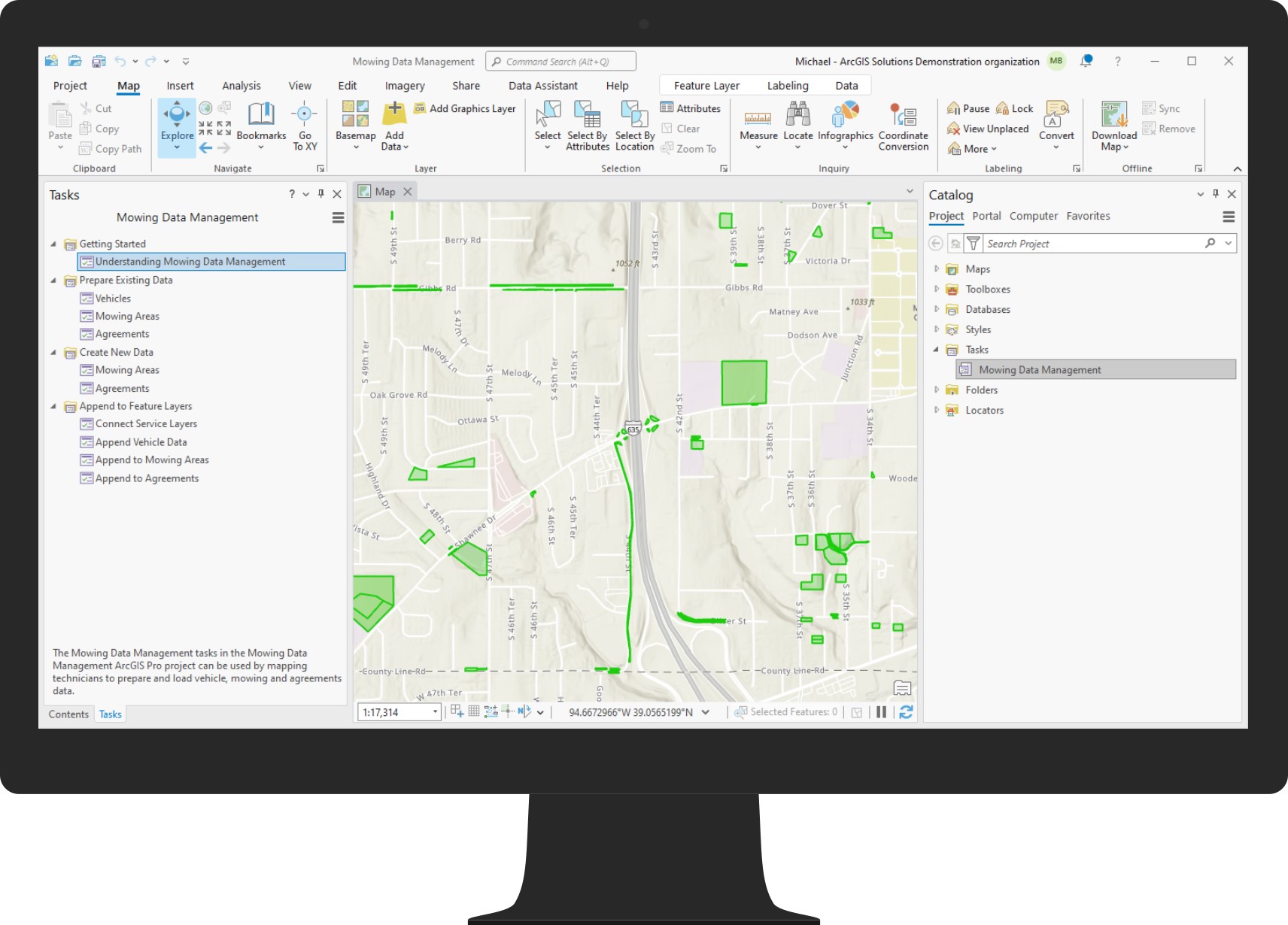
Developing an effective mowing plan before the mowing season begins requires reliable and current data. The Mowing Data Management ArcGIS Pro Project helps you manage an authoritative inventory of mowing areas, service agreements and vehicles so you can develop mowing season maintenance plans.
Inventory vehicles
The ArcGIS Velocity analytics shipped with the Mowing Operations solution are designed to work with both existing AVL providers as well as ArcGIS location tracking technology. Maintaining a vehicle inventory helps you understand the current state of automated vehicle location (AVL) technology used by your fleet, identify the needs of vehicles without AVL, and helps you document important information for each vehicle required by the solution.
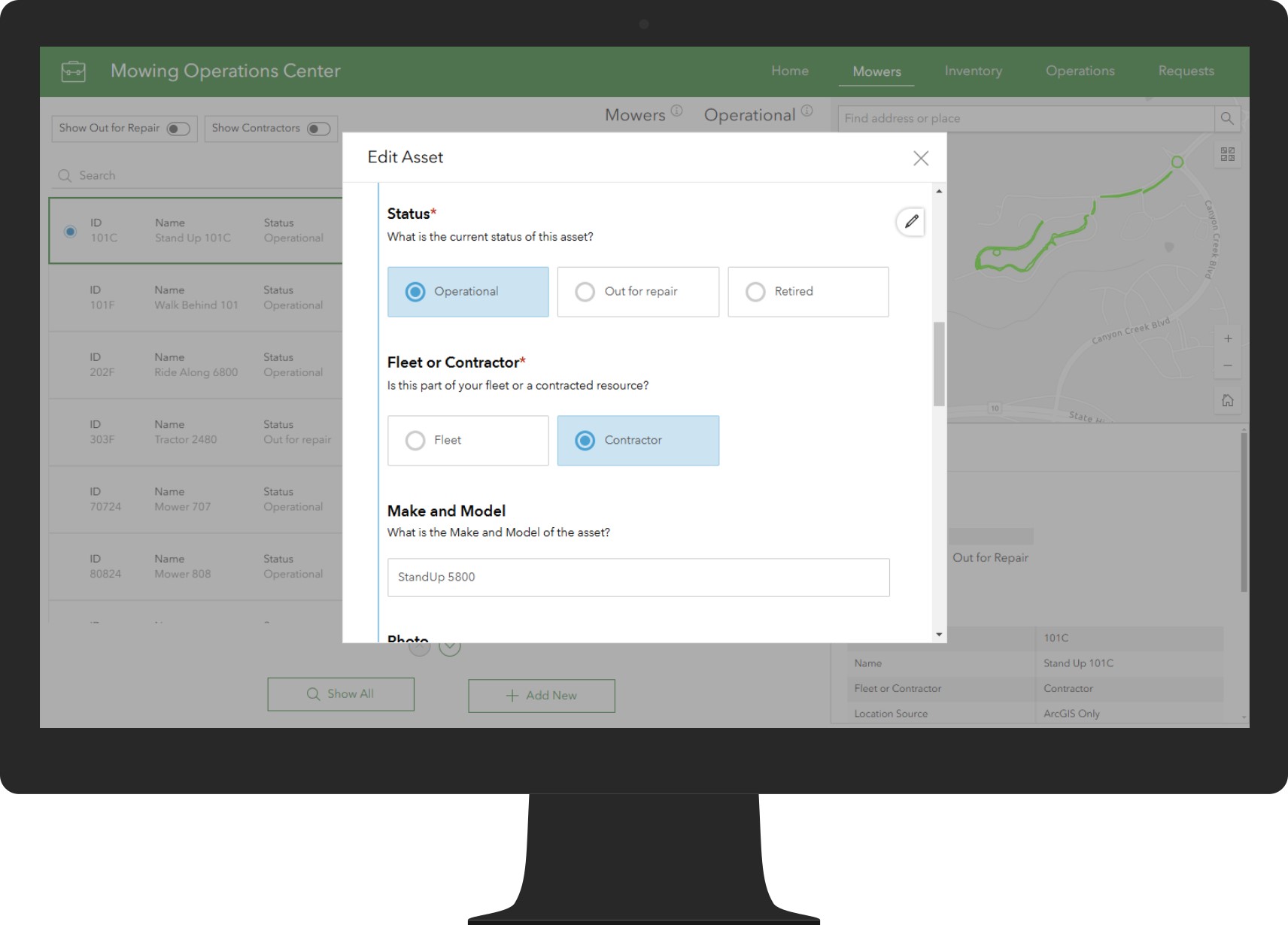
Create and manage an authoritative inventory of mower fleet and contractor vehicles with the Mowing Operations Center so you can bring together disparate sources of information and create a common operating picture of vehicles supporting your mowing operations.
With your vehicles inventoried and mowing areas and other foundational datasets created, you will be ready for the growing season when it arrives.
Streamline mowing operations
Public works, parks, and transportation agencies can use ArcGIS to extend their ability to track and monitor mowing operations by including vehicles with limited or no existing AVL technology on board. Mowing operators and contractors equipped with ArcGIS location tracking technology and field operations apps can be tracked alongside vehicles supported by an AVL system.
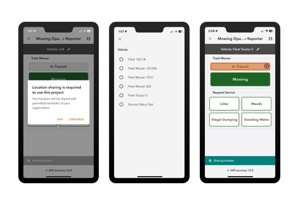
The Mowing Operator Reporter ArcGIS QuickCapture project can be used by mowing operators to record current vehicle location, service status and service requests during operations.
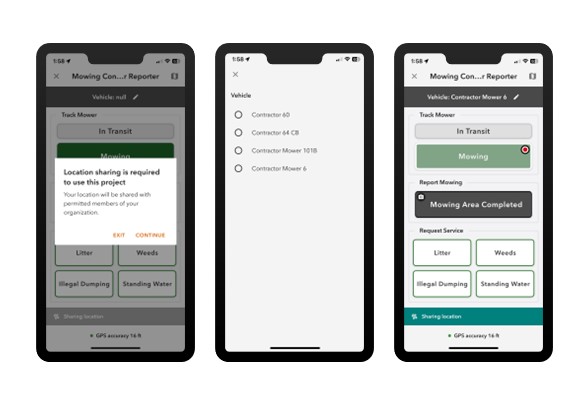
The Mowing Contractor Reporter ArcGIS QuickCapture project can be used by mowing contractors to record current vehicle location, service status and service requests during operations. Optionally, mowing contractors can submit a mowing report to submit locations and photos of completed work.
Monitor mowing operations
Real-time information and transparency are critical during mowing activities. Understanding where mowers have traveled and are currently located helps clearly identify which mowing areas have been serviced, and which are past due.
The Mowing Operations Dashboard can be used by operations and maintenance managers to help monitor mowing activity during operational periods so you can ensure service agreements and key performance metrics are being met.
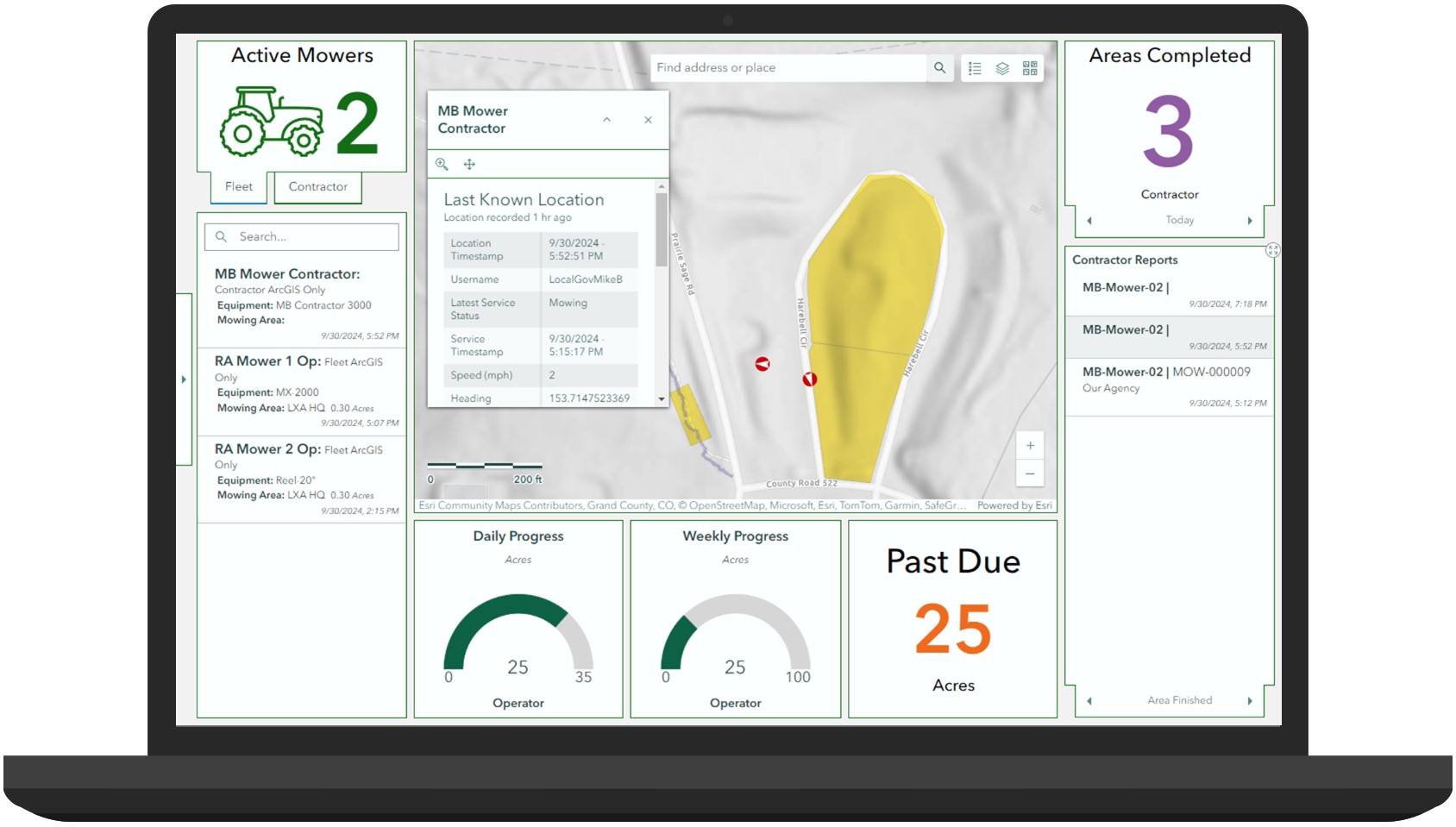
Each mowing area can be filtered by service agreement, service date, and contractor to track mowing season performance. Contractor mowing reports and service requests can also be viewed to assess current mowing conditions and field issues.
To manage incoming requests, staff can use the Mowing Request Manager app to triage mowing service requests from the operators and contractors.
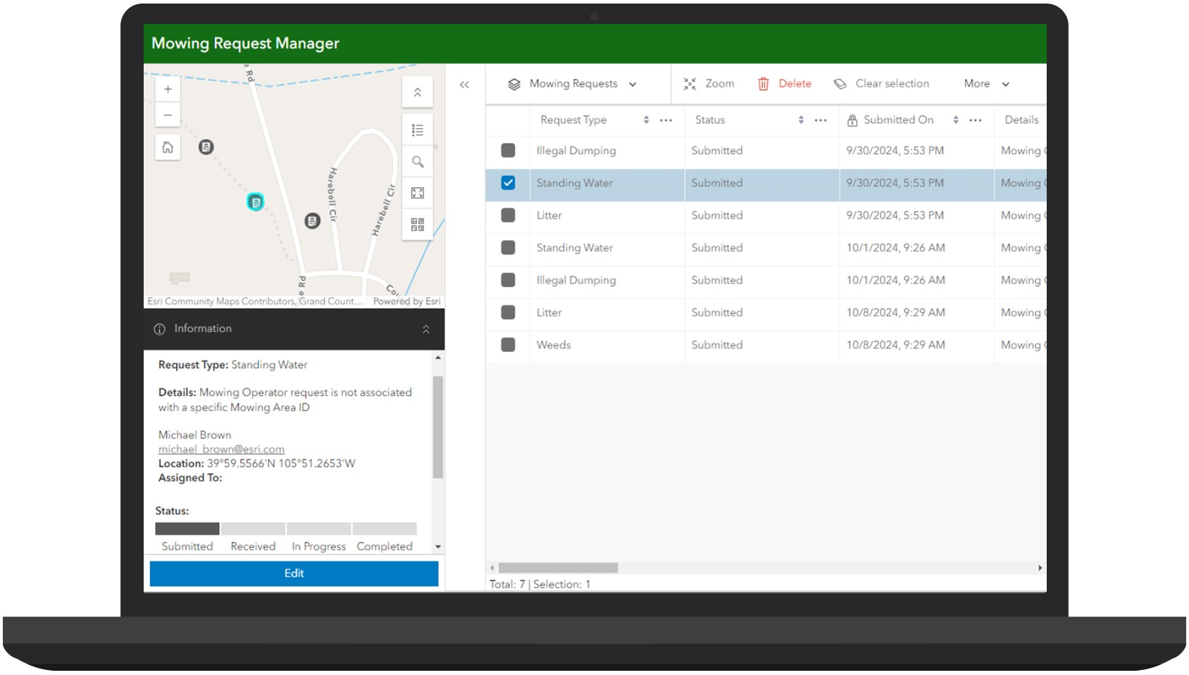
This allows staff to monitor and address small issues before they become too big, costly, or unsafe for your community.
Learn more
For more information about the Mowing Operations solution, check out the following resources:
- Learn how to deploy, configure, and use the solution.
- View a demo video.
- Discover related solutions: Cemetery Management, Parks and Grounds Management, Street Sweeping Operations, Winter Weather Operations, Tree Management.
- Learn more about ArcGIS Solutions.

Article Discussion: