ArcGIS Excalibur continues to mature and this release brings several additions to provide better project management and analysis experiences. There was a particular focus on streamlining the process for getting up and running quickly with the application from an architecture and licensing standpoint. The analytics footprint has increased and the application becomes even more tightly paired within the ArcGIS web framework.
Updated Architecture & Licensing for Seamless Access
Excalibur has traditionally been provided as a premium add-on for ArcGIS Enterprise which required a separate installation within an ArcGIS Enterprise base deployment and an administrator assigning the application to a named user. At the Enterprise 11.4 release, Excalibur is now an embedded application that requires no additional installation. In addition, as per the user type changes in June of this year, ArcGIS Excalibur is included with the Creator and above user types. This means you can get up and running quickly without the need to install the application or assign an add-on license because user types leverage the named user model in the wider ArcGIS system.
The Excalibur Project Increases Collaboration with New Support for Contextual Layers
The Excalibur project continues to grow in functionality and extends an already rich set of supporting tools. Excalibur projects provide a dynamic way to organize all the resources required for an image or video-based task. They promote collaboration across an organization by enabling analysts to conduct focused, ready-to-use workflows aimed at creating content from imagery and video.
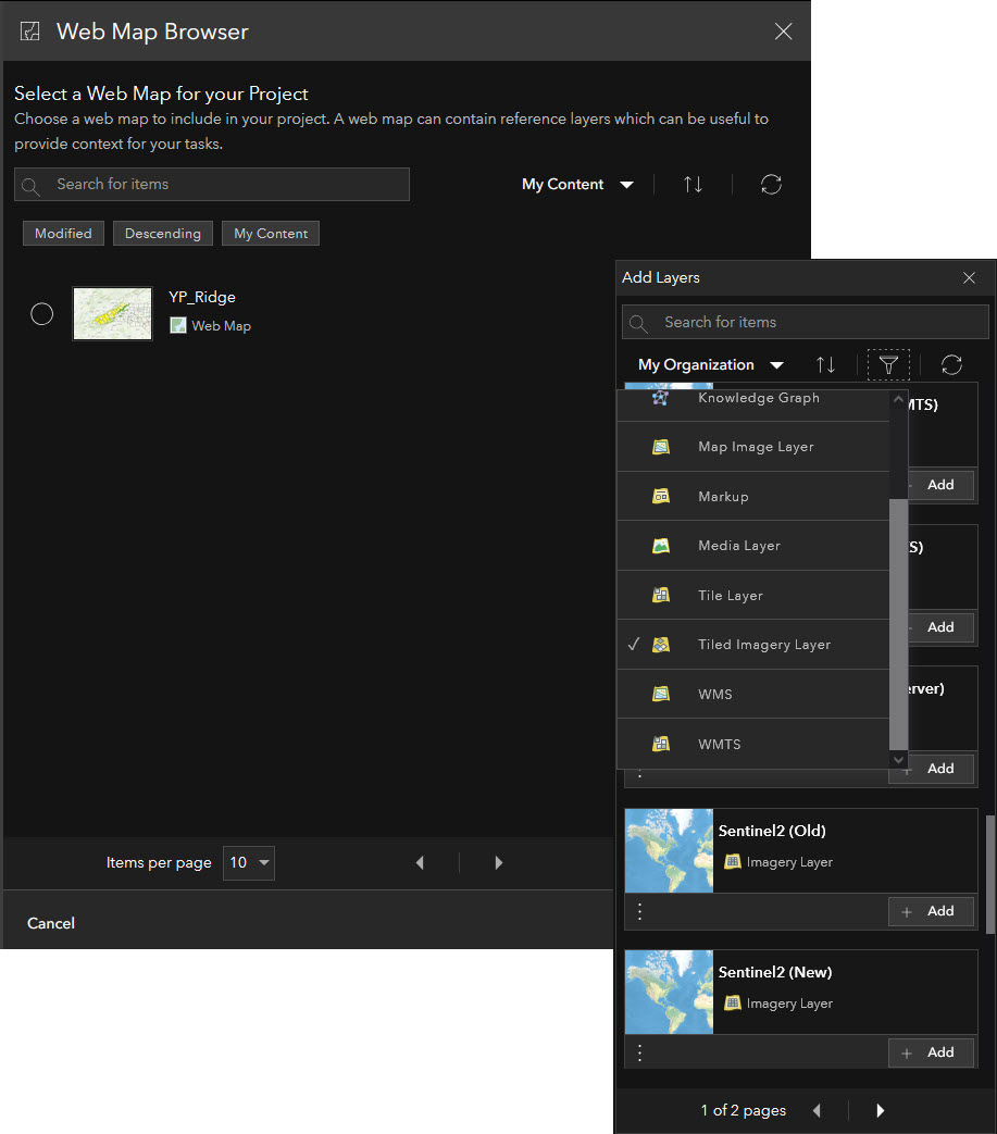
It now supports the ability to add layers from an authenticated Portal which brings the utility of adding contextual or supporting supplemental layers into the project. In addition, there is now support for the ArcGIS WebMap enabling existing maps to be consumed as well as authoring of new maps all within the confines of the project.

Enhanced Analytics Through Use of Image Chips and Attachments
There has been a significant effort to extend the observation collection experience. Observation collection has a variety of use cases but is well suited for remote inspections or pattern detection. It essentially allows you to capture feature data with the corresponding attributes from supporting layers or focus imagery that are posted into an authoritative system of record.
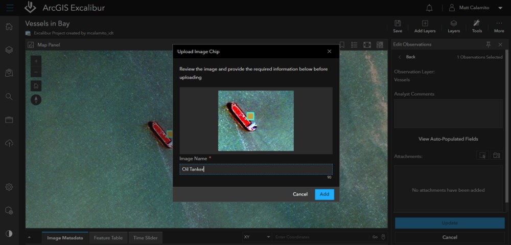
An addition at the November 2024 release allows the user to capture image chips (small defined images) that are added into the feature layer as an attachment. This now enables an Excalibur user to extract imagery observations for a series of images over time and provides attachments for downstream analysis within ArcGIS. In addition, Excalibur has a new tool that will create a web application experience around these attachments. This is an iteration of the Attachment Viewer Instant App and is created and published into the Portal.

Additions to Publishing: Easily Add Geospatial Context to Videos
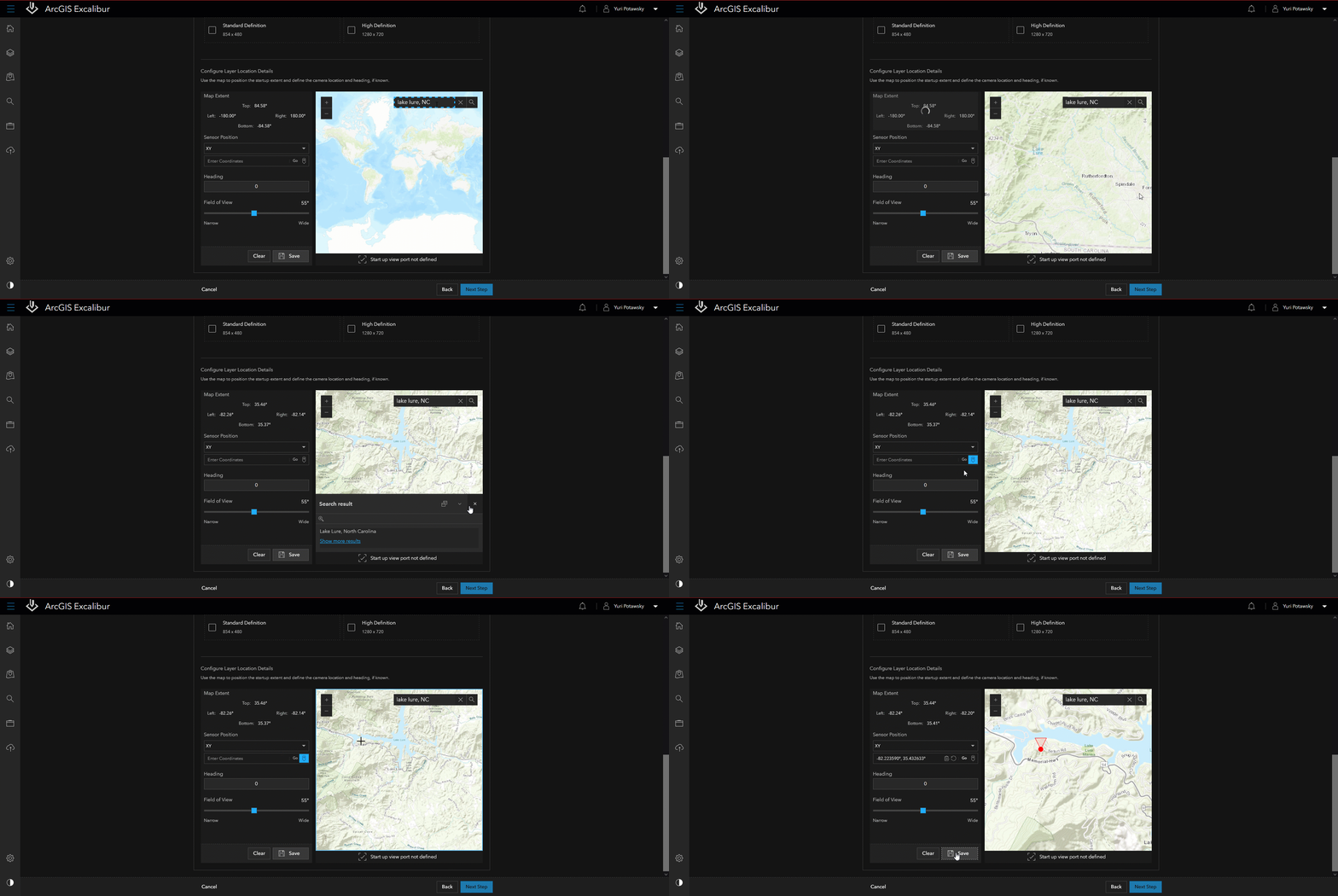
Frequently users capture video that do not contain the metadata required for geospatial awareness. When publishing video layers through the Excalibur publishing tools, key location details can be defined. Users can now leverage geolocated videos in their GIS by manually adding location data, expanding the range of videos that can be accurately displayed on a map.
To learn more about what ArcGIS Excalibur can do, visit the product page or ask the experts on Esri Community.


Article Discussion: