For November 2024, Esri will deliver new offerings featuring three long-requested datasets. In the US, we are releasing a new urbanicity dataset as well as data based on school district boundaries. Esri Demographics will also introduce a new European cross-boundary dataset in beta.
Additional updates for November 2024:
- Users in search of global data will have access to data for countries in North America, South America, Asia, and Oceania.
- Business Summary data—Features 14 new categories of business of three variables each. This dataset will be updated three times/year and represents a June 2024 vintage. Business Summary data was previously updated once a year in June. New categories include the Construction, Transportation/Warehouse and the Health Care/Social Assistance industries. Click here for the updated Business Summary methodology.
- Traffic Counts data (from Kalibrate).
- Tapestry Early Adopter Program enrollment (ends early November 2024.)
- Reminder: All 4orange data for the Netherlands will be officially deprecated.
Click here for a copy of the November 2024 release notes.
Esri’s demographic data is available through the following delivery mechanisms: ArcGIS GeoEnrichment service, ArcGIS Business Analyst (web and mobile apps, Pro, and Enterprise), ArcGIS for Excel, and ArcGIS Insights.
US Data
Urbanicity
Urbanicity is the level of urbanization in a particular area ranging from “urban cores” (e.g., Manhattan, Los Angeles, other dense areas) to rural communities. Urbanicity Type is a classification system built by Esri that designates land into one of 10 urbanicity categories. These categories can share characteristics, such as density, distance, and socioeconomic dependence on urban cores. Sample use cases include the following:
- A retailer analyzes urbanicity data to choose locations for new stores based on customer traffic and demographics
- A city government office studies urbanicity data for transportation and infrastructure improvements
- A pharma/health care company analyzes urbanicity data to improve service offerings and deliveries to improve customer service.
For the November release, urbanicity data will be available for Business Analyst users through ArcGIS Business Analyst Web App, ArcGIS Business Analyst Pro, and ArcGIS Business Analyst Enterprise. Dominant urbanicity variables will be available through GeoEnrichment service, but not in business Business Analyst Web App.
For a full list of Esri’s different Ubanicity Types, click here. To learn more about Esri’s Urbanicity Types, read the new methodology statement or take the urbanicity tutorial.

School Districts
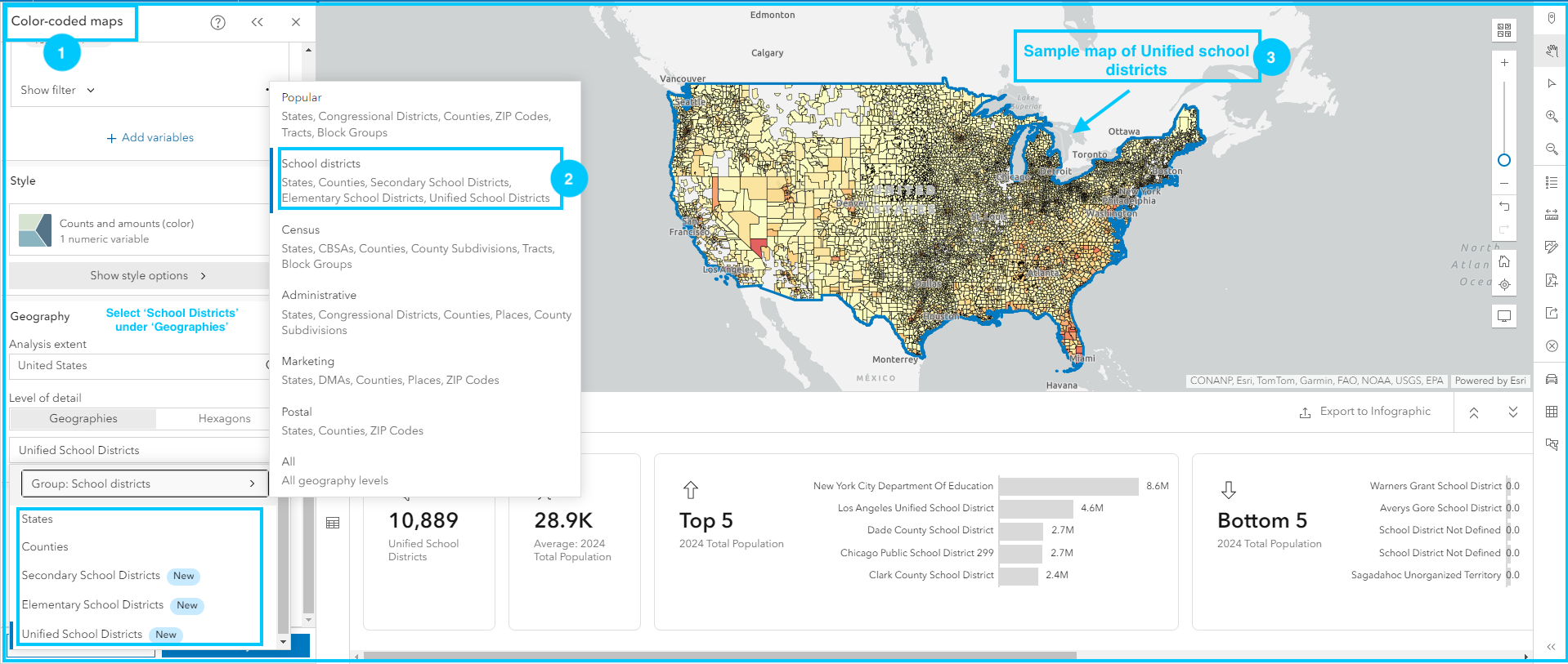
In 2020, the US Census Bureau worked with the National Center for Education Statistics to update boundaries for Elementary, Secondary, and Unified school districts. Esri will enable boundaries for all three school district types. For Puerto Rico there will be one school district.

Global Data
European Cross-Border Data (Beta)
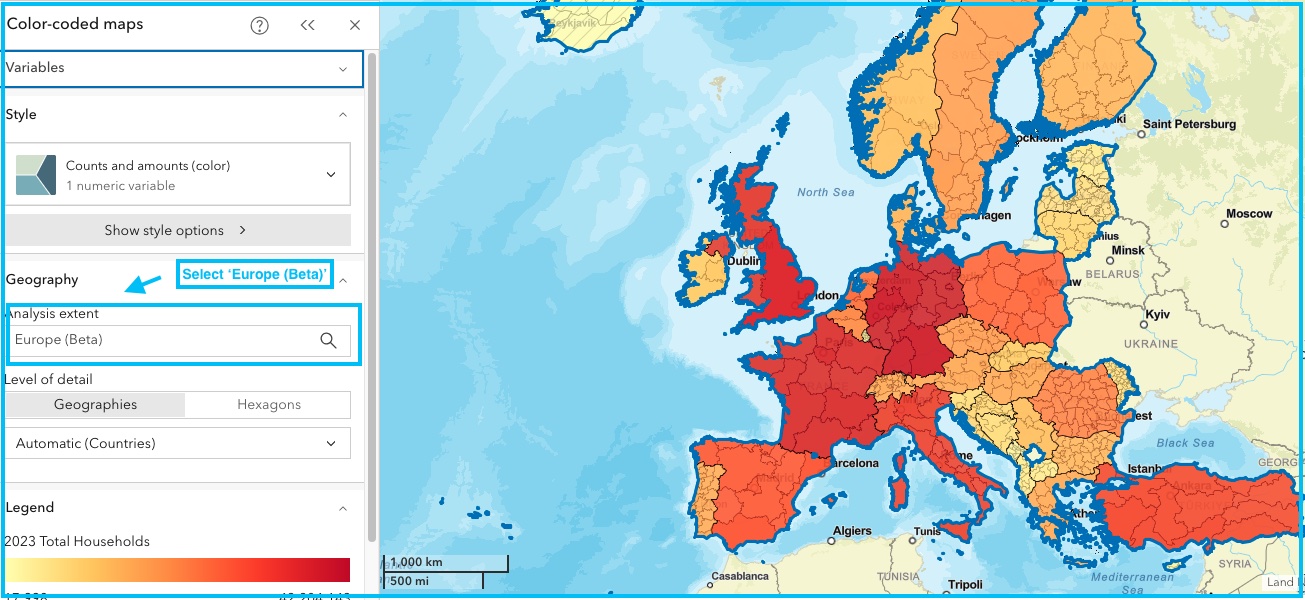
With cross-border analysis, users can analyze demographic data across country boundaries. In the past, users could only analyze one country at a time. With this new dataset, users can analyze areas that cross two or more country boundaries.
This Beta will only be available for Business Analyst Web App and Business Analyst Pro users.

Standard Demographics:
Standard Demographics for 12 countries in South America
- Argentina, Bolivia, Brazil, Chile, Colombia, Ecuador, French Guiana, Guyana, Paraguay, Peru, Uruguay, Venezuela
- Source: Michael Bauer Research GmbH
- Data Vintage: 2024
Standard Demographics for six countries in Oceania
- Australia, Fiji, New Caledonia, New Zealand, Papua New Guinea, French Polynesia
- Source: Michael Bauer Research GmbH
- Data Vintage: 2024
Advanced Demographics:
North America
- Advanced Demographics for Canada
- Source: Environics Analytics
- DemoStats (Environics’ source for current year estimates and projections) will feature updated data inputs for each theme to include all available data from the 2021 Canadian Census. Users will now have access to the most current data available.
- Data Vintage: 2024
India
- Advanced demographics for India
- Updated boundaries and one additional variable (current year population estimate)
- Source: Esri India
- Data Vintage: 2024
Visit the Esri Demographics documentation page to learn more about global data offerings.
Get Started
Esri Demographics are accessible in various ways from Esri…
ArcGIS Online and ArcGIS Pro
Use Enrich Layer to append location-based data to points, lines, or areas.
ArcGIS Business Analyst
Identify sites and evaluate markets with ArcGIS Business Analyst, a demographic mapping software.
ArcGIS Location Platform
Enhance workflows and apps with additional location-based information about people and places in a specific area.
Reports and Data
Just need a report? Buy Esri Reports.
Just need data? Contact datasales@esri.com.

Article Discussion: