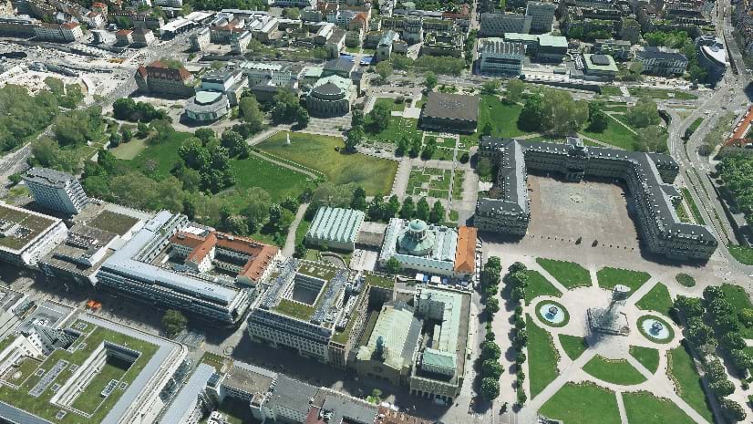
If you are interested in doing reality mapping at city and country-wide scale, keep on reading. You’ll see a sneak peek of some of the quality, performance and usability improvements that will be part of ArcGIS Reality Studio 2024.3, scheduled to be released October 8th.
Do More, Faster.
We designed Reality Studio to address the needs of professionals wanting to efficiently generate high-quality results out of large collections of aerial images. In every release, we optimize our algorithms to accelerate the generation of the output products and work on reducing the amount of time operators need to achieve the level of quality they need. This release introduces three important productivity improvements that help deliver quality results with less effort.
Digitize water bodies, once.
Water bodies are a big challenge for photogrammetric software. Water lacks texture; it moves and reflects light, a perfect combination of things photogrammetry struggles with. So far, our users have had the option of providing very detailed 3D polygons that overwrite the out-of-the-box results. The challenge with this workflow is that things change, boats move, trees grow, and human-made structures are extended or replaced often. This required users who wanted the best possible output quality to manually digitize detailed 3D polygons for every project.
With this latest version, users can quickly digitize coarse 3D polygons within Reality Studio. These polygons are only required to include the water bodies and can be digitized in a fraction of the time needed for accurate ones. Our algorithms filter out unreliable data within the coarse polygons and retain above-ground structures like boats, docks, bridges, etc.
Even better, if water bodies don’t change dramatically, you can use the same polygons for multiple projects, reducing the required manual interaction to zero for future projects.
If you forgot to provide a waterbody from the beginning, no problem, you could update your reconstruction and provide your coarse or precise waterbody at a later stage. The software will deduce what areas were affected and will reprocess them.

Retouch your results, fast.
We know that capturing the best imagery is not always possible. Flight permissions may be granted at sub-optimal times, weather conditions are hard to predict, and the flying season is not long enough to cover demand. So, we do our best to develop robust algorithms that get the most out of the available data, yet results are not always perfect.
To address this, we are providing users with a way to quickly iterate on the initial results.
With this product update you will be able to create correction polygons directly on your initial results. Reality Studio will automatically deduce what areas need to be updated and will reprocess them.

True Orthos and DSMs from oblique imagery.
So far, users working with oblique imagery had to create an additional reconstruction if they wanted to generate DSMs and True Orthos in addition to Point Clouds and 3D Meshes. The upcoming version decreases manual interaction and shortens time-to-delivery by enabling users to create all output products in a single reconstruction.
Better Quality Out-of-the-Box
This update also includes improvements to the reconstruction pipeline aiming at extracting as much information as possible from the input data. It will generate more detailed and complete 3D Meshes and Point Clouds.

In previous versions, we improved our image alignment to correctly model imagery captured over multiple sessions/flights. Now we are introducing enhancements to our global color balancing that make this process not only faster, but also better at handling radiometric differences frequent in multi-day captures and long flights.

Quality of Life Improvements
Reality Studio 2024.3 is also packed with a wide range of usability improvements to help you get things done faster.
- Digitize Polygons without leaving Reality Studio
Easily create and edit 2D polygons to define the project area, and 3D polygons for corrections and water bodies without switching to another application. - Visualization and Filter
Users can now toggle the visualization of multiple layers at the same time, avoiding having to toggle each layer separately. Users can also filter layers by type, enabling them to go about their work with less clicks. - Rename, Remove, and Edit Project Items
Rename items to tidy up your project. Remove project items that were erroneously created or are no longer necessary. Modify the CRS of items to correct mistakes. - Select Control Points on Map
Users can now choose which control points to measure from the table. They can also use the selection tool in the Image Measurement view directly to choose the target control point on the map. - Import your navigation data
Import navigation data containing angles stored in degrees, radians, or gradians. - Inspect Raster Results Without Distortion
The new Nadir view and parallel (orthographic) drawing mode allow users to visualize rasters without perspective distortion or effects introduced by the terrain.
Stay Connected
If you have questions or ideas regarding city and country-wide reality mapping, please visit our ArcGIS Reality Studio community.
For examples of what can be done with these kinds of results, please read this blog on how the city of Stuttgart is creating 3D foundational content and explore this storymap by Esri Germany on how to extract analysis from your reality outputs.


Article Discussion: