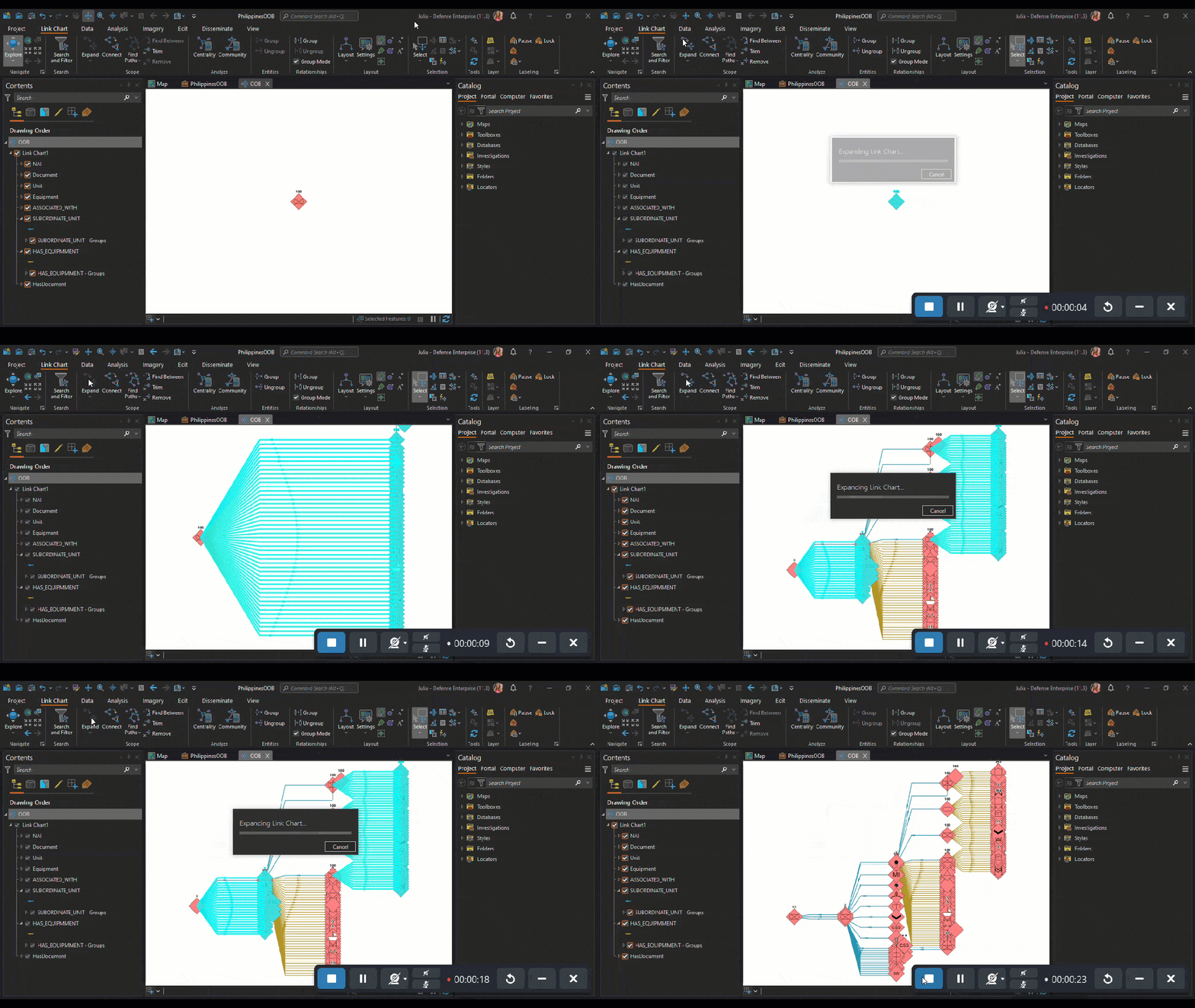
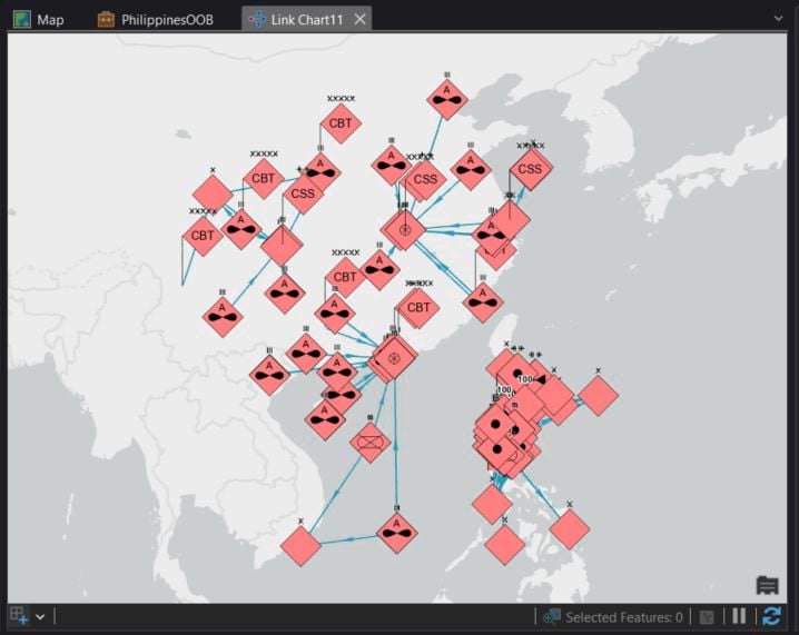
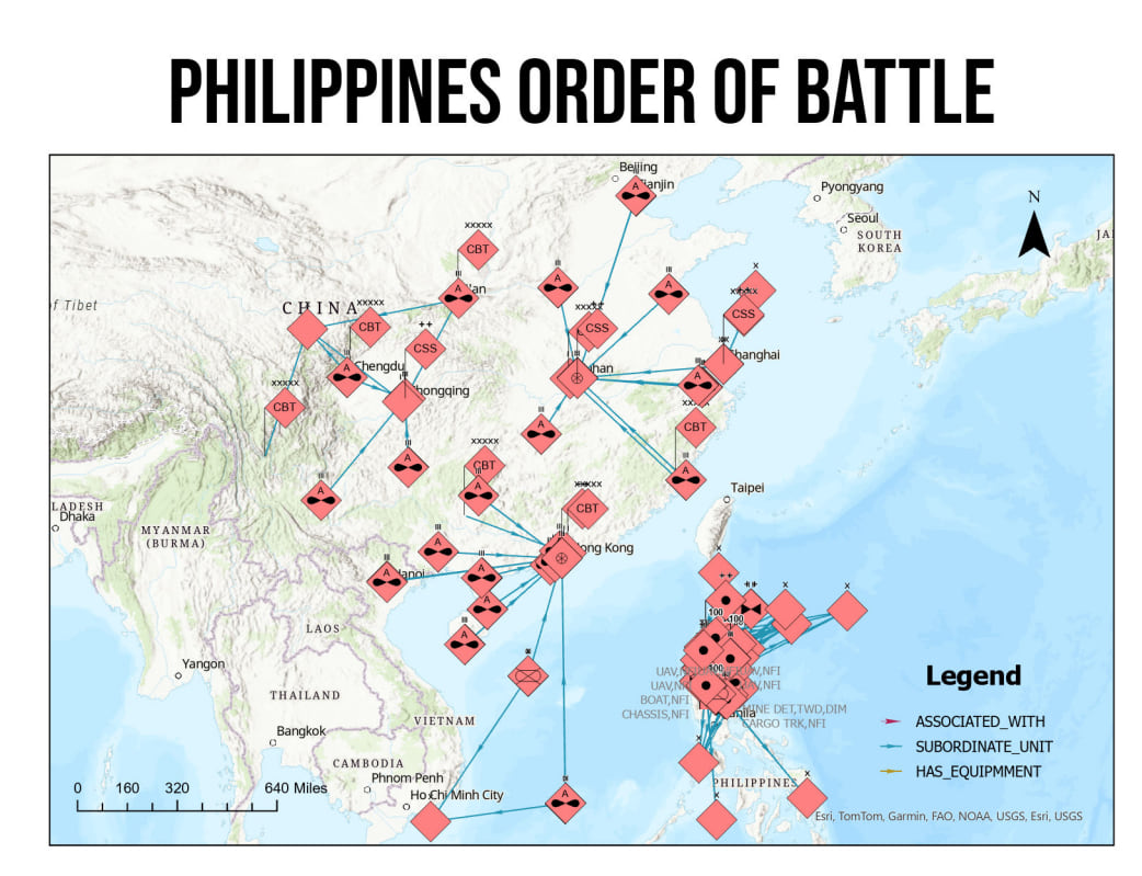
In complex and dynamic military operations, the integration of advanced technological tools is crucial for strategic planning and execution. ArcGIS enhances military operational efficiency and readiness through advanced analysis and data management tools. It enables military leaders to quickly assess their capabilities, understand the structure of their forces, and make informed decisions based on the comprehensive visualization of their assets and their interrelationships.
This blog explores how ArcGIS supports operational planning, course of action (COA) analysis, and after-action reviews (AAR) to contribute to more informed decision-making and strategic advantages.
Operational Planning
Terrain features such as elevation, vegetation, and urban structures are vital components of operational planning. Using ArcGIS, commanders can access detailed information to determine optimal movement routes, identify defensible positions, and predict potential enemy courses of action (COA). This spatial analysis ensures that military forces can navigate complex terrain by making decisions that leverage the landscape to their advantage.
Weather plays a significant role in military operations. ArcGIS provides dynamic updates and detailed spatial information on weather patterns affecting operational areas. Whether it’s planning for adverse weather conditions like fog, rain, or snow, commanders can time their operations, adjusting logistics to minimize environmental impacts and ensuring that forces maintain a tactical edge.
Understanding and disrupting enemy logistics are key to gaining an upper hand. ArcGIS helps monitor and analyze enemy supply lines, identifying critical choke points, logistic bases, and preferred routes. By targeting these areas, forces can cripple the enemy’s ability to sustain operations, forcing them into defensive positions.

Course of Action Analysis
ArcGIS facilitates the analysis of historical intelligence and real-time data, allowing commanders to discern patterns and trends in enemy behavior and terrain usage. This insight is crucial for shaping current strategies and anticipating future enemy movements, thereby enhancing the preparedness and responsiveness of military operations.
Tracking real-time movement of troops and equipment is a force multiplier in military strategy. ArcGIS enables commanders to receive up-to-the-minute location updates, allowing for swift adjustments in troop deployment and resource allocation to counteract enemy strategies effectively.
Furthermore, ArcGIS supports advanced link analysis across people, military groups, equipment, devices, and financial accounts. For example, ArcGIS enables leaders to better understand terrorist financial transactions, geographically and in non-spatial relationships, providing insights into the funding streams of terrorist activities within the Area of Responsibility (AOR). Integrating and visualizing the spatial and financial or transactional relationships between entities can all be done within the same interface.
Adhering to the Rules of Engagement (ROE) and minimizing collateral damage are essential aspects of modern military operations. ArcGIS provides essential data on civilian populations, protected sites, and designated non-combat zones, helping planners to avoid civilian casualties and adhere to international laws.

Dissemination
By leveraging its sophisticated mapping and analytical capabilities, ArcGIS facilitates the swift transformation of raw data into actionable intelligence. This intelligence is then effectively disseminated across military commands, ensuring that decision-makers and operational units at every level have timely access to crucial information. The system supports a range of dissemination formats, from detailed reports and briefings to real-time digital feeds, enhancing the responsiveness of military units. This capability not only speeds up the decision-making process but also improves the accuracy and relevance of the shared intelligence, thereby enhancing operational effectiveness and strategic outcomes.

After Action Review
AARs are critical for continual improvement. ArcGIS supports this through time series animation of various stages of the operation, helping military leaders evaluate actions taken and how they can better respond in future operations. Whether deploying anti-aircraft systems or ground forces, ArcGIS improves operational and tactical planning by enhancing situational understanding highlighting the position, relationship, and capabilities of friendly and enemy forces on key terrain, enhancing overall operational effectiveness.
Closing Thoughts
ArcGIS is an indispensable tool in the arsenal of modern military forces, facilitating detailed terrain analysis, real-time operational adjustments, and planning. By harnessing the power of spatial and dynamic data, military commanders can execute operations with increased precision, adaptability, and strategic depth. As military operations continue to evolve, the role of ArcGIS in supporting these complex missions will undoubtedly expand, driving further innovations in military strategy and execution.
Want to learn more about how ArcGIS products are used in the Defense and Intelligence space? Check out Esri’s Defense and Intel page and explore how GIS allows users to incorporate location intelligence into high-level decision-making.
Talk to your account manager today to understand how you can utilize ArcGIS for your organizational needs.

Article Discussion: