Alright people, it’s here! The one thing you’ve been waiting for all year (so far)! More exciting than Christmas in July, more exciting than that raise you got at work, dare I even say, more exciting than… your wedding day?
ArcGIS CityEngine 2024.0 is finally here! I know I say this every time, but I am legitimately so excited for this release!
From Visual CGA (VCGA) moving out of Beta to quick web scene creation, this release is jam-packed and we hope it knocks your little socks right off!
– Taisha
What’s New in the 2024.0 Release?
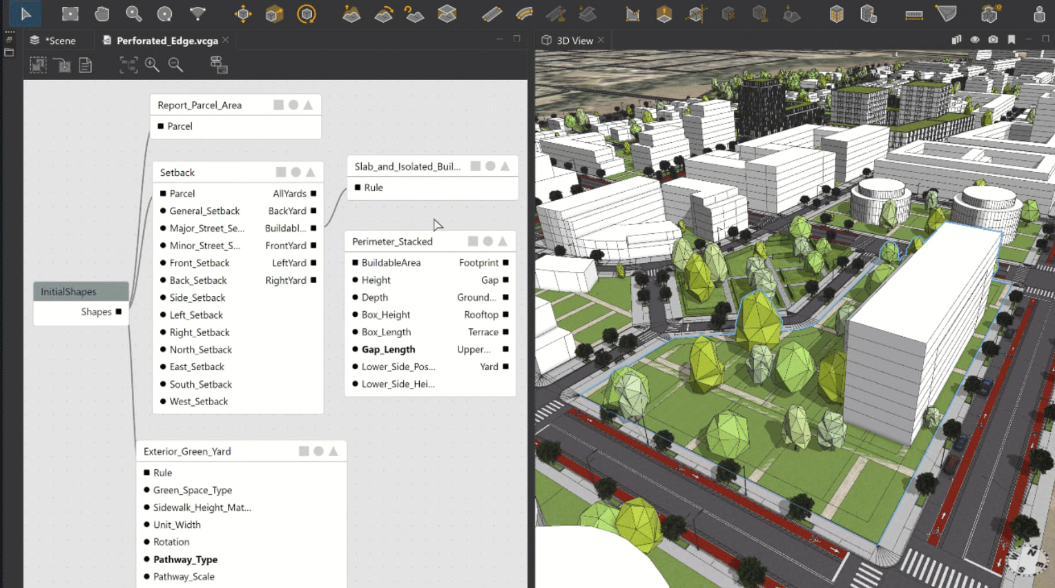
Visual CGA
The Visual CGA Editor has left Beta and is now available to all! This tool simplifies workflows and will be a game-changer for users who don’t have programming backgrounds – architects, urban planners and designers will be able to dig into models with more ease than ever before. The built-in content library also introduces a set of sophisticated components for site partitioning and massing in this release.
See it in action, check out this playlist of tutorials.
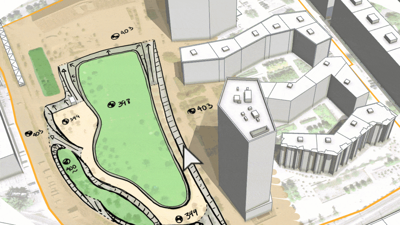
ArcGIS Urban integration
This release together with the current release of ArcGIS Urban now allow CityEngine users to edit the elevation or terrain of a plan in ArcGIS Urban. When importing an ArcGIS Urban Plan in CityEngine, these layers are automatically imported as separate terrain layers—one per scenario. You can then modify the terrain using the intuitive terrain editing tools in CityEngine so it matches your scenario perfectly. After editing the terrain, you can conveniently upload it back to your ArcGIS Urban Scenario.

Share as Web Scenes
A simple solution to directly share from CityEngine to ArcGIS Online is now available, enabling you to quickly export and view your 3D scene in Scene Viewer. The “Share as Web Scenes feature makes it easier than ever to share, explore and organize multiple scenarios in ArcGIS Online.
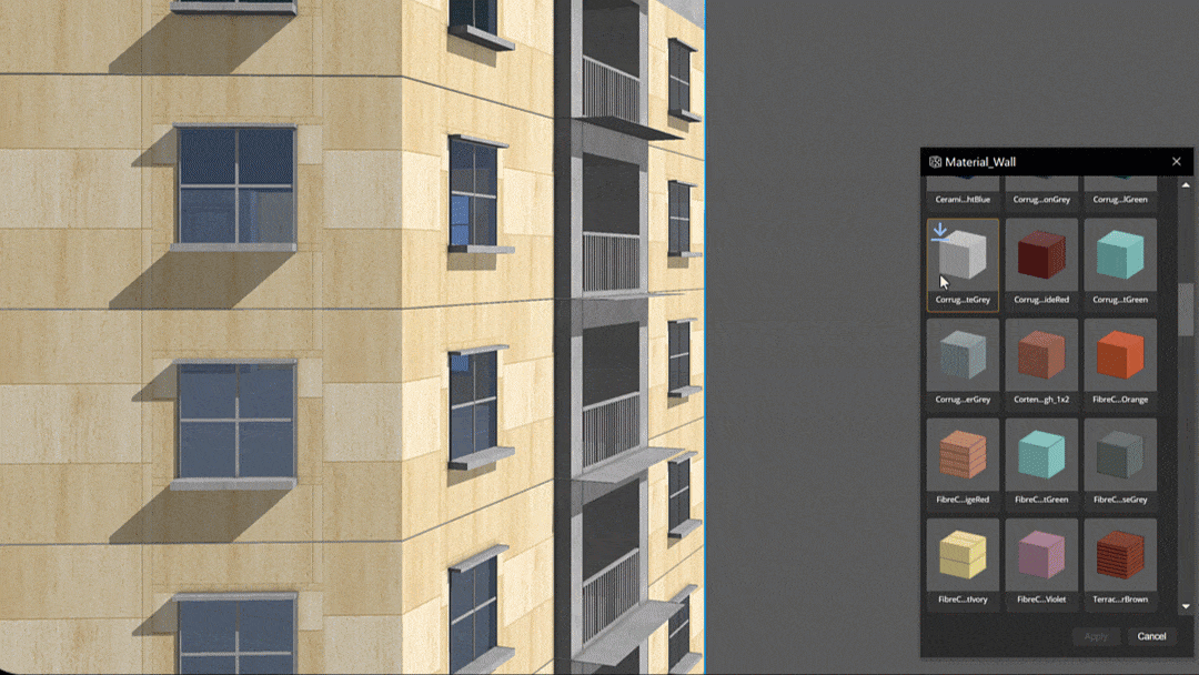
Materials Collection & Browser
Users now have access to a new, extensive collection of high-quality materials that can be used to add texture to buildings, open spaces such as gardens, and more. Access it though a dedicated browser and browse away!
For a full rundown of the updates, check out the release notes.
New! CityEngine Now Included in ArcGIS User Types

We’re excited to share that CityEngine is now included in the new Professional Plus User Type, and available to add-on to the Creator and Professional User Types.
New to ArcGIS User Types? Learn more here to see what’s included in each option.
Not using CityEngine yet but interested in taking it for a spin? Try our 21-day Free Trial and get started with help from our Tutorials today.


Article Discussion: