Millions of scientists and naturalists around the world utilize the iNaturalist network to share detailed information about the biodiversity and species around them. This substantial collection of crowdsourced observations is now freely available in Beta within ArcGIS Living Atlas to be used within your GIS workflows.
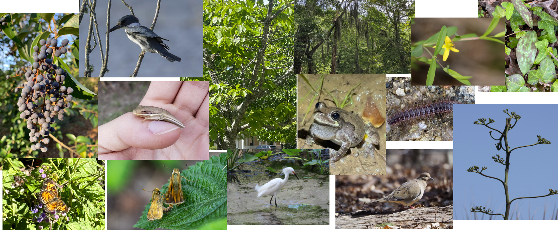
The iNaturalist vision is described as a “a world where everyone can understand and sustain biodiversity through the practice of observing wild organisms and sharing information about them”. [1] The project allows you to record your observations, share with fellow naturalists, and discuss your findings with the community. As of June 2024, there are over 800,000 naturalists who have recorded millions of observations spanning over 479 thousand species. This impressive display of citizen science allows the broader GIS and scientific community to better understand and validate the natural patterns which surround them.
iNaturalist is an online social network of people sharing biodiversity information to help each other learn about nature. It's also a crowdsourced species identification system and an organism occurrence recording tool. You can use it to record your own observations, get help with identifications, collaborate with others to collect this kind of information for a common purpose, or access the observational data collected by iNaturalist users.
Use iNaturalist within your GIS workflows
The beta hosted service is accessible as a layer through ArcGIS Living Atlas and is scheduled to be updated monthly with the newest observations from iNaturalist. It contains the research-grade observations, which have been reviewed and validated by other participants and naturalists within the iNaturalist community. In the future, the service will continue to grow and expand with the most current observations.
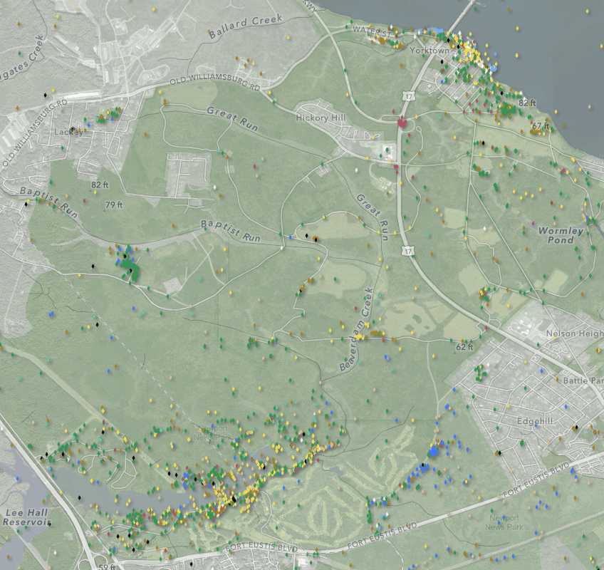
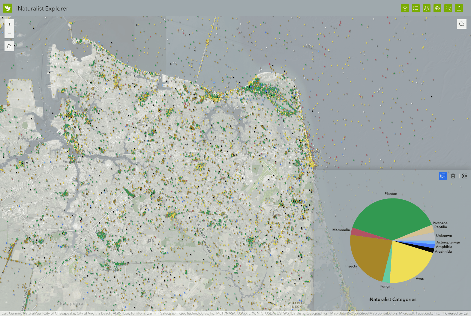
The layer is symbolized to show the observations based on which of the 12 iNaturalist categories in which it falls, to better understand the type of species being reported in an area:
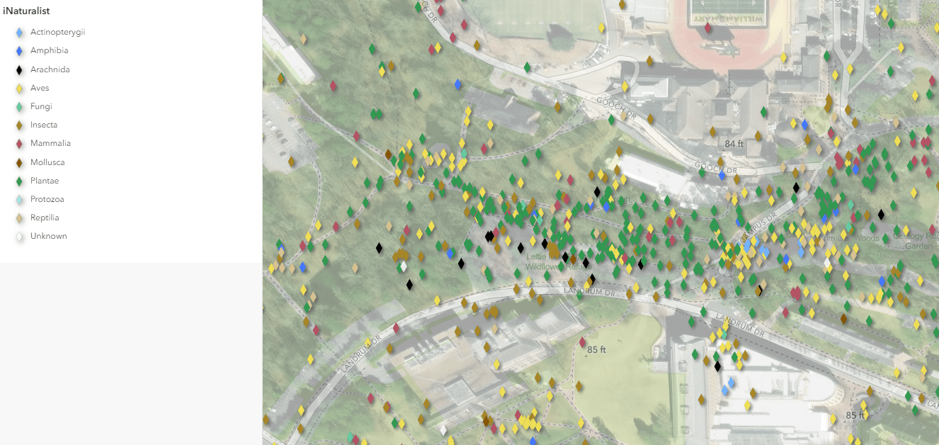
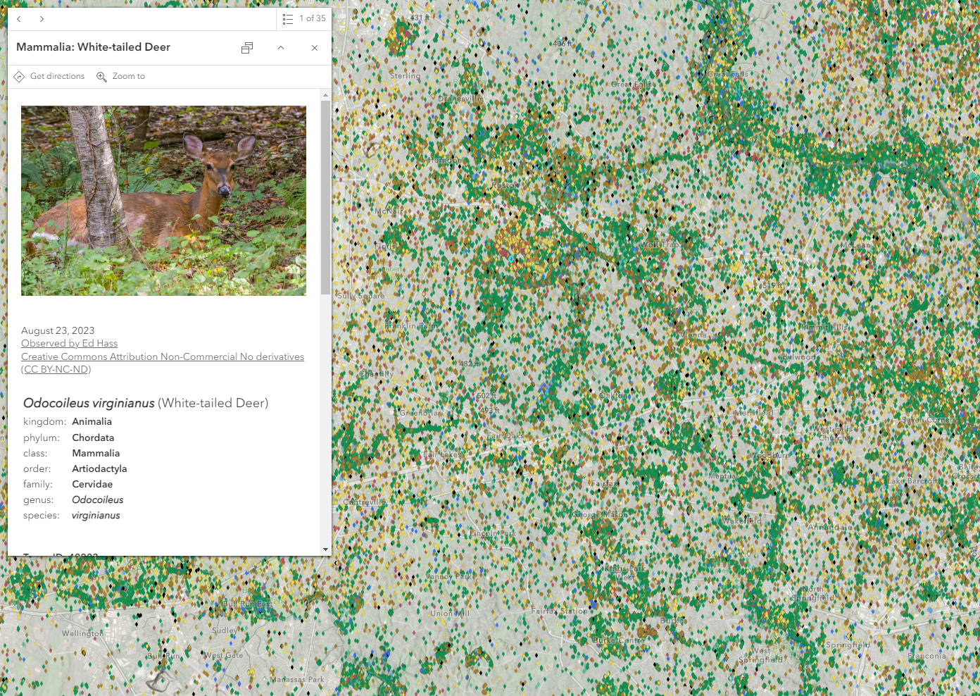
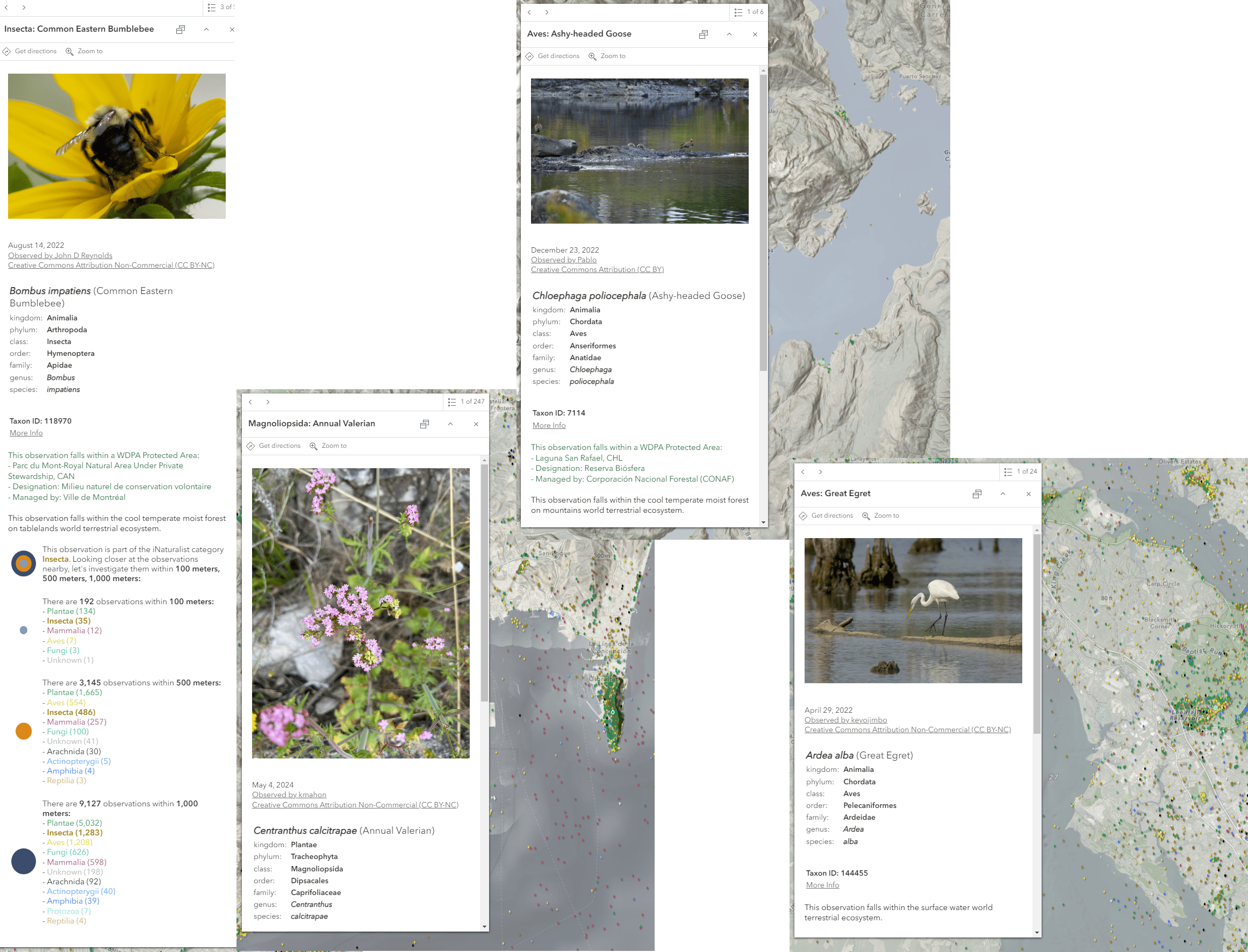
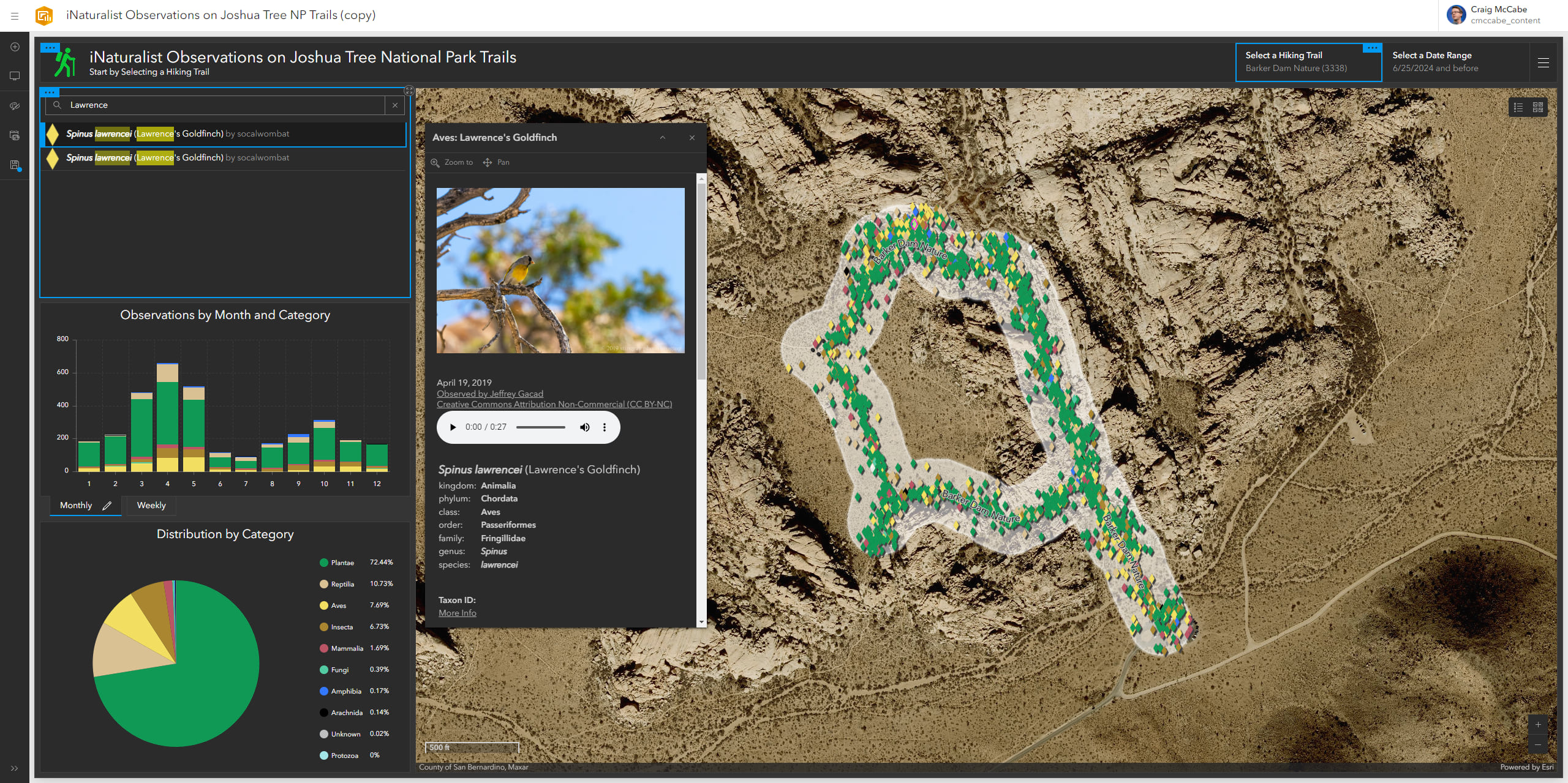
The detailed pop-up provides a summary of the iNaturalist observation such as the image, the observer, the taxonomy, and scientific classification. The pop-up will also reveal if the observation falls within a WDPA protected area, and will provide a summary of the ecosystem in which the observation falls. There is also a dynamic summary of the nearby observations in order to show what types of species are being recorded locally.
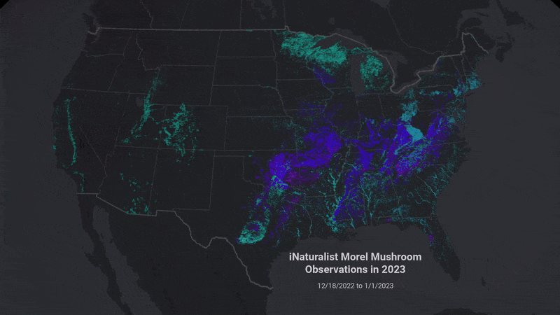
The layer can easily be incorporated into your mapping workflows throughout ArcGIS. Summarize a species within your project area or overlap with environmental layers from Living Atlas to identify spatial intersections. Create your own spatial analyses by diving deeper into the stories contained within this vast dataset. For example, this story map explores multiple case studies showing the applications of this layer within citizen science.
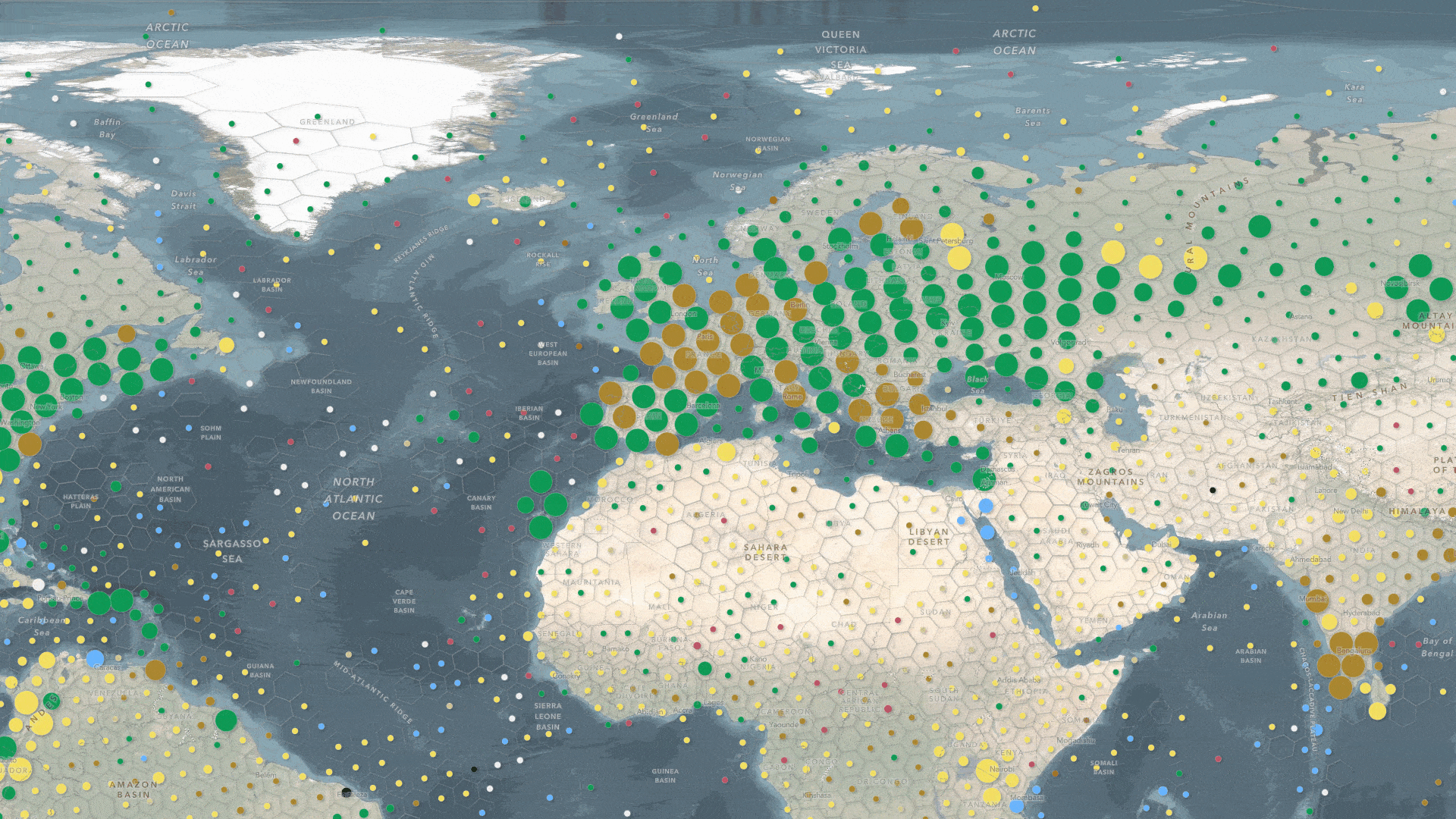
There is also a ready-to-use web map item which can be added directly into your GIS projects or apps like ArcGIS StoryMaps, ArcGIS Instant Apps, ArcGIS Experience Builder, and others. The map’s basemap contains contextual environmental layers from ArcGIS Living Atlas such as imagery, elevation, and parks/paths from OpenStreetMap. The map also includes a regional and global view of the observations by summarizing them within H3 hex bins. Explore your area, or use one of the bookmarks to explore interesting observations around the world.
For a quick way to visualize, search, and summarize the data, there is also a custom ArcGIS Experience Builder application. This easy-to-navigate application allows you to search anywhere in the world, and filter the observations by the iNaturalist category of your choosing. This provides a holistic view of the data so that clusters of points and species are easy to find.
More About the Data
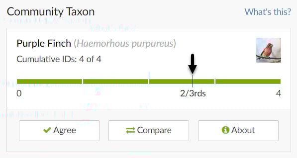
Research grade
All citizen scientists using the iNaturalist app are able to submit observations, but in order to be deemed as “research grade”, the wider community of naturalists need to agree upon the taxon classification. Experts within the community are able to confirm or suggest species details to help promote an observation to research grade.
Location accuracy
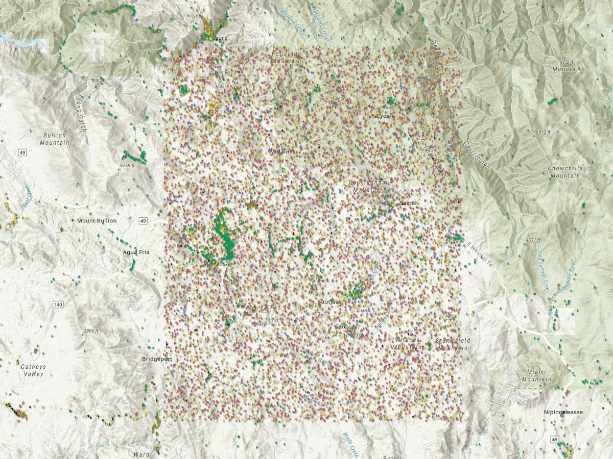
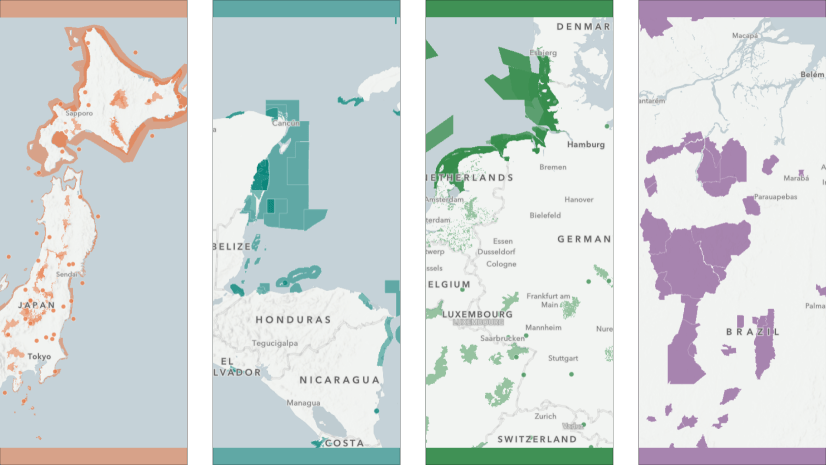
Privacy safeguards have been built in to the dataset in order to protect the participants as well as the natural environment. Threatened or endangered species are automatically tagged using their taxon identification, and the exact location is obscured to help protect the species. When viewing the observations on the map, you may see “blocks” of data as an artifact. For more information about the geoprivacy efforts put in place by iNaturalist, visit this resource.
Observation bias
Because observations are collected via a social media experience, the observations are likely to correlate to various factors by those collecting them. A few of these observer behaviors are:
- Population – maps of observations mimic population maps. Where people are, people observe.
- Weekends – People tend to observe more on weekends in free time or holidays, so fewer observations are recorded on weekdays.
- Weather – People observe when weather is more comfortable, and where the vegetation is easier to navigate.
- Oddities – People take pictures of things that are unusual or less common because they find these things more interesting.
These are just a few considerations, but are worth noting when using the dataset. For more information and data considerations, visit this story.
Contribute your Observations
Join the iNaturalist community to become part of the largest group of naturalists in the world! The observations are shared with the Global Biodiversity Information Facility where scientists can find and use the data for topics such as conservation, climate change, metagenomics, and more. Use the iNaturalist website to join, find tutorials, and learn more about the naturalist community.
From iNaturalist:
“Get connected with a community of millions scientists and naturalists who can help you learn more about nature! What’s more, by recording and sharing your observations, you’ll create research-quality data for scientists working to better understand and protect nature. So if you like recording your findings from the outdoors, or if you just like learning about life, join us!“
More iNaturalist Resources:

Article Discussion: