Announcing a global wildland-urban interface dataset
Ever wondered how close you live to areas prone to wildfire? Or have you thought, why would anyone want to build a housing community there given the possibility of wildfire?
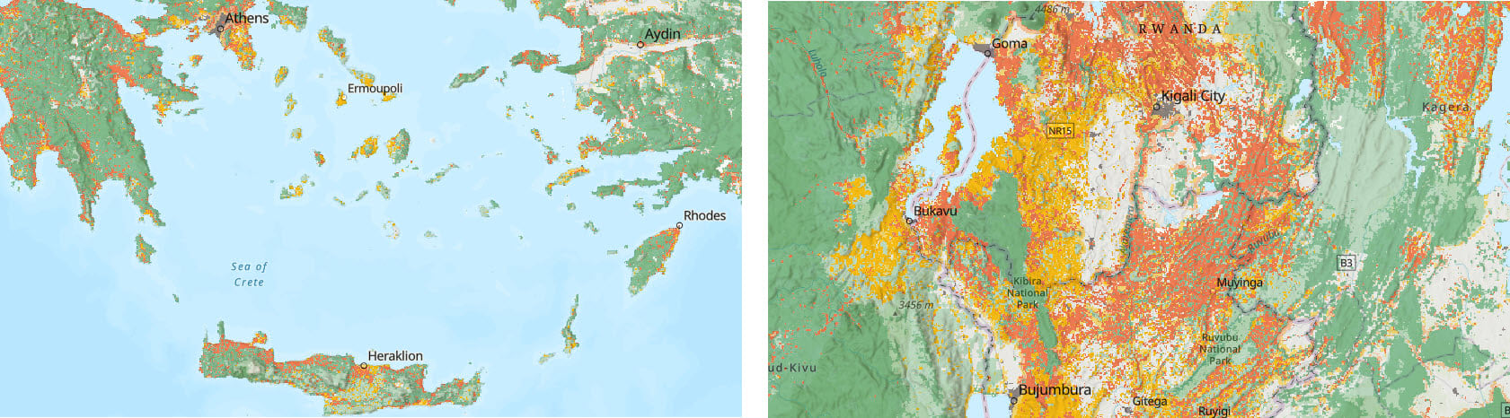
Now you can begin to explore the answers to these wildfire-potential questions with the release of the Global Wildland-Urban Interface (WUI) in ArcGIS Living Atlas of the World.
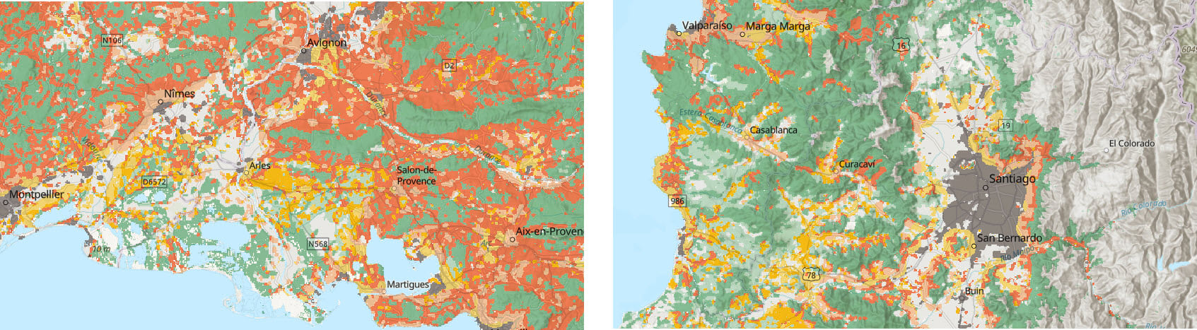
The Global WUI tiled imagery service is a 10-meter dataset produced by SILVIS lab at the University of Wisconsin-Madison. It maps the areas around the world where human activity interfaces or intermixes with wildland vegetation.
Areas in the WUI do not necessarily imply increased risk of fire. But WUI areas do have an increased potential for fire given the intermixing of human activity with wildland vegetation.
A better understanding of WUI areas can help identify vulnerability of structures and people to wildfire, understand habitat loss and fragmentation, and help minimize the spread of zoonotic diseases.
This new service is the first of its kind in Living Atlas to document the WUI on a global scale and will serve as a companion to the other wildfire related content in Living Atlas. It is one more tool in your toolbox to help prepare for and assess the potential risks from wildfires.
Firefighting professionals, emergency services organizations, and regional and local land developers will all find unique ways to incorporate this new data service into their daily workflows.
The Importance of a Wildland-Urban Interface Map
The Anthropocene era brings many surprises and one of them, unfortunately, is fire in places where we never had to think of it happening before.
Which housing communities or proposed developments should be considering wildfire hazard preparation?
This layer can help communities make choices by location based upon the potential of wildlands to conduct and spread fire.
Where should companies target wildfire mitigation efforts for their facilities and assets worldwide?
Companies may wonder just how vulnerable their property and logistics are to wildland fires, which are growing in occurrence and severity. Used in analysis, this layer can help to uncover that risk.
Are a community’s hospitals, evacuation routes, and other critical infrastructure vulnerable to fire as well?
Sometimes communities find out too late that their hospitals, built in beautiful parklike settings adjacent to wildlands, are too easily consumed by fire. Then, just when the community needs them, the hospital and its staff are left to evacuate their patients along with the rest of the community.
What other uses of the Global WUI service can you think of? Come to the Living Atlas and see.
Additional Resources:
- Esri Wildfire Aware App
- U.S. Forest Service Wildfire Risk to Communities
- Satellite (VIIRS) Thermal Hotspots and Fire Activity
- Schug, F., et al. Map of the Global Wildland-urban Interface. 1.1, Zenodo, 1 Apr. 2023, doi:10.5281/zenodo.7941460
- Schug, F., Bar-Massada, A., Carlson, A.R. et al. The global wildland–urban interface. Nature 621, 94–99 (2023). https://doi.org/10.1038/s41586-023-06320-0


Article Discussion: