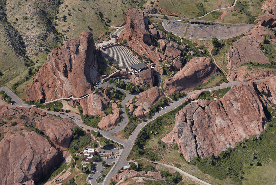
Situated just outside of Denver, the iconic Red Rocks Amphitheatre isn’t just a venue for world-class concerts and events; it’s now at the forefront of technological innovation in public safety. A recent collaborative project between the City of Denver, Denver Fire Department, West Metro Fire Department, and Esri’s Imagery and Remote Sensing Team has set a new standard for emergency preparedness and venue management. Esri is working closely with the city of Denver to achieve this goal, leveraging their expertise to enhance safety and efficiency.

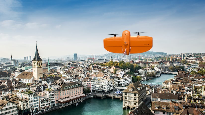
As the sun rises over the Amphitheatre, a team of geospatial professionals and firefighters are already at work. They’re not here for a fire or a rescue mission but for a groundbreaking task: capturing the amphitheater in unprecedented detail using advanced drone technology by ArcGIS, aimed at enhancing public safety at Red Rocks and other Denver venues – now and in the future. This initiative is part of a broader effort by Esri and the City of Denver to use cutting-edge technology to improve public safety across the city.
A Flight Towards Situational Awareness
The 3D ampitheatre mapping project began with meticulous planning and the deployment of a Freefly Astro mapping drone, operated using the ArcGIS Flight app. The vastness of Red Rocks, covering over 700 acres, posed a unique challenge. To manage this, the team divided the area into five overlapping flight polygons, ensuring comprehensive coverage without sacrificing detail. Each flight captured critical data, which they then used to create a highly accurate 3D digital twin of the venue.

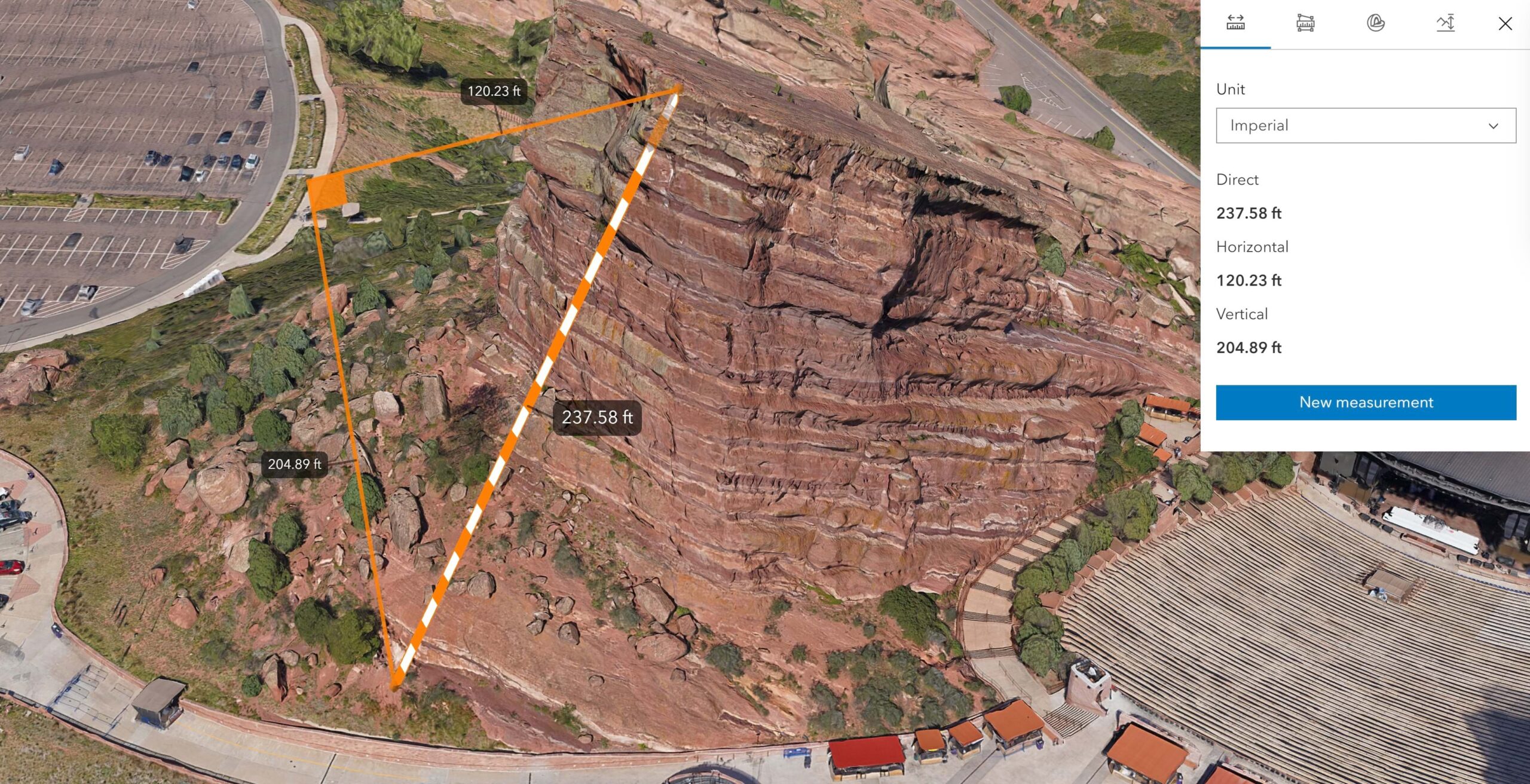
Accuracy is paramount in such a high-stakes project. The team used a Trimble DA2 high-precision GNSS system, paired with ArcGIS Field Maps, to collect and document 63 ground control points. These points ensure that the digital twin aligns perfectly with real-world coordinates, crucial for any emergency response scenario. ArcGIS Field Maps enables users to collect and record ground control points, and document them with field photos.
Digital Twins are More Than Pretty Pictures
The resulting digital twin of Red Red Rocks is not just a technological marvel; it’s a vital tool in public safety and venue management. Site Scan for ArcGIS has captured detailed views of all venue features with precision, from hiking trails to fire hydrants, and even the texture of the rocks themselves. Venue managers can now utilize this accurate digital replica to simulate and prepare for various scenarios, from evacuations to emergency responses. This enhances safety and operational efficiency with a level of accuracy that was previously impossible.
-
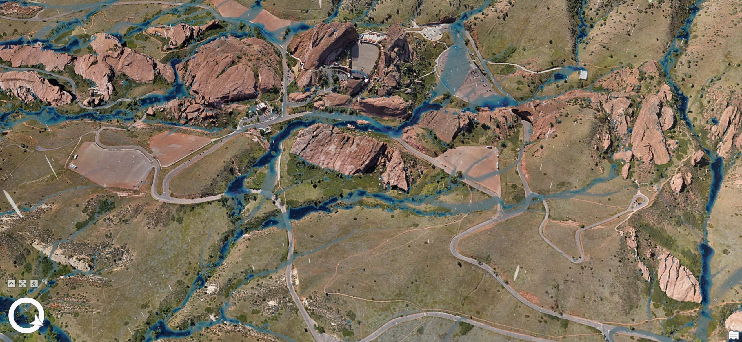
This incredibly detailed and accurate 3D mesh of Red Rocks ampitheatre and the surrounding area was created using the ArcGIS Reality engine.
Enhancing Real-Time Responses
Perhaps most critically, this digital model is integrated into the operational protocols of the fire departments. Now that they are equipped with tablets loaded with the 3D GIS data, first responders can access detailed, actionable information en route to or at the scene of an incident. ArcGIS-powered capabilities dramatically enhance situational awareness, allowing for quicker, more informed decision-making that can save lives.
A full motion video recording from the drone allows us to update the map with new information
A Model for the Future
As concert season draws near, the significance of this project becomes increasingly apparent. When you next visit Red Rocks, take a moment to soak in the stunning vistas and iconic performances. However, also remember the high-tech safety measures now invisibly safeguarding this historic venue and other public spaces throughout Denver.
The City of Denver’s dedication to safety and innovation is clearly reflected in this initiative, which serves as a benchmark for venues worldwide. It showcases the effective application of GIS technology to enhance public safety, ensuring that the excitement of public events is never diminished by concerns over personal security.

Explore the Interactive Story
See for yourself how Denver is using ArcGIS to transform public safety.


Article Discussion: