We are excited to announce yet another upcoming in-person Esri User Conference (July 15-19, 2024) in San Diego in just a few weeks! Read on to learn more about activities related to our real-time visualization and analytics products – ArcGIS Velocity and ArcGIS GeoEvent Server.
Join Us at the Expo
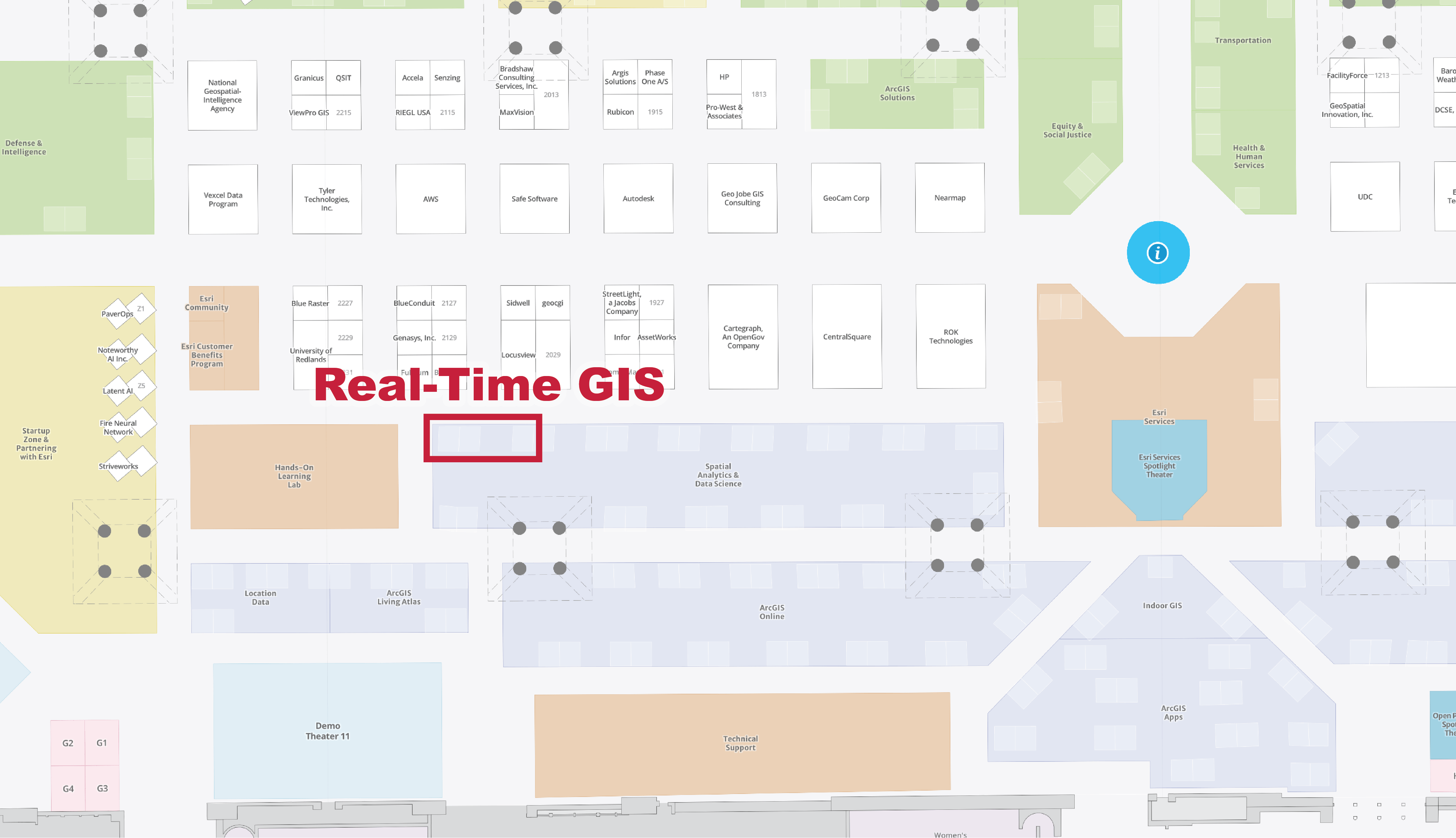
Whether you are interested in seeing the latest updates in ArcGIS Velocity and ArcGIS GeoEvent Server or looking for answers, our experts are available to help! We are located in the Spatial Analytics area within the Esri showcase. Stop by for a chat!
Interested in securing time with the real-time GIS product team while at UC? Schedule time with us here.
Showcase Hours
- Tuesday, July 16, 9 am–6 pm PT
- Wednesday, July 17, 9 am–6 pm PT
- Thursday, July 18, 9 am–4 pm PT
Attend the Sessions
We have curated a list of product-focused sessions to deepen your understanding of real-time GIS.
Tuesday, July 16
ArcGIS GeoEvent Server: An Overview
Technical Session | 8:30 am–9:30 am PT | Room 1 AB | SDCC
Real-time dynamic data works seamlessly in the ArcGIS system with ArcGIS GeoEvent Server. It provides real-time visualization and spatial analytics capabilities in ArcGIS Enterprise, enabling organizations to connect with virtually any type of data to derive insights that inform decisions. Join us to learn about incorporating real-time data feeds with your existing GIS data and IT infrastructure and performing continuous processing and analysis on streaming data with filters and processors. Presenters also share examples of different use cases across various
ArcGIS Solutions: Real-Time Operations
Demo Theater Presentation | 2:30 pm–3:15 pm PT | Expo Demo Theater 4 | SDCC
Managing real-time operations in public works and transportation, like winter-weather services, street sweeping, and mowing operations, can be challenging. Join us to learn more about the ArcGIS Solutions tailored to these challenges. Presenters discuss the capabilities included in these solutions and how to deploy and configure them for your organization.
ArcGIS GeoEvent Server: Applying Real-Time Analytics
Demo Theater Presentation | 2:30 pm–3:15 pm PT | Expo Demo Theater 10 | SDCC
Join us to learn about advanced ArcGIS GeoEvent Server workflows, including how to connect to and analyze virtually any type of streaming data, push spatial data to web applications or data stores, and automatically alert personnel when specific conditions occur. Discover how to create GeoEvent Services, configure filters and processors to perform real-time analysis, and identify events of interest. Topics include best practices, attribute/spatial (geofence) filtering, geotagging, calculating field values, enriching real-time observations from external data sources, mapping data schemas, and detecting incidents and gaps.
ArcGIS Velocity: An Overview
Technical Session | 2:30 pm–3:30 pm PT | Room 30 AB | SDCC
Real-time data is crucial to GIS. ArcGIS Velocity is a real-time and big data analysis capability in ArcGIS Online, enabling organizations to ingest, visualize, analyze, store, and act on data from Internet of Things (IoT) sensors. This presentation discusses how to connect to virtually any type of streaming data, perform real-time analytics and processing, and automatically disseminate information and alert personnel when specified conditions occur. Learn how to create analytic models to process high-volume historical data to gain insights into patterns, trends, and anomalies in your big data.
Wednesday, July 17

ArcGIS Velocity: An Overview
Technical Session | 8:30 am–9:30 am PT | Room 4 | SDCC
Real-time data is crucial to GIS. ArcGIS Velocity is a real-time and big data analysis capability in ArcGIS Online, enabling organizations to ingest, visualize, analyze, store, and act on data from Internet of Things (IoT) sensors. This presentation discusses how to connect to virtually any type of streaming data, perform real-time analytics and processing, and automatically disseminate information and alert personnel when specified conditions occur. Learn how to create analytic models to process high-volume historical data to gain insights into patterns, trends, and anomalies in your big data.
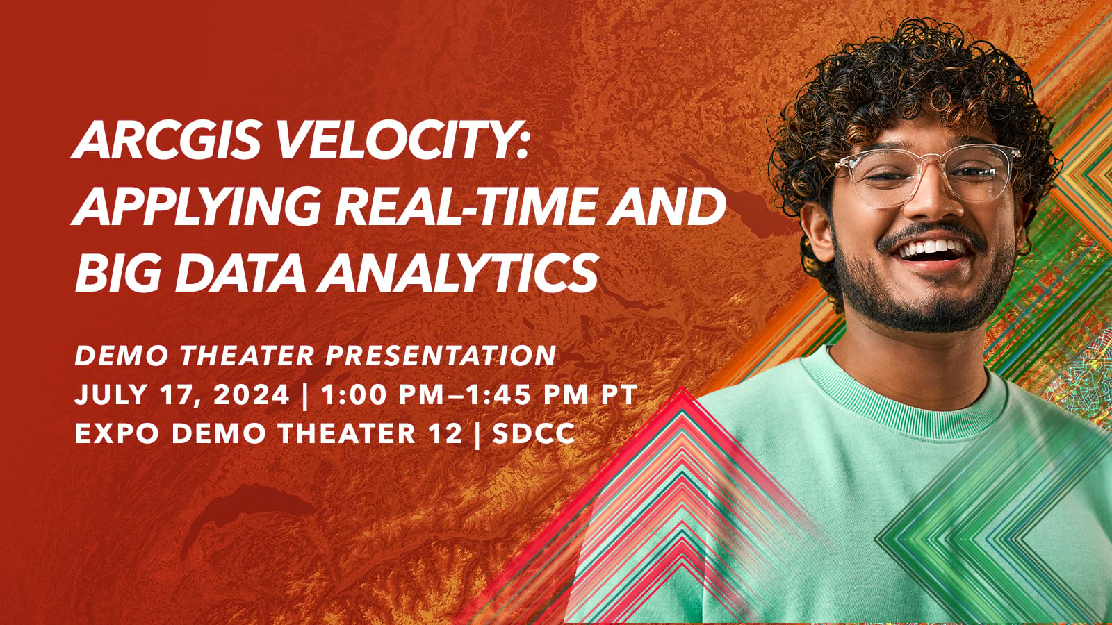
ArcGIS Velocity: Applying Real-Time and Big Data Analytics
Demo Theater Presentation | 1:00 pm–1:45 pm PT | Expo Demo Theater 12 | SDCC
ArcGIS Velocity makes detecting incidents from streaming data fast and easy. Velocity is a real-time and big data analysis capability in ArcGIS Online. Discover how to create and schedule big data analytic models to process high-volume historical data and gain insights into patterns, trends, and anomalies. Also, learn about using ArcGIS Arcade functions and expressions and get tips for choosing the right analysis tools for your scenarios. Presenters will demo complex use cases and workflows that incorporate Velocity.
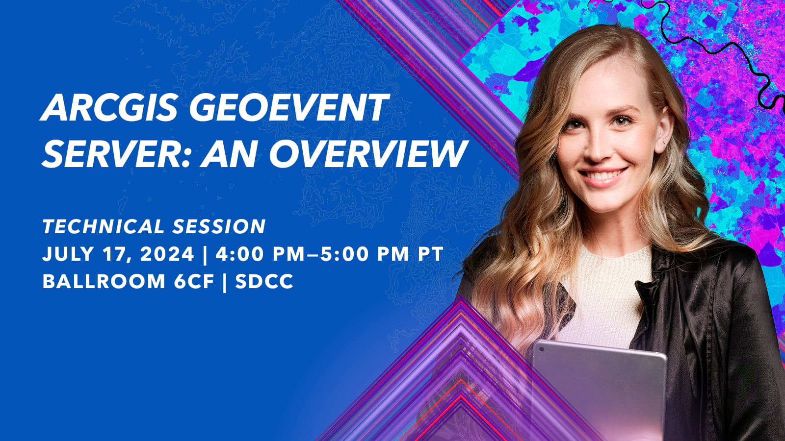
ArcGIS GeoEvent Server: An Overview
Technical Session | 4:00 pm–5:00 pm PT | Ballroom 6CF | SDCC
Real-time dynamic data works seamlessly in the ArcGIS system with ArcGIS GeoEvent Server. It provides real-time visualization and spatial analytics capabilities in ArcGIS Enterprise, enabling organizations to connect with virtually any type of data to derive insights that inform decisions. Join us to learn about incorporating real-time data feeds with your existing GIS data and IT infrastructure and performing continuous processing and analysis on streaming data with filters and processors. Presenters also share examples of different use cases across various industries.
Additional Sessions Where You Will Find Real-Time
In addition to product-focused sessions, real-time GIS will be featured across many sessions at UC. We have curated a list of sessions where real-time GIS plays a critical role in the workflow.
Tuesday, July 16
Emergency Management Operations: Maximize Your GIS Resources
Demo Theater Presentation | 10:00 am–10:45 am PT | Expo OPS Demo Theater | SDCC
Join Esri’s emergency management team as they share tips and tricks to maximize your GIS resources in the emergency operations center (EOC). Presenters demonstrate streamlining and automating account setup for your EOC partners and establishing role-based accounts. Also, learn about the new Emergency Management Operations solution, which has a scalable and flexible interface that allows users at all skill levels to use GIS, ensuring a force multiplier for when it is needed most.
Thursday, July 18
Embracing the Era of Transportation with Real-Time Capabilities
Demo Theater Presentation | 10:00 am–10:45 am PT | Expo Demo Theater 14 | SDCC
With the emergence of real-time data, sensors, and workflows within the transportation industry, understanding and leveraging real-time capabilities for your organization can seem overwhelming. Join presenters as they share a strategy and explore GIS solutions that allow you to integrate real-time capabilities into your work. Whether that work involves airports, railroads, public transit agencies, local or state departments of transportation, or ports, learn about next steps and best practices that you can apply.
Emergency Management Operations: Maximize Your GIS Resources
Demo Theater Presentation | 1:00 pm–1:45 pm PT | Expo OPS Demo Theater | SDCC
Join Esri’s emergency management team as they share tips and tricks to maximize your GIS resources in the emergency operations center (EOC). Presenters demonstrate streamlining and automating account setup for your EOC partners and establishing role-based accounts. Also, learn about the new Emergency Management Operations solution, which has a scalable and flexible interface that allows users at all skill levels to use GIS, ensuring a force multiplier for when it is needed most.
Resources
Note that the UC Event Map is now available to allow you to get familiar with the convention center and view locations of sessions and activities before you go to San Diego. You can also generate a route and directions between two locations and view the estimated travel time. Use the map along with the Detailed Agenda and My Schedule for planning your UC experience. The map will also be available in the Esri Events App and at directory kiosks on site in the convention center.
Here are a few additional resources:
- ArcGIS Velocity product information, resources, and user community
- ArcGIS GeoEvent Server product information and user community
- Read about our real-time data providers and sources
- Explore, save, and share a custom real-time session agenda
Haven’t registered for the user conference? It’s not too late. Join the in-person event, register for digital access, or watch the Plenary Session only.
Register Here
See you in San Diego!

Article Discussion: