The biggest GIS event of the year, the Esri User Conference (Esri UC), is happening on July 15-19 in San Diego, CA. This year’s event is held under the motto GIS—Uniting Our World, highlighting the inclusive and collaborative nature of GIS (geographic information system) that allows us to approach challenges holistically, indoors and outdoors, and make a positive change.
As always, the event is an excellent opportunity to connect with like-minded people, chat with our subject matter experts, listen to industry leaders, and learn about the latest product updates and capabilities in our presentations. This blog post provides an overview of the agenda of indoor GIS at the 2024 Esri UC to help you make the most of your attendance.
Showcase
Come by the indoor GIS showcase area to talk to our indoor GIS, ArcGIS Indoors, and ArcGIS IPS product experts. Learn how you can benefit from indoor mapping, indoor positioning, indoor facility management , space and asset management, and more.
Like last year, the event will be supported by the UC Event Maps powered by ArcGIS Indoors. The map is designed to help you familiarize yourself with the conference venue, plan your visit, and get directions once you’re on-site. In addition, the Esri Events mobile app helps attendees navigate to the showcase, sessions, and other points of interest. Access the 2024 Esri UC Events Map via web or mobile app (iOS or Android).
Here is a direct link to the indoor GIS showcase area on the web map.
Alternatively, there will also be directory kiosks throughout the conference venue. Attendees can use these to quickly find their destination and can even scan to transfer directions into the map in the Esri Events App.
Expo hours and location
| Day and Date | Time | Location |
| Tuesday, July 16 | 9:00 a.m.–6:00 p.m. | Halls A/B/C/D |
| Wednesday, July 17 | 9:00 a.m.–6:00 p.m. | Halls A/B/C/D |
| Thursday, July 18 | 9:00 a.m.–4:00 p.m. | Halls A/B/C/D |

Indoor GIS Live Demo
This year, you can look forward to a refreshing, new and diverse live demo experience for indoor GIS use cases. The Hilton Bayfront and Mariott Marquis hotel next to the San Diego Convention Center are equipped with an ArcGIS IPS indoor positioning system. Come by our booths for a guided, hands-on demo to experience indoor GIS firsthand. Explore our demo schedules for each hotel below and use the UC event map to navigate to the demo locations.
If you are planning to come by, please feel free to fill out this short survey to help us gauge demand.
Mariott Marquis San Diego Marina Hotel
North Tower | Lobby Level
Demo schedule
Sat, July 13 | 9am – 5pm
Sun, July 14 | 9am – 5pm
Tue, July 16 | 9am – 5pm
Wed, July 17 | 9am-5pm
Hilton San Diego Bayfront Hotel
Indigo West Foyer
Demo schedule
Sat, July 13 | 9am – 5pm,
Sun, July 14 | 9am – 5pm
Indoor GIS Sessions
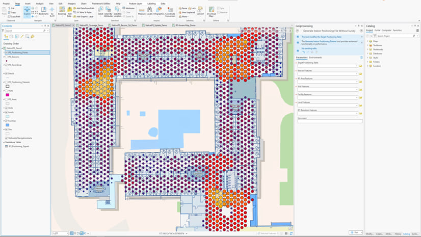
ArcGIS IPS: An Overview
Bring the blue dot indoors with ArcGIS IPS, Esri’s indoor positioning product. In this presentation, learn how ArcGIS IPS lets you locate yourself and others inside a building or facility in real time. Presenters provide a product overview, technology background, use cases, trends, and road map.
Session Type: Technical Session
Tuesday, Jul 16, 8:30 AM – 9:30 AM (PDT)
Room 3 | SDCC
Wednesday, Jul 17, 4:00 PM – 5:00 PM (PDT)
Room 15 AB | SDCC
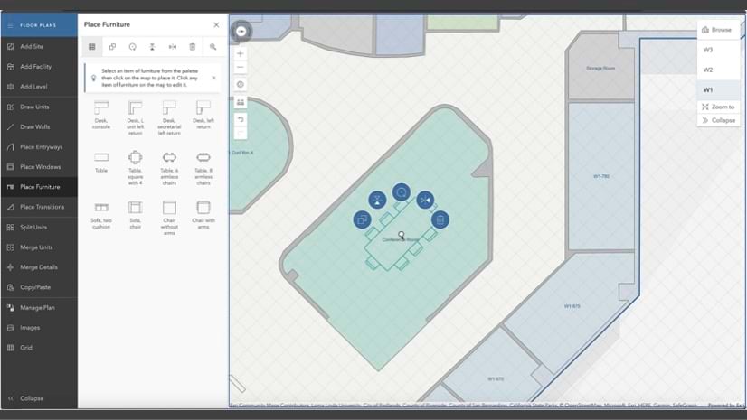
ArcGIS Indoors: An Overview
Discover the power of indoor mapping with ArcGIS Indoors. This presentation provides an overview of this extension’s capabilities and explains how to create and share floor-aware maps of your building interiors. Gain insight into how licensing works as well as how to use indoor maps to power Indoors apps for space planning, workspace reservation, indoor navigation, location sharing, and more.
Session Type: Technical Session
Tuesday, Jul 16, 10:00 AM – 11:00 AM (PDT)
Ballroom 6CF | SDCC
Wednesday, Jul 17, 8:30 AM – 9:30 AM (PDT)
Room 5 AB | SDCC
Indoor GIS SIG: Bring The Science of Where Indoors
The Indoor GIS Special Interest Group will facilitate and drive discussion about indoor GIS and connect you with professionals from the industry who share your passion. Get firsthand insights from customer ETH Zurich, and partners Langan Engineering and MipMap Technologies about their indoor GIS projects and take the opportunity to learn from their journey.
Session Type: Special Interest Group Meeting
Tuesday, Jul 16, 11:30 AM – 12:30 PM PDT
Room 4 | SDCC
ArcGIS Indoors: Establishing a Hybrid Workplace
The future of hybrid workspaces is happening now. Learn how ArcGIS Indoors supports a hybrid workplace through indoor space assignment, office hoteling, hot desking, and meeting-room booking. This presentation shows you how to offer web and native mobile employee experiences to support hybrid staff in finding the people, places, assets, and amenities needed and in scheduling spaces to work and collaborate in the office.
Session Type: Demo Theater Presentation
Tuesday, Jul 16, 2:30 PM – 3:15 PM (PDT)
Expo Demo Theater 8 | SDCC
Indoor GIS: Floor Plan Editing on the Web
Join us to see how the Floor Plan Editor makes indoor GIS more accessible for organizations that do not have GIS professionals or digital floor plans. With the Floor Plan Editor, such organizations can still build indoor maps. This capability serves the need for the indoor GIS market related to U.S. state legislation, which requires schools to have indoor maps. The editor also enables first responders to easily create indoor maps for their workflows.
Session Type: Demo Theater Presentation
Tuesday, Jul 16, 4:00 PM – 4:45 PM (PDT)
Expo Demo Theater 8 | SDCC
Indoor GIS: Mapping Indoor Assets
Looking to map your indoor assets? In this presentation, learn how to collect asset data using indoor maps created with ArcGIS Indoors in ArcGIS Field Maps. See firsthand how Field Maps and ArcGIS IPS work together to provide “blue dot” locations for fieldworkers inside a building.
Session Type: Demo Theater Presentation
Wednesday, Jul 17, 1:00 PM – 1:45 PM (PDT)
Expo Demo Theater 10 | SDCC
Indoor GIS: How to Build Custom Indoor Mapping and Positioning Apps
Learn how to use ArcGIS Experience Builder to develop a low-code or no-code custom app for indoor mapping. This presentation also showcases how to use ArcGIS Maps SDK for Kotlin and ArcGIS Maps SDK for Swift to add indoor mapping and positioning to your native mobile apps for iOS and Android.
Session Type: Demo Theater Presentation
Wednesday, Jul 17, 2:30 PM – 3:15 PM (PDT)
Expo Demo Theater 10 | SDCC
Related Sessions and User Presentations
ArcGIS Indoors: Facility Inspections for Asbestos Compliance
Facility inspections for asbestos, lead, health, and safety can be modernized with ArcGIS Indoors. Learn how you can use ArcGIS Field Maps to navigate between building floors to complete indoor inspection workflows and how natively floor-aware web maps allow all users to create and interact with indoor GIS data.
Session Type: Demo Theater Presentation
Tuesday, Jul 16, 1:00 PM – 1:45 PM PDT
Expo Demo Theater 12 | SDCC
Hospitals Elevate Patient Satisfaction with ArcGIS Indoors
Hospitals can become overwhelming mazes as patients navigate from large parking structures to private doctor offices. Leading hospitals are integrating Epic’s My Chart app with ArcGIS Indoors, and allowing patients to check in via the app and receive directions to their room. Optimized exam room utilization and improved patient experiences are achieved through timely and accurate location reporting. Discover how to utilize real-time location services to provide turn-by-turn wayfinding, and how mobile, Wi-Fi, and infrared devices have been leveraged to improve the timeliness of patient care.
Session Type: User Presentations
Tuesday, Jul 16, 2:30 PM – 3:30 PM PDT
Grand Ballroom 8 | Marriott
Facilities and Vertical Asset Management for Water Utilities
Learn to apply GIS technology for the management of facility and vertical assets. In this presentation, focused on water utilities, explore the available technology options and see applications of how to apply 2D and 3D GIS demonstrated.
Session Type: Demo Theater Presentation
Wednesday, Jul 17, 1:00 PM – 1:45 PM PDT
Expo Demo Theater 13 | SDCC
GIS Solutions in AEC: From Digital Twins to Facility Asset Management
Discover how GIS applications address business challenges in facility design, construction, and operations. The session starts with a case study using ArcGIS Indoors to explore the benefits of Digital Twins in the AEC industry. Next, learn how the Detroit Zoo utilized GIS to improve facility asset management. From mapping utility assets to integrating data, managing inventory, planning maintenance, allocating resources, and assessing risks, GIS provides precise location and attribute information for informed decision-making.
Session Type: User Presentations
Wednesday, Jul 17, 1:00 PM – 2:00 PM PDT
Grand Ballroom 10 | Marriott
Managing Park and Recreation Facilities and Assets with GIS
Explore how parks organizations are leveraging 3D, 360 degree cameras, Lidar and ArcGIS to better capture and manage outdoor and indoor assets and facilities.
Session Type: User Presentations
Wednesday, Jul 17, 1:00 PM – 2:00 PM PDT
Grand Ballroom 8 | Marriott
GIS Solutions for Safe and Sustainable Campus and School Accessibility
GIS tools are transforming accessibility and facility planning in educational institutions. Clemson University is leveraging GIS with a focus on ArcGIS Indoors, to enhance safe routing for pedestrians with disabilities, ensuring ADA compliance between parking lots and buildings. Clovis Unified School District illustrates their comprehensive approach to facility planning and operations using GIS. From implementing the ArcGIS Indoors data model to CAD to GIS data conversion and integration of space and asset attribute data sources, learn how GIS enhances school floorplan management.
Session Type: User Presentations
Wednesday, Jul 17, 2:30 PM – 3:30 PM PDT
Grand Ballroom 10 | Marriott
Learn more about indoor GIS, sign up to our newsletter, and join the Esri Community places for ArcGIS Indoors and ArcGIS IPS to ask questions and let us know your ideas for future product features you would like to see.


Commenting is not enabled for this article.