The oriented imagery capability of ArcGIS empowers you to turn all kinds of images into geospatial assets in your GIS: 360 images, street-level images, cell phone images, high oblique drone images, aerial oblique images, and more. Discover and explore full-resolution images in an intuitive viewing experience that combines multiple image perspectives with 3D, vector, and other geospatial data to improve human interpretation and generate new and unique insights from your GIS.
New in ArcGIS Pro 3.3
ArcGIS Pro 3.3 introduces exciting new oriented imagery features:
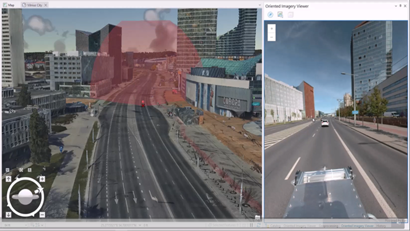
- 3D scene support allows you to visualize full-resolution images in the context of a 3D mesh, point cloud, or other 3D data.
- When you publish an oriented imagery layer, you can now choose to upload images as feature attachments, simplifying image management and security.
- Users and data providers who want to streamline the management process for imagery with complex metadata formats can now define a custom input type to use when adding images to an oriented imagery dataset.
Scene support for oriented imagery
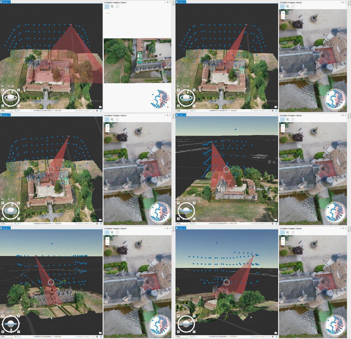
Now you can visualize your oriented imagery in the context of a 3D scene, including 3D coverage features (frustums), and (optionally) Z-enabled camera location points. Simply load a scene in Pro, and visualize the oriented imagery layer using the oriented imagery viewer as usual.
To visualize Z-enabled camera location points, you’ll need to publish a Z-enabled oriented imagery layer. To do this, when you use the Create Oriented Imagery Dataset GP tool, be sure to select “Yes” for “Has_Z” in the tool dialog and add images using a CSV file with a column for Z-values. When you visualize the Z-enabled oriented imagery dataset in a scene, you’ll see the camera location points symbolized at their XYZ locations.
Publish images as feature attachments
With the new Generate Service from Oriented Imagery Dataset GP tool, you can publish an oriented imagery layer with images hosted as feature attachments, allowing you to securely host images in the ArcGIS Online cloud or ArcGIS Enterprise 11.2+.
Credit usage follows standard credits for feature attachments (currently 1.2 credits/GB/month). You can attach JPG and TIF (COG) images under 2GB (ArcGIS Server limit on attachments) for the attachment workflow. The tool lets you attach images under the size limit.
Define a custom input type for complex metadata formats
For users or data providers with imagery that has a complex metadata format (like an EO file), or who need to automate image metadata pre-processing for frequent or large-scale data ingest, they can now use the Add Images From Custom Input Type GP tool in place of the standard Add Images to Oriented Imagery Dataset tool.
To use it, you’ll first need to define an oriented imagery custom input type using ArcPy. Once that custom input type is installed, you can simply select the type and your input metadata in the Add Images from Custom Input Type tool to add your images to an oriented imagery dataset, eliminating the need for creating an intermediate CSV table as input.
Next steps
For a deeper dive into troubleshooting tips and the plan for Oriented Imagery Classic users, check out the updated FAQ. And if you have an idea for a new oriented imagery feature or enhancement you’d like to see in future releases, let us know in Esri Community!
Article Discussion: