ArcGIS Solutions helps you make the most of your GIS by providing purpose-driven, industry-specific configurations of ArcGIS.
When the station alarm sounds, first responders immediately jump into action, knowing that time is of the essence. In seconds, crews are out the door and on their way to the scene of the emergency.
This high-stakes ballet may look seamless, but it could never happen without a great deal of planning and organization. Forward-thinking fire agencies, using standards set by the National Fire Protection Association (NFPA), build pre-incident workflows that help them manage incidents more effectively and maximize the protection of property, the environment, and most importantly, lives. As a result, the best-prepared and most efficient crews have access to hazard and site consideration information about the structure they’re speeding toward and can review strategy en route.
But pre-incident plans need to be regularly maintained, a process that is time consuming and can be complicated. Large fire agencies often have plans in place, but they may not be location enabled or easily accessed by firefighters during an incident. And many smaller fire agencies still rely on hard-copy plans.
The Pre-Incident Planning solution from ArcGIS Solutions is the perfect partner for fire agencies that understand the value of planning ahead but may need a little help with the execution of it. It includes a series of preconfigured apps that help streamline the pre-incident planning process so that fire agencies have the information they need to make informed decisions at the exact moment they need to.
Ready
A department doesn’t get more forward thinking than Brevard County Fire Rescue (BCFR), an all-hazards fire organization located in east-central Florida. With more than 600 personnel staffing upwards of 32 stations across five fire districts, BCFR is responsible for roughly half the county—568 square miles that include urban centers to rural farmland—and serves 260,000 residents. For BCFR, pre-incident planning is not only smart but critical.
However, after their last ISO review, BCFR realized they still had a lot of pre-planning work to do. They knew they needed a more data-driven and map-focused system, but they weren’t finding a solution from most of the third-party products out there.
We were looking for a solution that was well made and flexible to our growing needs but not overly complex for field crews to learn.
Then, someone mentioned Esri’s Pre-Incident Planning solution to senior staff. GIS analyst Nicholas Cirivello knew of Esri and had used Esri’s Target Hazard Analysis solution in the past to successfully identify areas at high risk. The organization deployed Pre-Incident Planning and haven’t looked back since.
Set
Before deploying Pre-Incident Planning, BCFR’s process was inefficient. Crews conducting site visits would complete a form in Excel and then email it to their district chief for review. After review, the district chief would forward the completed plan to the computer-aided dispatch (CAD) analyst, who would upload the plan into the CAD system. The process took hours, touched many hands, and was essentially just a snapshot in time; information didn’t carry over, and the next time crews conducted a site visit, they had to start from scratch.
Go
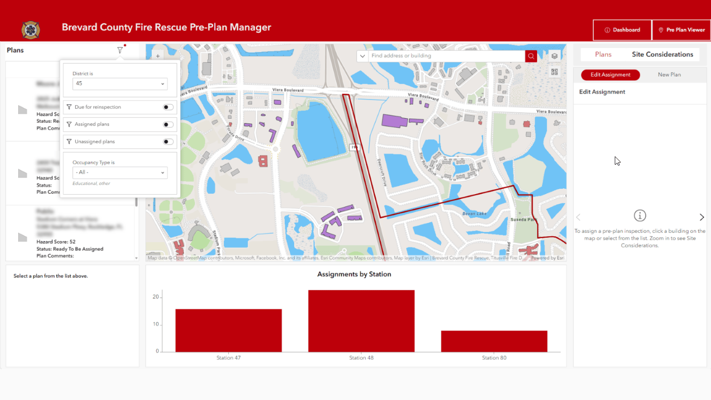
Now, the process is significantly smoother and takes roughly a third of the time as before. BCFR district chiefs use an ArcGIS Experience Builder app to organize pre-incident plans and manage routine site visits. With the app, they can identify which structures need a pre-plan and then assign that structure to a station.

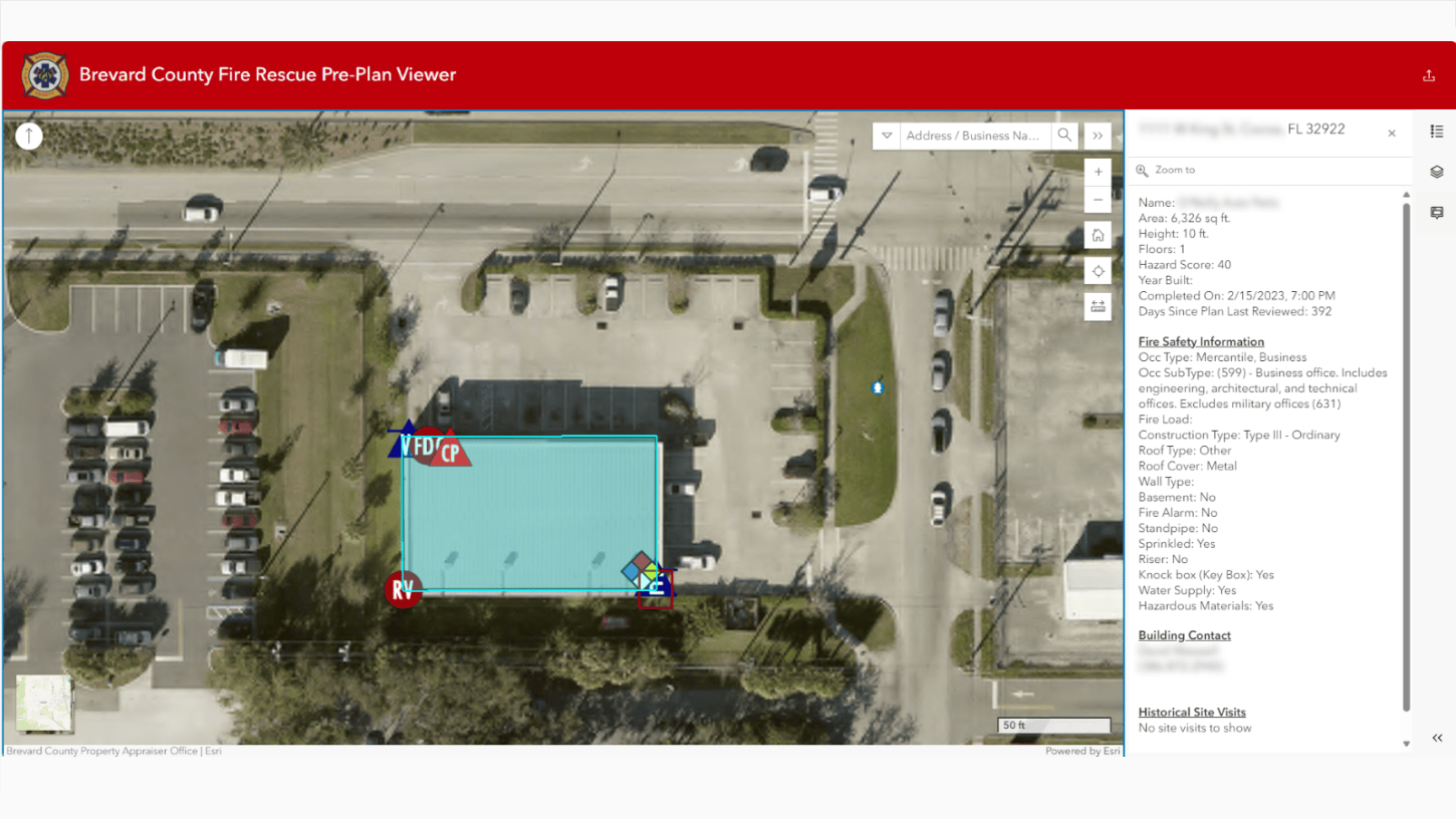
After receiving assignments, senior officers conduct site visits, using ArcGIS Field Maps to collect pre-plan information. As soon as an officer submits a form, the data is immediately available to district chiefs and crews alike.
“So far, the crews love utilizing the solution,” says Cirivello, adding that they find it quick and easy to learn. And, because the data is stored and accessible via connected apps, crews no longer have to complete a new pre-plan every time they visit a site. Now, they can review existing data and update or add information only if necessary.
Of course, pre-incident planning is about safety. Where is the keybox? Does the structure have sprinklers? Are there hazardous materials, and, if so, where are they located? From the scene of the emergency, BCFR first responders can access all this information by viewing the structure’s pre-plan on a mobile device. “With our pre-plans being driven through GIS, fire crews will have better situation awareness when on scene,” says Cirivello.

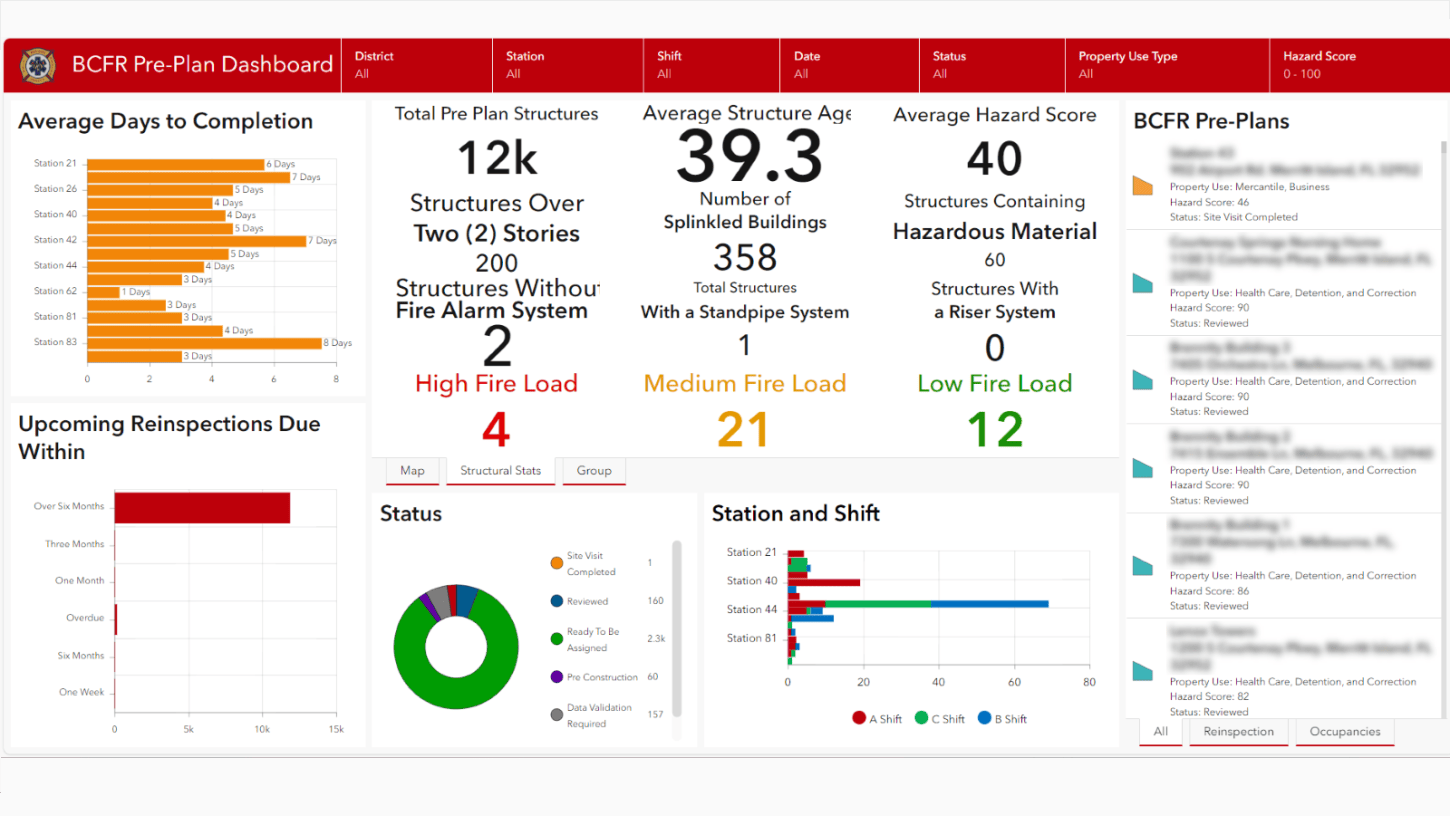
Additionally, with ArcGIS Dashboards, BCFR district chiefs can monitor performance across their districts and check when plans are due for reinspection, something that wasn’t possible before adopting the solution.

And keep going
BCFR has taken advantage of the solution’s customizability, working with Fire Rescue IT to automate email and notification processes. Now, when crews change a status, the information is automatically emailed to the district chief, and if crews create a building footprint, the GIS office is notified. In the works is similar automation that will notify district chiefs when plans are near due.
The organization also sees a broader application of the solution. For example, they use the risk scores they calculated using the Target Hazard Analysis solution to inform pre-plan frequency based on hazard potential. And, since the Fire Prevention department inspects the same buildings and uses the same information as Fire Operations, BCFR plans to bring Fire Prevention into the mix. They’ve also discovered the value of sharing data through ArcGIS Online with other fire agencies in their county. “With a few simple clicks, we can add other agency pre-plans into our system, and vice versa,” notes Cirivello.
So, if you’re ever in Brevard County and see a Brevard County Fire Rescue vehicle speed by, you can be sure that the crew on board is headed to an emergency armed with the information it needs to keep you—and everyone else—safe.
Learn more
For more information about the Pre-Incident Planning solution, check out the following resources:
- Learn how to deploy, configure, and use the solution.
- View a demo video.
- Learn about related solutions:
- Read related blog posts:
- Learn more about ArcGIS Solutions.


Commenting is not enabled for this article.