In this blog article, we will primarily focus on the new enhancements in ArcGIS Online. For those using ArcGIS Enterprise, you can refer to the ArcGIS Field Maps Enterprise Matrix to explore the corresponding capabilities in your version.
Deployment & authentication
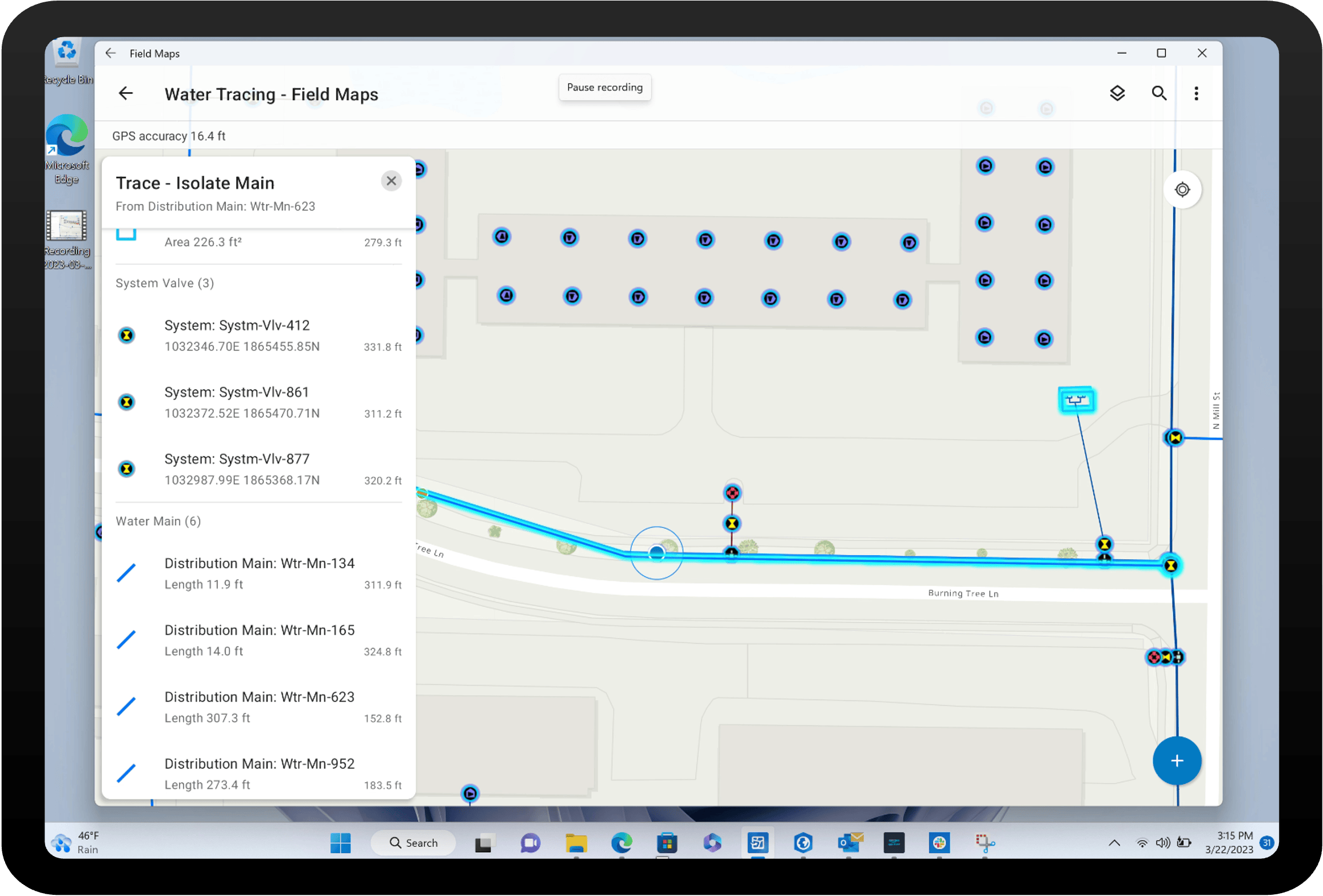
Windows 11
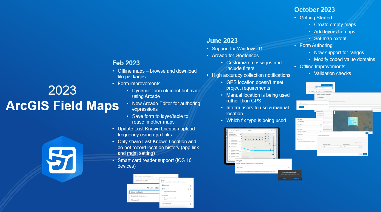
Since the release of Field Maps, one of the most frequently requested enhancements has been its availability on Windows devices. With the June release, all the features and functionalities previously exclusive to Android and iOS are now accessible on Windows 11 through Windows Subsystem for Android. However, there are certain factors to consider when using Field Maps on Windows 11. To assist users with these considerations, we have prepared a comprehensive FAQ.
Smart Card
Smart card authentication provides an additional level of security to Field Maps by necessitating users to present a physical smart card for authentication. In our February release, we introduced support for Smart Cards in Field Maps, available on iOS devices running iOS 16 or higher.
Field Maps Designer
In February of this year, we introduced an exciting update to the web app component of Field Maps. It was officially named Field Maps Designer, signaling the arrival of a host of new capabilities aimed at enhancing the field experience for your users. These additions have been carefully designed to streamline the process of designing field experiences, making it faster and more efficient than ever before.
A lot of the capabilities that we are about to dive into in this blog are surfaced through Field Maps Designer such as configuring the form, defining the accuracy for capture, configuring geofences as well as check for going offline.
Getting started
Our October release focused on making it easier than ever to build the maps you need for the field. Building on the ability to create new layers for the field (introduced in Nov 2022) comes the ability to create a new empty map that you can then add new or existing layers to on the Forms page.
Capture
Forms
Forms have fast become one of the most popular and powerful capabilities in ArcGIS Field Maps. If Forms are new to you, check out this quick introduction to Smart Forms video.
In our February release, we introduced two new capabilities. The first of which was the ability to save the form to the layer. This enables form authors to re-use forms as the form is present when adding the same layer to other maps.
The second form capability released provides form authors with greater flexibility in defining field behavior. Previously authors could define whether or not a field was visible. Since the release, you can now manage if the field is also editable and required. These form options make it much easier to ensure data that is added correctly without having to define behaviors at the service level. These behaviors were extended through additional arcade functions, such as feature set, in the June release.
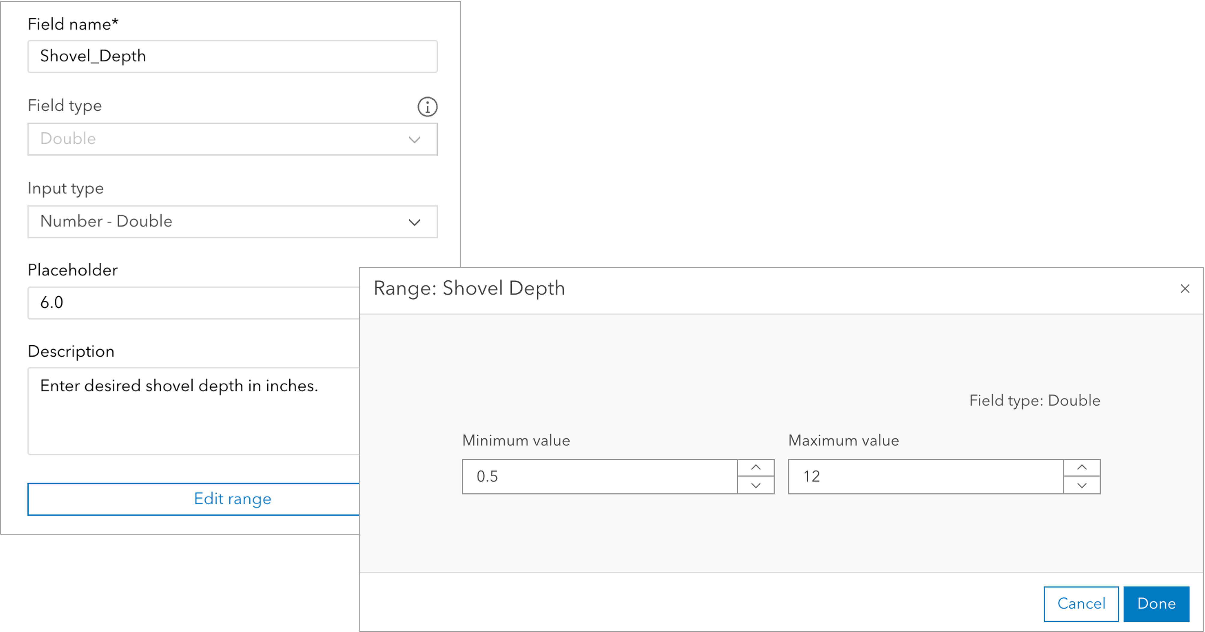
In our final release of the year we added additional form enhancements. From October there is now the ability to add and edit ranges as well as edit lists of values on new and existing form, whether those lists were created in Field Maps Designer, Map Viewer or published from ArcGIS Pro.
High Accuracy
In our June release, we focused on high accuracy and data quality, providing additional capabilities to ensure that data captured meets organizational standards. The enhancements included the ability to set the required GPS fix type threshold and to decide whether to block or warn users when manual locations are being used to collect features.
For those leveraging Field Maps on Windows, the June release also facilitated the ability to Connect to a GPS receiver using TCP/IP as the location provider.
Awareness
The awareness capability in Field Maps is all about improving the situational awareness for teams in the field whether that’s through the map itself, or through the use of pop up elements, or even using location-aware notifications powered by Geofences.
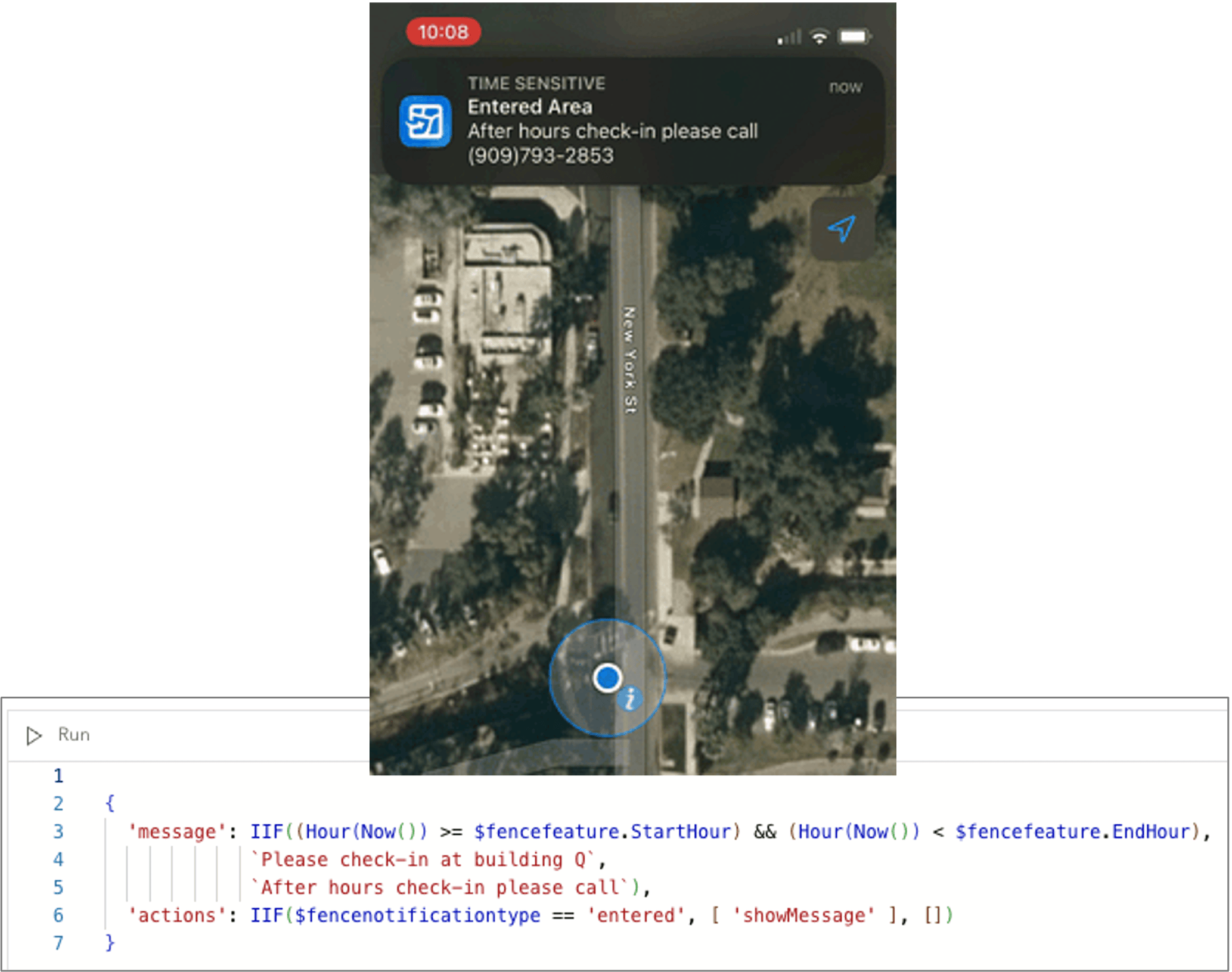
In June, we added the ability to leverage Arcade with Geofences to facilitate advanced customization. See the example here which shows an after-hours message to users who enter a geofence after the defined time.
Offline
While cell connectivity has improved it’s still not ubiquitous and offline workflows are important to ensuring fieldwork is not interrupted by lack of service. Our offline functionality is one of the areas in which we have added new capabilities and will have a continued focus in 2024 to make the process of going offline easier for both the teams prepping data and those syncing data to their devices.
In our February release we provided users to the ability to define a tile package as the offline basemap when preparing maps for offline use. This is a great new option because it enables the use of a larger and more detailed basemap across multiple maps with only one download for the user in the field. Additionally, Field Maps now checks if the tile package already exists on the device when syncing data, avoiding unnecessary downloads.
Making sure your data is ready for offline just got easier with the October release which introduced enhanced checks to the Offline page in Field Maps Designer.
Documentation
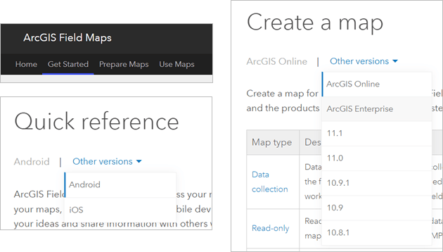
We have made significant enhancements to our Field Maps documentation site, ensuring that it is easier for you to access the information you need. In addition to reorganizing the content into three tabs – Get Started, Prepare Maps, and Use Maps – we have also implemented filtering options to view which features are available to you whether you use ArcGIS Online or a specific version of ArcGIS Enterprise.
Road ahead
We’re really excited about our plans for 2024. In our first release we are adding even more capabilities to Field Maps Designer, such as the ability to reorder layers, disable markup, and define different spatial reference systems when creating new layers.
Looking out a little further, we are introducing a new task capability that will provide the ability to create to-do lists for users in the field. With this new capability, organizations will be able to configure task types, add necessary fields for field teams to complete, and leverage form features like calculated expressions and conditional logic. We will provide an opportunity for organizations to test this new functionality in a Tech Preview of Field Maps in early 2024.
We need you
We want to continue to build the capabilities you need to support your field operations. The best place to provide feedback and ideas for Esri Field Maps is through Esri ArcGIS Field Maps Community. Our team actively monitors and considers the ideas submitted, discussed, and voted on by the user community. Additionally, you can participate in our Field Maps Early Adopter Community to provide feedback during the development of new capabilities. Keep an eye on the Esri Field Maps Community blog for announcements about opportunities to beta test new functionality. To participate in a user research interview, please contact your Esri representative or email us at ArcGISFieldMaps@esri.com.
Where to find out more
This article highlights the new functionality released in Field Maps throughout 2023. To learn more, refer to the provided resources for each release. The archived What’s New offers a historical view of all the past functionality releases.

Article Discussion: