Does more investment in public lands cause a decrease in forest fires?
Does easier access to purchasing guns and ammo cause more mass shootings?
Does increased social media use cause depression and anxiety?

Do violent video games cause adverse behavioral effects in youth?
Does a lack of infrastructure funding lead to higher rates of housing vulnerability or crime?

Questions such as these are imperative to helping shape and transform the problems in our society – now more so than ever.
However, with traditional statistical techniques and models it can be challenging, or even impossible, to separate out and measure how a single phenomenon may cause another.
There are so many extraneous factors and confounders in the data we observe that a new method and approach is necessary to determine and act on these complex relationships.
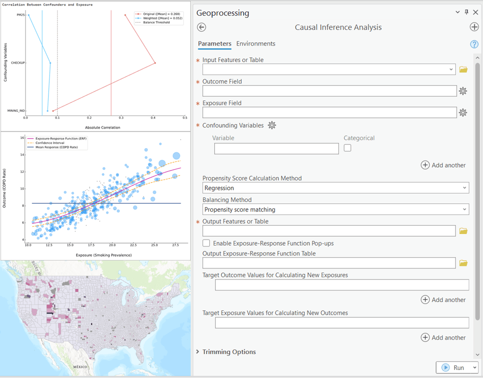
The new Causal Inference Analysis tool in the Spatial Statistics toolbox in ArcGIS Pro 3.2 was developed to help answer these pressing questions.

Causal inference analysis is a cutting-edge and continuously developing field of statistics and analytics. Causal inference takes observed data and controls for other outside effects and quantifies how one factor influences another. This type of conclusion and analysis is important and can address policy questions.
A government could quantify and prove, for example, a relationship between tobacco packaging warnings and reduced teen smoking rates, without getting lost in confounding effects and possibly making incorrect conclusions and wasting money. They could then take action on new packaging legislation that is based on informed research.
With the continuous stream of ever-increasing volumes of data, there is more opportunity than ever to investigate and learn from the cause-and-effect relationships in our society and harness this information for positive change.
Further Resources:
Link to paper — brought to you by our friends at https://causalab.sph.harvard.edu/
Causal Inference Analysis documentation

Article Discussion: