The USGS Historical Topographic Map Explorer is getting an update, and you can try out this new beta version, here: LivingAtlas.ArcGIS.com/TopoMapExplorer
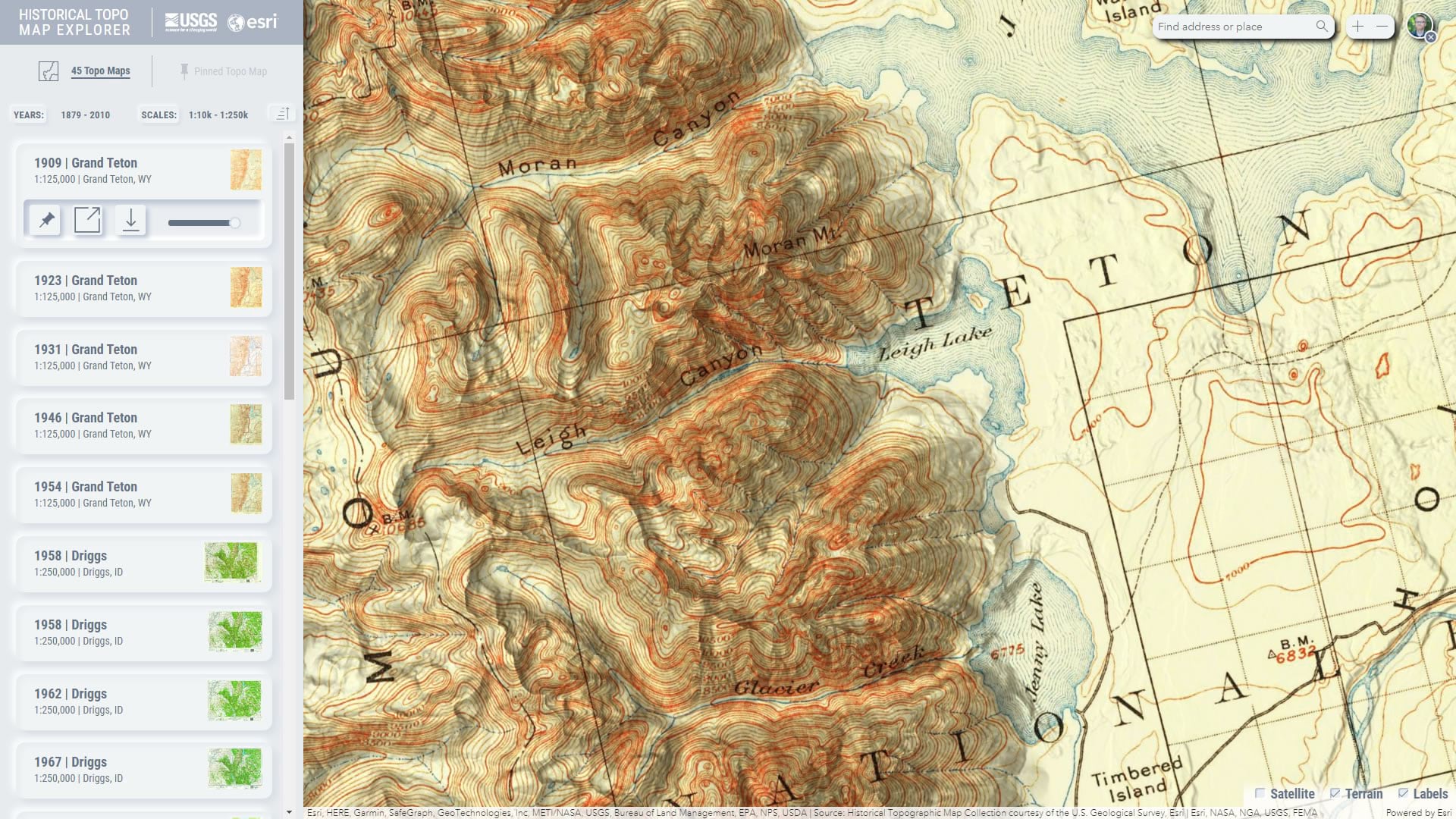
The United States Geological Survey has a rich history of creating exquisite topographic quadrangle maps. These topo maps are available as a digital library spanning 125 years. The Historical Topo Map Explorer provides a visual way to search and explore these thousands of maps via geographic extent, publication year, and map scale.

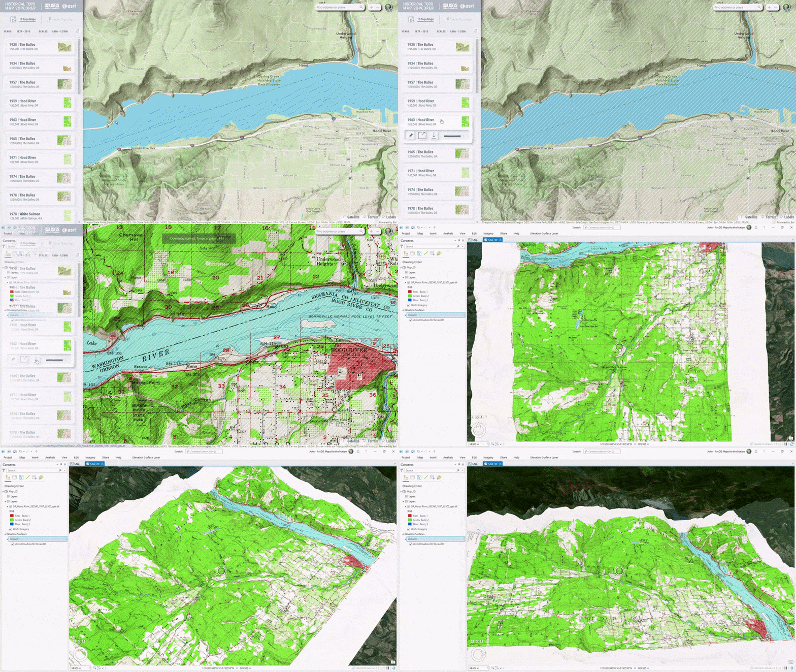
Create beautiful mashups of old and new by blending modern World Hillshade into these historic maps for added topographic context and visual interest.
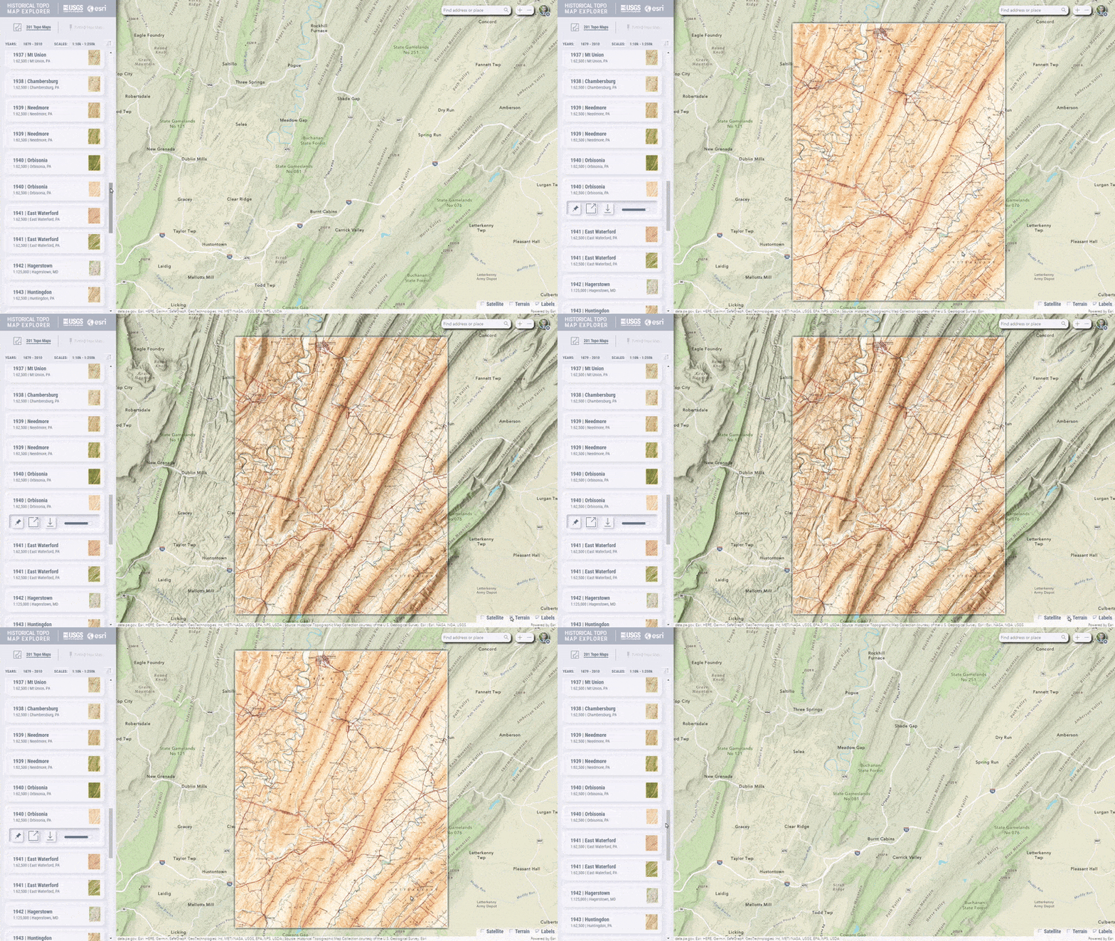
Just as you might with a collection of actual paper topographic maps, you can pick out digital maps of interest and pin them together to assemble a broad coverage…
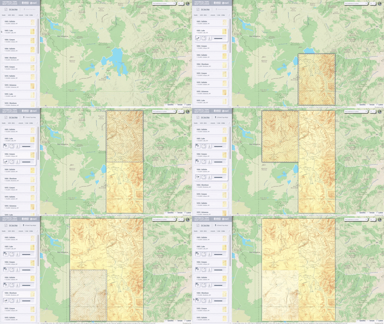
…or you might stack up several maps of the same location to compare its changed mapping over time.
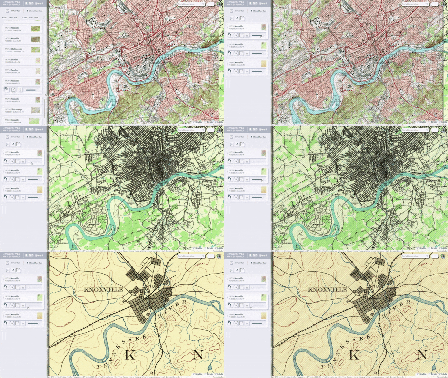
These topo maps can be downloaded to your computer as spatially-aware GeoTIFF image files and added to an ArcGIS Pro project…
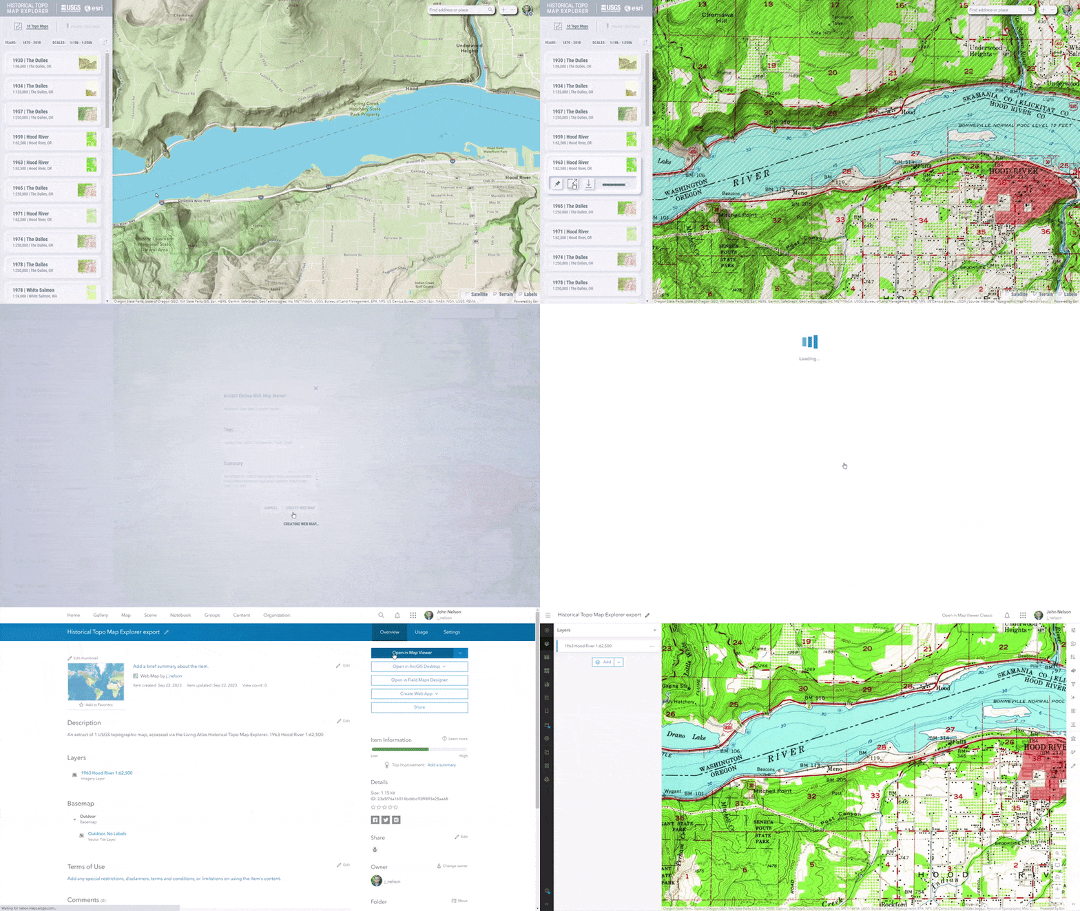
…or you may prefer to work in ArcGIS Online and save a topo map, or pinned collection of topo maps, as a new Web Map.
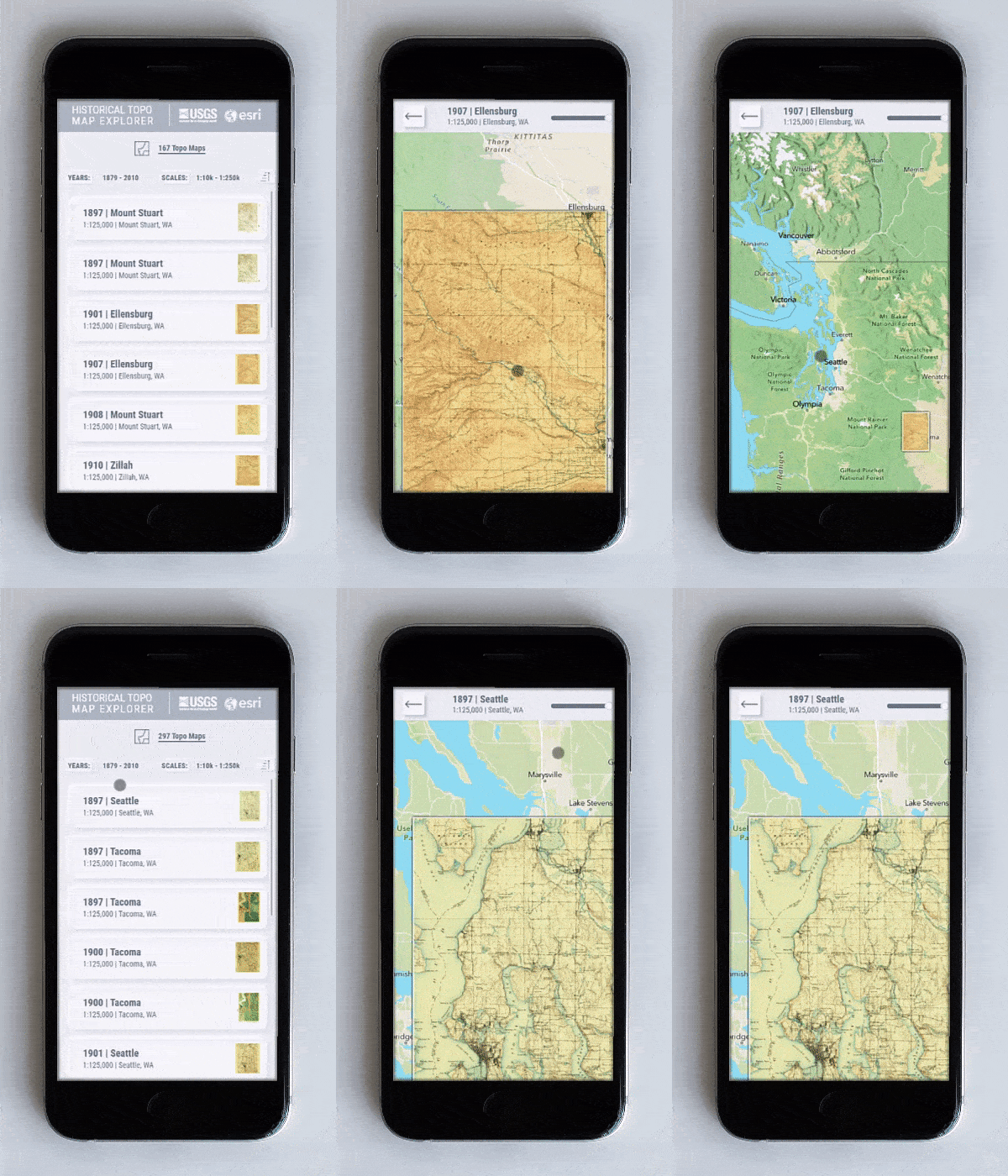
Explore historical topo maps on your mobile device, too.
If you need a historic reference, are comparing change, or just revel in exploring the beautiful collection of USGS topographic quads, we welcome you to visit the Historic Topo Map Explorer beta. We have lots of plans for future releases and we welcome your ideas too! Please comment with your suggestions and feedback.
Happy Mapping!
John Nelson, Calvin Manning, and Ken Baloun


This might be my first blog comment, but I felt compelled. The beta app is beautiful, intuitive, and powerful. What more could you want? Well, I guess a few things, since you have big plans. While I didn’t hate the old timeline, I much prefer the new side panel for a more immersive map experience. I also like being able to see up to five pinned maps in the list vs. three in the classic panel (based on my setup anyway). When saving a web map, the layer names now include the scale, which is a handy addition. And is… Read more »
Wow thanks, Derek! I’m so happy you’re enjoying it! Yes, some backend improvements to the underlying service enabled us to query the whole country’s worth of topo maps, rather than having to zoom in before seeing any. That was a big help.
Pin away, you can pin lots of topos!
Cheers,
John
Nice work!
Is it possible to use this as a template-app for presenting our own municipal archive of historical maps?
Thanks Martin! The source isn’t available yet as we are still in the beta phase and significant changes and enhancements lie ahead. When we are out of beta, it is likely the project will be available in GitHub, where your organization can look under the hood and see if it will be useful as a template for your project.
Cheers,
John
Hi @John Nelson,
any news about the availability of the App on GitHub?
Roberto
this is a hot topic! thanks for asking, and for your interest. our lead developer is currently working on refactoring the code, preparing it for public sharing on github. no word yet on timing, but we will likely share the news of its availability here on the blog and/or in the community site.
cheers,
John