Hey there, spatial problem solvers! We hope you enjoyed the Spatial Analytics Summit. Let’s keep the discussion going during the UC. The Esri team you just met and others are eagerly waiting to assist you.
Perhaps you had a question on the trends or capabilities shown at the Summit, or you’re looking for guidance on the best method to apply to your analysis; regardless of your question, we’re here to support you.
Visit us during sessions, within the Expo, or access this helpful story map with resources related to Summit topics.
Sessions
Take a deeper dive into GeoAI, spatial stats, suitability analysis, network analysis, graph analytics, real-time analytics, and more. Sessions welcome users of all types – those just starting with spatial analytics and savvy users. Take a look at this customized, detailed agenda to plan the rest of your time in San Diego:
Expo
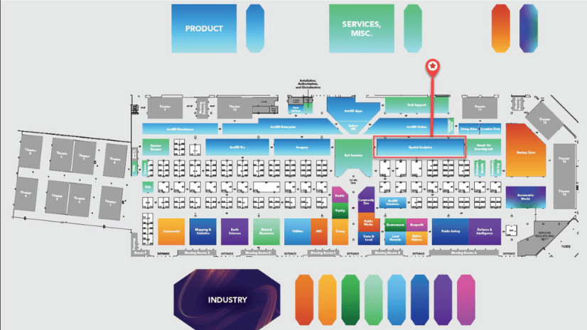
Visit the following kiosks, and don’t forget to pick up your I am a Spatial Data Scientist button.
- Analysis in the Map Viewer | Web-based spatial analysis
- ArcGIS 3D Analyst | 3D analysis and modeling
- ArcGIS AllSource | Intelligence analysis software
- ArcGIS GeoAnalytics | Big data spatial analytics
- ArcGIS GeoEvent Server | Real-time analytics in ArcGIS Enterprise
- ArcGIS Geostatistical Analyst | Spatial interpolation and prediction
- ArcGIS Insights | Visual analytics software
- ArcGIS Knowledge | Knowledge graph software
- ArcGIS Network Analyst | Optimize transportation routes
- ArcGIS Spatial Analyst | Raster analysis and modeling
- ArcGIS Velocity | Real-time analytics in ArcGIS Online
- ArcPy | Python scripting for automated analysis
- Charts | Explore and visualize spatial data
- Data Engineering | Prepare data for analysis
- Geoprocessing | Analyze and manage spatial data
- Geoprocessing Services/Web Tools | Share analysis in a web service
- ModelBuilder | Model and automate analysis
- R-ArcGIS Bridge | Spatial analysis across ArcGIS & R
- Spatial Statistics and Machine Learning | Analyze patterns and make predictions
Spatial Analysis & Data Science UC Expo
Day and Date Time Location
Tuesday, July 11 9:00 a.m.–6:00 p.m. Hall B
Wednesday, July 12 9:00 a.m.–6:00 p.m. Hall B
Thursday, July 13 9:00 a.m.–4:00 p.m. Hall B

Take the opportunity to connect with our supportive staff and take your spatial problem-solving skills to the next level.
Resources
Check out all our 2023 Esri User Conference Q&A for even more conference info, or search for specific topics like Spatial Analytics & Data Science, ArcGIS for Microsoft 365, ArcGIS Business Analyst, GeoAI, and ArcGIS Insights. And don’t forget to check out this Summit-specific story map that guides you to sessions and resources related to topics discussed during the Spatial Analytics Summit.
We look forward to seeing you in San Diego!!!


Article Discussion: