Designed for planners, by planners, ArcGIS Urban offers a blend of sketching, analysis, and 3D visualization tools for modeling and assessing proposed development and zoning changes. In the latest release of ArcGIS Urban, you’ll find the following additions designed to boost productivity and ease-of-use:
- Transparent 3D envelopes for effortless communication and interpretation of zoning and building regulations.
- Interactive snapshots of your 3D projects to build dynamic narratives and guided presentations.
- More guidance and efficiency with in-app tips, auto-saved suitability models, and snapping while measuring.
Visualize envelopes for a new perspective on development limits and opportunities
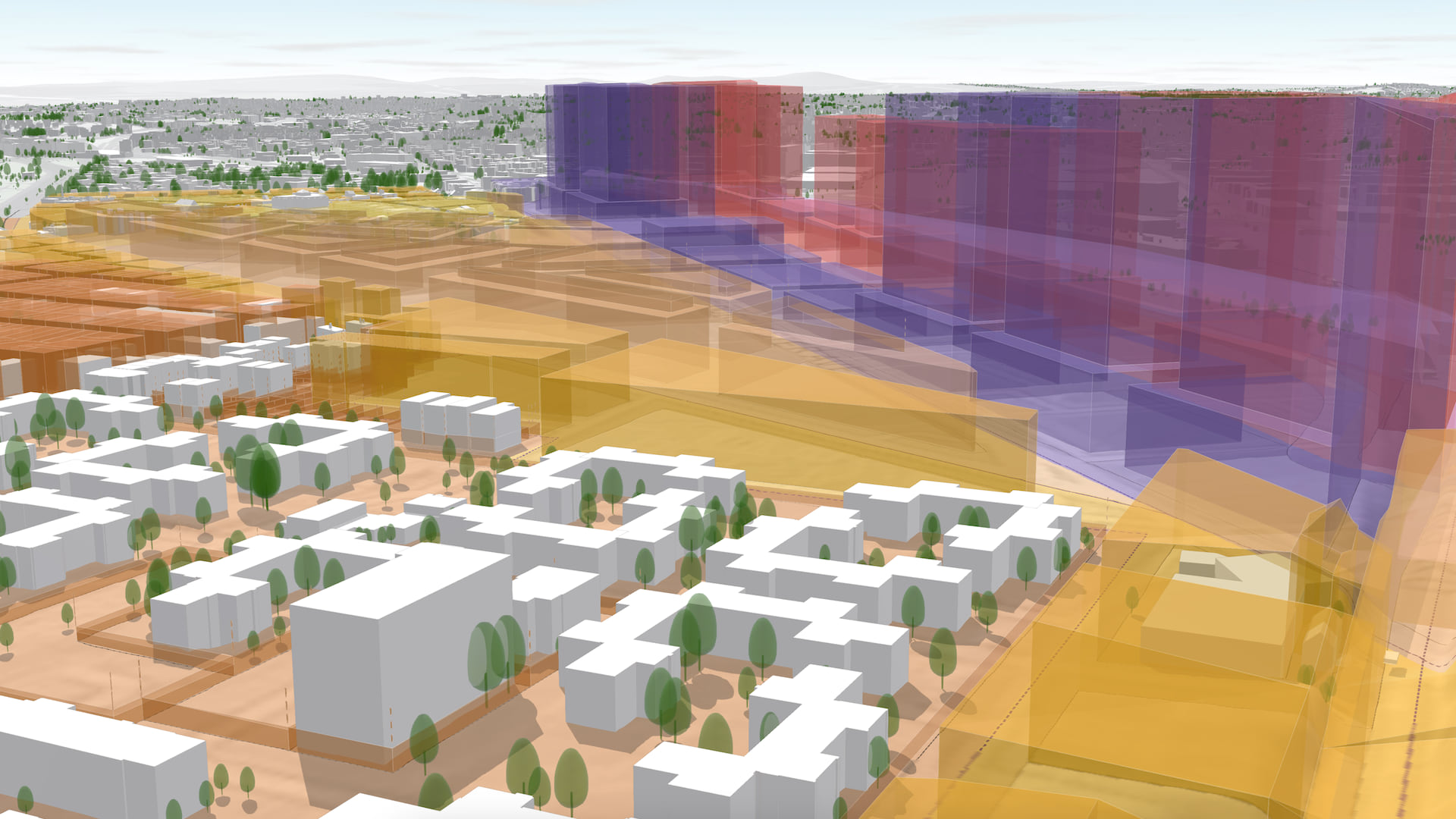
When we think of digital 3D models of towns and cities, we often think of physical representations, like buildings, trees, and street furniture. ArcGIS Urban goes beyond with the ability to visualize envelopes as transparent 3D boundaries – an effective way for planners to interpret the complexities of zoning regulations and communicate them to residents and developers.
While planners have always been able to visualize 3D envelopes for a plan area in ArcGIS Urban, we’ve improved how you interact with them in this release.
Identify room for growth
When viewing an area-of-interest, you can now directly show all envelopes, allowing you to identify densification opportunities. Or you can simplify the visualization to focus solely on planned developments so that you can quickly see where proposals are not compliant.
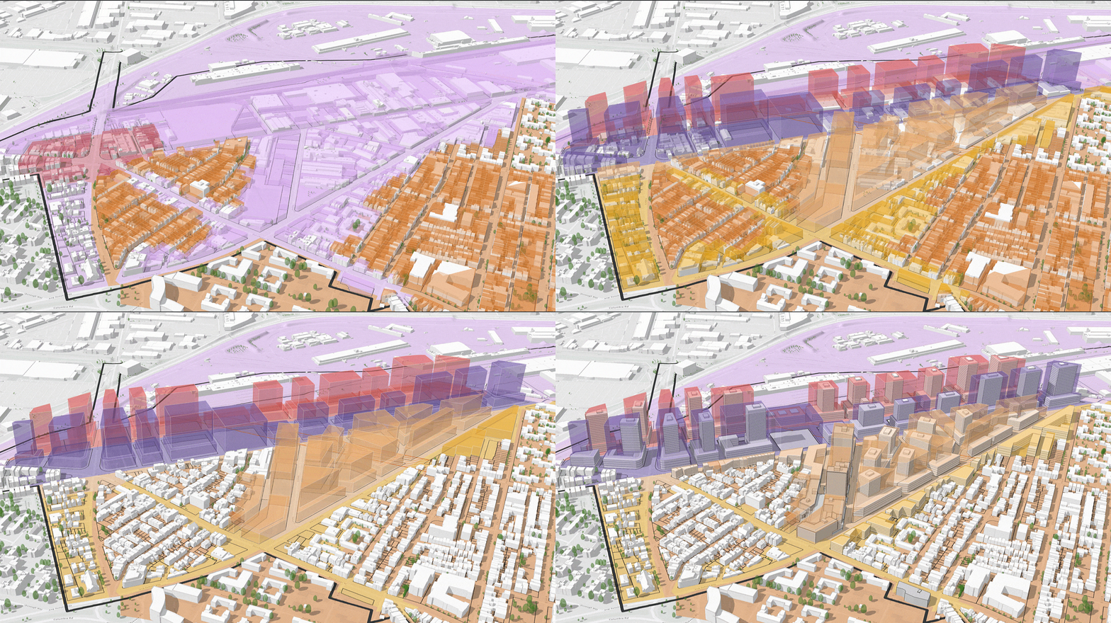
Want to visualize a potential change to an envelope? Simply click on a zone in the editing side panel and adjust values. While your newly calculated parameters load, you can now view and edit other aspects of your plan area without delay.
Review with confidence
No need to worry if a few of your zones are missing height parameters. Parcels without specified heights are now automatically marked with a finite dotted line, ensuring they don’t cause distraction.
3 ways to bring 3D visualizations to life for dynamic and engaging storytelling
We know that 3D models and contextual narratives are a powerful duo for engaging stakeholders in the planning process. Building on our continuous efforts to make sharing content with ArcGIS Urban easy and convenient, we’re happy to now make a snapshot of your urban projects shareable as web scenes.
Showcase individual project-based scenarios
Projects represent a collection of design submittals or phases within a short-term development, usually at a site-level. Planners now have the option to export individual project-related scenarios directly from ArcGIS Urban for use in custom applications, websites and StoryMaps.
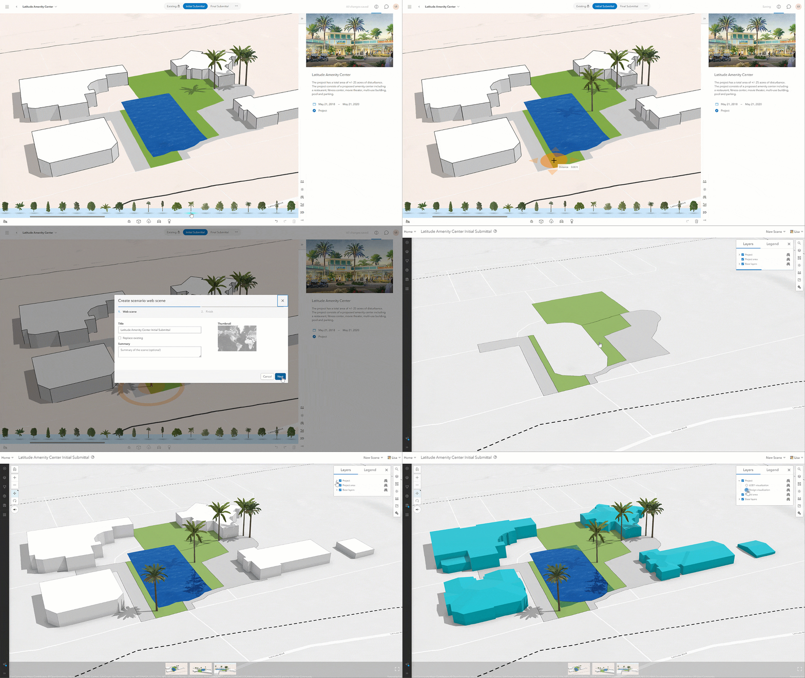
The addition of exportable project web scenes completes the seamless export functionality for all three types of Urban elements:
- New! Projects – Represents design submittals or a phase within a development project, usually at the parcel-level.
- Plans – Shows existing or proposed buildings (and their metrics), surfaces, and parcels within a larger area, such as those considered for zoning reform or redevelopment.
- City or town models – A customized selection of plans and projects for creating a high-level overview of ongoing and future developments.
Feature any of these ArcGIS Urban elements individually or together to create engaging narratives and guided tours for sharing with your stakeholders and the public.
Bonus workflow! Export web scenes for use in VR
What better way to explore a 3D model of a town or city than with a VR headset? VR headsets are an excellent way to encourage participation at stakeholder meetings and public forums. To export projects and plans, simply use the new 360VR scene option, just as you would export the new project webscene to an app or ArcGIS StoryMaps. Learn more.
Greater insights and efficiency as you work
Whether you’re new to ArcGIS Urban or an experienced 3D-modeler, here are a few more enhancements we’ve added to make learning and using ArcGIS Urban that much easier.
Tips and guidance as you need it
With busy schedules and existing priorities, it can be tough to master a new skill. Keep an eye out for tips. We’ve added links to our online documentation to help you through common workflows. For example, you’ll find them when using the editing toolbar for zones and development modeling.
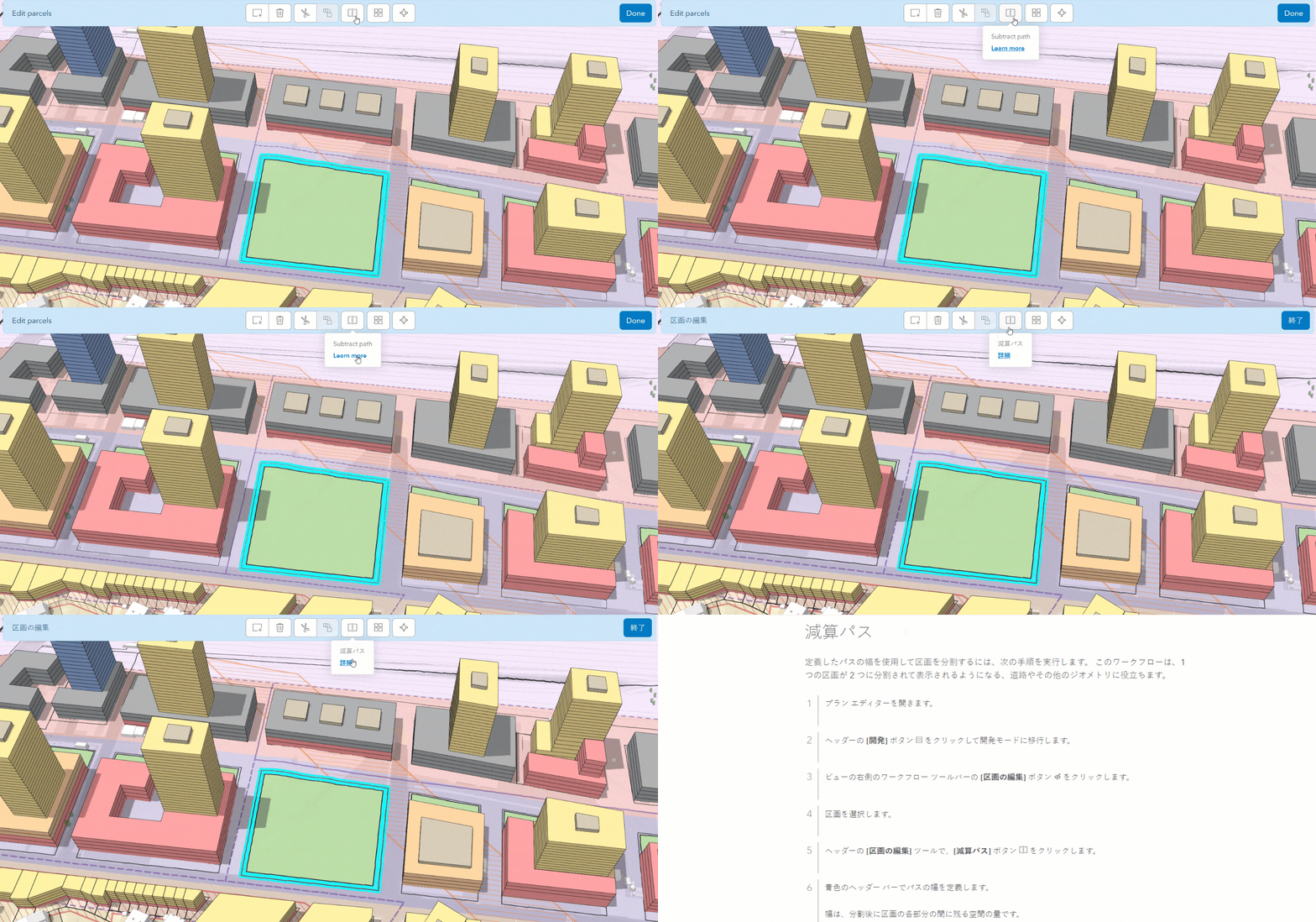
Access to the entire ArcGIS Urban documentation catalog and our latest news is also now available when opening the collapsible side panel in the top-left corner of your window. Wherever you are in ArcGIS Urban, whether editing a parcel layer or configuring plan settings, this navigation button is a consistent wayfinder that now includes helpful links.
Auto-save parcel suitability analysis
Finding out which parcels are a good fit for development is tricky enough. With autosave, you can build your virtual suitability model without worrying about losing your progress.
Measuring dimensions
Now when measuring distance and area, you can snap to every line and vertex, ensuring precise measurements, such as when tracing the boundaries of a parcel or building. To continue with freeform measurements, simply use the CTRL key on your keyboard to temporarily disable snapping.
Learn more about ArcGIS Urban
Headed to this year’s Esri User Conference? Check out our curated list of ArcGIS Urban sessions and be sure to stop by the Community Development Area. Not going to make it this year or want to chat with us sooner? Schedule a demo to meet with a member of our team one-on-one.
Additional resources
- For a comprehensive list of all new features, improvements and bugfixes, please see our Release Notes.
- Stay up-to date with announcements like this and more by signing up for our tri-annual ArcGIS Urban Newsletter.
- Check out the ArcGIS Urban Resources StoryMap for a complete overview of all the available ArcGIS Urban resources.
- Help improve Urban and join our ArcGIS Urban User Lab to be contacted for user research and testing.

Article Discussion: