With the March 2013 ArcGIS Online update, map authors can now add GeoRSS, OGC WMTS, and tile layers to their web maps. Here’s how you add tile layers using the ArcGIS.com map viewer.
About tile layers
A tile layer is a set of web-accessible tiles that reside on a server. The tiles are accessed by a direct URL request from the web browser. For example, OpenCycleMap is a tile layer. Because the tiles in a tile layer are not available as a service, they must be in a specific format on the web server. Client applications consuming the tiles such as ArcGIS.com map viewer use the format to request the appropriate tiles.
Access to the appropriate tiles in the tile layer depends on the URL to the tile layer. The URL contains parameterized values, which are used by the map viewer to dynamically request the tiles that correspond with the extent and scale of the web map as you pan and zoom. This is the tile layer URL for http://www.opencyclemap.org/:
http://{subDomain}.tile.opencyclemap.org/cycle/{level}/{col}/{row}.png
The portions of the URL encapsulated with {} indicate parameterized values, which the map viewer uses to dynamically access specific tiles. Each parameter is detailed below:
{subdomain} Subdomains are used by the tile layer provider to distribute tile requests across multiple servers. For example, the OpenCycleMap tile layer contains three subdomains: a,b,c. Not all tile layers have subdomains. If you are unsure of the subdomain labels, contact the tile layer provider.
{level},{col},{row} These three parameters are used by the map viewer to dynamically access tiles. No input necessary.
How to add a tile layer to your web map
Step 1: Open the ArcGIS.com map viewer and click Add.
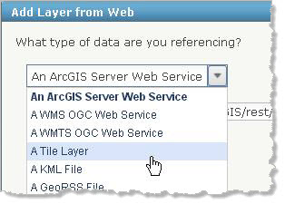
Step 2: Choose Add Layer from Web.
Step 3: Choose A Tile Layer.
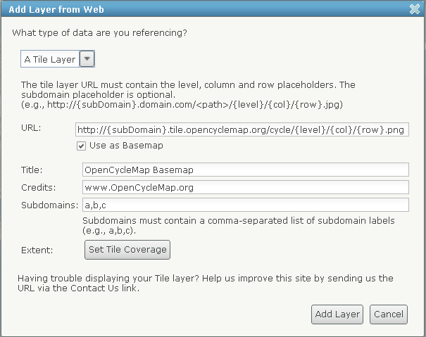
Step 4: Enter the layer’s web address in the URL field.
Step 5: If the tile layer contains one or more subdomains, specify the tile layer’s subdomain labels in the Subdomains field. Delimit the labels with commas. If you are unsure of the subdomain labels, contact the tile layer provider. If the tile layer does not have any subdomains, the window does not display the subdomain field.
Step 6: Enter a title for the tile layer in the Title field. The title is used as the name of the tile layer in the map contents.
Step 7: Enter any copyright information or required attribution information for the tile layer provider in the Credits field. The ArcGIS.com map viewer displays the information you enter in the lower right of the map.
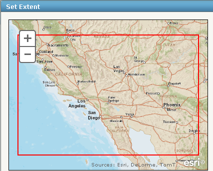
Step 8: Click the Set Tile Coverage button and set the extent of the tile coverage. Tile coverage represents the extent of all the tiles. This is an optional setting. When the extent is set, tiles are only requested for the extent specified. However, because the tiles are not clipped to fit the extent, tiles may extend beyond the extent.
Step 9: Check the box next to Use as Basemap if you want to use the layer as a basemap.
You now have all the information you need to add your tile layer to your map.
Step 10: Click Add Layer.
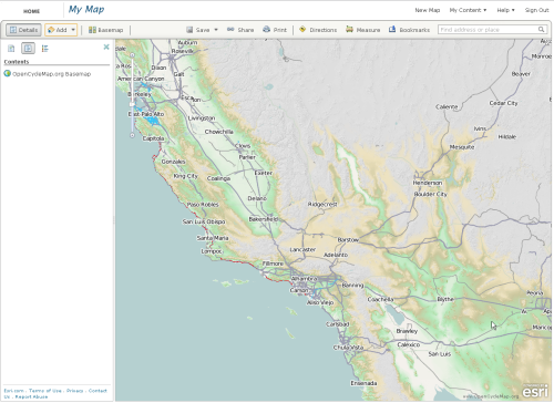
The layer is added to your web map.
For more information, see Adding layers from the web.

Commenting is not enabled for this article.