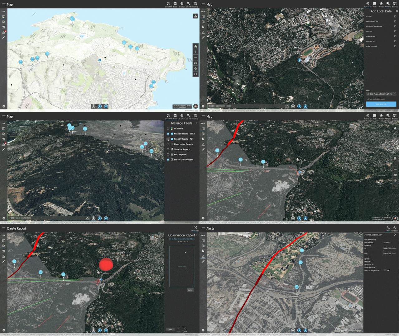
ArcGIS Runtime developers today have the ability to build dynamic, real-time situational awareness into their native applications, running on any platform from desktops to mobile devices. Many system integrators and business partners need to build operational field apps and command and control systems that give a common operating picture to decision makers. These systems are critical during tactical events such as military mission planning, disaster response, humanitarian aid, and border patrol surveillance.
This week, Esri announced the unveiling of an example application called the Dynamic Situational Awareness Example App (DSA). This example helps ArcGIS Runtime SDK developers get familiar quickly with these situational awareness and analysis APIs through best practices and patterns. The DSA example app is an open-source application built with ArcGIS Runtime SDK for Qt, which developers can download, customize, compile, and configure for in-vehicle and handheld devices on Windows, Linux, macOS, Android, and iOS platforms.

What it does
The DSA example demonstrates how these mission critical, dynamic applications can be created to operate while completely disconnected from a server. It works completely offline, performing spatial operations and analysis on local data and computing resources residing on the device, and allows multiple users of the app to send messages to each other in the field over a peer-to-peer communication protocol.
The DSA app demonstrates the best practices and patterns of utilizing the following ArcGIS Runtime SDK capabilities:
- 3D map with navigation controls
- Own location tracked on the map with various navigation modes
- Read and display local file data including support for both foundation GIS data and overlays
- Uses local data formats supported by ArcGIS Runtime such as Shapefile, GeoTIFF, DTED, NITF, Mobile Mosaic Dataset, GeoPackage
- Support for sharing information over a tactical, ad-hoc, peer-to-peer network and low-bandwidth
- Support for military symbology with high performance display
- Interactive, on-device, dynamic exploratory analysis with line of sight and viewshed
- Alerts triggered by spatial rules such as geofences
- Coordinate conversion between various notations such as DMS, MGRS, GARS and UTM
Go to the DSA Example App home page for more details of what ArcGIS Runtime can do.
How to get started
You can clone the Github repo today at https://github.com/Esri/dynamic-situational-awareness-qt. All the source code is available. You’ll also need the ArcGIS Runtime SDK for Qt, which you can download and install for free when you sign up for an ArcGIS Developer Program subscription. Then, download the sample data to your device, compile and run! We invite you to submit GitHub issues and share your feedback.
Don’t have a development environment, but want to demo the DSA Example App yourself? No worries! Download and run the pre-compiled versions on your Windows desktop or Android device. You can get both the Windows executable and the Android APK from ArcGIS Online.
Want to connect? Engage with the community on the Example Apps GeoNet place. This is a great forum for sharing your experiences and questions with Esri development teams as well.
Commenting is not enabled for this article.