ArcGIS Image Analyst extension for ArcGIS Pro is releasing enhancements to deep learning, motion imagery, multidimensional analysis and stereo mapping in the November 2021 release.
Deep Learning
Deep learning has several improvements in this update.
Labelling
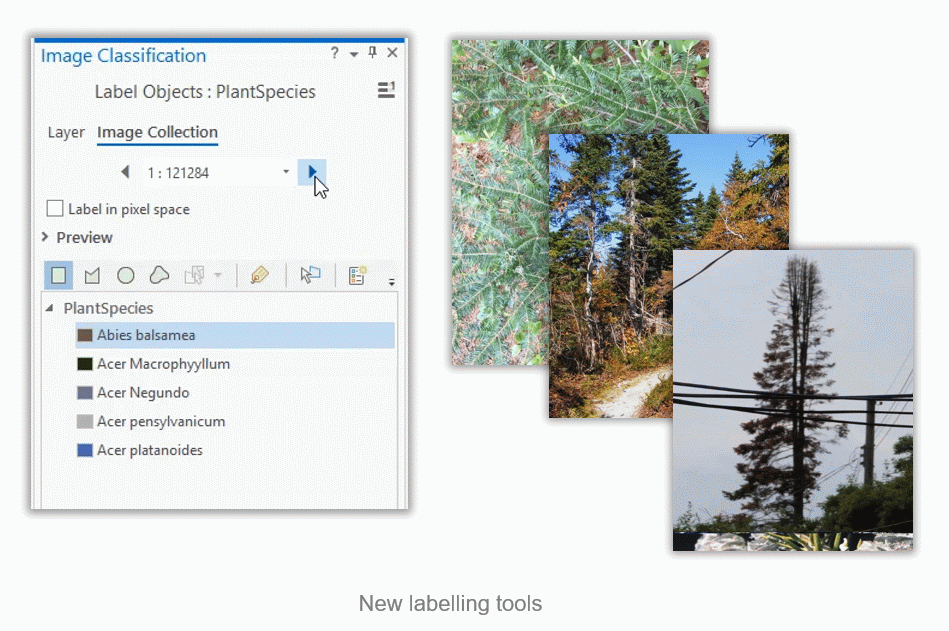
The labelling tool has been simplified for users working with large amounts of imagery where each image represents a single class. This tool previously required users to draw features around an object in order to label it. Now, users can just select the image, assign a class label and apply it to the whole image.
Labelling tools have also been enhanced to work with image collections and motion imagery frames.

New deep learning models
As with every release, the number of models to support users’ workflows continue to increase. New models such as MMDetection and Pix2PixHD have now been added to ArcGIS Pro.
Additionally, two new object tracking deep learning models (Deep Sort and Siam Mask) have been introduced to train your own model to track objects of interest.
End-to-end support for motion imagery
The new labeling experience and the 2 new models to support object tracking enables end-to-end deep learning workflows on motion imagery.

Motion Imagery
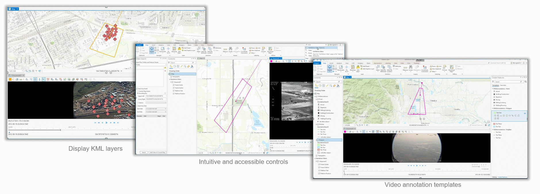
In motion imagery, we increased the number of formats we support. HTTP Live Streaming (HLS) is now being natively supported in ArcGIS Pro 2.9. While KML was previously accessible on ArcGIS Pro, motion imagery is now able to display the KML layer in the video pane.
Improvements have also been made to the user interface, making some of the controls more intuitive and accessible. Users can now customize their view to display the sensor display, frame locations and look angle. Video search is also more interactive with the video search capability being directly accessible through the video player. Similar to editing templates in ArcGIS Pro, this release introduces video annotation templates so users with their own symbology can quickly annotate features.

Multidimensional Analysis
Multidimensional analysis capabilities have been enhanced. ArcGIS now supports Zarr format which is optimized for storing multidimensional and climate data in the cloud.
New tools and raster functions have also been added to support multidimensional analysis. “Dimension moving statistics” works across dimensions that helps in workflows such as smoothing out noise or anomalies across dimensions. Additionally, this release introduces “interpolate by dimension”, which is available as a tool or function and is critical to fill in gaps in datasets across multiple dimensions.
Finally, the Principal Component Analysis (PCA) tool for multidimensional data looks at spatial and temporal patterns using a multidimensional dataset. This means that instead of just looking at dominant spectral patterns in a multispectral imagery, users can run PCA on time series data.
Stereo mapping
This release also highlights improvements to stereo mapping. The stereo model selector pane will now display names of the images comprising the stereo pair. Previously, there was no indication of which images comprised of a stereo pair. In the event of problematic or corrupt stereo, users can now backtrack to the participating images and identify the source of the problem.
The non-stereo areas have also been removed to enhance the user experience, subsequently eliminating eye strain.
The final update to stereo mapping is the system automatically displays the best available stereo pair in your area of interest as you zoom and pan around your project. Users no longer have to manually load stereo pairs when doing stereoscopic editing or analysis.
Ready to give these new capabilities a try?
Check out these resources to get you started:
- Learn more about the ArcGIS Image Analyst extension for ArcGIS Pro and how to get it
- See what’s new in ArcGIS Pro 2.9
- Learn how to use ArcGIS Image Analyst, including hands-on tutorials
- Check out help documentation for ArcGIS Image Analyst

Article Discussion: