Article updated on 4/18/2023
ArcGIS Instant Apps quickly transform your maps into apps to provide your audience with an intuitive experience to interact with your maps and data. This blog illustrates how you can highlight different stories from the same data or map using a handful of Instant Apps. All the examples will use National Park data and maps. Using different Instant Apps, we can answer a variety of questions and showcase specific map features.
The eight Instant Apps were created using the following datasets from the National Park Service:
National Park Boundaries
Instant App #1: Zone Lookup
This app was inspired by this blog post. The Zone Lookup Instant App returns information about a zone (polygon) based on a location; think searching for your school zone based on your location. In this app, we used the nearest National Park theissian polygons idea from the previously mentioned blog post as the polygon layer identified in the search. The point of interests and trails were included as well, so that when an address is searched and a polygon is identified, points of interests and trails located in that polygon are returned.
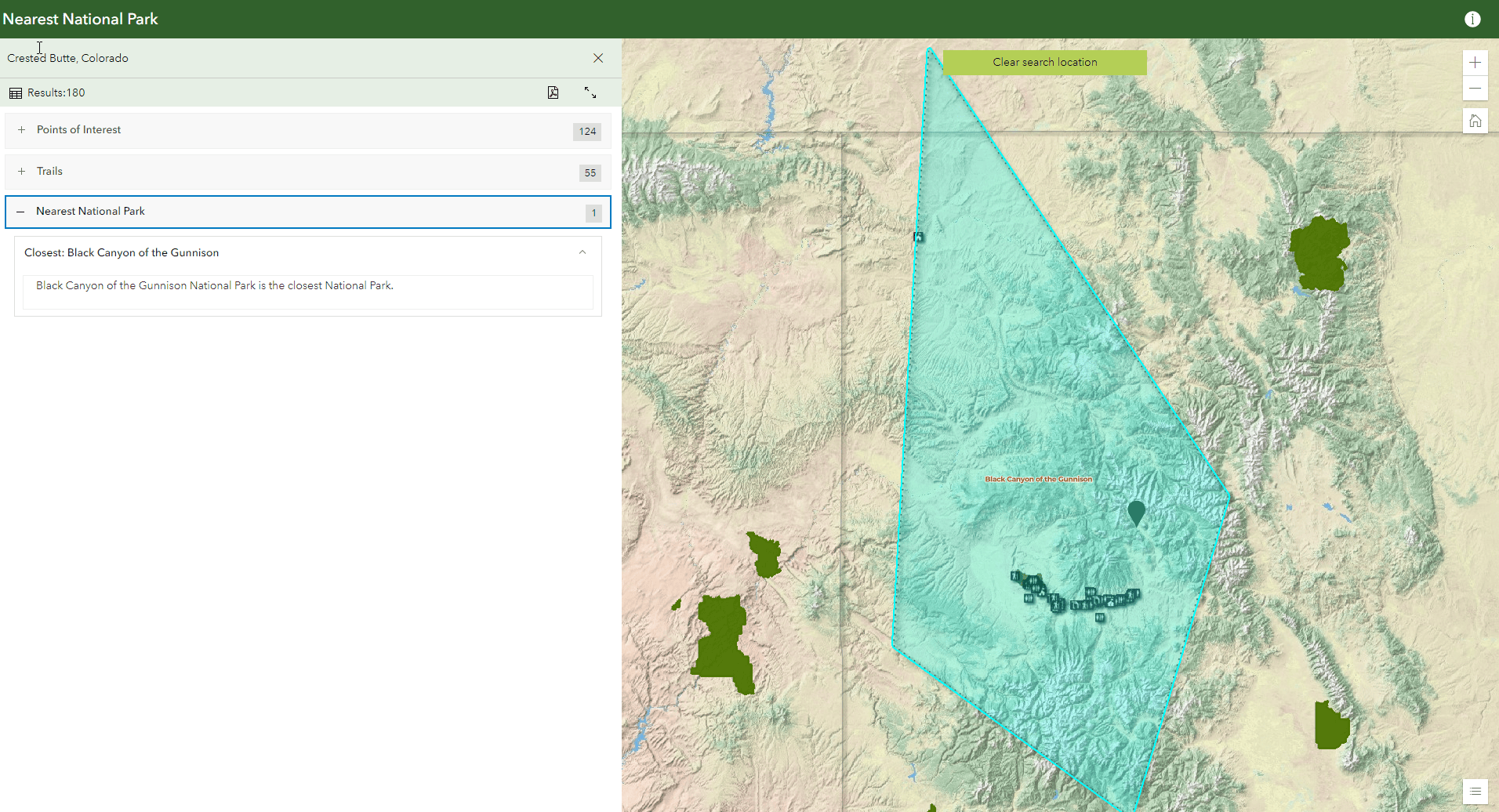
In simpler terms, when an address is searched the polygon with the closest National Park is identified and lists of points of interests and trails located in the identified National Park are displayed!
Here we are really highlighting the identification of nearby National Parks and interesting features within the park!
Instant App #2: Attachment Viewer
Perhaps the simplest app created, this app shows the location and an image of each National Park. The Attachment Viewer Instant App allows easy exploration of feature attachments, with attachment focused tools and multiple layout options. The images were added to the National Parks layer through the attribute table in Map Viewer Classic. Then the Attachment Viewer app was created from that map and voila! You have a picture filled app that zooms to a picture and location for each park.
Instant App #3: Countdown
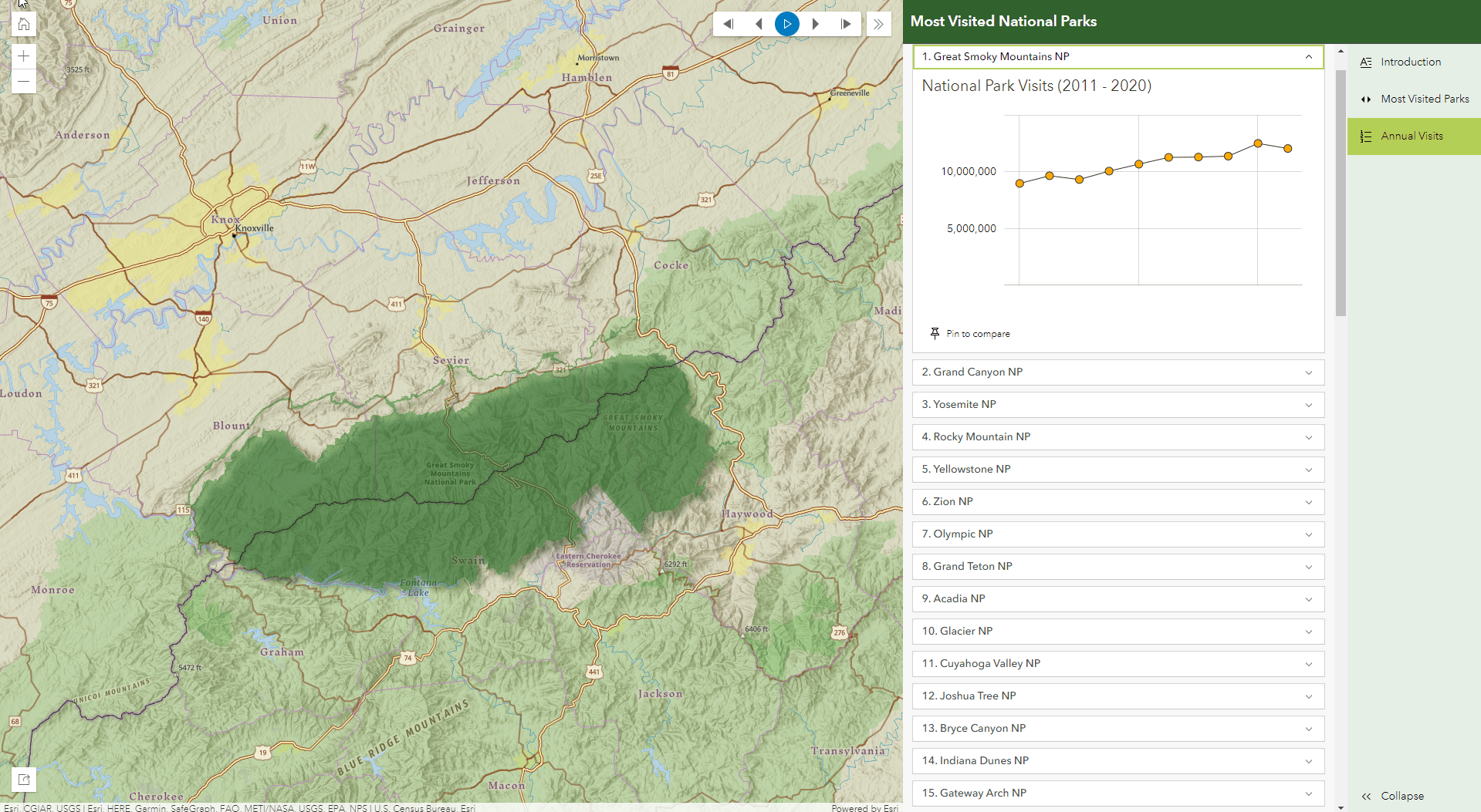
For this app, we merged the National Parks Visits data to the National Park data from the earlier app to create an app ranking the most popular National Parks. The Countdown Instant App enables you to create an interactive “top-ten” experience that tours through a statistical map. The app itself ranks National Parks based on their 2020 visits and includes charts illustrating annual visits for each park since 2011. These charts were incorporated using charts within the pop-ups in the Map Viewer.
Instant App #4: 3D Viewer
Going in a completely different direction, this app is based off a 3D Scene and is focused on a singular park, the Grand Canyon. The 3D Viewer Instant App showcases scenes and provides new capabilities to interact with 3D data. Meant to act as a hiking route planner, the app includes trails and POIs in the Grand Canyon. A few cool features in the app are the elevation profile and measurement tools that enable you to measure both elevation changes and distance. In addition the daylight tool to animate daylight and shadows for a specific date and time. Basically, this app makes it easy for you to be as lazy or as ambitious of a hiked as you’d like.

Instant App #5: Sidebar
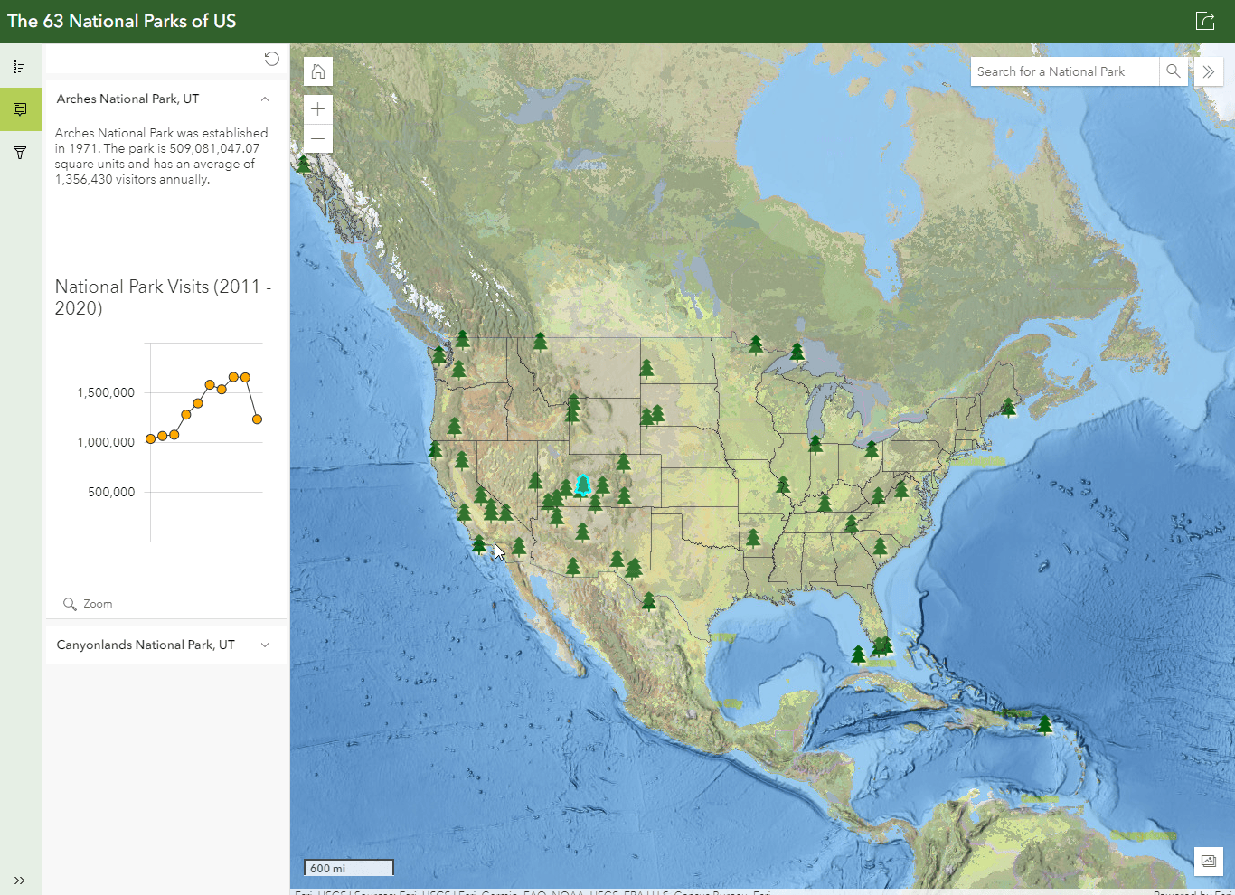
If you want to highlight pop-ups, the Sidebar Instant App is a great option. In this app, the pop-ups are displayed in a side panel, rather than above the map, making it much easier to read. This app keeps the focus on the map while providing some simple tools, like filter. Sidebar has many additional tools that can appear along side the map, including options like details, edit, layer list and utility network; visit a the Sidebar blog for information on additional capabilities.
Instant App #6: Slider
The Slider Instant App is the way to go for time data. For the National Parks, the Slider app was used to visualize the growth of National Parks over time using the year established as the time data. Starting with one park in 1872, and ending with the 63 there are now. The Slider app can animate both temporal and numeric data, for more info visit a blog on Slider.
Instant App #7: Insets
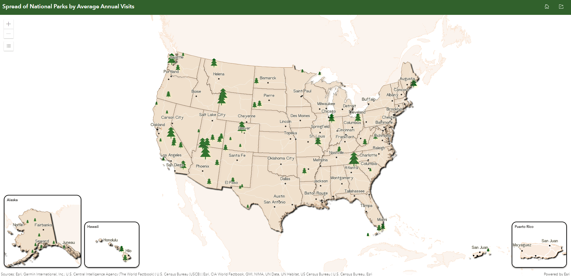
The Insets Instant App display an interactive collection of noncontiguous locations from one map within a single layout. Choose from a list of predefined geographic layouts, like this example in the United States of America or customize the layout using bookmarks. Predefined mode currently supports layouts for the US, France, Spain, Portugal, and Japan, with more on the way in coming releases. For more information visit the blog on Insets.
Instant App #8: Portfolio
Round out the last of the app tour is the Portfolio Instant App! A logical place to end, this app allows you to showcase related content related to a topic all in one place, in this case, the National Parks. In addition, Portfolio makes navigating between multiple apps, maps, and web pages and avoids the hassle of sharing a handful of long links.
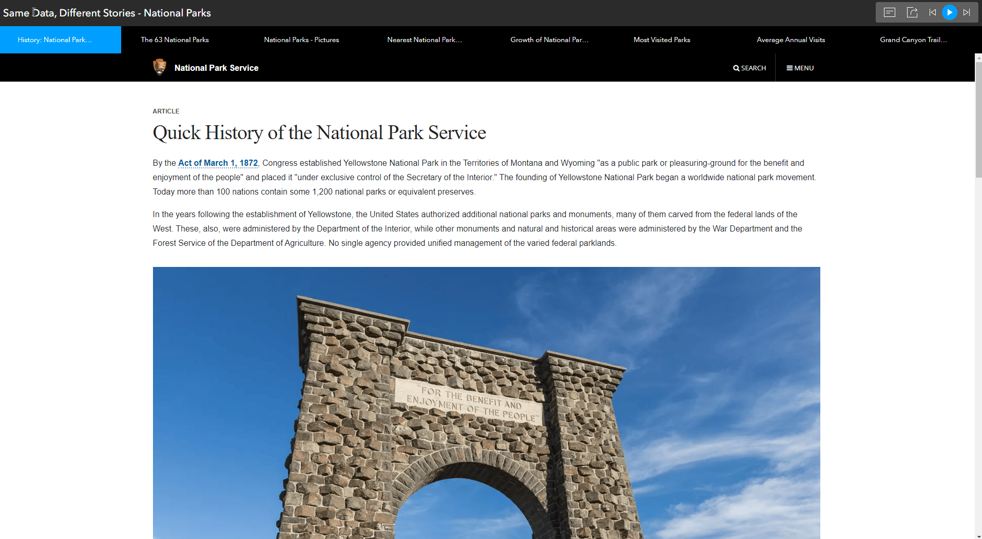
Overall, using these Instant Apps makes it easier for the viewers to digest the data, is much more user friendly than sharing a typical map, and allows you to easily create polished final products!


Article Discussion: