ArcGIS Earth mobile users got a major update for ArcGIS Earth on iOS and Android in January 2021, and we’re excited to now be rolling out another major release that includes improvements to GPS track recording, a new quick-start feature allowing users to browse and explore data hosted on ArcGIS Online and ArcGIS Enterprise. Read on for all the highlights on what’s new in this release.
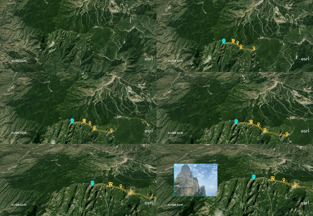
Improved Experience for Adding Data
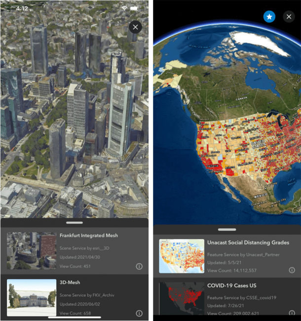
A major benefit of ArcGIS Earth is the ability to add and work with data from multiple sources including ArcGIS Living Atlas, ArcGIS Online, and ArcGIS Enterprise. In this new release of ArcGIS Earth mobile, this workflow has been redesigned so that users can now preview and add multiple data sets without leaving the search result list in the portal, making for a smoother and more convenient user experience.
When adding and previewing content on the scene, you can easily add the current data to My Favorites with one tap when signed in to ArcGIS Online or ArcGIS Enterprise:
To learn more about adding and working with data from ArcGIS Living Atlas, check out our Learn ArcGIS lesson for a step-by-step guide.
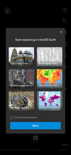
Recommended Online Content
The ArcGIS Earth mobile app now provides highlighted online content recommendations for you to explore when launching the app:
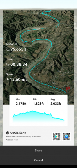
Customize Shareable Cards from Recorded GPS Tracks
When framing your recorded GPS tracks as a sharable card, users can now choose a custom view and attach an elevation profile:
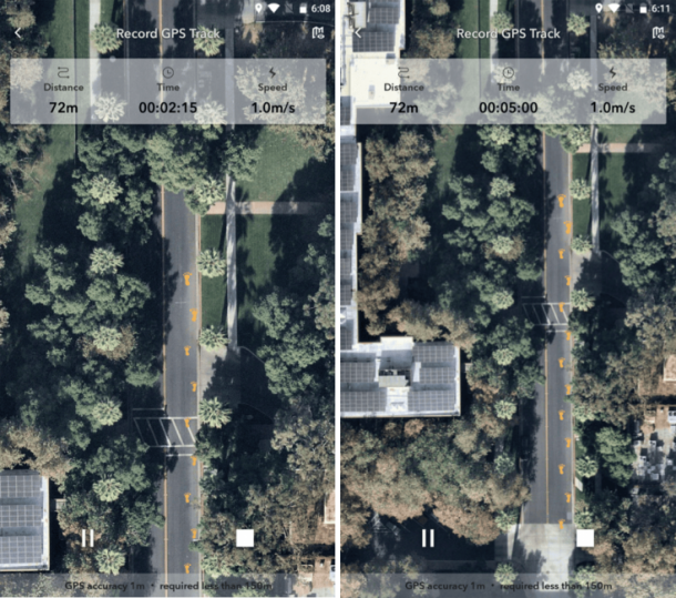
New GPS Tracks Style
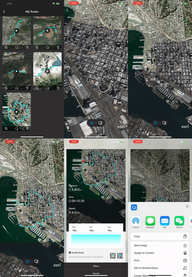
Starting with our January 2021 release of ArcGIS Earth mobile, users gained the ability to record tracks based on GPS location captured on a mobile device. Once a GPS track is successfully recorded, users can view and replay it on the scene, frame it as a shareable card, export it as a KMZ file, or upload it to ArcGIS Enterprise and ArcGIS Online.
This latest release introduces new footprint style while viewing recorded GPS tracks:
Additional Features and Enhancements
- Switch between Full Extent or Dynamic Following mode when replaying recorded tracks
- Search history in Add Data from portal is now saved and can be easily retrieved
- Enhanced sharing My Placemarks as KMZ, and added support for sharing across other apps or uploading to ArcGIS Online or ArcGIS Enterprise
- Support for searching locations from geographic coordinates in various formats
- Support for recording and sharing Tour videos in landscape mode
We’re thrilled to share these improvements with our ArcGIS Earth mobile users and are looking forward to adding many more in the future. Users can download the latest versions of ArcGIS Earth mobile and desktop on our website, and find the mobile apps on the App Store and Google Play. For free resources and training materials, and visit the ArcGIS Earth Resources page. And as always, we love to hear user feedback and encourage users to get involved in the ArcGIS Earth Esri Community.



Commenting is not enabled for this article.