Insights for ArcGIS is a browser-based analytic workbench that enables you to interactively explore and analyze your data coming from many sources. Insights enables you to quickly derive deeper understanding and powerful results through its rich, interactive user experience.
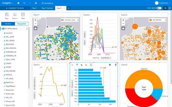
This screen capture displays crime incidents and uses descriptive statistics to summarize the human and financial costs of criminal activity in San Francisco over a five-year period. Click the image to view a video demonstration from the 2017 Esri Developer Summit.
Insights for ArcGIS has the ability to integrate a variety of data sources for your analysis. It integrates and enables analysis of GIS data, enterprise data warehouses, big data, real-time data streams, and spreadsheets, and more. Insights for ArcGIS also leverages Esri’s vast ecosystem of data, including the curated and authoritative Living Atlas of the World, by including a wider variety of information in analysis.
The Insights Workflow
1. Get Started
Create an Insights workbook, visualize your data, and explore.
2. Add and Manage Data
Add data from different sources, and extend your data with location fields, attribute joins, and calculated fields.
3. Map and Visualize
Create and interact with great-looking visualizations, thanks to smart defaults.
4. Find Answers with Spatial Analysis
Update maps, draw buffers, use spatial filtering, and aggregate data across any geography and more.
Learn More
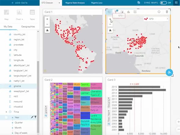
Video demonstration: Using Insights for ArcGIS to analyze global terrorist activity
Ten questions and answers: Insights for ArcGIS
—–
This post is excerpted from The ArcGIS Book, Second Edition: 10 Big Ideas about Applying The Science of Where, by Christian Harder and Clint Brown. The twin goals of this book are to open your eyes to what is now possible with Web GIS, and then spur you into action by putting the technology and deep data resources in your hands. The book is available through Amazon.com and other booksellers, and is also available at TheArcGISBook.com for free.


Commenting is not enabled for this article.