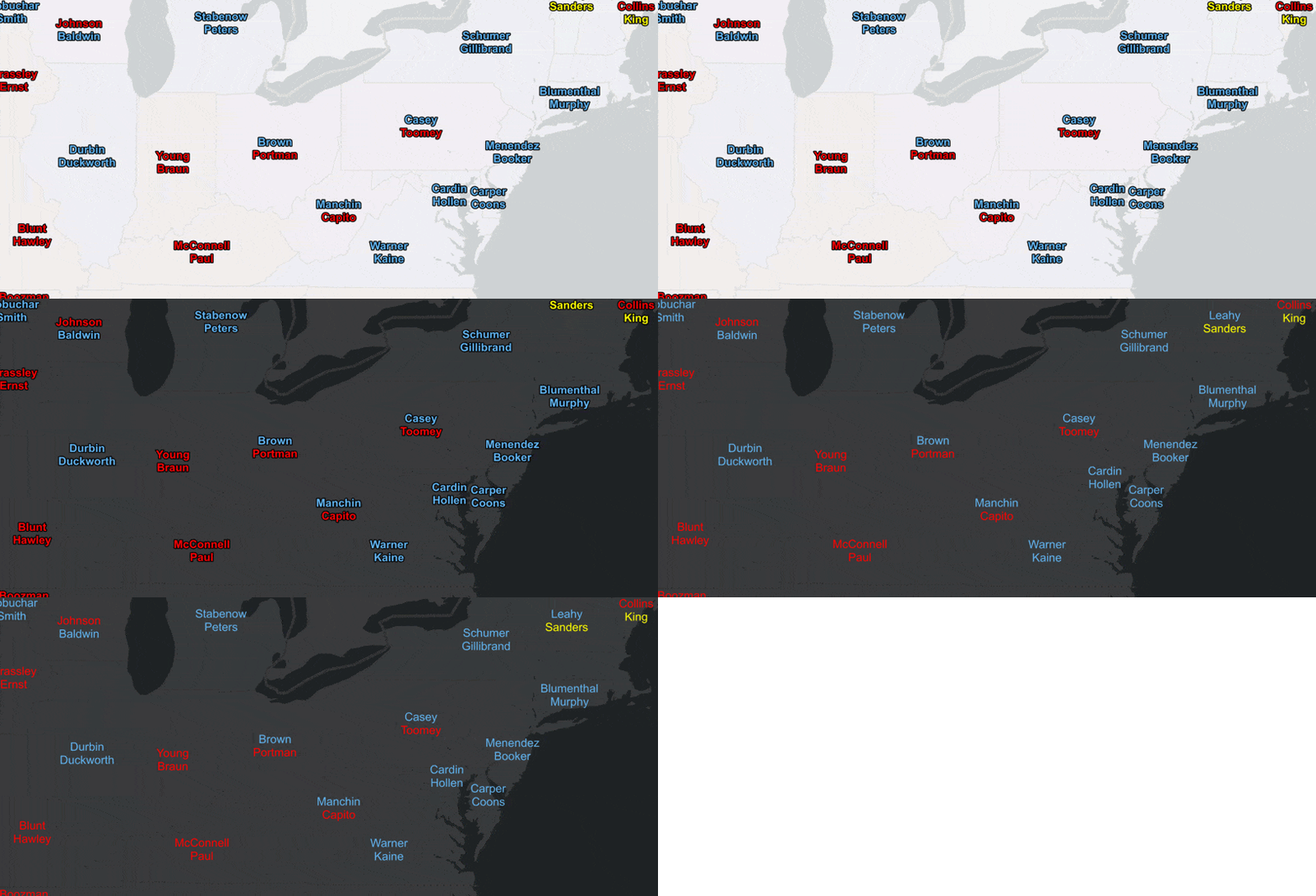
It’s been a busy 4 months since we released Runtime 100.10 and today, hot on the heels of the virtual Developer Summit, we’re pleased to announce 100.11 of ArcGIS Runtime. Update 11 delivers a new labeling API, more offline capabilities for utility networks, improves support for true curves, and much more. Let’s take a look…
Labeling API
Runtime has supported labeling in maps since 100.2 and in scenes since 100.9 but you either had to author the labeling using a tool such as ArcGIS Pro, the Map Viewer, or Scene Viewer, or by constructing JSON. If you wanted to modify label definitions in code, you would have to manipulate JSON. This made modifying labels on the fly somewhat challenging, error prone, and frustrating.
Update 11 introduces a powerful and comprehensive labeling API allowing you full control over:
- Appearance (font, size, color, halo, etc.)
- Content, from static attributes to Arcade expressions
- Which features get labeled, and at what scales
- Label positioning
- Handling label conflicts

To be clear, these are all things you could control previously, but you had to understand the web map labelingInfo specification, and you had to manipulate JSON. Now you can just use a few lines of code.
This is a feature many of you have been asking for, and that we’ve wanted to add for some time. The labeling capabilities of ArcGIS Runtime are powerful, and the new API opens up a whole new world of great application experiences that you can build for your users. For example, it is now much easier to switch label colors when changing the map’s basemap for light or dark modes.

For more info, see the documentation for .NET, Android, iOS, Java or Qt.
True curve support
Mobile map packages authored in ArcGIS Pro can contain feature layers with parametric (true) curves for use in ArcGIS Runtime apps. With Update 11 you can now identify, query, and select these features that contain geometry with true curves. In addition, thanks to work on Runtime’s geometry engine, you can perform a number of relational, topological, and measurement operations on true curves.
This is just the first phase of our support for true curves. In future releases we plan to enable the ability to use features with curve geometry from a feature service, enhance our geometry API to create and edit true curves, and add support for more geometry engine operations.
See the .NET, Android, iOS, Java, and Qt release notes for specific details on true curve support in the geometry engine with Update 11.
Utility network
Runtime has been enhanced to support named trace configurations. Traces can be configured with ArcGIS Enterprise 10.9, and published to a web map, rather than being hard-coded in your application. This allows an application to be configured to work with multiple customer data models, or to adapt to a customer data model that changes over time.
Using ArcGIS Enterprise 10.9, you can take certain utility network information offline, including network associations, which allows field users to gain a better understanding of their network configuration. For example, users can now see how equipment is attached to power poles, contained within a regulator station, and connected inside a switch cabinet.
Other improvements
Of course we’ve been working hard on various other parts of the Runtime too. Here are some highlights of other improvements we’ve included in 100.11:
- Support for dynamically scaling symbols when using a dictionary renderer.
- Honoring web map specification improvements around initial viewpoints and bookmarks, including rotation.
- ArcGIS layers in a web map or web scene can include custom URL parameters. This is often useful when referencing layers from ArcGIS services through an API gateway.
- Performance improvements have been made to image tile layers, improving network performance, draw times, and caching of downloaded tiles.
- MrSID raster layer rendering has been significantly improved.
- Scene rendering has been improved when panning and zooming around scenes with elevation-relative data.
- You can set an API key on the Basemap class. This is helpful for switching out basemaps.
- Updates to supported Arcade versions in popups and renderers.
For more details see the release notes for Android, iOS, Qt, .NET, and Java.
Locator deprecation
New locators were introduced with ArcGIS Pro 2.3 via the Create Locator tool and supported as of ArcGIS Runtime 100.5. These locators consist of a *.loc and *.loz file which are smaller, faster, easier to maintain, and offer consistency across the ArcGIS system. As previously mentioned, Runtime 100.11 is the last release to support classic geocode locators (which do not include a *.loz file). Note, this only pertains to use of local locators – there is no change to Runtime support for ArcGIS geocode services.
Download and get started
To get 100.11, go to the ArcGIS for Developers web site, browse the ArcGIS Runtime SDK page of your choice and download the SDK. You can also reference through NuGet, Gradle, Swift Package Manager, or CocoaPods. If you’re new to developing with ArcGIS Runtime and don’t have an ArcGIS Developer subscription, simply sign up for a free account and you’ll be able to access everything you need to develop your app.


Article Discussion: