In this compelling demonstration Yigal Muntner from Systematics, Israel walks us through the seamless process of using deep learning in ArcGIS Pro 2.7. By employing the ready-to-use model to extract doors and windows, we see in this demo how Yigal and his team could detect objects in the view and create point features from them. These points were then used to analyze the line of sight.
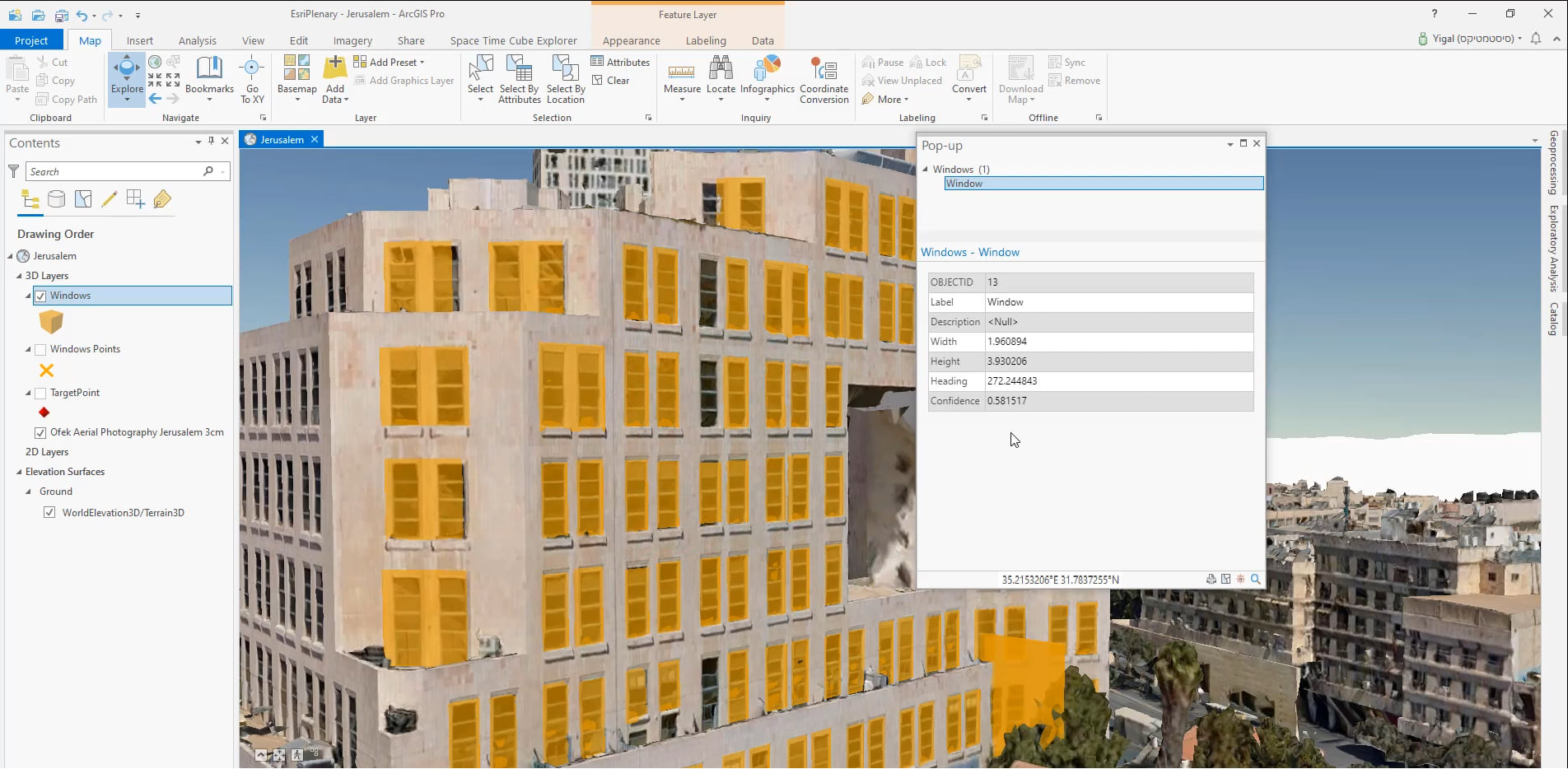
They worked with the integrated mesh scene layer from Ofek Aerial Photography and highlight a construction site in the center of Jerusalem, Israel. Using the Object Detection tool (found under the Analysis Tab -> Exploratory 3D Analysis gallery in ArcGIS Pro), Yigal loads the pre-downloaded ‘Esri Windows and Doors’ model and selects the output (Windows) and sets the symbology for the output feature layer (Vertical Bounding Box). You can also customize other parameters such as the confidence level and overlap threshold. Click here to learn more about using the Object Detection Tool in ArcGIS Pro.

As we see in the image above, the tool has successfully identified the windows from this construction building, and has included information such as width, height and heading of the window in the result layer, which helps us verify the correct dimensions of these windows.
But sometimes, objects such as trees can get in the way and obstruct our view. We see in this demo how we can get around this, by using the Create Profile tool (found under the View tab in ArcGIS Pro). Yigal shows us how he created a digitized clipped section of a particular inn using the Create Profile tool. Since the Object Detection Tool works with input data that is currently in the view, this result from using the Create Profile tool can be used to focus on just the inn and help identify its windows with ease.
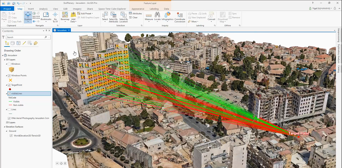
Another example that we saw in the demonstration was for analyzing the line of sight from multiple windows for a specific target point and to observe how it is being affected by the new construction site. The Construct Sight Lines tool (3D Analyst geoprocessing tool) was used here to create the 3D lines that connect each window to the target point. Following this, the Line of Sight tool (3D Analyst geoprocessing tool) was used which analyzes the visibility using these lines. ArcGIS Pro 2.7 and above allows you to bring an integrated mesh as an input to this tool. As is clear in the image below, the results from these tools helped Yigal and his team examine the impact of the new building on surrounding visibility.

We saw in this demo how the ‘Esri Windows and Doors’ model can be used within the Object Detection Tool. Here is a simple guide that walks us through the process of retraining this model on new data. You can also use your own model within this tool, and future releases will support additional models as well.
Additional Resources:

Article Discussion: