An all new version of the Crime Analysis solution is available now with ArcGIS Pro 2.7. When you update Crime Analysis and ArcGIS Pro, you will find an updated user experience, new capabilities, and updates to many existing tools. A complete review of all updates can be found in the help documentation. Highlights of the new version of Crime Analysis include the following:
Updated user experience
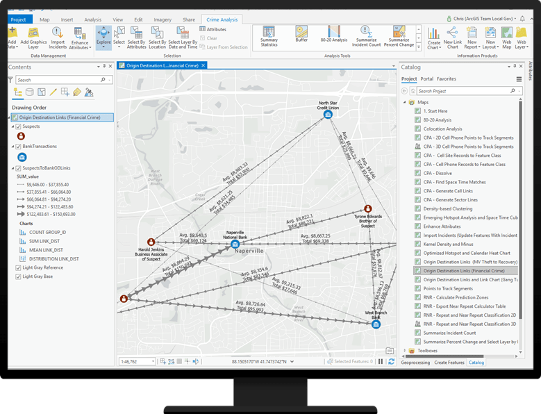
The Crime Analysis ribbon now uses an analysis tool gallery to organize all analytical geoprocessing tools in the solution. In the gallery, the tools retain their grouping categories from the previous version of the solution, such as tactical and strategic analysis, investigative analysis, and cell phone analysis. The new design allows more analytical tools to be displayed on the Crime Analysis solution ribbon.
New capabilities
Several new capabilities have been added to the Crime Analysis solution in this release:
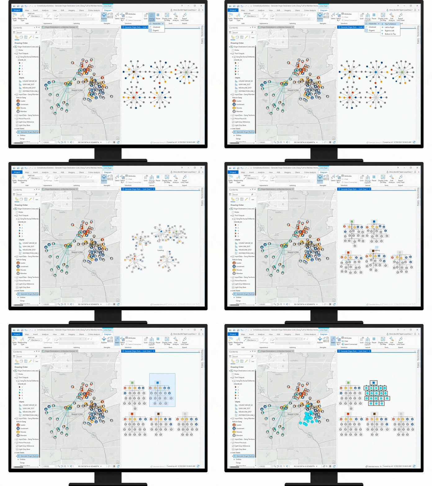
- Perform link analysis: Visualize the relationships of people, events, and places during an investigation, and conduct analysis to find patterns using the link analysis methods, including path analysis, centrality analysis, clustering analysis, and neighborhood analysis. Link analysis supports your layers and nonspatial tables and allows you to define relationships to connect the layers and tables. Link analysis leverages link charts that can be visualized clustered, hierarchically, or organically, and you can make selections in the link chart and see the same selection on your map. Link charts can be exported to be included in printed or static reports or briefings.
- Add graphics to your maps: The ability to create graphics on top of a map has been one of the most frequently requested features by users of the Crime Analysis solution. Graphics layers allow users to insert text boxes, arrow lines, images, or other graphical elements onto a map without having to manage feature layers. This enables crime analysts to create simple maps for presentation purposes and to annotate their maps with descriptive text and visual cues.
- Explore colocation relationships: The Colocation Analysis tool is used in crime analysis to examine significant associations between the locations of features such as crashes with crime, or to understand where data may be statistically isolated from one another, such as Terry stops to crime or shots fired calls for service to activations from an acoustic gunshot detection system.
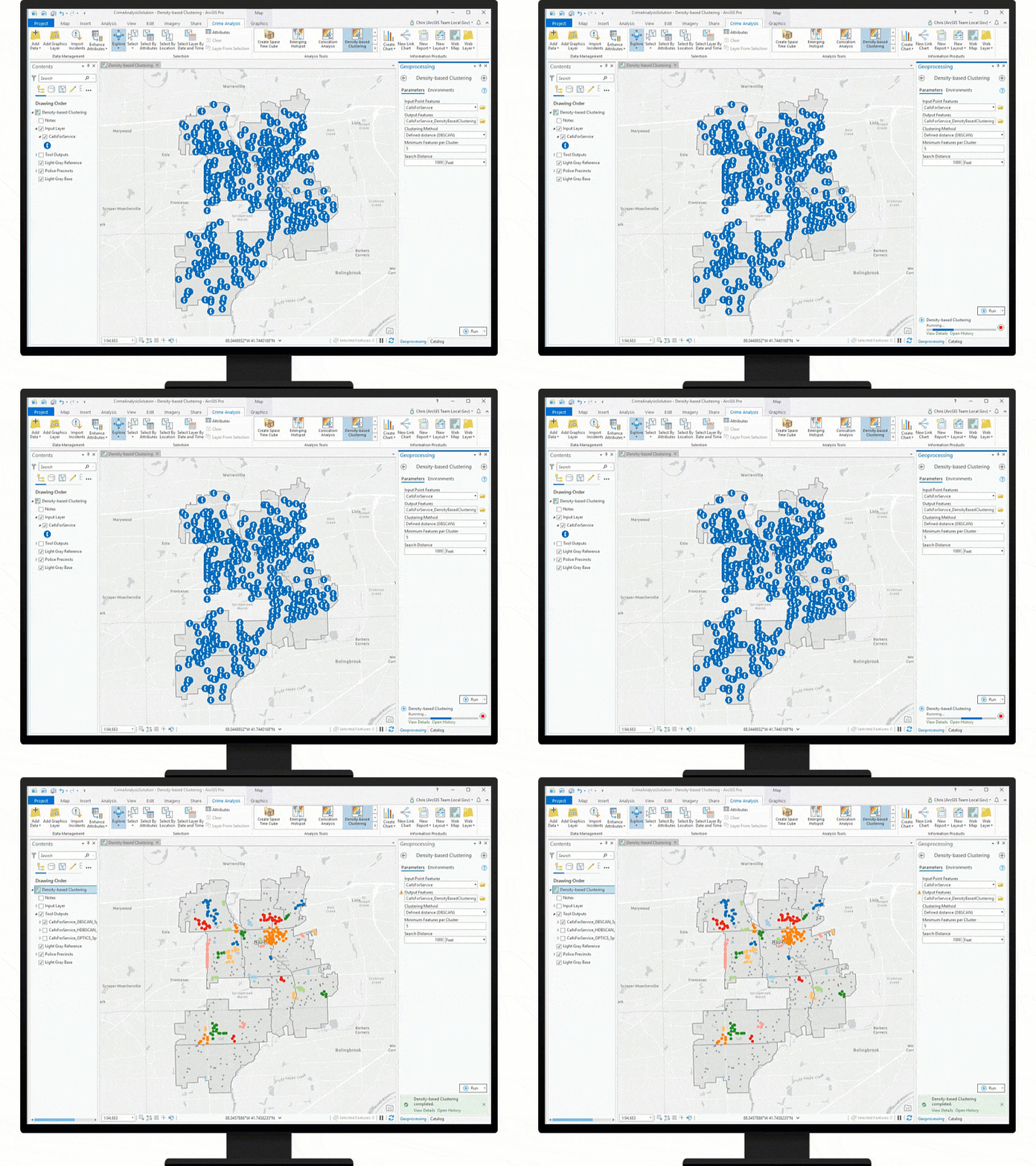
- Identify incident clusters with machine learning: Density-based Clustering uses machine learning to find clusters of incidents and can be used as an alternative or complementary method to traditional hot spot identification methods such as kernel density.
- Build reports: Crime Analysis now supports tabular reports from your project layers and tables. ArcGIS Pro reports can include any chart created in an ArcGIS Pro project. This is ideal for creating record-level reports on law enforcement-related data. Reports can be exported to PDF, which can also be automated using the scheduling tool.
- Access Crime Analysis tools from a toolbox: Many of the custom geoprocessing tools originally deployed with Crime Analysis are now installed natively with ArcGIS Pro. The tools are in the Crime Analysis and Safety toolbox and available to all ArcGIS Pro users. In this release, tool names and parameters have been updated to improve performance and usability. Finally, the enhancements mean that Crime Analysis now only requires ArcGIS Desktop Basic and the ArcGIS Spatial Analyst extension.
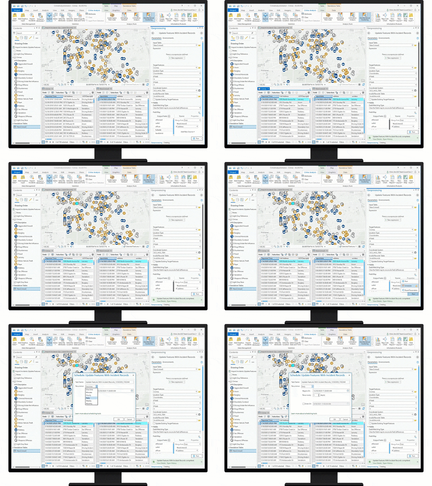
- Automate your work: Did you know that ArcGIS Pro now has built-in tools to automatically run any geoprocessing tool on a regular schedule? Crime analysts can use ArcGIS Pro scheduling tools to save time by automating their data import and cleaning processes, generate kernel density or other analytical products, and export reports and hard-copy maps. Additionally, Crime Analysis now includes Update Features With Incident Records, a tool that can be used to import data from a spreadsheet, CSV file, or database (or Microsoft Access) table, map records using addresses or x,y coordinates, and update an existing local or web layer. This tool can be used with ArcGIS Pro scheduling tools to perform daily imports of data to your desktop or Web GIS from your records management system or computer-aided dispatch system.
Learn Crime Analysis
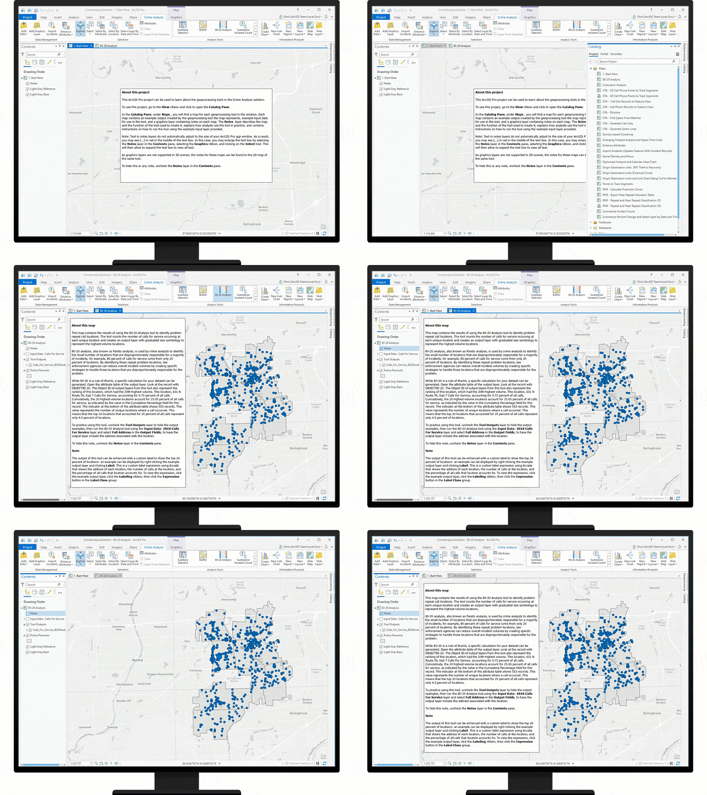
To help you learn how to use Crime Analysis, we have enhanced the ArcGIS Pro project included in the solution. The project includes example maps for each tool in the solution; input data to help you try running the tool; and notes explaining what the tool does, how it is used in crime analysis, and how to run the tool with the sample data. The ArcGIS Pro project is intended to help you jump-start your self-directed learning process, so you can be productive with Crime Analysis immediately. For further training, we have a learning path containing a series of lessons to help grow your skills with the Crime Analysis solution.
Additional resources
Learn more about Crime Analysis and other public safety solutions on the ArcGIS Solutions site. For questions and feedback, chat with us on GeoNet or contact Esri Support Services.


Article Discussion: