Looking back, 2020 was a very strong year of advancements in ArcGIS Pro and in Pro extensibility.
We again saw plenty of growth as more organizations moved to ArcGIS Pro and developed custom add-ins with the ArcGIS Pro SDK for .NET. These add-ins help to extend Pro to meet users’ specific organizational needs, tailor the Pro UI to streamline workflows, and build custom routines and solutions.
Also in 2020, we again saw several Partner organizations releasing exciting Pro add-ins as new solutions and products. This is great news as these new Pro add-ins continue to help make migrations to Pro possible for many organizations, and they allow users to leverage even more of Pro’s extensive functionality.
Pro SDK Advances in 2020
Throughout the year, ArcGIS Pro development teams released new Pro SDK functionality, and again grew the Pro APIs and SDK in general.
Looking back, we recently saw the Pro 2.7 release in December, and we also had the 2.5 and 2.6 releases earlier in the year, all with significant enhancements.
Each release of Pro has brought expanded capabilities to the Pro SDK and the many Pro APIs. The new capabilities have been used by organizations to build, expand and tailor workflows with the new features.
Let’s take a look at some of the significant updates included in the Pro SDK 2.5 – 2.7 releases last year.
Pro 2.5 SDK Updates
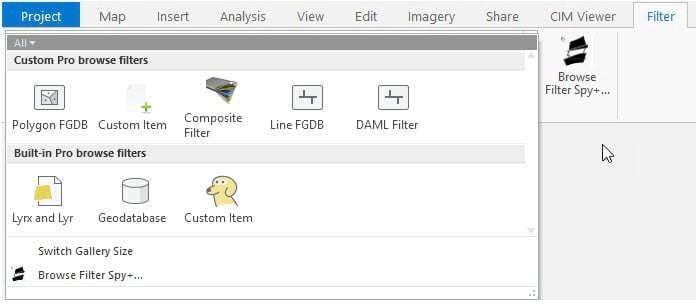
Content API – Developers can create and configure browse dialog filters to better control what users can browse to within Pro. This can help to focus and tailor the Pro UI for users, to save time and ensure the accuracy of your workflows. The new capabilities are discussed in the Browse Dialog Filters section of the Content ProConcepts document. Also, there’s a new ProGuide Custom Browse Dialog Filters document which walks you through how to get started. There’s also a new community sample you can try and use with your own add-ins. Also, the new browse filter builds on earlier custom items capabilities, find out more about those in the concepts and guide documents.
The Browse Filters community sample:
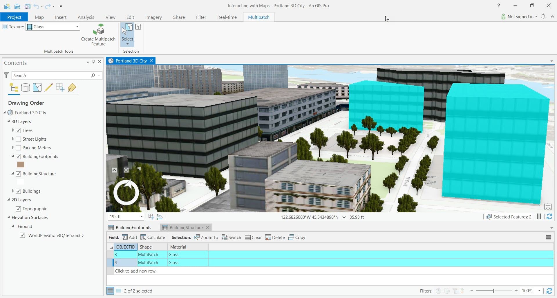
Geometry API – Support for writing multipatch features, with the ability to update geometry, and apply materials and textures. Developers are able to create tools for building 3D content that are focused around specific organizational needs. There are a series of new code snippets available, as well as a new community sample which allows you to explore the capabilities.
An example of extending Pro with a custom multipatch editing workflow:
Pro 2.6 SDK Updates
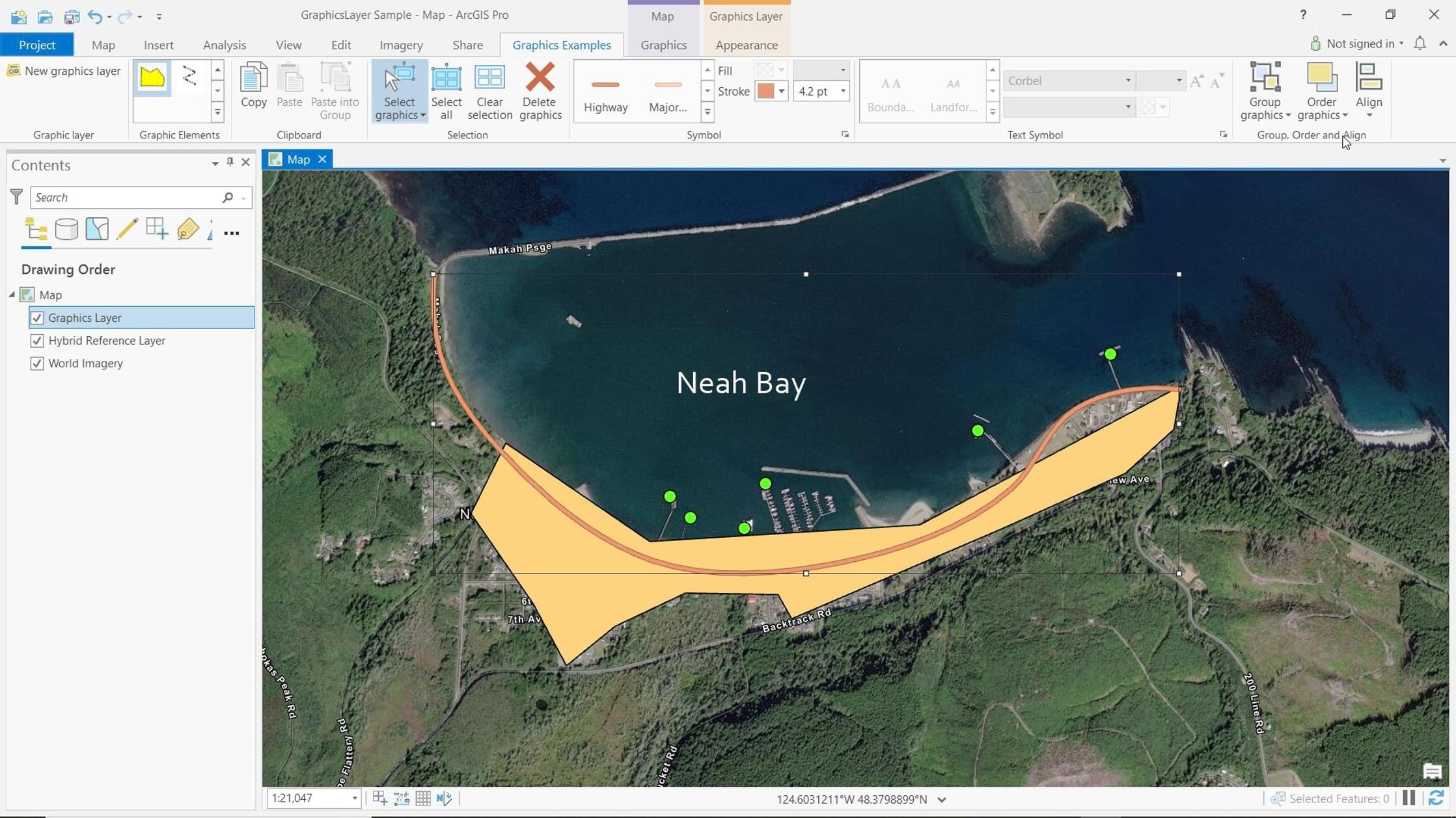
Map Authoring – Graphics Layers API – Pro’s Graphics Layers capability provides users the ability to make graphic and text notations on a map or layout that highlight particular areas or label places, without creating features. Developers can create and manage graphics layers in ArcGIS Pro. The SDK provides access to insert, update and delete graphic elements including text elements, as well as update their geometry and symbology. Developers can also manage element selection, grouping, alignment, distribution and ordering. You can learn more in the new ProConcepts Graphics Layers document, and get code snippets for many of the standard approaches for working with the graphics layer in the ProSnippets Graphics Layers doc. There’s also a new community sample available for you to quickly get started.
The Graphics Layers sample with custom tools available on a new tab:
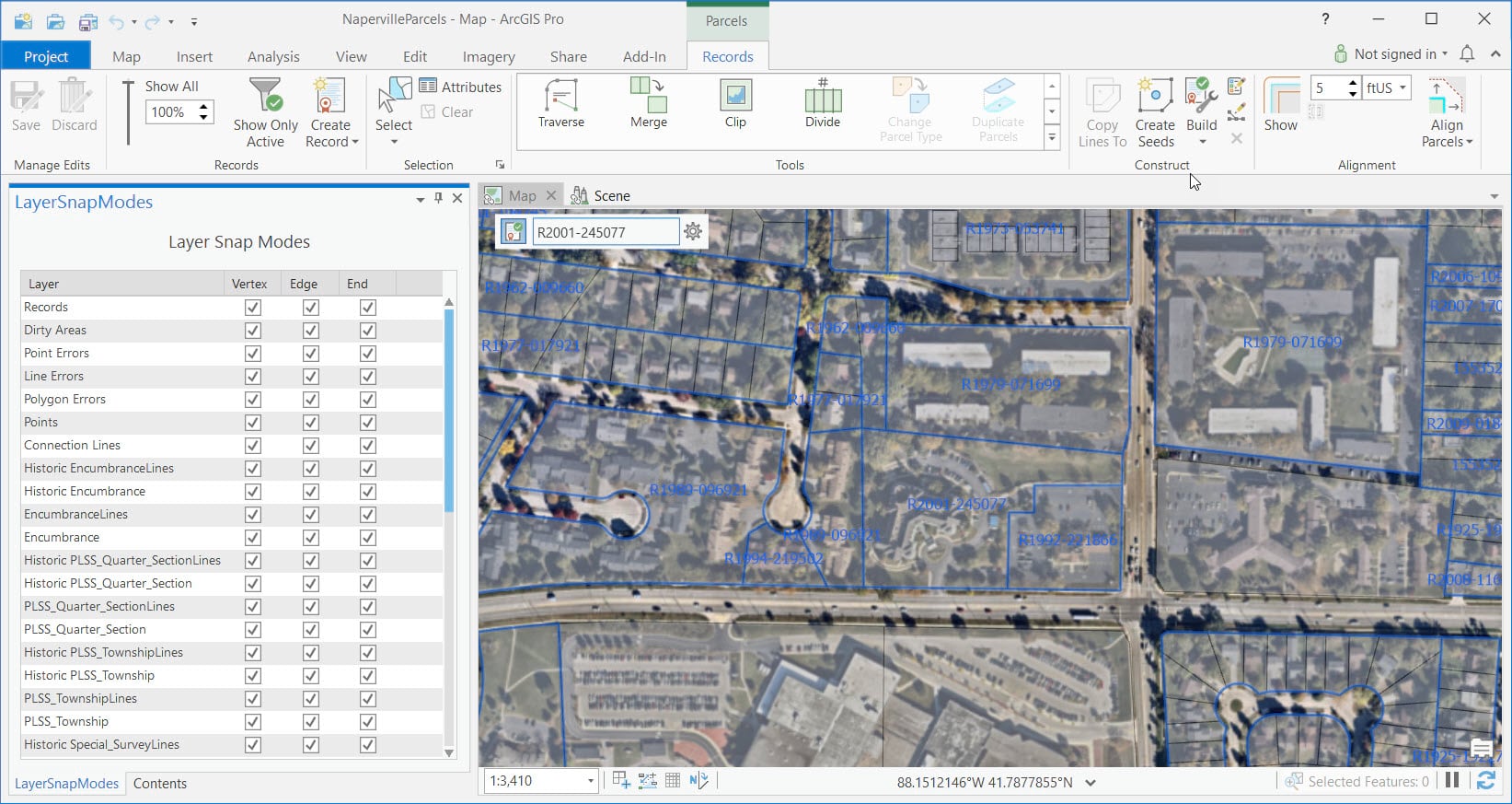
Editing API – With Layer Snap Modes, developers can provide improved snapping control by setting the target layer of interest, building additional accuracy and efficiency into custom editing workflows. To help you get started, Layer Snap Modes are discussed in a new section in the ProConcepts Editing document, as well as a new community sample to try it out.
A custom snapping pane in the new Layer Snap Modes sample:
Pro 2.7 SDK Updates
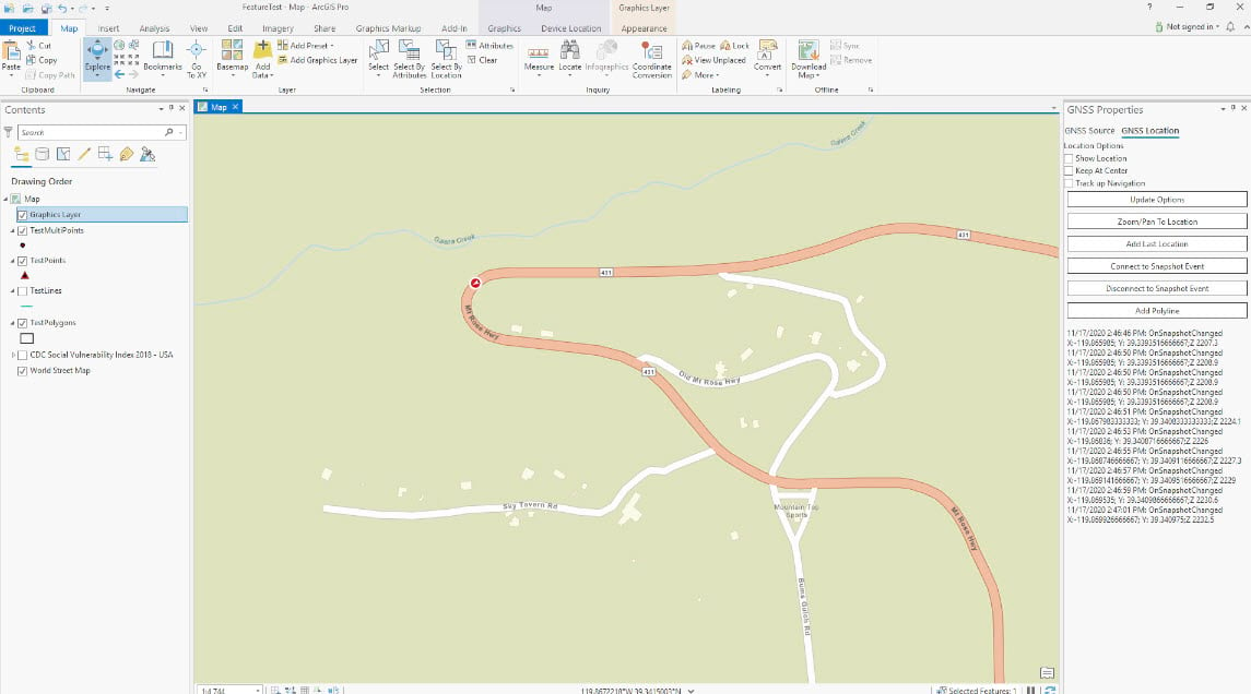
Device Location API – Pro’s new Device Location API provides the ability to connect to GNSS (Global Navigation Satellite System) devices, such as GPS receivers, and manage those device connections within your Pro add-ins. You can also control visualization of device positions, as well as collect data and create new features. You can learn more in the new section in the ProConcepts Map Authoring document, along with code snippets for many of the standard approaches for working with GNSS device data. There’s also a new community sample available for you to try and incorporate into your work.
The Device Tracker community sample with a custom dockpane for working with GNSS device connections and data:
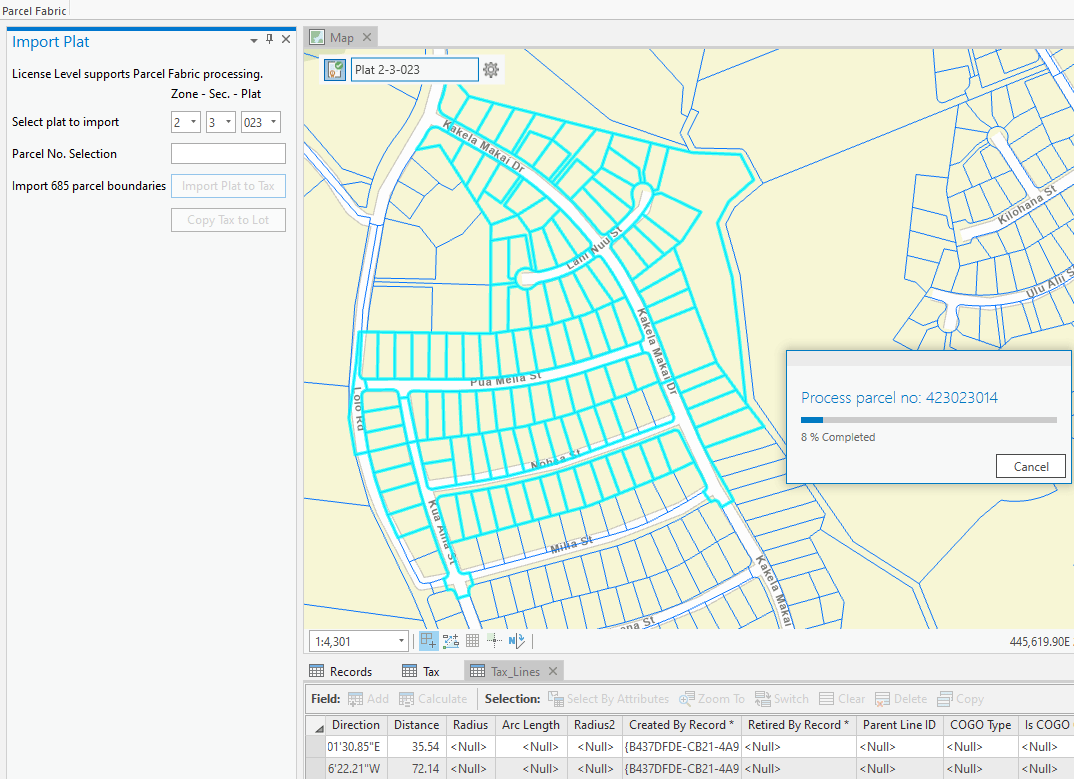
Parcel Fabric API – After being in pre-release for the past year, the Parcel Fabric API was fully released and supported at 2.7. The API allows users to create parcel editing tools, develop record- and quality-driven workflows, and also manage parcel seeds, parcel types and parcel fabric records. You can learn more about the capabilities in the ProConcepts Parcel Fabric document, and find code snippets for many standard coding tasks. There’s also a new community sample available for you to see how the API works.
The new Parcel Fabric API community sample showing a custom dockpane for importing of plat data:
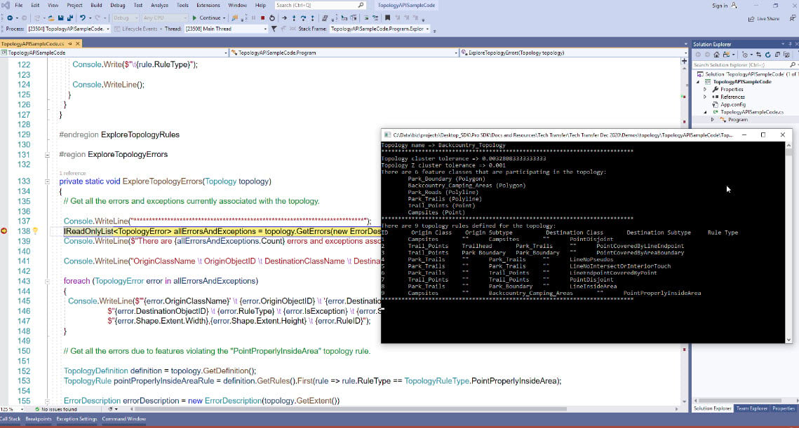
Topology API – The new Topology API available with 2.7 allows developers to explore and manage topology rules, errors, validation and the topology graph for geodatabase and service topologies. You can learn more in the code snippets and try the new community sample and include the code in your own project.
The new CoreHost Topology API sample showing exploration of a geodatabase topology through a console application:
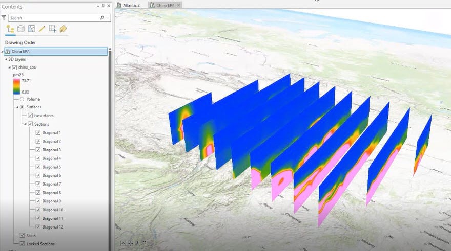
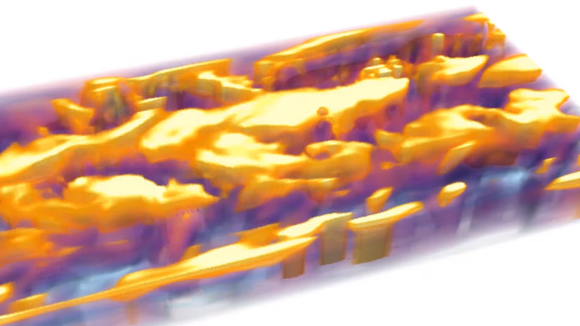
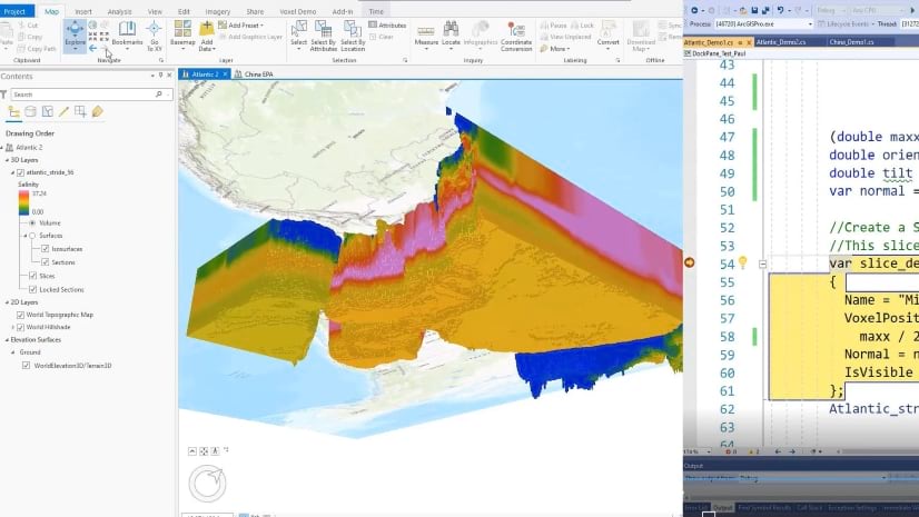
Voxel Layers API – With the new Voxel Layers API available with 2.7, developers can create and manage voxel layer slices, sections and isosurfaces, control voxel layer lighting and rendering. You can learn more in the ProConcepts Voxel Layers document, and also find an extensive collection of code snippets for many tasks. There are also new community samples available for you to see how the API works.
An example of creating a series of vertical sections with the voxel layers API:
Developers also took advantage of the many SDK online resources, such as the Concept and Guide documentation, building on the free sample code available in the extensive community samples with ready-to-run solutions such as those seen in some of the images above, as well as getting started with the ArcGIS Tutorials.
Also, many developers were able to attend Dev Summit and UC and take advantage of the many Pro SDK sessions and get updates directly from the SDK team and many other ArcGIS Pro teams. We also saw extensive, growing participation in the GeoNet Pro SDK Group, as more developers are finding their way to the group to collaborate, find resources and ask technical questions.
New Partner Add-Ins
In 2020, Esri Business Partners continued to make great progress with ArcGIS Pro and released many exciting new Pro add-in products and solutions. Some of these were updated versions of established ArcMap-based products, and some were brand new products leveraging new capabilities found only in Pro.
All of the Partners have new product pages for their add-ins, along with several listings available on the ArcGIS Marketplace, where some of the add-ins can be directly downloaded. Here are just some of the new partner add-ins from the past year, with links to more information:
- Blue Sky Evolution – Lightning Pro alignment sheet generation tool
- Cartegraph – Cartegraph Add-In for ArcGIS Pro data sync tool
- Datamine – Discover for ArcGIS Pro natural resources exploration tool
- Digital Data Services – GeoProspector for ArcGIS Pro search tool
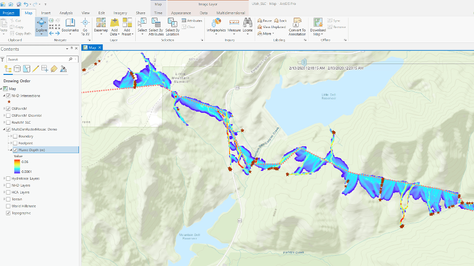
- G2 Integrated Solutions – Liquids HCA Tool Add-in
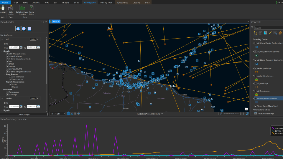
- HawkEye 360 – HawkEye RF Data Explorer Add-In for ArcGIS Pro
- New Century Software – SheetCutter Pro alignment sheet generation tool
- TerraGo – GeoPDF Publisher for ArcGIS Pro
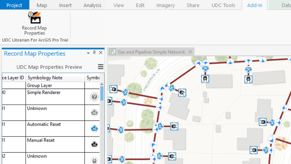
- UDC – UDC Librarian for ArcGIS Pro
The ArcGIS Marketplace
The following are a few of the add-ins above which have listings available on the ArcGIS Marketplace.
The HawkEye RF Data Explorer Add-In for ArcGIS Pro, from HawkEye 360, simplifies the experience of using HawkEye 360’s RF data and analytics:
The Liquids HCA Tool Add-in, from G2 Integrated Solutions, performs hydrocarbon plume transport simulations:
The UDC Librarian for ArcGIS Pro, from UDC, enables users to easily document and share map layers, details and symbology with export and import functionality:
Looking Ahead into 2021
The ArcGIS Pro teams are planning several new API enhancements this year, and as always, the teams are focused on both new features and ensuring developers can effectively migrate ArcMap customizations to Pro add-ins.
New Capabilities
The following are some the new SDK capabilities planned for this year:
- Content API – Additional support for favorites and offline maps
- Geodatabase API – DDL (Data Definition Language) geodatabase schema creation support
- Layouts API – TOC improvements for grouping elements and multipoint support
- Map Authoring API – Support for layer file portal items
- Map Exploration API – Reports API enhancements to streamline defining of reports
Also, additional enhancements are planned for Geometry, Geoprocessing and Raster APIs. In addition, there will be updates to the SDK Resources, including enhancements to concept docs and guides, and code snippets and community samples.
Learning Opportunities
Every year provides many opportunities to learn the Pro SDK and start building Pro add-ins. Let’s take a look at some of the upcoming SDK learning opportunities.

The Esri instructor-led training course, Extending ArcGIS Pro with Add-Ins, is available online.
If you’re looking for a thorough introduction to help jump-start your development work with the Pro SDK, the course provides a great opportunity for you. It assumes you are well-versed with .NET development and either the C# or VB.NET language. There are several online offerings that have been scheduled to help you get started this year:
- January 20-22 – Pacific Time
- February 17-19 – Mountain Time
- March 15-17 – Central Time
- April 5-7 – Pacific Time
- April 12-14 – Central Time
- April 26-28 – Mountain Time
- June 9-11 – Mountain Time

The Esri Developer Summit is one of the best Pro SDK learning opportunities of the year, and will be held online this year. You’ll be able to attend and learn from the many ArcGIS Pro and Pro SDK sessions and get updates directly from Pro Team staff who develop the SDK and the Pro APIs.
For Dev Summit 2021, there will be 15+ Pro SDK sessions throughout the week, so check back at the agenda site for the detailed agenda which will be posted soon, and then search on “Pro SDK” for the list of offerings.
Your Feedback and the SDK Community
Finally, and as always, we encourage you to send us your feedback on the Pro SDK. The team is always keen to learn what enhancements your organization requires to develop better add-ins. Let us know, find out more and collaborate with others in the GeoNet Pro SDK Group. The group is very active and allows developers an opportunity to ask technical questions, search on existing threads, and answer questions.
We wish you a safe and happy new year, and we look forward to working with you and supporting your work extending ArcGIS Pro.


Article Discussion: