displaying 310 results
Make your maps do so much more with ArcGIS Arcade, a cross-platform expression language.

Kim Morrison is helping the world’s largest gold miner improve operational performance and visibility with GIS dashboards, drones, and more.
ArcGIS Experience Builder and ArcGIS Instant Apps have several new features to help users build robust web apps with minimal effort.

Recent releases of some of Esri’s most popular app builders help users deliver compelling digital experiences along with their maps.

With GIS, international organizations can monitor and profile vulnerable populations to get them the help they need.

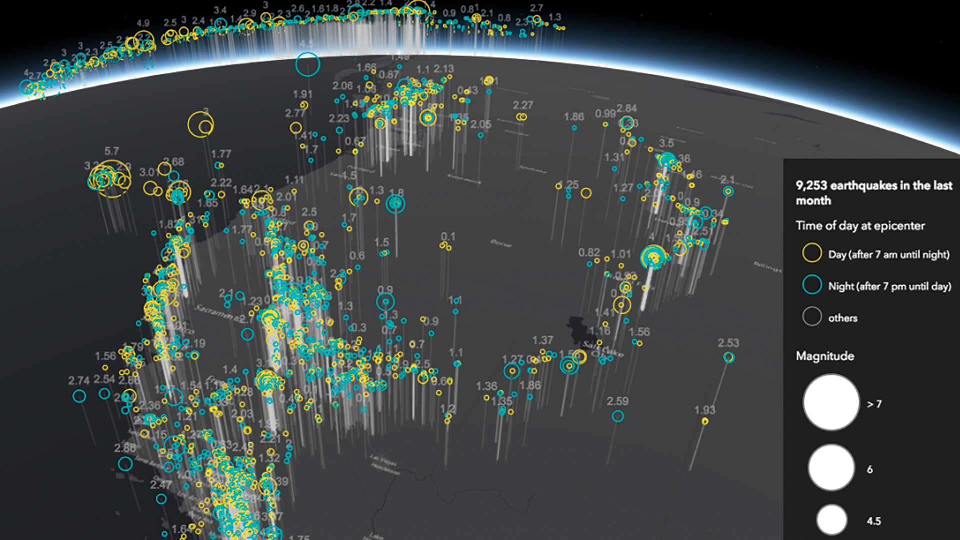
Learn how ArcGIS Maps SDK for JavaScript can be used to visualize a dataset representing atmospheric temperature and pressure measurements.

A data solutions director uses GIS to help world-renowned companies see nuances among customers and locations.

Publisher of Black Voice News finds ways to use GIS mapping to advocate for the voiceless while promoting corporate social responsibility.

Erik Henderson is one of many GIS pros whose use of location intelligence technology saves his company time and money and boosts worker safety.

Bill Miller, a pioneer in the concept of geodesign, feels strongly about the broad context of its application.

VHB tech enablement SVP Steve Anderson elegantly merges technology and talent to innovate new solutions, like a solar site selection app.

Amidst a construction boom, AEC firm HDR is harnessing location technology to drive collaboration and deliver timely solutions for clients.