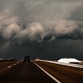
As a meteorology major at the University of Oklahoma, Lela Davis’s passion to understand weather drove her, at times quite literally, into the paths of storms. At the wheel of a three-door Saturn crammed with weather measurement instruments and fellow students, she chased tornadoes amidst powerful winds and pounding rain.
Today, as chief meteorologist and geographic information system (GIS) project manager at SERVPRO, Davis doesn’t chase storms—she anticipates them, using data science to help the company and its customers respond to disruptions.
SERVPRO is one of the nation’s leading providers of cleanup and restoration services, including large-scale disaster recovery. Across 50 states and in Canada, its 2,000-plus franchisees help residents and companies recover from burst pipes, flooding, fire damage, and other disasters that often result from extreme weather. When a storm is developing, Davis uses GIS to provide SERVPRO franchises with real-time, location-based insight—known as location intelligence—on where storms are likely to hit and what kind of damage they could inflict.
In an industry where cleanup and restoration professionals often race against the clock to redress water or mold to mitigate damage, predictive analysis can sometimes help save a home or business.
“We’re trying to get out there and help all those people that probably had the worst day in their life,” Davis says. “If we can just do one thing to help them out with that, that’s what we want to do.”
A Storm Plan—and Business Strategy—Shaped by Data
The smart maps Davis creates—layered with data on storm movements, SERVPRO’s franchise territories, topography, population, drive times, and other key metrics—inform decision-making across the company, from executives to fast-response field teams.
Franchisees use the location intelligence Davis shares to decide which equipment they’ll need, where to stage operations, and whether to join regional response teams after far-reaching incidents.
Over the past several years, her weather forecasts have demonstrated the business value of a geographic approach, and new applications of GIS have begun to spread across other business units at SERVPRO.
An interactive dashboard she created gave the SERVPRO HQ Franchise Expansion team a first-ever comprehensive view of every franchise and its surrounding market opportunity.
By analyzing that map, sales managers identified submarkets where the company wasn’t active, and signed up an additional 30 to 40 franchises to drive company growth and serve new customers, according to Laura Williams, SERVPRO’s assistant vice president and director of franchise expansion, and a mentor to Davis.
With location insight, “we went from two-dimensional to four-dimensional overnight,” says Chad Lewis, SERVPRO’s assistant vice president of marketing and Davis’s former manager. “We got this view of the map which allowed us to really rethink the [franchise] territories and how we can better serve people by having better resources and more resources in certain areas that required it.”
Location intelligence also helps the marketing department customize messages to specific customer groups and regions across the country. With that precision, executives raise awareness of the SERVPRO brand and share tips on how to stay safe and prepare for storm damage.
SERVPRO’s Multidimensional View of Weather Impacts
Davis is part of a generation of savvy GIS professionals providing businesses with operational intelligence to maintain continuity amidst increasing climate volatility. Even businesses not typically associated with weather are employing in-house analysts who can interpret how climate disruption could affect company assets.
A leading telecommunications company is using location intelligence to predict climate outcomes decades in advance and situate data centers and cell phone towers away from areas of potential risk. Commercial ports are using supply chain simulators to avoid interruption to the global flow of goods caused by cyclones or extreme heat that warps train tracks.
SERVPRO is unique because it’s one of the few organizations whose employees run toward the danger. That makes it even more imperative to have the latest and most precise data to guide their efforts.
As a visual learner and communicator, Davis thinks often of how she presents that data. “In weather, you have to think in pictures,” she says. “Everything is in 3D. GIS is portraying images of all that data that’s in your mind, and then putting it in a format where other people can understand it, where it may be harder to describe with words.”

As a child, Lela Davis dreamt of tornadoes—a common occurrence, she later learned, among kids who grow up to become meteorologists. She used to stand on the front porch of her home in Coopertown, Tennessee, with her father, watching in thrall as black storm clouds rolled in across the sky.
From Chasing Storms to Chasing Data
When Davis first came to SERVPRO, her work had nothing to do with weather or GIS—she started out in the call center, gaining a ground-floor view of the business.
Managers soon noticed her aptitude for data and the doggedness she brought to each task. “If you asked her to do something, you knew beyond a shadow of a doubt she was going to get it done,” Williams says. “And if she didn’t get it done, it couldn’t be done.”
Lewis recruited her for an assignment on the marketing team. Like a lot of companies, SERVPRO wanted to understand how much of its business was driven by search engine marketing, so it could determine the ROI of that spending. Davis ended up identifying a few million dollars’ worth of business that hadn’t previously been attributed to the program, as well as the keywords that were most effective. As a result, Lewis’s team was able to optimize their investment in online ads.
The search engine marketing was often tied to weather patterns and location, and Davis suggested to Lewis that she use her background in meteorology and location technology to help SERVPRO forecast storms.
Fueled by her passion for the subject, she taught herself how to adapt GIS analysis to the company’s needs, fashioning a system that would send out map-based alerts and story maps to SERVPRO executives and individual franchisees.
A New, Location-Based Picture for Decision-Making
The local news or a mobile app can provide a general overview of what conditions to expect, but Davis tailors her analysis of storm and weather impacts to SERVPRO’s business model. She shares insights about the location and magnitude of weather events, as well as specific impacts, like storm surge flooding that might afflict low-lying areas.
The software is key to turning information into insight.
“I think that’s the coolest part of GIS, that integration of data,” Davis says. “Maybe it’s data that wasn’t created in GIS, but if you can incorporate that with the spatial side of things, it brings everything together. It makes things pop out that you may not have been able to see before.”
The recipients of these weather-driven insights at SERVPRO include executives, large-loss specialists, business intelligence analysts, franchisees, and marketing leaders like Lewis. If Davis predicts a high-category storm for a high-population area, the company will pull commercials from major news channels to avoid the perception of advertising on top of a disaster. Once people are returning to their homes, SERVPRO might restart search engine marketing to connect them with services that can speed recovery.
Under normal conditions, a franchise can handle the cleanup and restoration demands in its assigned territory—but when a major storm like Hurricane Florence or Hurricane Sandy descends, individual offices can become overwhelmed. In those cases, franchise owners from unaffected areas may travel in to help address the needs of residents and businesses. As those trips cost time and redirect focus away from home territories, Davis’s forecasting assists owners in making those business decisions.
She also advises SERVPRO employees—who are often among the first workers on the scene—on measures to ensure their safety. For instance, in advance of Hurricane Sandy, she warned colleagues to expect more than a hurricane: a winter storm was following closely on its heels, dumping snow and making travel hazardous. Storm teams needed to plan routes ahead of time to account for that fact.
Seeing a Landscape of Business Growth
When SERVPRO was acquired by the private equity firm Blackstone in 2019, the executive team pushed for a more data-driven approach to drawing and licensing franchise territories. At Williams’s behest, Davis pitched GIS as the platform to do it—and won the enthusiasm of SERVPRO’s leadership.
“It was getting into the mapping of our territories that I think really opened the eyes of the executives [on] how we utilized GIS in our organization,” Davis says. Some territories had been established years earlier, meaning the company might have overlooked subsequent opportunities created by shifts in population or development.
By analyzing customer demographics, weather patterns, drive times, and urban and rural characteristics by location, smart maps helped show executives where to draw new lines to best serve their markets.
Exploring New Ways to Support the Business
In recognition of how Davis’s location insights have resonated across the company, SERVPRO recently moved her position to IT. In this new capacity, she’ll serve as a liaison between departments that can benefit from mapping and weather insights. She also got the greenlight to hire a GIS analyst, freeing her for more strategic thinking about future applications of location intelligence.
“I really don’t think we’ve yet to see the true value of what this can bring to the table,” Lewis says of Davis and her GIS work. “I think the coolest part about this and what Lela has brought with this is the potential of what it could bring in the future. It just kind of opens up our thinking to what new add-ons to our business could be.”
The Esri Brief
Trending insights from WhereNext and other leading publicationsTrending articles

December 5, 2024 |

July 25, 2023 |

April 1, 2025 |

November 12, 2018 |

April 16, 2024 |

February 1, 2022 |


