When a landside collapsed the road connecting southeastern Idaho and Jackson, Wyoming, it instantly isolated nearly 40 percent of the popular destination’s 25,000 workers. For hotels, health-care facilities, and rafting operations, this wasn’t just a traffic headache—it was an economic blow, noted the Wall Street Journal in its coverage of the incident.
As business execs weigh the many factors impacting their operations, they have new what-ifs to consider—wildfires, floods, or sinkholes that cut off key transportation corridors.
Predictive maps can help pinpoint risks and vulnerabilities, allowing business owners to plan alternatives that keep their workforce in service and operations humming.
Commute Analysis Illuminates Employees’ Paths to the Workplace
When evaluating new office or business locations, many companies analyze employee commutes, comparing travel times by car or public transit to find the most suitable location.
The predictive modeling technology used for that analysis, a geographic information system (GIS), can address a more complex modern dilemma: Which routes may be impacted by a natural disaster, and what might that mean for business operations?
Directly and indirectly, weather-related events cause significant damage to transportation networks each year. Heat, flooding, fires, and even the heavy traffic involved in disaster response weaken roads and other infrastructure. For example, the two weeks spent removing debris from the devastating 2018 Camp Fire in Paradise, California, equaled 20 years of traffic on those roads, according to a federal official quoted by Construction Dive.
When those natural perils cause lengthier commutes for workers, the outlook for business continuity grows more complicated. In the past, a long commute was a burden for the employee but not necessarily the employer. Now, infrastructure failures are making it the employer’s problem, too, as business grinds to a halt when multiple employees can’t get to work. Workers like those in Jackson are being priced out of residential areas near the places they work, exacerbating the problem.
Forward-thinking business analysts can add modern GIS techniques to commute analysis, using information about past hazards to anticipate what may happen. Ample resources already reveal such vulnerabilities. FEMA’s National Risk Index, for one, shows a county or census tract’s susceptibility to events such as an ice storm, landslide, wildfire, or flooding that could cut off employees from business locations. The Climate Mapping for Resilience & Adaptation tool shows which climate hazards may affect locations around the country throughout this century.
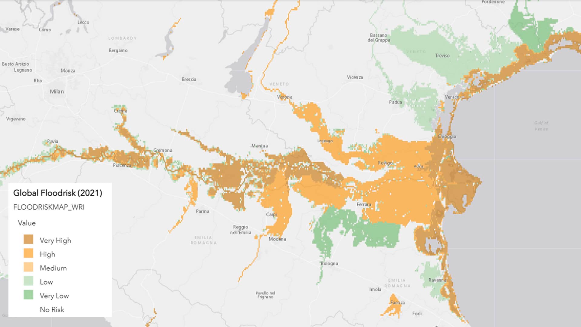
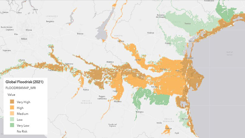
The situation in Jackson illustrates how quickly landslides or floods can wipe out a crucial route. GIS flood inundation models illustrate precisely where water levels are likely to reach during a storm or even sunny-day flooding. Some municipalities have taken this a step further, making 3D renderings of what streets will look like with sea-level rise or crafting new planning regulations and building codes to account for it.

As executives plan new business locations and reassess existing sites, employee access is becoming a more complicated equation—one that demands reliable location intelligence.
Linking a Workforce with Work via GIS
The landslide disrupting the commute to Jackson inspired innovative ideas, such as pairing employees with local homeowners offering rooms for rent near workplaces.
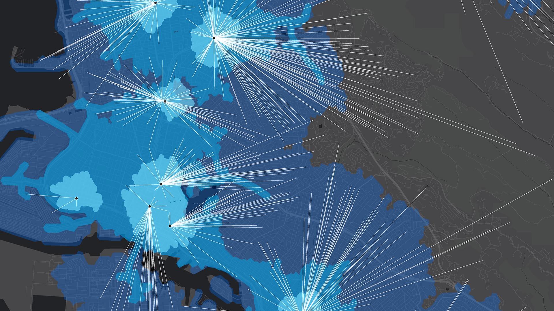
That kind of contingency could be mapped in advance as part of a business continuity plan. To do so, analysts might take a lesson from Miami-Dade County. Officials there assigned more than 6,000 essential workers to manage 80 evacuation shelters during hurricane season. They used the HR system and GIS to make the assignments and to create an app showing workers located near each shelter along with which languages they spoke and other skills.
As volatile weather puts transportation corridors in jeopardy, smart organizations will use GIS technology to gauge what might happen if things don’t go as planned. That includes a new form of commute analysis aimed at creating a safe path for employees to get to work.
The Esri Brief
Trending insights from WhereNext and other leading publicationsTrending articles

December 5, 2024 |

July 25, 2023 |

November 12, 2018 |

February 1, 2022 |
July 29, 2025 |

July 14, 2025 |