A few years ago when I began using a technology that CEOs, scientists, retail planners, and insurance adjusters rely on daily, I made a few mistakes. In overcoming them, I found new ways to help my colleagues and my company. I thought I would share what I’ve learned.
I’m a research director at Hearst Television, covering six stations in two markets: Pittsburgh, Pennsylvania and Portland, Maine. Throughout my career, I’ve collaborated with sales colleagues to help local business owners, corporate executives, and advertising agencies deliver messages to the public. While television advertising is a mass-reach medium, digital advertising through our websites and apps is far more targeted, and a few years ago I found myself searching for a new research tool to support this type of marketing.
That’s when I discovered GIS technology—a geographic information system. The location intelligence it produces helps us understand our viewers better and guide advertisers with a level of precision we couldn’t have imagined just a few years ago. But we didn’t get there overnight, and I made some mistakes along the way.
In fact, when I was first exposed to the technology, I was a little intimidated. One of the world’s largest retailers runs its emergency operations on a geographic information system. FedEx orchestrates its airplane maintenance, Nespresso monitors ESG compliance, and John Deere predicts high-performing locations for dealerships. I quickly saw why GIS analysts have been in high demand among Fortune 500 businesses.
But I wasn’t an analyst, and hadn’t studied geography, so I wasn’t sure if the technology was for me. It took some time before I realized that location intelligence can be as simple or as sophisticated as you need it to be. As soon as I figured that out, I began to appreciate its true value.
Lesson 1: Setting Aside Time for Discovery
Challenge: During my first two years working with GIS, I learned how to show advertisers a detailed view of WTAE’s audience. I knew the technology could address other business challenges, but I hadn’t yet taken the time to explore its capabilities.
Solution: If you wait for inspiration to strike, it may not. Schedule time to explore the technology, and hold yourself accountable for discovering new techniques.
How I Learned: In 2018, I was using a simple mapping tool to show WTAE advertisers our station’s geographic reach. My husband was working on his master’s degree in geography at the time, and suggested I try GIS technology instead. The location intelligence created by GIS seemed like a great way to guide WTAE’s advertisers, so I decided to try it.
Hearst covered the modest cost of a SaaS GIS product, and I attended a workshop at Carnegie Mellon University here in Pittsburgh. Flush with a day’s worth of GIS instruction and plenty of curiosity, I figured I would learn the rest on the fly. That was the beginning of my first mistake.
Once I started working with the software, I sensed it could help our business in many ways. But like most professionals, my days were already stretched thin, so I stuck to the basics.
That alone was a major advance. If a car dealer with six locations was considering advertising with us, I could create a GIS map showing the kinds of customers who lived within a 15-minute drive of each location, along with the sales performance of nearby competitors. With location intelligence like that, WTAE became more than a simple distribution channel—we became a marketing consultant to companies in our area. We helped a university map the hometowns of its students for clues to where it might market to high schoolers. We even worked with an orthodontics company to plan its new office locations by analyzing the demographics around prospective sites.
Meanwhile, GIS helped our news team understand the backgrounds and interests of our viewers—allowing producers to further tailor our news coverage to topics that matter most to our audience.
Those advances were well received at the station, but I had the nagging feeling that GIS could do even more for WTAE. After sticking to the basics for a couple of years, I needed and wanted to find time to learn more. So, I scheduled an hour a week to explore.
One Tuesday not long after that, I stumbled onto the GIS business and facilities search. Intrigued, I watched a short video explaining the capability, and quickly saw its potential. I could create a map of all the new restaurants—or new ice cream shops, or hair salons—in any geographic area. I decided to share the technique with WTAE’s sales team so they could talk to new businesses about the benefits of advertising with our station.
That’s when I encountered my next important lesson.

It’s difficult to slow down when the emails are piling up, but Hearst’s support for learning and development spurred me to schedule weekly GIS discovery time, and that led to a new sales development tool.
Lesson 2: Expecting Colleagues to Adopt a New Technique on Their Own
Challenge: When I first showed my sales colleagues how GIS could help them find new prospects, they didn’t immediately adopt the technique.
Solution: If you discover a new way for GIS and spatial analysis to help your organization, don’t expect magic. Be prepared to communicate the benefits to colleagues and make it easier for them to use.
How I Learned: After I discovered that GIS could locate new businesses in any given market, I created a prospecting report for our sales team. It included a map with pins showing all the new businesses in a county, and a spreadsheet of all the data points behind the map.
I was excited to share the technique with sales managers, but after rolling out the report, the lack of response was somewhat disappointing—I’d invested time to find useful data, and they weren’t using it. Once the initial disappointment subsided, I considered my own experience. I’d known the technology could do much more to help our team, but didn’t make the time to explore it. My colleagues were as busy as I was, which meant that the report I considered a breakthrough probably didn’t immediately sink in to them.
Part of my miscalculation was that I hadn’t been thinking like a salesperson. [See the sidebar, “Think and Speak Like Your Client.”] I went back and focused on creating a more targeted report—then selling its benefits to the team.
Throughout the year, WTAE sponsors community events like the Salvation Army’s Project Bundle Up (a winter coat collection drive) and the Susan G. Komen Race for the Cure (a cancer research fundraiser). Since local businesses often align their advertising with non-profit events, I tailored the GIS prospecting reports accordingly. Instead of creating a map showing hundreds of new businesses across our market, I filtered the data with special projects in mind. Then I shared a digital map with a note saying, “Since you’re working on sponsorships for the race, here are some nearby businesses you might want to talk to.”
Now I make a habit of following up in sales meetings and personal conversations. If I don’t, valuable location intelligence can get lost in the daily rush.
Lesson 3: Sharing My Experience Sooner
Challenge: For two years, I was the only person at Hearst Television using GIS. Others in the organization are now beginning to leverage location intelligence technology, but that might have happened sooner if I had been more vocal.
Solution: Create peer groups and share what you’ve learned with colleagues—you’ll improve your GIS skills faster together.
How I Learned: Being a champion of a technology can sometimes be something of a quest. A GIS analyst in a company’s real estate planning department might deliver smart maps to the advisory board and never know that a colleague in marketing is analyzing customer demographics, or that an executive is tracking nationwide sales trends on a GIS dashboard. These are perfect opportunities to learn from one another and multiply the value of GIS across the organization.
In 2018, I became the first person in the Hearst Television organization to leverage GIS. I learned the technology through curiosity and passion, and focused on finding ways to help the station better serve viewers and advertisers. Looking back, I should have shared my results and insight with fellow research directors sooner.
In those early days, I was laser-focused on learning GIS, and excited to see what it could deliver. In one instance, a local tire company wanted to target online ads to a certain group of buyers—in this case, soccer moms. Using demographic analysis, I created a map showing ZIP codes with high concentrations of soccer moms. When viewers from those areas visited WTAE’s website or streaming channel, we automatically delivered the tire ads to them. That saved the advertiser money and increased the chance that it would connect with its core customers.
After GIS contributed to that and other sales wins, Hearst Television’s corporate team asked if I would share what I had learned from the technology. I began meeting with fellow research directors in South Carolina and California, and recently learned that one of the directors wants to compare the locations of advertisers against areas where his station’s viewers are concentrated. The data has been locked in spreadsheets and difficult to visualize. With my basic knowledge of GIS and his data, we’re learning to create maps that answer his question at a glance.
The camaraderie of the group and our collective knowledge-building have been invigorating, and we’re all advancing faster than any one of us would have on our own. As we learn new GIS techniques, we’re looking forward to sharing our discoveries with colleagues across the organization.
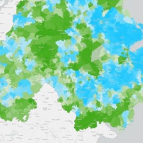
With GIS technology, we now have a system that lets us delve into the geographic aspect of how people get messages, where we couldn’t really do that effectively with our other research tools.
Taking Time to Reflect
Looking back on my lessons learned, one common thread is that I lost sight of the important connections in my organization. It’s an unfortunate by-product of our ever-busier lives: we put our heads down and get our work done, but we forget how beneficial it can be to share the value we discover.
My advice is to keep the big picture in mind. Make time to explore new forms of location intelligence. Tell your colleagues about your GIS discoveries so they can benefit from them. And collaborate so you can learn more—about the technology and how it can help the people and organizations around you.
I didn’t fully appreciate all of this at the start. I hope you do.
The Esri Brief
Trending insights from WhereNext and other leading publicationsTrending articles

December 5, 2024 |

July 25, 2023 |

November 12, 2018 |
April 29, 2025 |

February 1, 2022 |
April 1, 2025 |

