Changes in the way we work have ushered in an era of innovation and adaptive reuse that is giving many office buildings new life in a postpandemic world.
Real estate markets in San Francisco, New York, Seattle, Los Angeles, and other large cities are showing high vacancy levels as employees who began working from home during the COVID-19 pandemic continue that arrangement. Nationwide, office vacancy rates have risen to 12.2 percent from 9.7 percent over the past two years, according to data from Costar and others. As more leases come up for renewal and companies offer hybrid work schedules, some industry watchers think vacancy rates could tick higher.
It may sound like a gloomy outlook for commercial real estate assets, but forward-looking owners and investors are rethinking these spaces and embracing the practice of adaptive reuse. As they do so, many find that location data reveals important community dynamics surrounding a property—and insights for the best uses of the space inside it.
Using a Location Lens to Drive Adaptive Reuse
As office space owners and investors embrace the needs of a changing workforce, some are installing upgrades like touchless building entry and high-quality air filtration, while others are converting office space to e-commerce warehouses, residential spaces, and even self-storage units.
To better understand how a space can be transitioned to meet changing demands, it’s important for executives to analyze the surrounding market as well as the space itself. With location intelligence generated by geographic information system (GIS) technology, investors can analyze local demographics and economic patterns—and map indoor spaces to determine the most productive prospects for adaptive reuse.
In some markets, location data reveals strong demand for converting empty office space into residential housing. A recent report from RentCafe documented more than 150 apartment conversions in US cities in 2021, 41 percent from former office buildings. In other cases, property owners are converting office space to self-storage units, as occupancy rates and demand continue to rise in that sector.
Location Intelligence from the Outside In
Once an owner decides how to adapt a building based on local market conditions, GIS mapping can ensure that the space is optimized to meet the needs of its new occupants.
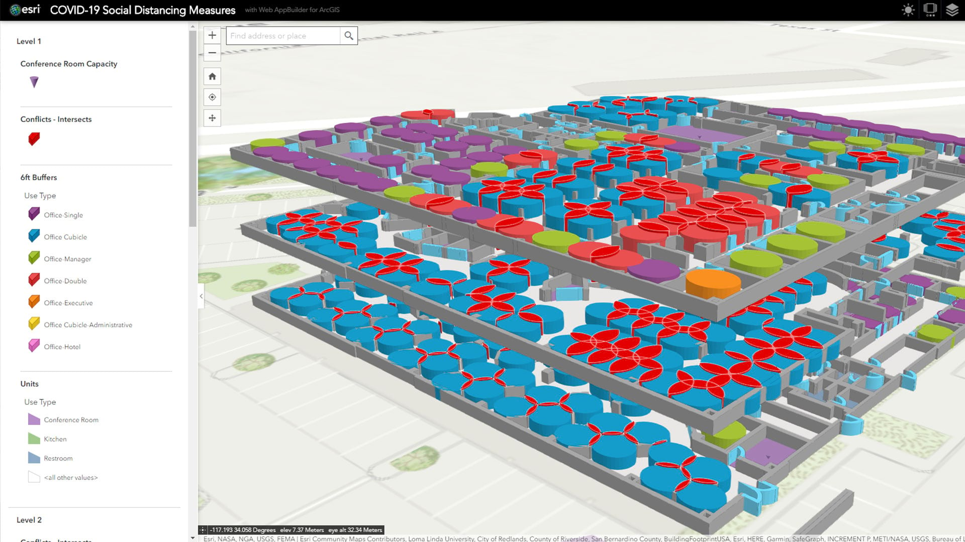
An indoor mapping system can create a digital twin of a property, helping design teams create greater efficiency and safety for occupants navigating the space. Combining GIS with building information modeling (BIM) technology helps decision-makers understand the dimensions of a space and the optimal placement of assets within it.
By anonymously mapping how people move through a space, location technology also provides key insights for adaptive reuse, including improvements that might better address tenants’ needs in residential, industrial, or retail settings.
The decline in demand for traditional office space has challenged assumptions and uncovered opportunities. From affordable housing to much-needed warehouse and storage space, property owners are tuning into emerging market demands. Location intelligence provides them an outside-in view of how best to use a given property, providing clarity for major investment decisions in the post-pandemic economy.
Listen to this podcast to hear Mary Rowe of the Canadian Urban Institute explain how location technology can help planners reimagine the use of office space.
The Esri Brief
Trending insights from WhereNext and other leading publicationsTrending articles

December 5, 2024 |

July 25, 2023 |

November 12, 2018 |

February 1, 2022 |

July 29, 2025 |

July 14, 2025 |


