displaying 3089 results

Ian Wint, the GIS manager at the City of Fort Lauderdale, Florida, takes risks and isn’t afraid to fail. That’s why he’s a GIS Hero.

At Ingka Group, Claudia Blagu’s location intelligence skills promote sustainable forestry and the bottom line.

Water and Sewer Company of Thessaloniki S.A. (EYATH) integrated infrastructure and customer aspects of the business using GIS.

The key metrics for technology projects are speed and rate of user adoption.

The City of San Diego, California, rolled out a software solution to improve its infrastructure management.
For land managers across the western United States, the task of drafting postfire recovery planning has become daunting as the number of…
The Port of Rotterdam bustles like a metropolis. The Netherlands port handles more commercial shipping than any port in Europe and more than mos…

See how four Esri partners helped several organizations improve operations, update planning procedures, and streamline data management.
To effectively manage its more than 9,500 local traffic signs, the public works department for the city of Ames, Iowa, uses a new, custom, GIS-b…
ArcGIS for Aviation is a new solution to support users in the aeronautical information management, air navigation service provider, and...
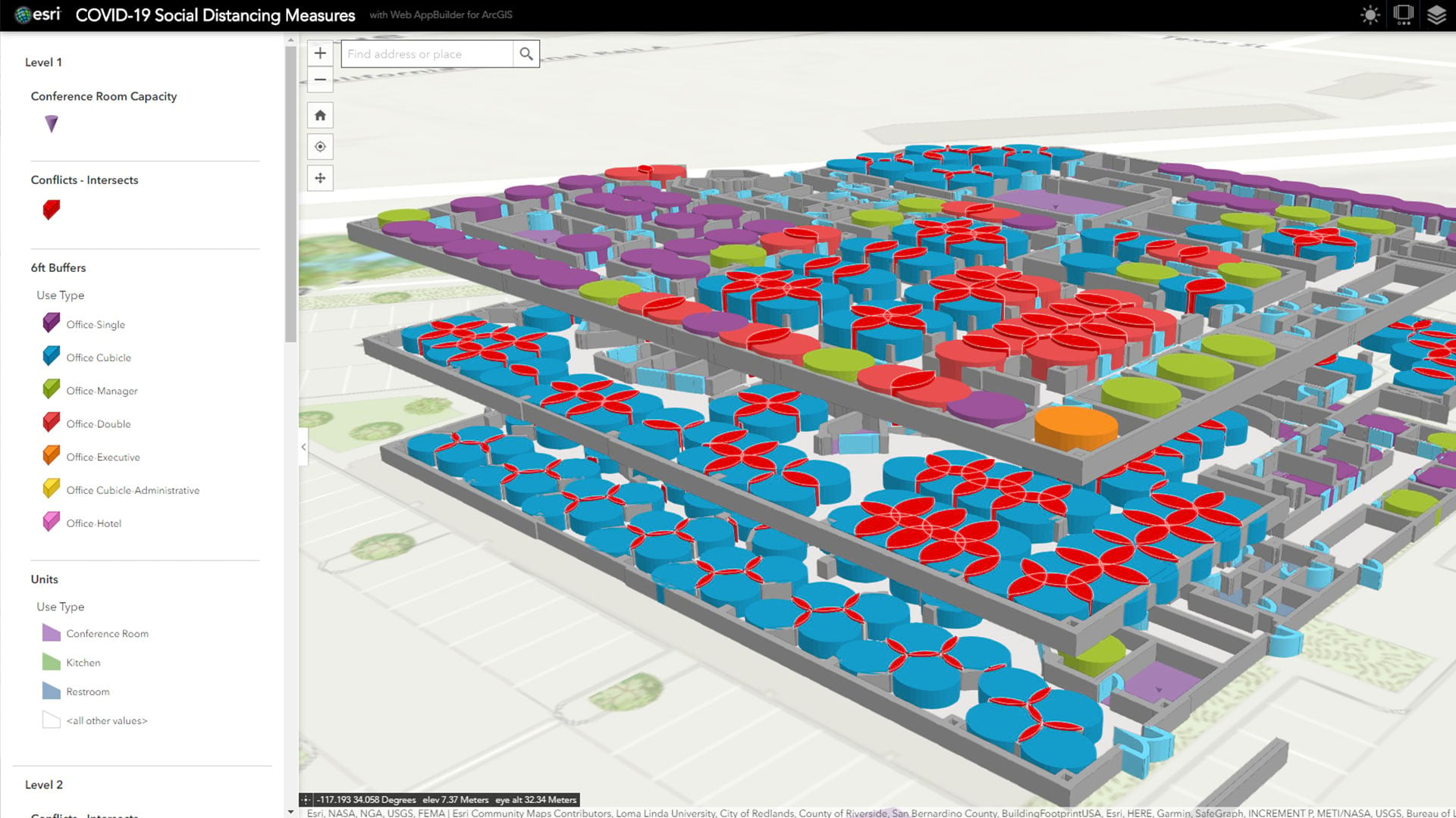
Faced with an unprecedented threat to employee safety, business and organizational leaders are mapping a changed workplace.
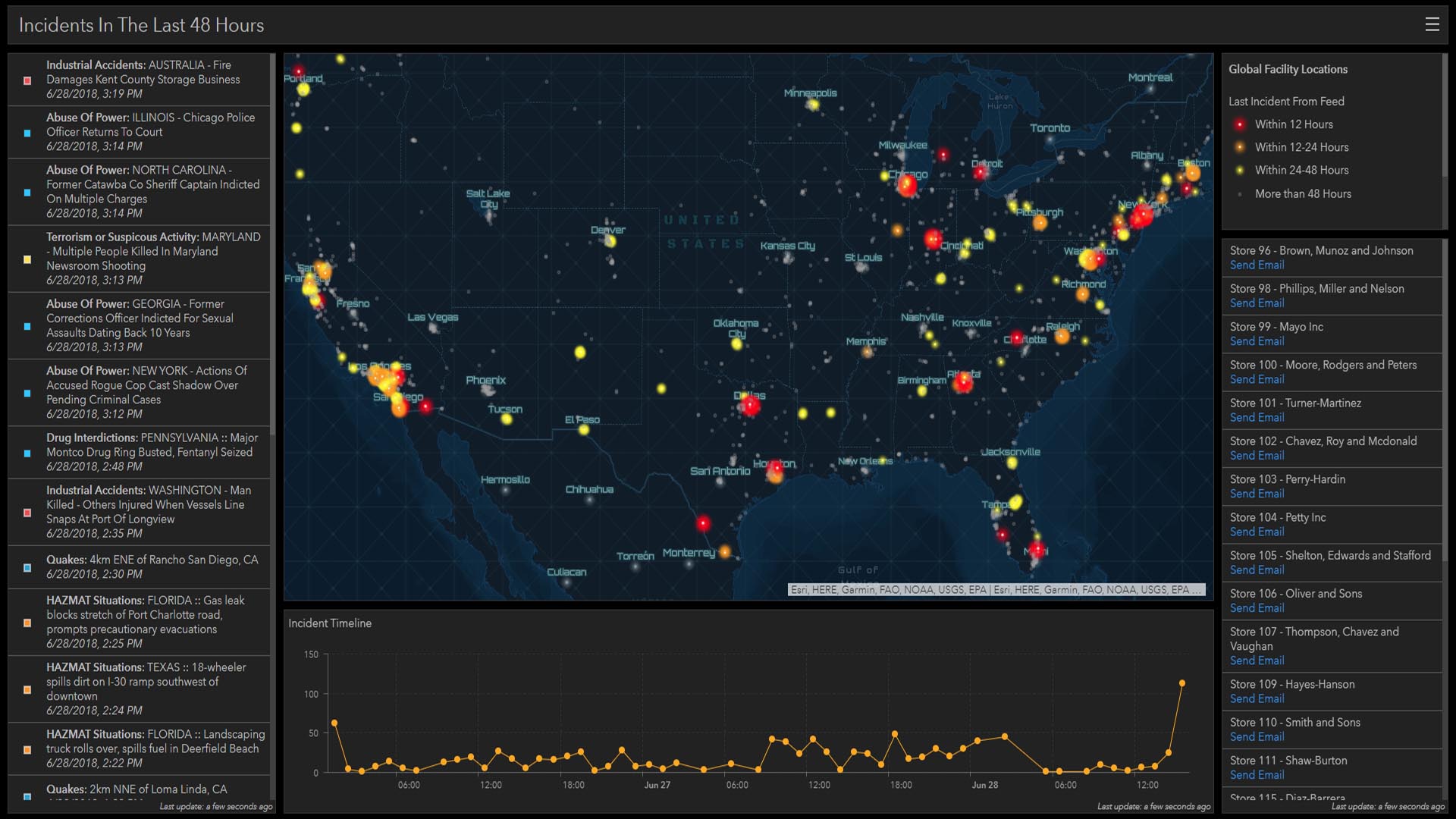
A look inside the world of corporate security, where the safety of people and assets is top priority and new tools are making their mark.