displaying 1097 results

Numerous geodesign projects, including one to make a US Air Force base more climate resilient, were presented at the Geodesign Summit.

With their innovative solutions and comprehensive services, Esri partners help users get the most out of Esri technology.
At the 2019 Esri User Conference, a range of users demonstrated how their GIS implementations work as an intelligent nervous system.

Police in Ogden, Utah, used Esri technology to help manage security, traffic, and other issues at a historic railway celebration.

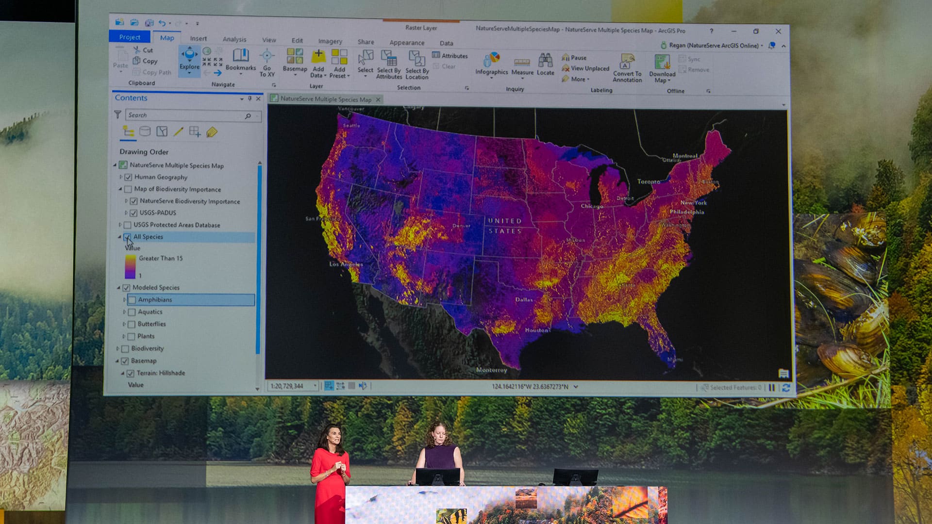
The City of Pasadena, NatureServe, the US Census Bureau, and other organizations show how GIS helps them see what others can't see.
ParcelAtlas, available in ArcGIS Marketplace, is a frequently updated cloud-based cadastral content service for use with ArcGIS technology.

Every time Woodland Park Zoo changes an exhibit, infrastructure gets moved. The lead gardener decided to keep better track of that with GIS.
With Data Appliance for ArcGIS, Esri users can protect their internal proprietary data by keeping it local—on their organization’s network.
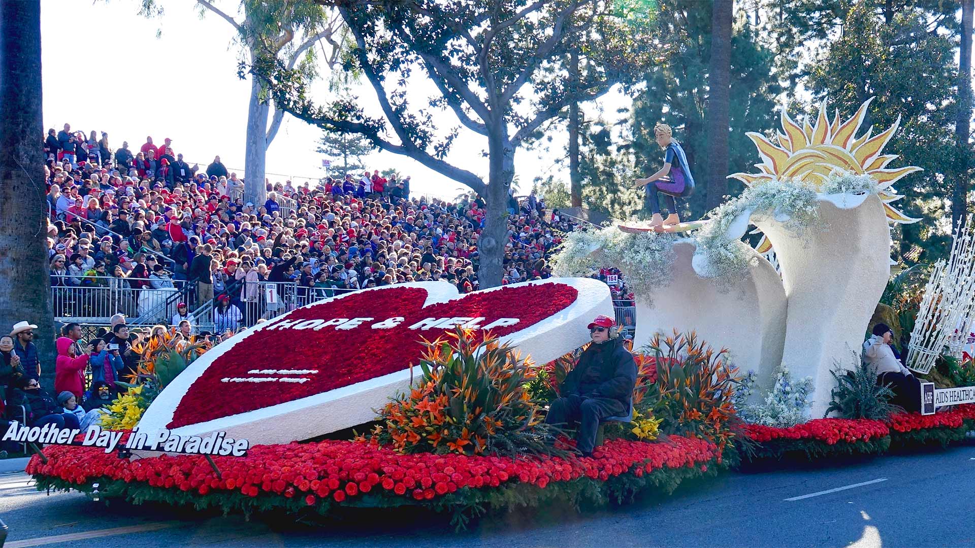
For the 2019 Rose Parade, the Pasadena Fire Department relied heavily on ArcGIS technology, including the new Tracker for ArcGIS app.

Travel to the surface of Mars and explore its features from the comfort of your computer, using d ArcGIS Online.
Esri software users from around the world send in photos documenting their travels and accomplishments while wearing Esri T-shirts.

Since its fall 2012 debut, the WWW Conference is living a virtual life via a mobile application available to attendees...