displaying 3148 results

Electric and gas utility companies have been using Remote Desktop Services (RDS) for remote client access to central hosted ArcGIS for Desktop…
Five years ago, the National Audubon Society, the century-old conservation group devoted to protecting bird populations and habitats, embarked…
In May 2015, the International City/County Management Association (ICMA) and Esri invited a small group of local government executives to Esri's…
One of Australia's largest water providers used the advanced location-based analytics in ArcGIS to conduct a meter audit far more efficiently…
Features in this update make it easier to manage your subscription, add analysis capabilities, improve ready-to-use apps, include more configura…
The enterprise GIS developed by a Louisiana airport helps not only to meet federal reporting requirements but also to save money and better conn…
Opinionated consumers, take heart. Your Tweets are being read by people very important to you—the manufacturers of the products you buy.
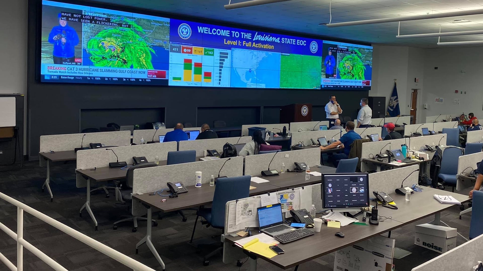
Louisiana uses GIS to better prepare for emergencies and coordinate actions across agencies.
GIS managers need to take proactive steps to overcome adoption barriers and realizing successful digital transformation.

The Fort Indiantown Gap National Guard Training Center uses GIS to ensure a rare butterfly species thrives amidst the chaos of the bombing range.

iMMAP and The HALO Trust lift up women in the Global South, providing training and jobs that help them feel valued and improve their lives.

Los Angeles County uses maps to track investments in sustainable, equitable, and climate resilient water supplies.