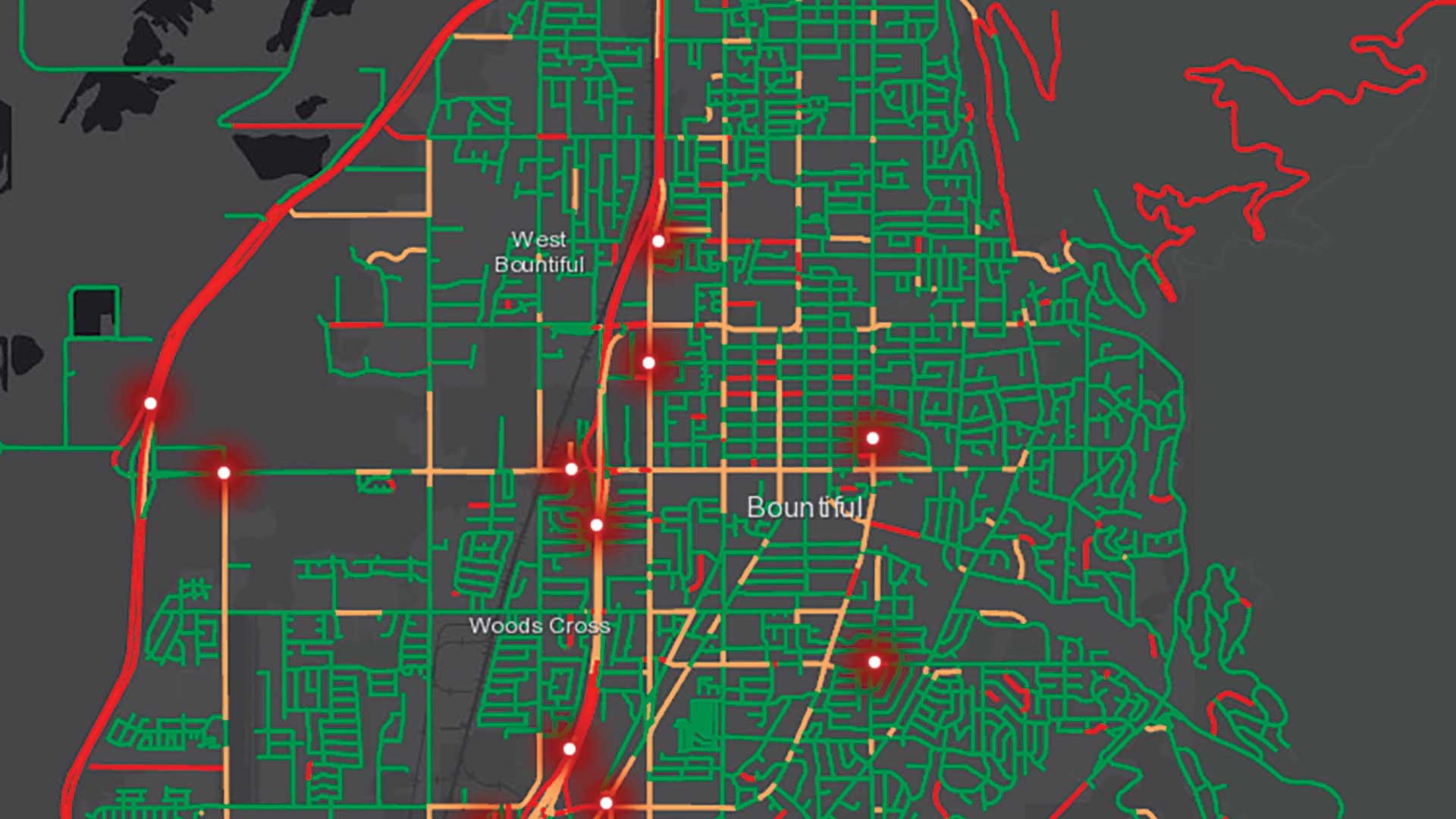
displaying 4700 results

ArcGIS platform uses AI, real-time analysis, and scalable process to help organizations realize better outcomes.

Esri-Autodesk integration partnership will foster BIM and GIS integration and the application of geodesign principles.
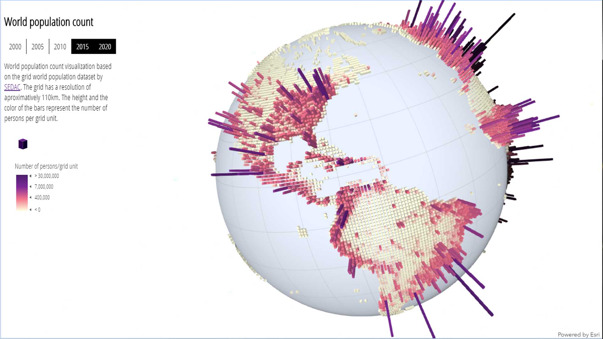
Esri’s continued advancements parallel and distributed computing make solving problems with machine learning and GIS increasingly possible.
GIS helps create the broader strategic view needed for digital transformation.

You can go to the Esri Academy website and create a learning plan tailored to your professional needs or personal interests.

Software engineers, data scientists, and security researchers teamed up to participate in a hackathon.
With the ArcGIS API for JavaScript, developers can now create 3D experiences that work well in both mobile and desktop browsers.
Organizations create and manage a vast amount of data. Many of these organizations, such as government agencies, desire or are required to share…
This practical, hands-on workbook will show you how to immediately become more productive with ArcGIS by using Python to streamline and automate…
Gottfried Konecny gives readers a comprehensive overview of the evolving field of geoinformation in Geoinformation: Remote Sensing, Photogrammet…
The rich imagery offerings available with your ArcGIS Online subscription can be used for digitization and, in some cases, analysis as well as v…
As a GIS manager, you must figure out how to prepare your team to leverage new tools and capabilities as the technology evolves. Helping your pe…