displaying 4314 results

Since the start of the COVID-19 pandemic, AAG has offered more than 100 varied events online. Here’s what the organization has learned.

You can do more than just link out Excel files in ArcGIS Pro – Esri product engineer Elaine Evans shows you how.

The International Cartographic Conference—held in Florence, Italy, in December—brought together cartographers from all over the world.
Drone technology, citizen science, and location intelligence are being used to study humpback whale feeding behavior off the Australian coast.
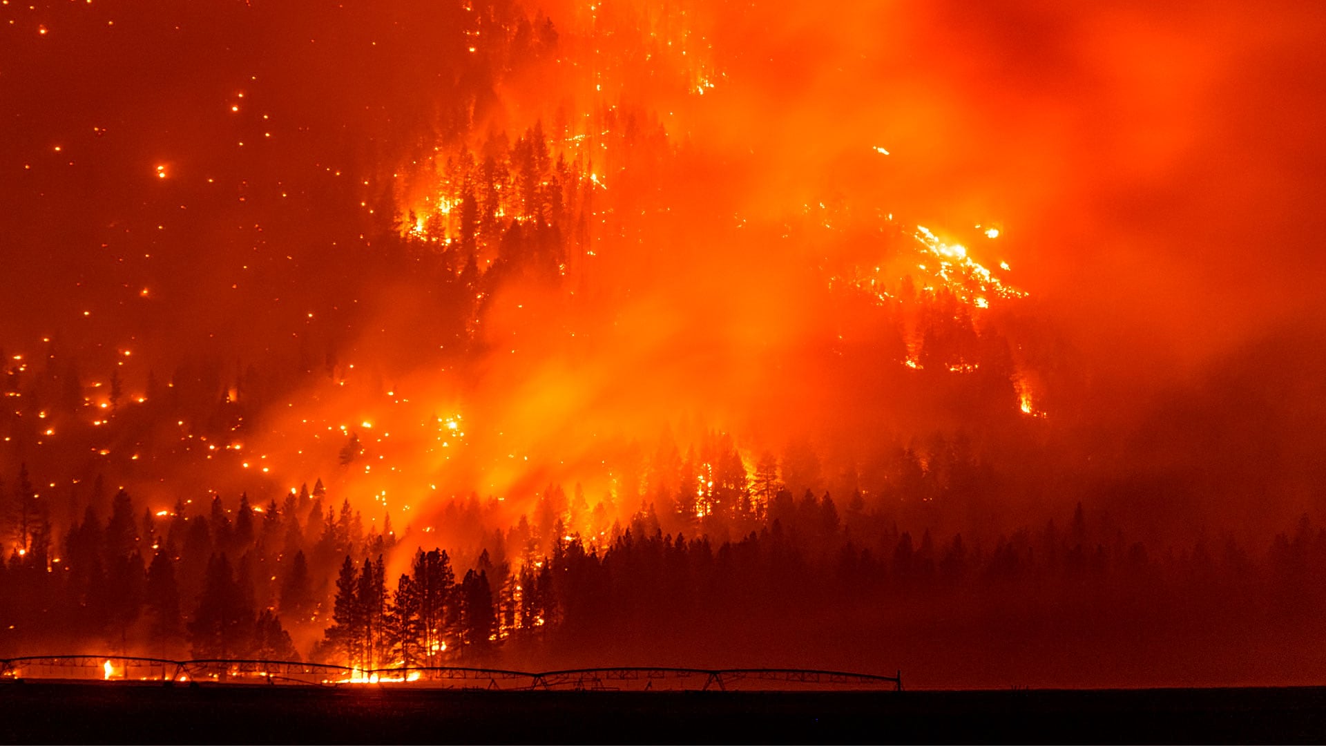
The WindNinja Mobile app, powered by GIS, provides firefighters with wind speed and direction forecasts in potentially dangerous conditions.
Your maps in ArcGIS Online will really pop if you use the new Effects capability in the Map Viewer.
While the relevance of geography is being challenged at the university level, the growth of the field at community colleges is promising.
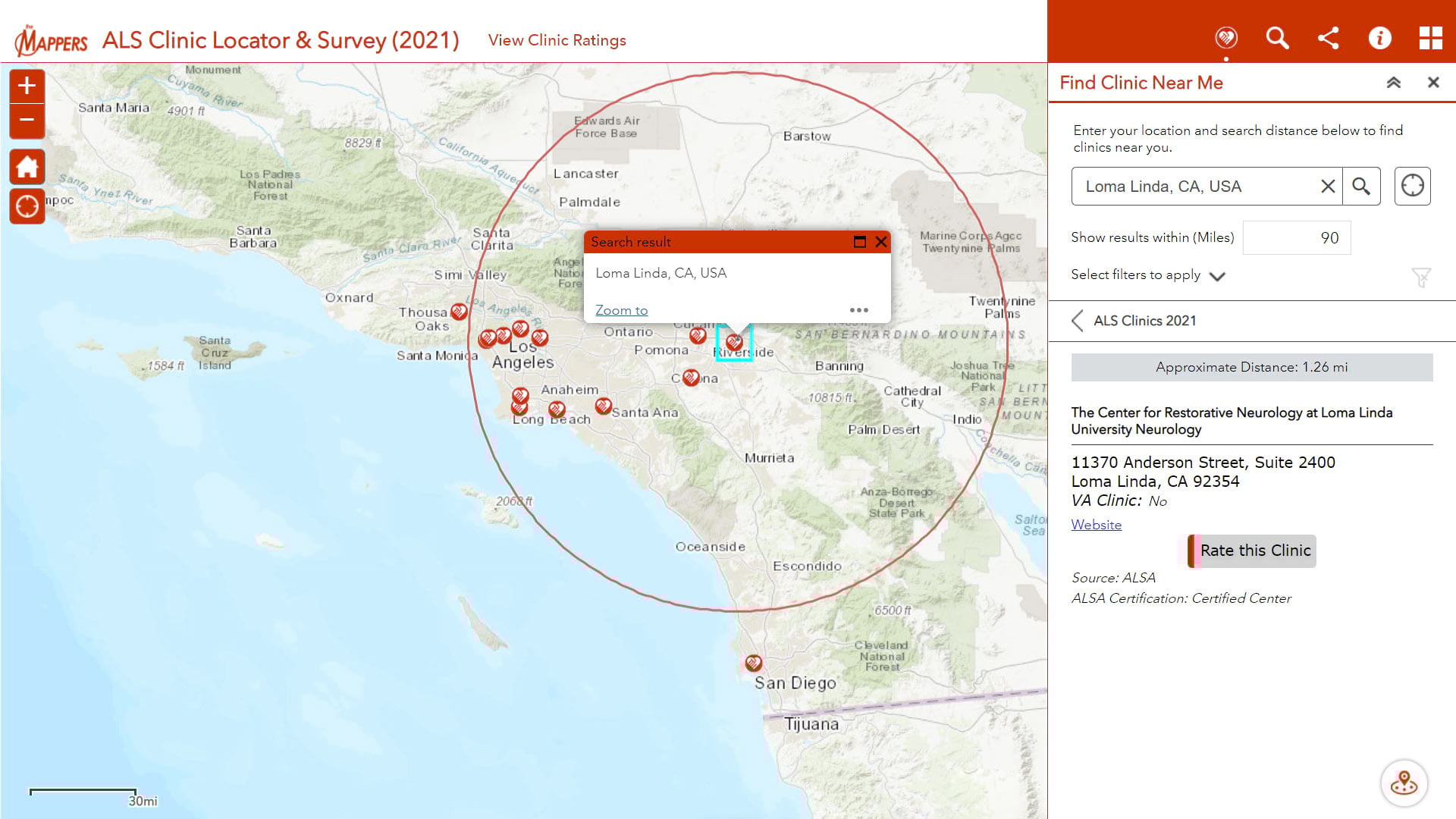
Pat Dolan, diagnosed with ALS or Lou Gehrig's disease, uses his GIS knowledge and skills to help other ALS patients locate care services.
The Minneapolis Star Tribune newspaper offers its advertisers business consultation services, including location intelligence powered by GIS.
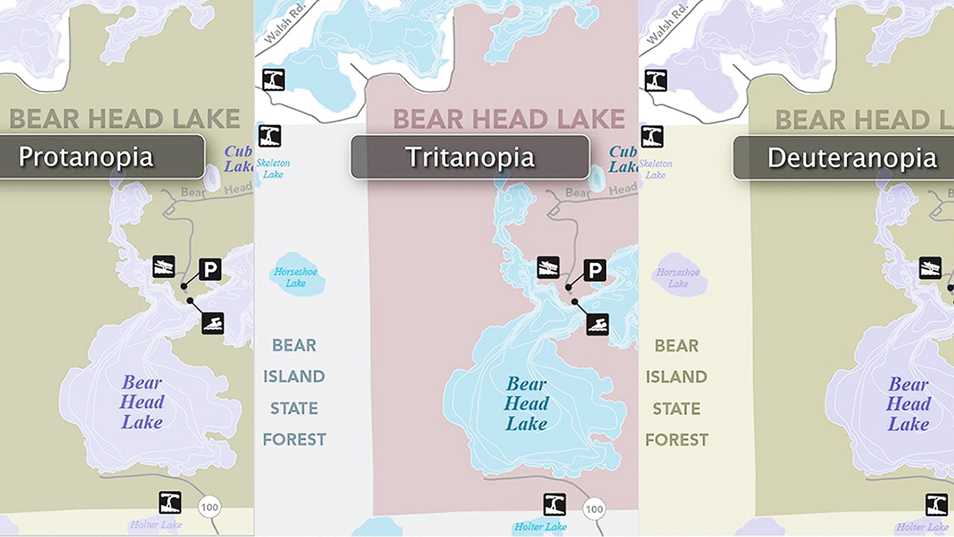
A statewide team ramped up digital accessibility efforts created an online resource center that can help anyone make accessible maps.
The US Vessel Traffic web map—built with ArcGIS API for JavaScript—lets you see vessel paths in and around United States waters over time.

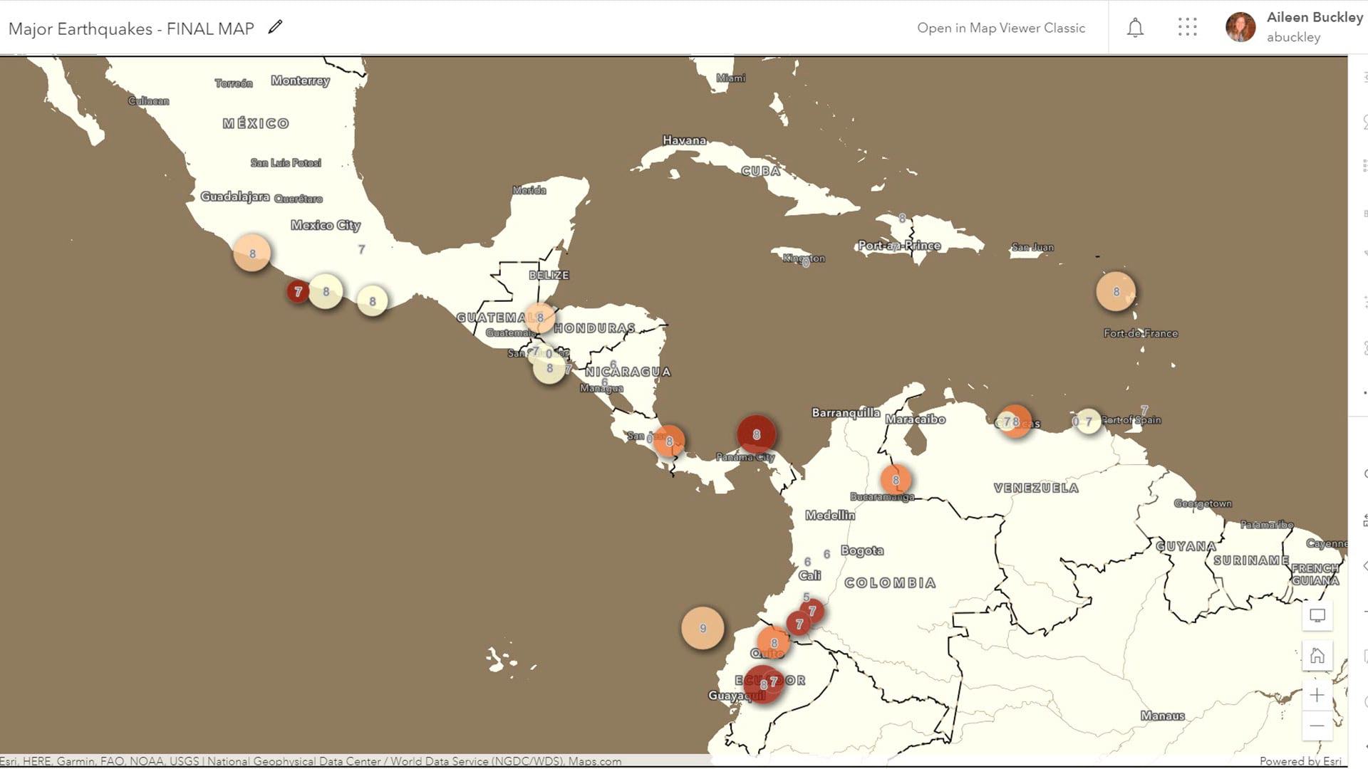
Take a look back at the Tōhoku earthquake and tsunami in Japan and see the new GIS technology you can use to analyze these types of events.